2026's 9 Best Small Towns To Visit In Queensland
Queensland's best small towns to visit in 2026 have more to them than their beaches suggest. On Tamborine Mountain, the ground gurgles after rain, thanks to earthworms that can grow a meter long. Near Yungaburra, a fig tree strangled its host and dropped a 15-meter curtain of roots to the forest floor. Airlie Beach built a lagoon so people could swim when stingers take over the sea. The town also won a national tourism title this year, along with Stanthorpe. Hughenden took silver at the state level, and a life-sized dinosaur named Hughie stands inside its fossil museum.
Beyond these unusual sights, there's rainforest, gold-rush history, and cool mountain air.
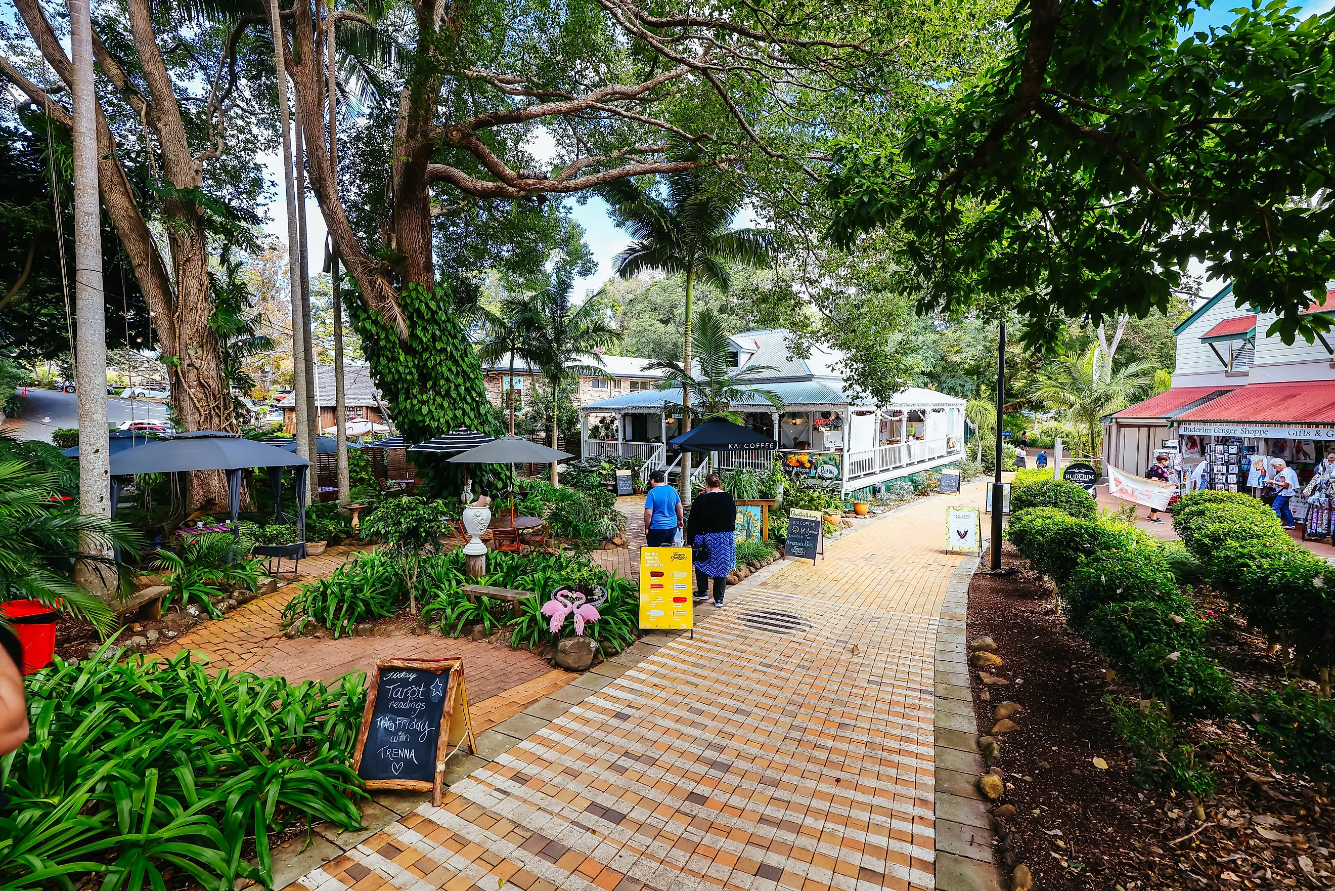
Montville

Montville was once called Razorback, after the steep ridge beneath it. When storekeeper Henry Smith applied for a mail receiving office, that name was rejected as already in use, and so was his second choice, Vermont. His third choice, Montville, borrowed the name of a Connecticut town linked to his family. The village stands high on a ridge, with views toward the jagged peaks of the Glass House Mountains. Its main street has galleries, fudge shops, and independent stores.
Kondalilla Falls, outside town, plunges 90 meters into a deep rainforest valley, with walking tracks leading through the surrounding forest. Sections of the 58.8-kilometer Sunshine Coast Hinterland Great Walk pass through the wider area, linking rainforest, valleys, and waterfalls. Flame Hill Vineyard has vines and farmland on the surrounding hills.
Eungella

Until the Eungella Range road opened in 1909, the settlement could only be reached by pack-horse track or a steep road via Nebo. Gold found at Bee Creek in 1888 created the Eungella Goldfield, and timber-getters and dairy farmers followed. Eungella stands high in the Clarke Range, about 81 kilometers west of Mackay. Its cool, misty climate sets it apart from much of tropical Queensland. The Eungella Chalet, built in 1933, is a local landmark, and the settlement has a small collection of community facilities and places to eat. Subtropical rainforest covers the mountain slopes around the settlement.
Information boards along the wheelchair-accessible Sky Window walking track cover the area's history. From the lookout, the land drops toward the Pioneer Valley, where forested hills and farmland stretch into the distance. At Broken River in Eungella National Park, wild platypuses surface briefly before slipping back underwater. Park-goers can spot platypuses, particularly around dawn and dusk, from the viewing platforms beside the river. Eungella serves as a base for trips to Finch Hatton Gorge as well, where walking tracks follow the creek through rainforest toward pools and waterfalls.
Stanthorpe

Winter frost is part of life in Stanthorpe, a Granite Belt town where vineyards and apple orchards thrive in a climate more commonly associated with cooler parts of Australia. The settlement was originally known as Quart Pot Creek and after tin was discovered nearby, it became known as Stannum. The settlement took the name Stanthorpe in 1872. Sitting high on the Great Dividing Range, Stanthorpe experiences four distinct seasons. Local farms produce apples, berries, and stone fruit, and wineries grow cool-climate grapes.
Winter brings what locals call brass monkey weather, when temperatures can fall sharply and frost is common. Girraween National Park, south of town, has granite boulders scattered across open eucalypt forest. At Granite Arch, two huge rocks lean together to form a natural gateway. The Pyramid, another granite formation, has broad views across the park. Stanthorpe was named Australia's Top Tourism Town in 2026.
Airlie Beach

Stinger season usually lasts November through May, when the water off Airlie Beach is a risky place to swim, because box jellyfish and Irukandji drift in. The town's public lagoon, opened in 2001 after a community fundraising campaign called Loot for the Lagoon, gives locals another place to swim. Shute Harbour Road forms the town's commercial spine, lined with cafes, restaurants, tour operators, and independent shops. Saturday markets bring local produce, handmade goods, and crafts to the waterfront, and the coastal walkway connects parts of the foreshore.
Airlie Beach was named Australia's Top Small Tourism Town in September 2026, after winning the Queensland title for five consecutive years. The town lies on the Coral Sea and is the gateway to the Whitsunday Islands, an archipelago of 74 islands known for their forested hills, turquoise water, and white-sand beaches. Whitehaven Beach is known for its pale silica sand, and shifting tides at Hill Inlet create swirling patterns where white sand meets clear water. The Bicentennial Walkway follows the coast toward Cannonvale.
Cardwell

Cardwell looks across Rockingham Bay toward Hinchinbrook Island, where rainforest-covered mountains rise from the sea. The town, founded in 1864 as a port, is on Queensland's Cassowary Coast, along the Bruce Highway between Townsville and Cairns. Hinchinbrook Island National Park protects a landscape of rainforest, heathland, beaches, and mountains. The 32-kilometer Thorsborne Trail is a demanding multiday hike that crosses the island's eastern side.
Campers and overnight hikers need permits booked in advance. The trail closes January through February, and hiking conditions can be challenging October through March because of extreme heat, humidity, and unreliable water sources. On the mainland, Cardwell Lookout has views over the bay, and Cardwell Forest Drive passes through forest toward creeks and waterholes. Cardwell is a gateway to the Great Barrier Reef and nearby offshore islands.
Tamborine Mountain

Tamborine Mountain is where Queensland's national park system began. Less than an hour from the Gold Coast, Tamborine Mountain has a cooler hinterland setting away from the coast's beaches and tourist strips. It is not one compact village but a plateau with three main localities. North Tamborine has many of the area's daily services, and Eagle Heights is home to Gallery Walk, a strip of specialty shops, art galleries, and restaurants. Mount Tamborine has a more rural feel, with acreage properties and pockets of farmland. The mountain's early economy relied on farming, including orchards and vegetable crops.
Tamborine National Park protects multiple sections of rainforest, including the area around Curtis Falls. A walking track leads through trees to the waterfall, a cascade that spills over a rocky ledge into a shaded grove. At Hang Glider Launch and Lookout, the escarpment opens onto views across the hinterland. The mountain is home to giant earthworms, Digaster longmani, that grow to about a meter long and make unique, gurgling sounds underground after rain.
Cooktown

Cooktown's history is tied to Captain James Cook and the damage his ship sustained on the Great Barrier Reef in 1770. The HMS Endeavour entered the river that now bears its name so the crew could repair the vessel. During their stay, Cook climbed the hill now known as Grassy Hill. Cooktown later grew around the Palmer River gold rush. When gold was discovered inland in the 1870s, the town became the goldfield's main port.
The Endeavour River curves past the town toward the Coral Sea, with hills and mangrove-lined waterways shaping the surrounding landscape. Grassy Hill Lookout looks out over the river and coastline, and a historic lighthouse stands at the summit. South along the Mulligan Highway, Kalkajaka, known as Black Mountain, is a jumble of granite boulders that is a sacred meeting place and a source of Dreaming stories for the Eastern Kuku Yalanji Aboriginal people.
Yungaburra

Yungaburra has one of Queensland's most intact historic village centers. Up in the Atherton Tablelands, many buildings in town have remained largely unchanged since 1910. Timber facades, leafy streets, cafes, and monthly markets give the settlement a strong local identity. The village developed as the Tablelands opened up to European settlement in the late 19th century. Its village center still has historic pubs, small shops, and businesses housed in older buildings.
Outside the village, Lake Eacham's deep blue water fills a volcanic crater surrounded by dense rainforest. Nearby, Curtain Fig National Park protects one of the Tablelands' best-known trees, the Curtain Fig Tree. The strangler fig's aerial roots drop down to the forest floor from its spreading trunk, forming the 15-meter tangled curtain that gives the tree its name. As the fig grew, it strangled its host tree, and the host eventually fell against a neighboring tree. The host trees later rotted away, leaving the fig standing on its own. The tree is thought to be more than 500 years old, about 50 meters tall, with a trunk circumference of 39 meters.
Hughenden

Hughenden is an outback town in Queensland's rugged northwest. It is part of Queensland's Dinosaur Trail, and fossils found in the surrounding region have helped establish the area as a destination for anyone interested in ancient life. Porcupine Gorge National Park is nearby, where millions of years of erosion have carved a deep chasm through layers of red, pink, and cream-colored rock.
Down on the gorge floor, an isolated sandstone monolith known as the Pyramid rises from the surrounding rock. More than 3,000 fossils have been found in the area, once covered by an ancient sea. The Flinders Discovery Centre in Hughenden displays fossils and a life-sized replica of a Muttaburrasaurus named Hughie. The town received silver in Queensland's 2026 Top Tiny Tourism Town category.
Queensland Beyond The Beaches
Queensland's beaches and reef get most of the attention, but its small towns show how much more there is to the state. The mountains have cooler air, vineyards, and old village streets. Farther north, rainforest trails pass enormous trees and creeks where wildlife can be hard to spot. Inland, sandstone gorges and dinosaur fossils belong to a landscape millions of years in the making, and old goldfields still carry traces of Queensland's mining past. Even the coast has more than swimming, with offshore islands and a long maritime history. For anyone planning a trip in 2026, these towns are worth spending time in rather than simply passing through on the way to somewhere better known.