2026's 12 Best Small Towns To Visit In The Pacific Northwest
One of these towns has North America's steepest gondola. In another, people ring a brass bell every time someone spots a whale. A third was Cicely, Alaska, on 1990s television without ever leaving Washington. The famous Pacific Northwest small towns show up on every list, but these twelve are the ones worth the detour in 2026, and most of them you have never heard of.
Joseph, Oregon

Bronze sculpture is unusually prominent in Joseph, where large works stand along Main Street outside the galleries. The reason is Valley Bronze and the other local foundries, which have cast monumental sculpture here for decades. About six miles south, Wallowa Lake sits in a glacial basin below the Wallowa Mountains. The Wallowa Lake Tramway climbs about 3,700 vertical feet to Mount Howard, where short hiking routes reach viewpoints above the lake and the surrounding peaks. At lower elevation, kayak rentals and shoreline paths make for easier ways to spend time near the water. The Old Chief Joseph Gravesite, near the lake, marks the burial place of the father of Chief Joseph and remains an important Nez Perce cultural site. Travelers with extra time can also use Joseph as a base for hikes into the Eagle Cap Wilderness.
Stanley, Idaho

Stanley has fewer than 200 permanent residents, yet several of Idaho's best-known alpine landscapes sit within a short drive. Redfish Lake lies about five miles south of town beneath the Sawtooth Range. It has swimming areas and kayak rentals along the near shore, and a seasonal boat shuttle carries hikers to trailheads at the far end. Stanley Lake, northwest of town, opens a broad view toward McGown Peak and usually sees less activity along its shoreline. The Salmon River runs close to the community and draws rafting and fishing during the warmer months. Visitors can also reach several natural hot springs along nearby roads, including simple pools beside the river. Hikers will find that trailheads throughout the Sawtooth National Recreation Area lead toward alpine basins and high mountain lakes. Clear nights are another practical advantage of the remote location, since artificial lighting stays limited across much of the valley.
Bandon, Oregon

Bandon is best explored with the tide table in mind. At low tide, visitors can walk much farther around the rock formations below Face Rock State Scenic Viewpoint and find tide pools between the larger sea stacks. Coquille Point, slightly north, has paved paths above another section of the same rugged shoreline and stair access to the beach. The harbor side of town takes a different focus. The heart of Old Town Bandon is a waterfront boardwalk lined with small shops and restaurants, with the Coquille River and its fishing fleet in view beyond. Bullards Beach State Park starts north of the river, with several miles of beach inside its boundary and the Coquille River Lighthouse near the mouth of the estuary. The surrounding area is also one of Oregon's major cranberry-growing districts, and the fruit turns up all over town, in bakery cases and at the fall harvest festival especially.
Wallace, Idaho

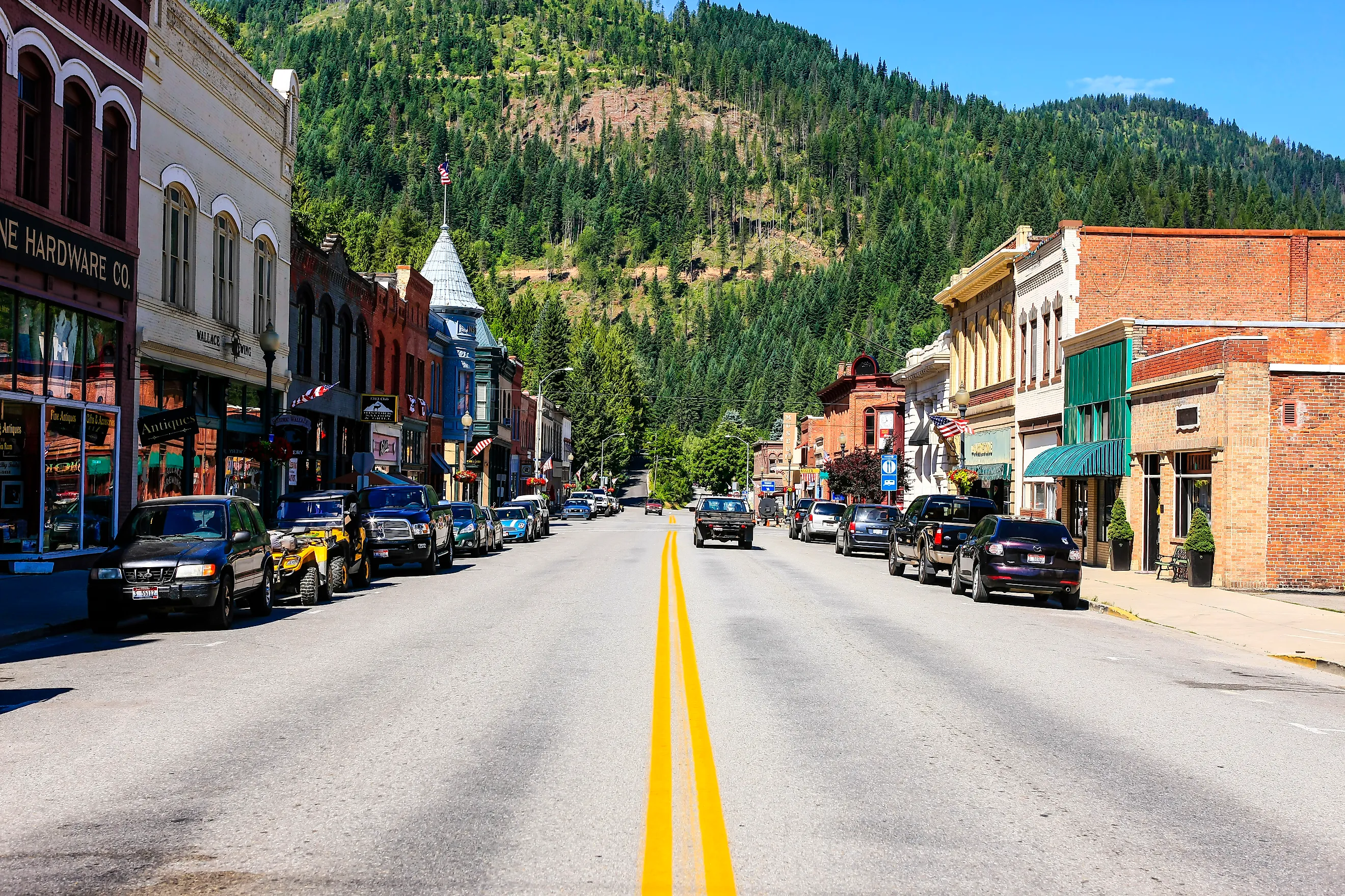
Much of downtown Wallace falls within a National Register historic district, which is why the late nineteenth- and early twentieth-century commercial buildings survive so intact. Brick hotels and narrow storefronts stay concentrated within a few blocks, several of them former banks and saloons from the silver years. The Wallace District Mining Museum traces the silver industry that shaped the surrounding Coeur d'Alene Mining District, while the Sierra Silver Mine Tour takes visitors underground with guides who have direct mining experience. One of the region's biggest outdoor attractions lies east of town. The Route of the Hiawatha follows a former railroad grade for 15 miles through the Bitterroot Mountains, passing through 10 tunnels and over seven high trestles. Most people cover the route by bicycle. In downtown Wallace, the Center of the Universe marker at Bank and Sixth streets makes for a much lighter stop between the town's mining sites.
Manzanita, Oregon

Seven miles of sand run along Manzanita's shoreline, with Neahkahnie Mountain immediately north of town. Photographers get some of the best beach-and-mountain framing on the Oregon Coast here, without the volume of visitors usually tied to Cannon Beach. Laneda Avenue runs from Highway 101 straight down to the ocean, and most of the town's cafés and shops sit along it. Hikers can reach elevated coastal views on trails around Neahkahnie Mountain, though they should check route conditions and access points before setting out. Oswald West State Park lies only a few miles north, where headland trails run through old-growth forest down to Short Sand Beach, a small cove popular with surfers. Visitors who want an easier day can skip the car entirely, walk the beach for a few miles, and be back on Laneda Avenue by lunch.
Langley, Washington

Langley sits on a bluff at the south end of Whidbey Island above Saratoga Passage. The compact center is mostly galleries and independent shops, with several streets that dead-end at a view across the water. Seawall Park, reached below downtown, has beach access and benches along the shoreline. At Whale Bell Park nearby, a brass bell stands ready for anyone to ring after a confirmed sighting, a local tradition tied to the gray whales and orcas offshore. The Langley Whale Center tracks which species are passing through and when, and gray whales in particular show up around Whidbey Island in spring. Travelers can pair Langley with other island stops without a whole day behind the wheel. Fort Casey and Ebey's Landing lie farther north, and Clinton's ferry terminal is a short drive south.
Driggs, Idaho

Driggs lies in Teton Valley on the Idaho side of the Teton Range, where agricultural fields open long, unobstructed sightlines toward the mountains. The town makes a convenient starting point for the Teton Scenic Byway, which runs through eastern Idaho communities and open countryside beneath the range. In summer, stretches of the Teton River suit paddling and wildlife watching, particularly for visitors who want a slower outing than mountain biking or hiking. Grand Targhee Resort sits about 12 miles east of Driggs and has ski terrain in winter, followed by hiking and lift-served mountain biking during the warmer season. Trail networks in the Big Hole Mountains and access routes toward the western side of the Tetons fill out the surrounding valley. In town, the Teton Geotourism Center is a good first stop for background on the valley's geology and farming history before visitors head deeper into the range.
Ilwaco, Washington

The Port of Ilwaco stays an active commercial and recreational marina near the mouth of the Columbia River. Fishing vessels and charter boats tie up along the waterfront, with galleries and seafood businesses filling in behind them. The seasonal Saturday Market runs from late spring into early fall, adding local produce and crafts to the same stretch. The Discovery Trail runs through the port area and continues north along the Long Beach Peninsula, which makes Ilwaco a useful starting point for a cycling day. Cape Disappointment State Park starts just south of town, where the sights cluster far more densely. Trails there lead to two lighthouses, North Head and Cape Disappointment, and to viewpoints above the spot where the Columbia meets the Pacific. The Lewis and Clark Interpretive Center traces the expedition's journey to the Pacific and overlooks the river mouth. Weather changes quickly here, so clear conditions and dense coastal fog can produce completely different views of the same headlands.
White Salmon, Washington

White Salmon stands on elevated ground above the Columbia River, directly across the gorge from Hood River, Oregon. Several roads and viewpoints around town open clear sightlines toward Mount Hood, while Highway 14 reaches trails and scenic stops along the Washington side of the Columbia River Gorge. The White Salmon River is one of the main reasons to visit during the warmer months. Local rafting companies run trips through forested sections of the river, with routes for different experience levels. Hikers can reach wildflower areas and exposed gorge viewpoints within a short drive, particularly in spring. Downtown White Salmon is small enough to cover on foot. Restaurants and breweries line the main street, and White Salmon Baking Co. is a reliable stop for bread and breakfast. Wineries and tasting rooms in the surrounding hills give visitors another option after a morning on the river or trails.
Jacksonville, Oregon

Jacksonville has one of southern Oregon's most complete collections of nineteenth-century buildings. Along California Street, brick commercial blocks from the Gold Rush period now house shops and tasting rooms, several in former hotels. Guided and self-guided history routes cover many of these sites without requiring a car. The Jacksonville Cemetery, established in the 1850s, spreads across a wooded hillside north of downtown. Its grave markers trace early settlers and prominent local families. Britt Gardens lies nearby on the former estate of photographer and horticulturist Peter Britt. During summer, the Britt Music & Arts Festival fills an outdoor amphitheater above town with concerts beneath the surrounding trees. Jacksonville also sits close to the Applegate Valley wine region, where visitors can reach numerous vineyards and tasting rooms on a half-day drive. The town works particularly well for travelers who want history and food alongside short outdoor excursions.
Roslyn, Washington

Coal mining shaped Roslyn from the late nineteenth century into the early 1960s, and physical evidence of that period stays visible around town. The Roslyn Museum keeps the mining equipment and the household records of the families who worked the local coal fields, alongside photographs from the era. Nearby, the Coal Mines Trail follows part of an abandoned railroad corridor and passes several industrial remnants outside the center. Roslyn's cemetery complex is another important historical site. Immigrant miners buried their dead in separate plots by nationality and lodge, and those divisions still map the unusually diverse workforce the mines recruited. The brick and sandstone buildings in the downtown core later became familiar to television audiences through Northern Exposure, filmed extensively in Roslyn between 1990 and 1995. Hiking and mountain-biking routes begin close to town and continue into the surrounding Central Cascades, so visitors can combine the historic district with several hours on forest trails.
McCall, Idaho

Payette Lake reaches the edge of central McCall, placing beaches and boat access within walking distance of restaurants and shops. Legacy Park has a public beach and open lawn right at the water, with easy entry for swimming or paddling. Ponderosa State Park occupies a large peninsula northeast of downtown, with hiking and cycling trails running through the forest beside the lake. Several viewpoints within the park look across Payette Lake toward the surrounding mountains. In winter, crews groom parts of the trail network for Nordic skiing and snowshoeing. Brundage Mountain Resort handles the downhill skiing about 10 miles from town. Summer visitors can rent kayaks or paddleboards, take boat trips, or use McCall as a base for excursions into Payette National Forest. The town has more visitor services than Stanley or Joseph, though its shoreline access stays unusually close to the commercial center.
Planning The Route
These twelve towns divide cleanly by terrain, which makes them easy to string together. On the Oregon coast, Bandon and Manzanita share the sea stacks and long beaches, while Joseph and Jacksonville sit inland in the eastern mountains and the southern Gold Rush country. Idaho's picks gather around alpine water, with Stanley and McCall on their lakes and Driggs beneath the Tetons. Washington reaches the farthest. Langley sits out on Whidbey Island for the whale-watching, while the inland mining history runs through Wallace and Roslyn. Ilwaco and White Salmon sit down along the Columbia in the south. Anyone with a long weekend can build a trip around a single state, and anyone with more time can follow the water and the old rail grades into all three.