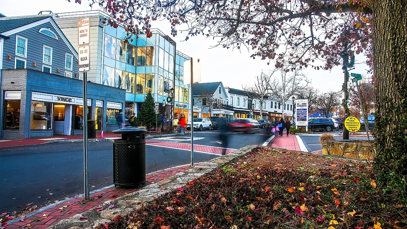
13 Off-The-Grid North Carolina Towns To Visit
Off grid in North Carolina means different things depending on which end of the state a town is in. On the coast, it means a place reachable only by ferry, or a road that quits at the water's edge. In the mountains, it means the end of a valley, where the pavement gives out and the ridges close in. Some of these towns have no stoplight. Others have no chain store, no parkway exit, no easy way in. What they share is distance, from the interstate and from the crowds that follow it.
Ocracoke

Ocracoke is the southern end of North Carolina's Outer Banks, and no bridge reaches it. The only ways onto the island are the state ferries. The run from Hatteras is free and takes about an hour. The two from the mainland, out of Cedar Island and Swan Quarter, take the better part of three hours and need a reservation. Ocracoke village is about four square miles at the lower tip, home to around a thousand year-round residents and no chain stores.
The 1823 lighthouse is the oldest one still working in North Carolina, a short white tower near the harbor. Blackbeard was killed in the water off the island in 1718, at a spot still called Teach's Hole. The British Cemetery is the grave of sailors whose bodies washed up after a German submarine sank their ship in 1942. Wild ponies, descended from horses left here centuries ago, live in a pen off the main road. Most of the island outside the village is national seashore, undeveloped and empty.
Cedar Island

Cedar Island is about as far Down East as the road goes in Carteret County. It is mostly marsh and water, the far end of a string of fishing communities where the pavement finally stops at a ferry dock. From there, a toll ferry crosses to Ocracoke, a little over two hours across Pamlico Sound. Not many people live out here, and the ones who do mostly fish.
The Cedar Island National Wildlife Refuge takes up much of the land, better than 14,000 acres of salt marsh and pocosin. Wild horses graze near the shore. Birds pass through in large numbers on the migration, and hunters and birdwatchers come for them. The beach by the ferry terminal is plain and quiet, with the sound on one side and the marsh behind.
Oriental

Oriental is a small town on the Neuse River, near where it widens into Pamlico Sound. About 875 people live there. By most counts the town has around 2,700 boats, which works out to better than three to a resident. There are no stoplights. People call it the sailing capital of North Carolina, and the harbor backs that up, full of masts.
The town marks Mile 182 on the Intracoastal Waterway, so boats on the long run up or down the coast tie up here for the night. Five creeks come together at the town, and the water is never far from any street. Lou-Mac Park, on the river, is the place to sit and watch the boats go by. The old downtown has a few galleries and the historic Old Theater, and that is about the size of it.
Bath

Bath is the oldest town in North Carolina, established in 1705 on the Pamlico River. It was the colony's first port, but the shipping moved elsewhere long ago, and the town never got much bigger. Fewer than 300 people live there now. Historic Bath, the district at the center, is a small cluster of 18th-century buildings, and that is most of the town.
Two of them stand out. St. Thomas Episcopal Church, from 1734, is the oldest church building in the state, and the Palmer-Marsh House, from 1744, is a well-kept colonial home. Down at the water, Bonner's Point is a quiet spot for a picnic. The Bayview ferry crosses the Pamlico nearby, the kind of short run that still stands in for a bridge in this part of the state.
Belhaven

View of downtown Belhaven North Carolina.
Belhaven is a small town on the Pungo River, in Beaufort County, on the inland side of the coast that locals call the Inner Banks. It is a stop on the Intracoastal Waterway, at Mile 136, and it has a claim to the waterway's history. The last sections that joined the inland route into one continuous waterway were finished here, which is why some call Belhaven the birthplace of the Intracoastal. Cruisers tie up for the night and walk into town.
The Belhaven Memorial Museum is the local oddity, two floors of a townswoman's lifetime of collecting, buttons and old tools and stranger things, left to the town. The River Forest Manor, a turn-of-the-century house on the water, has long been the landmark cruisers steer by. Past the marinas, the town is quiet, a few streets of old houses and not much traffic.
Edenton

Edenton is an old port town on Albemarle Sound, in Chowan County, settled in the 1720s. It lies well off the main coastal routes, on the quiet Inner Banks side, the kind of place most beach traffic drives past without knowing it is there. It has some of the oldest buildings in the state, most from the 1700s and 1800s, clustered around the Edenton State Historic Site. The Penelope Barker House, a mix of Greek Revival, Federal, and Georgian work, now serves as the town's welcome center.
The waterfront looks out on the sound, and Edenton Bay Cruises offers sightseeing trips from the dock. The 1886 Roanoke River Lighthouse, a squat screwpile structure moved to the Edenton waterfront, is one of the landmarks on the water. It is one of the few of its kind left in the country.
Bald Head Island

Bald Head Island has no cars and no bridge. Visitors leave the car at Southport and take a passenger ferry across, then get around by golf cart or on foot. Most of the island is left undeveloped, and the Bald Head Island Conservancy maintains sand trails through the maritime forest. The Kent Mitchell Nature Trail is an easy walk with a good chance of birds and other wildlife.
The Bald Head Island Club has tennis courts and an 18-hole golf course for members and guests. The older history is at the Old Baldy Lighthouse, built in 1817 and the oldest standing lighthouse in North Carolina, paired with the Smith Island Museum at its base. The climb up the tower is the best view on the island.
Robbinsville

Tapoco Lodge in Robbinsville, North Carolina.
Robbinsville is the seat of Graham County, one of the least populated and most cut-off counties in the state. No four-lane road reaches it. The way in is over the mountains on two-lane highways, and the county has only a handful of traffic signals to its name. The town is small, and the country around it is mostly national forest, not far from the southern edge of Great Smoky Mountains National Park.
Just outside town, the Joyce Kilmer Memorial Forest protects one of the largest stands of old-growth timber left in the East, tulip poplars several hundred years old and wide enough that it takes a few people to reach around one. The forest is named for the poet who wrote "Trees," killed in the First World War. Lake Santeetlah, ringed by forest, is nearby, and the Cherohala Skyway climbs out of town across the mountains toward Tennessee. There is very little out here that is not woods or water.
Hayesville

Hayesville is the seat of Clay County, in the far southwest corner of the state, closer to Georgia than to most of North Carolina. It is one of the smallest county seats in the state, just a few hundred people around a courthouse square. The old courthouse dates to the 1880s and still stands at the middle of town.
Lake Chatuge spreads along the state line just south of town, a reservoir with a long, broken shoreline and mountains behind it. The John C. Campbell Folk School, over in nearby Brasstown, has taught old crafts, weaving, blacksmithing, woodwork, since 1925, and people come from a long way off to spend a week at it. Past the lake and the square, Hayesville is mostly quiet country.
Hot Springs

Downtown Hot Springs, North Carolina.
Hot Springs is a small town in Madison County, on the French Broad River, north of Asheville toward the Tennessee line. The Appalachian Trail comes down off the ridges and passes right through the middle of it, down the main street and over the river bridge. It is one of the few places where the trail goes straight through the center of a town, not around it, and through-hikers stop here to rest and resupply.
The town takes its name from the natural hot springs by the river, mineral water near 100 degrees that people came to soak in long before the trail existed. A small resort still pipes the water into tubs along the bank. Beyond that, there is a short main street, a few outfitters and cafes set up for hikers, and the river. The mountains close in tight on both sides.
Marshall

Marshall is the seat of Madison County, downriver from Hot Springs on the same French Broad. The town is built on a narrow shelf between the river and a steep ridge, so tight that locals have long described it as one street wide, a mile long, and sky high. The railroad follows the river through the middle of it. There is not much room for the place to be anything but small.
The old high school, set on an island in the river, has been turned into artist studios and a music venue, which is most of what brings outsiders to town. The courthouse and a row of brick storefronts make up the rest of downtown. Marshall is the kind of county seat the main highway now bypasses, left to its one street and its river.
Bakersville

Bakersville is the seat of Mitchell County, a small town at the foot of Roan Mountain near the Tennessee line. A few hundred people live in it. The drive in is a climb on mountain roads, and the town is a long way from any city. It is the last real stop before the road heads up toward the high balds of the Roan.
Roan Mountain, just above town, is known for its natural rhododendron gardens, hundreds of acres that turn solid pink and purple in June and pull what crowds the area ever sees. The rest of the year the balds are windswept and bare and mostly empty. Down in town there is a courthouse, a few shops, and the North Toe River. People come through for the mountain, not the town, but the town is the way to the mountain.
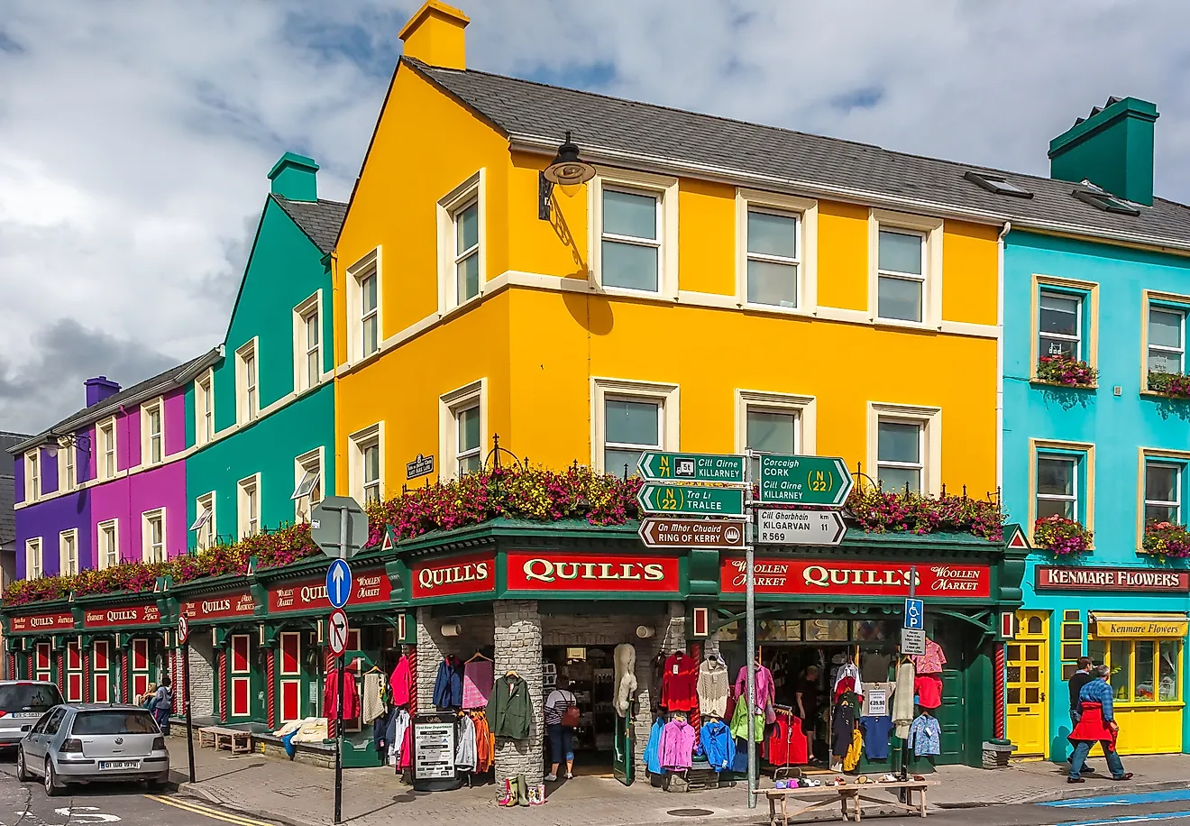
Saluda

Colorful buildings in Saluda, North Carolina. Image credit: Evanoc via Wikimedia Commons.
Saluda is a small town in Polk County, up on the Blue Ridge Escarpment where the foothills break into mountains. It got its start as a railroad town. The track climbing up to it, the Saluda Grade, was the steepest standard-gauge mainline railroad grade in the country, gaining better than 600 feet in under three miles at close to a five percent pitch.
Runaway trains wrecked on the grade for decades until the line finally closed in 2001. The tracks are quiet now, and the route is being turned into a rail trail. The town itself is a short historic main street near the top of the climb, a few hundred people, antique shops, and the old depot. Every July the town throws Coon Dog Day, which is exactly what it sounds like and about as off-the-grid a festival as the state has.
Where The Pavement Ends
These are not secret places, exactly. Ocracoke gets its summer ferry lines, and the Roan pulls its crowd when the rhododendron blooms. But they take some effort to reach, a ferry across the sound, a two-lane road over the mountains, a long drive past the last interstate exit. Some have no stoplight. Some have no bridge. What they have is distance, and the quiet that comes with it. Off the grid in North Carolina is less a place than a matter of how far a traveler is willing to drive.