12 Most Peaceful Small Towns In The Ozarks
Grand Gulf State Park, a short drive from Thayer, Missouri, counted 25,073 visitors in 2023, fewer than 70 a day across the whole year. Quiet on that scale sits close to a good number of small towns in the Ozarks, usually just past the last street, where a Corps of Engineers lake, a state park, a national forest creek, or a nonprofit preserve begins. The 12 towns below run from the Illinois River in northeastern Oklahoma through the Arkansas hills to the Branson area on the Missouri side of the state line. In several of them, timing matters as much as location. Big Piney Creek near Dover is floated mostly between late fall and mid-June, and during Eagle Days in early 2026, two active bald eagle nests were in view of a dam observatory near Warsaw.
Tahlequah, Oklahoma

From Memorial Day to Labor Day, the Illinois River outside Tahlequah is at its busiest. Many of the outfitters along it stay open all year, though, and in winter, says Oklahoma's tourism office, floaters can have the river in peaceful solitude. Bald eagles live along the river year-round, along with deer, foxes, and bobcats. Glass and styrofoam are banned on the water and the gravel bars, quiet hours run from 10 p.m. to 7 a.m., and jet skis are not allowed on the upper river above the Barren Fork.
About 5 miles east of town, the Sparrow Hawk Wildlife Management Area has a trail that runs 2 miles round trip to a viewpoint over the Illinois River valley. Spring and fall are the best seasons for it, since summer heat can top 100 degrees, and bird watchers on the area need a Wildlife Conservation Passport or a current hunting or fishing license. The Tahlequah Farmers Market sets up under the pavilion at 400 North Muskogee Avenue on Saturday mornings from April through October, and Town Branch Creek is the draw at Sequoyah City Park.
Colcord, Oklahoma

Each June, Colcord holds its Old Settlers Day picnic at the Talbot Library and Museum, and the town's mailing address also covers Natural Falls State Park. The park's 77-foot waterfall cascades through rock formations, and it can be seen from two levels, a railed observation platform above and a second deck with seating at the base. Swimming is not allowed anywhere in the park. Four and a half miles of hiking and nature trails wind through it, and five yurts sleep four to six people each.
Experienced hikers can go further. Fox Meadow, a 120-acre preservation area within the park, is reached only on foot, and camping there takes an approved permit. It has no restrooms and no running water.
West Fork, Arkansas

Swimming and fishing in the White River happen right in the middle of West Fork, at Riverside Park, which also has picnic tables and grills. The park is the starting point for a gravel cycling route of about 43 miles, with a shorter first loop.
South of town, Devil's Den State Park lies in a valley of the Boston Mountains. The Yellow Rock Trail climbs 300 feet over 3 miles to one of the park's best views, an unobstructed look down the Lee Creek valley. Devil's Den Trail was closed for repairs as of November 2026, so Yellow Rock is the hike to plan around. A rock dam on Lee Creek forms Lake Devil, an 8-acre fishing lake, and the park's cabins, with kitchens and fireplaces, are available year-round, long after the pool closes on Labor Day. The park brochure names dawn and dusk as good times to watch for wildlife.
Dover, Arkansas

Big Piney Creek, which runs through the Ozark National Forest north of Dover, is floated mostly in the cooler months. Its canoe season usually begins in late fall and can last through mid-June, depending on local rainfall, and fishing is a year-long possibility. Sandstone bluffs, waterfalls, and still pools line it, smallmouth and spotted bass are the fish most anglers want, and beaver are common.
For swimming, Long Pool Recreation Area, about 14 miles from town, has a large natural pool below steep rock bluffs. Long Pool Falls is in the same recreation area. Dover's own big day, Ozark Memories Day, is usually held in September.
Greers Ferry, Arkansas

Mill Creek is the quietest of the three Corps of Engineers parks on Greers Ferry Lake around the town of Greers Ferry, about 4.5 miles east on Arkansas 16 and a short way down Arkansas 92. Nobody staffs it. Its 31 non-electric campsites, vault toilets, and boat ramp make up the whole setup, and lake fishing is good throughout the year. Devils Fork, a quarter mile north of town on State Route 16, adds a playground, a swimming area, and a campground among red cedar, black gum, and red oak where deer and wild turkeys are often spotted. Narrows Park, 2.5 miles southwest, has a marina, and the Narrows Bridge is nearby.
Thayer, Missouri

Fishing starts at 4 a.m. in Thayer, when Warm Fork Park opens just north of the Highway 63 and 142 bypass. The one-acre city park has rock bass, sunfish, and black bass in the water, and it doubles as a bird-watching spot. About 6 miles out of town, Grand Gulf State Park is a day-use park with trails and boardwalks along the top of a gulf whose walls rise 130 feet and run for about three-quarters of a mile. A natural bridge spans 250 feet across it, with a 75-foot-high opening, and some people call the place the "Little Grand Canyon."
There is no official trail to the bottom, and the park asks anyone who tries it to use extreme caution. After heavy rains, the gulf can fill with more than 100 feet of water, which then drains out slowly over several weeks.
Alton, Missouri

The trail to Greer Spring, in the Mark Twain National Forest off Missouri 19 between Alton and Winona, is 0.9 mile long and drops about 250 feet. At the bottom is the second-largest spring in Missouri, averaging 222 million gallons a day, enough to more than double the flow of the Eleven Point River where the two meet.
A 44-mile stretch of the Eleven Point is a national scenic river, free of impoundments, with a largely undeveloped shoreline, and canoe outfitters work the river around Alton. Whitten River Access, a popular launch and take-out, is about 13 miles from town on paved and gravel roads, with a steep section on the way down.
Some of the river's seven float camps can be reached only by boat. Whites Creek Float Camp is one, a primitive site with a pit toilet on the western side of the 16,277-acre Irish Wilderness, a dense forest of oak and hickory. Trails there are not signed or marked except at junctions.
Sullivan, Missouri

Meramec State Park sits about 4 miles from Sullivan, and the Meramec River through it holds the greatest variety of aquatic life in Missouri. Canoe and raft rentals at the park's River Stop Store come with a shuttle, and weekday floats typically bring far more solitude than weekend ones. Muddy Banks Brewing Company on Acid Mine Road in Sullivan serves smoked meats with its craft beer.
Cabins scattered across the hillside overlook the valley, and primitive backpacking campsites line the Wilderness Trail. The park's forest holds more than 40 caves. Naturalists lead seasonal tours into one of them, Fisher Cave, by hand-held light, past well-preserved bear claw marks and columns 30 feet tall.
Warsaw, Missouri

Eagle Days comes to the Harry S. Truman Dam Visitors Center on Kaysinger Bluff, two miles north of Warsaw, in January and February. At the 2026 event, two active bald eagle nests were visible from the observatory, and visitors watched them through binoculars and spotting scopes. The center's regular season runs Friday through Sunday from April 15 to September 30, when waterfowl, bald eagles, and turkey vultures are routinely seen from the observation deck, and a quarter-mile nature trail and a three-quarter-mile walking trail start outside.
Drake Harbor lies beside downtown Warsaw on the Osage River arm of Lake of the Ozarks, with walking trails, a playground, and a concrete public boat ramp. White bass, walleye, crappie, and catfish are among the fish there. At Harry S Truman State Park, on a peninsula of Truman Lake, anglers go after crappie, bass, catfish, and spoonbill.
Stockton, Missouri

A southwest breeze blows across Stockton Lake almost without letup, according to Stockton State Park, which recommends the lake for sailing. The park has marina slips and a swimming beach, and the water is clear enough for scuba diving as well as water skiing.
Orleans Trail Park is a short drive south of town on Missouri 39 and R.B. Road, with a boat ramp, a swimming beach in its north section, and the Orleans Trail Marina nearby. Each September, the Black Walnut Festival brings a mile-long parade, terrapin races, and a carnival to town.
Hollister, Missouri

Lake Taneycomo runs cold all year, with the water near the bottom averaging 48 degrees, and Hollister sits on its shore just south of Branson. The lake is stocked with rainbow trout every month and with browns once a year, and 80 percent of the trout raised at the Shepherd of the Hills Fish Hatchery, upstream below Table Rock Dam, end up in it. In the trophy area, which starts 760 feet below the dam and runs to the mouth of Fall Creek, only flies and artificial lures are allowed, and rainbows between 12 and 20 inches go back in the water.
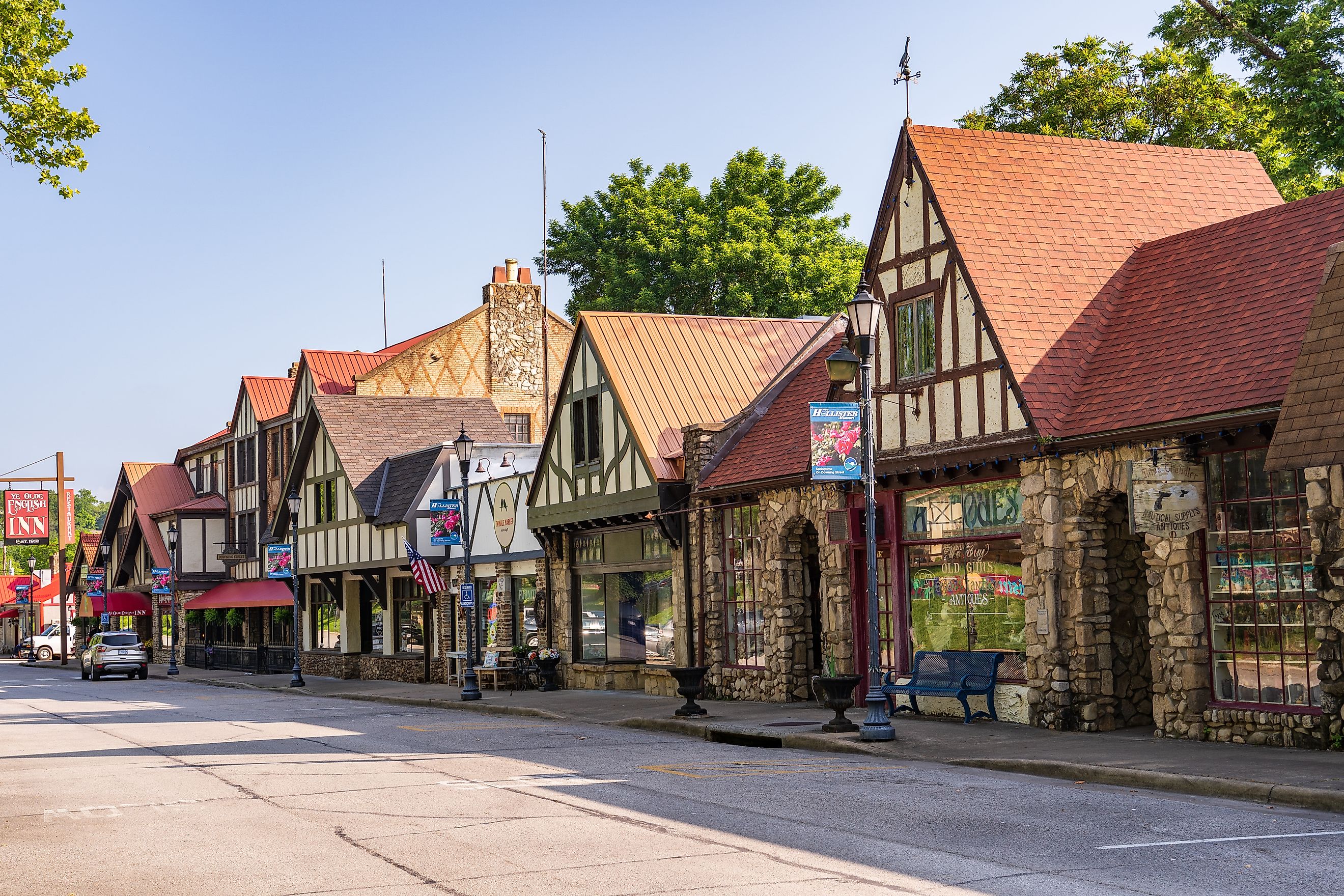
The hatchery grounds open at 4 a.m. every day, with about three miles of trails. Downing Street, Hollister's pedestrian mall, has the Downing Street Pour House for American and bar food and Kendall's Treasures for antiques, and the town lights its Christmas tree there each November. On the west side of Branson, the 1,534-acre Ruth and Paul Henning Conservation Area has 5.6 miles of hiking trails, a scenic overlook, and a lookout tower, and horses and bicycles are kept off the trails.
Lampe, Missouri

A day at Dogwood Canyon Nature Park, the 10,000-acre nonprofit preserve with a Lampe address, can begin on more than six miles of paved trails. The Hickory Ridge Trail adds a half-mile walk of moderate difficulty, and trout fishing and horseback riding are both available.
The afternoon can go to the two-hour narrated Wildlife Tram Tour, which crosses the state line into Arkansas and enters the Bison-Elk Country pasture, where bison and elk graze. As of 2026, seasonal pricing starts at $34 for adults and $24 for children.
The busy days in these towns are easy to find on a calendar. Stockton has its Black Walnut Festival in September. The Illinois River at Tahlequah is busiest until Labor Day, the same weekend the pool at Devil's Den closes for the year. Past those dates, most of the parks and lakes at the edge of these towns stay open. Cabins with fireplaces in the Lee Creek valley can be booked all winter, Mill Creek on Greers Ferry Lake still has no staff on site, and bald eagles can be found on Stockton Lake through February. In the Irish Wilderness near Alton, streams disappear and reappear farther downstream, and the Forest Service asks visitors to protect the solitude.