10 Off-The-Grid Great Lakes Towns To Visit In 2026
Ready to lose the crowds for good? The Great Lakes have thousands of miles of shoreline, and the best stretches almost never have a packed boardwalk attached. Reaching Copper Harbor means a long haul to the very tip of the Keweenaw Peninsula, roughly 250 road miles past the last interstate. Getting to Drummond Island means loading the car onto a ferry first. That extra effort is the whole appeal, and these ten towns are where it pays off, with room to actually hear the water.
Copper Harbor, Michigan

Copper Harbor is where the road simply runs out, and that is a wonderful thing. US-41 ends at the northern tip of the Keweenaw Peninsula here, with Lake Superior stretching past town and no reason at all to rush back south. The 2020 census counted fewer than 150 residents, and the local tourism office pegs the community at roughly 250 miles from the nearest interstate. As off-the-grid credentials go, that is tough to beat.
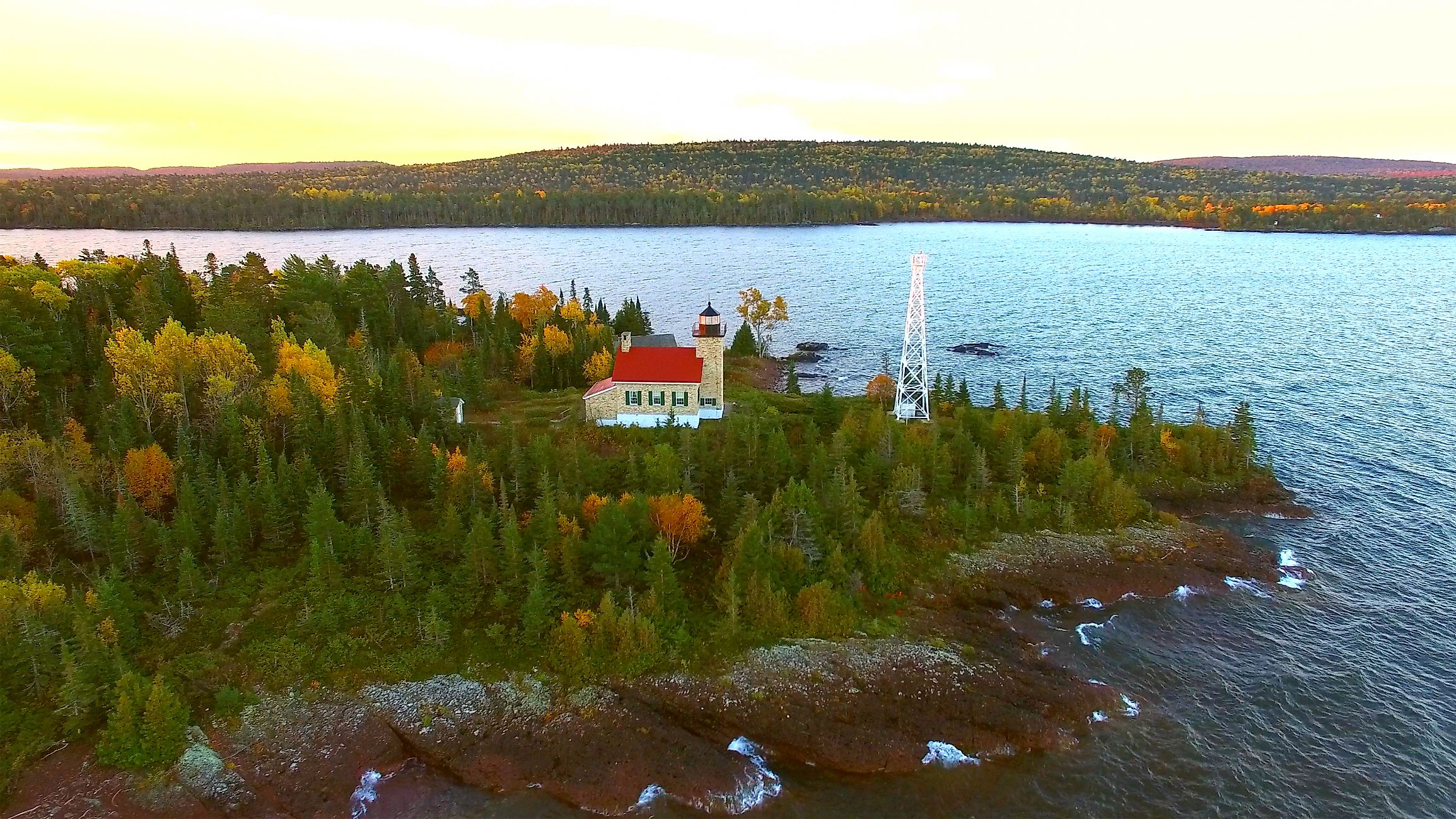
On foot from town, the forest trails at Hunter's Point Park lead out to a raw, wave-battered stretch of Lake Superior. Just east, Fort Wilkins Historic State Park sits on the site of an 1844 Army post beside Lake Fanny Hooe, complete with the Copper Harbor lighthouse complex and a tangle of trails wired into the area's celebrated mountain-bike network. Want the big view? The drive over Brockway Mountain climbs high above the peninsula before curling back down to the harbor. It is a small town with a genuinely enormous backyard.
Drummond Island, Michigan

Getting to Drummond Island starts with a ferry, and honestly, that beats another highway off-ramp any day. The vehicle crossing from De Tour Village takes only about ten minutes, and the boats run year-round. Summer schedules can tighten when one of the ferries is pulled for maintenance, so check the timetable before you load up. Pack a little patience and call it part of the adventure.
Once you are across, you get more than 100 miles of off-road trails. The Fossil Ledges on the island's east side are slabs of limestone crammed with ancient marine life, though you will likely need a high-clearance vehicle to reach them. Prefer to paddle? The Heritage Water Trail is all yours. For a gentler afternoon, the free Drummond Island Historical Museum is open seasonally into October. A ten-minute boat ride does not sound like much, but beyond the dock lie long, quiet stretches of woods where traffic is basically a rumor.
Port Wing, Wisconsin

Port Wing sits on Wisconsin's Lake Superior shore, well off the resort circuit. Commercial boats still work out of its harbor, and Harbor Park has a boat launch, a long breakwater, and a boardwalk along part of the shore. There is plenty of elbow room on the sand beaches nearby, minus the summer scrum you would find over in Bayfield.
There is enough going on to justify an overnight, too. The Saturday market runs through the warm-weather months, and Heritage Hall Museum is open on summer weekends. Fishing and the old sandstone trade shaped this place, so the working harbor is living history, not a backdrop. Just outside the village, a maintained trail leads to an overlook above the Twin Falls gorge. This is the rare Lake Superior stop where the harbor is the main event, not a stage set for a row of souvenir shops.
Grand Marais, Minnesota

Grand Marais is busier than most towns on this list, but it belongs here because wilderness is only a step outside of town. North House Folk School sits right on the harbor, where instructors still teach traditional crafts. Two miles inland, the Pincushion Mountain system has about 25 kilometers (roughly 15 miles) of trails above Lake Superior, and they connect straight into the North Shore's much bigger network.
The weirdest outing around is at Judge C.R. Magney State Park. There, at Devil's Kettle, half the Brule River pours into a deep pothole in volcanic rock. For years, nobody could say where that water went. Then, in 2017, Minnesota DNR hydrologists measured nearly identical flow above and below the falls, proving the water simply rejoins the river downstream rather than escaping through some secret tunnel to Lake Superior. Back at the harbor, an easy walk leads out to Artist's Point on the basalt shoreline, and you can still buy wild-caught Lake Superior fish by the pound at Dockside Fish Market.
Bayfield, Wisconsin

Bayfield is the launch pad for Apostle Islands National Lakeshore, a 21-island playground with another 12 miles of mainland coast attached. That is quite a backyard. When the weather cooperates, kayakers make for the sandstone sea caves while tour boats thread among the islands and their historic light stations. Too rough to paddle? The mainland trail above the caves is a solid dry-land plan B.
Winter is trickier than old brochures let on. You usually reach Madeline Island by ferry, with the ice road open only when conditions allow, and walking to the mainland ice caves is rarer still. Some winters the ice never sets up safely at all. In fall, the orchards are an easy excuse to linger, and from the compact downtown, the lake is in view on just about every walk.
Port Austin, Michigan

Port Austin sits at the tip of Michigan's Thumb, and its signature sight is not one you can drive to. Turnip Rock stands off a privately owned stretch of Lake Huron shore, so a kayak is the standard ticket. Paddlers can approach from the water, but the surrounding land is private, so no cutting across for a shortcut. That little hurdle is a big reason the shoreline still looks the way it does.
Saturday mornings get busy fast. The Port Austin Farmers Market runs through the warm-weather months, with well over 100 vendors at its peak. Once the stalls pack up, the quiet is only a few miles off at Port Crescent State Park, where a beach and a boardwalk run along the shore and the state-designated dark-sky preserve is open for stargazing after dark. You get a lively morning, a peaceful night, and no crowd to fight.
Two Harbors, Minnesota

Two Harbors is still a working town first and a vacation set second, and it is better for it. Ore docks still take up part of the harbor, and the historic light station stands beside Agate Bay. The old Duluth and Iron Range Railroad Depot is now a museum with about 4,000 square feet of exhibits on Lake County history. This is also the birthplace of Minnesota Mining and Manufacturing, better known today as 3M, which five businessmen launched here in 1902.
About 13 miles up Highway 61, Gooseberry Falls State Park is the obvious plunge into the woods, with more than 20 miles of hiking trails and a rocky Lake Superior shore beyond the falls. It is no secret, with well over half a million visitors a year, so an early start pays off. Back in town, the blend of lakefront industry and lighthouse heritage is a world apart from the glossier resort stops up the shore.
Fair Haven, New York

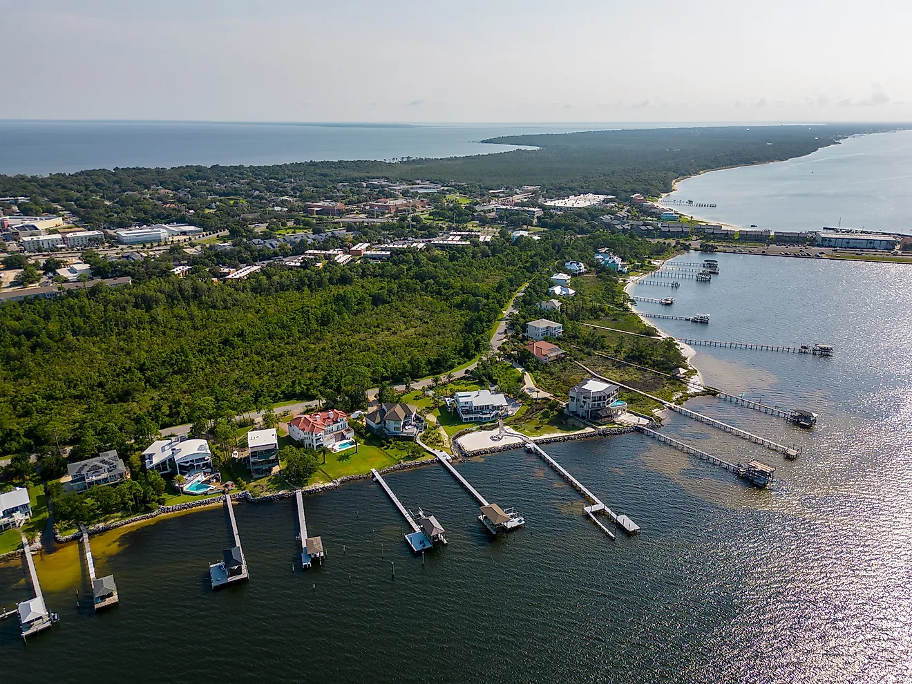
For its size, Fair Haven has a lot of Lake Ontario shoreline to work with. Fair Haven Beach State Park has about 1,500 feet of sand, including a 600-foot guarded swimming area in season, and the ground behind it climbs into wooded bluffs above the water. With 46 electric and 138 non-electric campsites, a night beside the lake does not require a resort reservation.
A few minutes away at Little Sodus Bay, the pace drops. Boats sit in the protected water behind the Lake Ontario shore, and anglers work the piers around the village. Inside the park, the canoe and kayak rentals are meant for Sterling Pond rather than the open lake, which matters a lot on a rough Lake Ontario day. Fair Haven is light on marquee attractions, and that is precisely the point. A long beach and a small harbor are plenty for a full day, no checklist required.
Grand Marais, Michigan

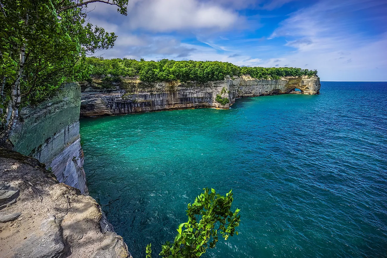
Grand Marais sits at the eastern edge of Pictured Rocks National Lakeshore, far enough from Munising that it feels like a different park entirely. Sable Falls is barely a mile west of town, where the water tumbles 75 feet over sandstone and 168 steps drop to the main viewpoint. Keep going past the falls and the trail reaches Lake Superior below the Grand Sable Dunes.
Those dunes perch atop the Grand Sable Banks, which rise as high as 300 feet for some of the most dramatic terrain in the park. Farther west, about 12 miles out, the Au Sable Light Station sits at the end of an easy walk. From Hurricane River Campground, it is a mile-and-a-half stroll along the old access road to the 1870s lighthouse. Best of all, Grand Marais is small enough that grabbing dinner after the hike never feels like re-entering a city.
Ontonagon, Michigan

Ontonagon is a reminder of just how much wild country Michigan's Upper Peninsula still has. The village sits where the Ontonagon River meets Lake Superior, and Porcupine Mountains Wilderness State Park begins about 15 miles to the west. At roughly 60,000 acres with more than 90 miles of hiking trails, the Porkies rank as Michigan's largest state park, and a big stand of old-growth hardwood and hemlock still grows inside it. A morning in town can turn wild by early afternoon.
The town also has one of the more approachable historic lighthouses on this stretch of Lake Superior. The current brick tower dates to 1866, and the Ontonagon County Historical Society runs warm-season tours, and its museum displays the station's original fifth-order Fresnel lens. Down at the river, boaters can reach Lake Superior straight from the marina. Ontonagon has just enough to make an easy base camp, yet forest, not development, covers most of the surrounding map. That is what makes it a far better fit for this list than any merely sleepy small town.
The Reward For Going Off-Grid
The Great Lakes contain about 21% of the planet's surface fresh water, and the famous waterfront towns will always have their fans. These ten are for the other kind of day. In Copper Harbor, the pavement simply ends. On Drummond Island, arrival alone means a boat. Elsewhere, a working harbor or a long public beach is enough on its own. The common thread is simple. Out here, you can still hear the water without hearing everyone else.