The First National Lakeshore In America
Established on October 15th, 1966, Pictured Rocks National Lakeshore was the first national lakeshore in America.
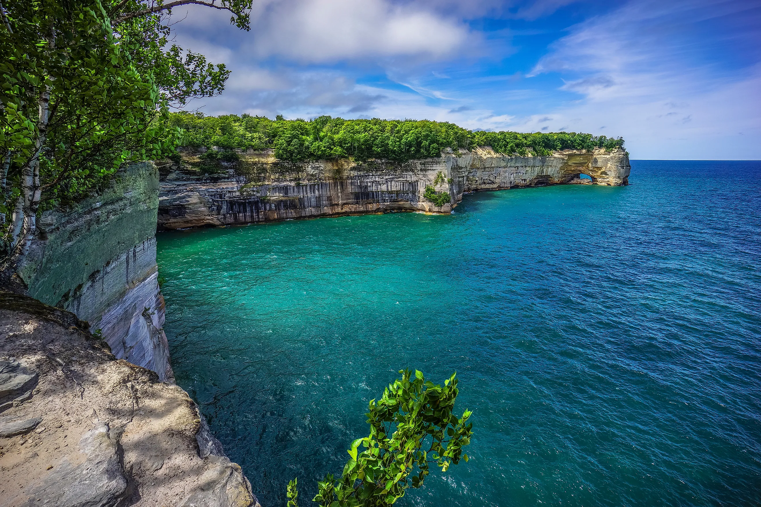
The 43-mile stretch of Michigan's Upper Peninsula continues to protect and promote the 200-foot mineral-stained cliffs after which it takes its name, as well as 300-foot perched sand dunes, waterfall-laden forests, and the clean, crisp waters of Lake Superior.
Nearly one-million annual visitors come to Pictured Rocks National Lakeshore to paddle alongside these expressive formations, take scenic cruises to various points-of-interest, hike some of its 111 miles of nature trails, and sink into the terminus towns of Munising and Grand Marais.
Establishing Pictured Rocks

The Pictured Rocks lakeshore was surveyed by the National Park Service in 1957 to 1958, in addition to more than 5,000 miles of Great Lakes shoreline.
The area was identified as a potential candidate for inclusion in the National Park Service (NPS) based on its "...unique and spectacular scenery unmatched elsewhere on the Great Lakes..."
Michigan Senator Philip A. Hart continued this momentum when he introduced the first federal bill to preserve the Pictured Rocks on June 27th, 1961.
This proposal faced opposition by local land owners and logging companies due to the short-term losses they would accrue, but he insisted on the economic benefits of a protected recreation area, citing Mackinac Island as an example.

"...in order to preserve for the benefit, inspiration, education, recreational use, and enjoyment of the public a significant portion of the diminishing shoreline of the United States and its related geographic and scientific features..." said President Lyndon Johnson on October 15, 1966, when the proposal was signed into law.
"Diminishing shoreline" refers to the rapid loss of publicly accessible shoreline to private ownership and industrialization in the first half of the 20th century.
In the coming years, 71,397 acres (since expanded to over 73,000) was acquired and divided into two zones of roughly equal size. The Shoreline Zone was intended for the preservation and recreation purposes of a traditional national park.
The Inland Buffer Zone (IBZ) served to protect the Shoreline Zone and peripheral naturescape, while also allowing for utilization of the land's resources for compatible economic purposes, namely, timber harvesting. The IBZ consists of national and state forests, private commercial forest, and some other privately-owned parcels.

Pictured Rocks is the only unit within the National Park Service that has a legislated buffer zone.
Land acquired and access roads installed, Pictured Rocks National Lakeshore was officially christened on October 6th, 1972, with a ceremony at Bayshore Park in Munising, Michigan.
In 2009, the 11,740-acre Beaver Basin Wilderness was established within the Shoreline Zone, adding even more federal protections to the inspiring and delicate naturescape.
Pictured Rocks National Lakeshore's ongoing mission, as stated by the National Park Service, is to preserve the nationally significant portion of the Great Lakes shoreline, to allow public access to its geologic, scientific, scenic and historic features, and to offer opportunities for recreation, education, inspiration, and enjoyment.
Now let's delve deeper into the natural, cultural, and recreational assets of the Pictured Rocks region.
Experiencing Pictured Rocks
Nature

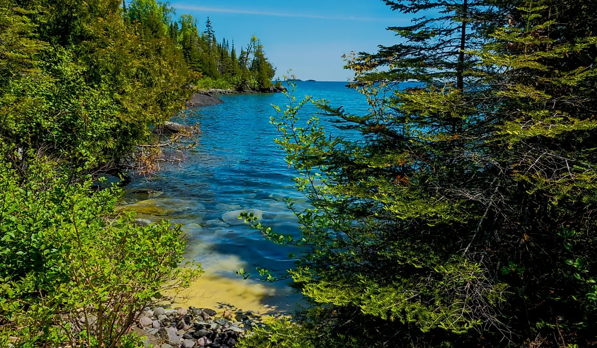
Pictured Rocks National Lakeshore covers 42.8 miles of Lake Superior shoreline, between the terminus towns of Munising, Michigan (west) and Grand Marais, Michigan.
Working west to east, the first 15 miles consists of the marquee sandstone cliffs that stand as tall as 200 feet above the water. These sheer, striated walls act as canvases for the mineral deposits that seep out with the ground water.
Different combinations of iron, copper, manganese, and limonite create streaks of red, orange, blue, green, brown, black, and white. Some sections of these cliffs also reveal rocks that were deposited between 500-million and one-billion years ago (as seen during the kayak tours).
Complementing the colorful cliffs are numerous caves, arches, and sea stacks. These features have names such as "Lovers Leap," "Chapel Rock," "Miners Castle," "Caves of All Colors," and so on, though it should be noted that due to erosion, the shapes and colors of the Pictured Rocks are ever-changing.

The final five miles on the east end of Pictured Rocks National Lakeshore is dominated by the Grand Sable Dunes. These 300-foot-tall perched dunes are a marvel to witness, and a serious challenge to conquer. They were used during the logging boom to send felled trees down to the water's edge, where they were subsequently shipped to sawmills around the Great Lakes.
Twelve of Pictured Rocks' nearly 43 miles consists of freshwater beaches. Some are at the base of the dunes, some are hiding in coves amongst the sandstone cliffs, and others are peppered throughout.
The purview of this national lakeshore also extends a quarter-mile over the surface of Lake Superior — the largest of the Great Lakes and the largest freshwater lake by surface area in the world.

Up above, Pictured Rocks National Lakeshore sits in a transition zone between boreal and eastern hardwood forests. This made the region initially attractive to loggers, and now hikers who come to explore the 111 miles worth of tranquil nature trails, many of which visit major waterfalls.
In terms of flora and fauna, Pictured Rocks National Lakeshore is home to over 300 species of animals, including black bears, gray wolves, bald eagles, and the federally-endangered piping plover.
This region also fosters over 900 species of plants, including the federally-threatened Pitcher's thistle and Lake Huron tansy, and several species of fern that are threatened state-wide.
Culture

Modern day Pictured Rocks National Lakeshore was part of the ancestral lands of the Ojibwe-Anishinaabe people. From their base on Grand Island, they would hunt, fish, and gather maple sugar, making offerings of tobacco to the cliffs (that they believed to be living spirits) as they passed by.
Jump ahead to the late 19th and early 20th centuries, logging and mining boomed across Michigan's Upper Peninsula. One of the sole remaining remnants of the logging era is the aforementioned Log Slide. This interpretive turnout awaits just outside of Grand Marais.
The chute that slid logs down to the water has long since been removed, allowing for a soft, unshod descent. But beware, it can take upwards of an hour to grunt and claw your way back up. Some people even require rescue.

With the increase in shipments up and down Lake Superior, shipwrecks began to stack up. In fact, owing to the brutal storms of this northernmost Great Lake colliding with the imposing terrain of the Pictured Rocks, 45 shipwrecks have been recorded along this shoreline.
This grave maritime history, in contrast to the prosperous logging era, is palpable throughout the Pictured Rocks National Lakeshore, not only because of the nearshore shipwrecks visible through the pristine water, but also historic sites such as the Au Sable Light Station (circa 1874), the Munising Front Range Lighthouse (1908), the Munising and Grand Marais U.S. Coast Guard Stations, and the Grand Marais Harbor of Refuge.
Outdoor Recreation

Pictured Rocks National Lakeshore is a treasure trove of outdoor recreation. There are three drive-in campgrounds, 13 backcountry camping areas, and a range of cottages, cabins, and traditional accommodations to be found throughout Munising and Grand Marais.
Depending on your basecamp, you might frolic about the dunes, hike to waterfalls and vistas via the crowd-pleasing Chapel Loop, or, during the winter, break out the skis, snowshoes, snowmobile, or even ice axes.
In fact, some of the world's best ice climbers congregate at Pictured Rocks each February for the Michigan Ice Fest.

As diverse as the terrestrial activities are, the best way to experience Pictured Rocks National Lakeshore is from the water.
Pictured Rocks Kayaking offers various guided tandem kayak tours that bring you right up close to the lakeshore's most famous sandstone features.
Alternatively, Pictured Rocks Cruises offers daytime and sunset sailings for anyone looking to cover more ground in a leisurely fashion. Of course, you are also welcome to explore Pictured Rocks via your own watercraft.
Other National Lakeshores
Pictured Rocks National Lakeshore was the first of its kind in America, but two other national lakeshores followed in its wake.
Apostle Islands National Lakeshore

Further west along Lake Superior, also within Ojibwe ancestral lands, Wisconsin's Apostle Islands National Lakeshore covers 21 of the 22 Apostle Islands and 12 miles of Bayfield Peninsula's shoreline.
Established on September 26, 1970, the Apostle Islands lakeshore also caught the attention of Congress for its beautiful sandstone cliffs (this time more of a solid reddish-brown hue), sea caves, and beaches. Apostle Islands also contains the largest collection of lighthouses in the NPS.
Sleeping Bear Dunes National Lakeshore

Established on Oct 21st, 1970, Sleeping Bear Dunes National Lakeshore showcases more of Michigan's world-leading perched dunes, including the 450-foot titular giant.
Stretching 65 miles and over 71,000 acres along the Lower Peninsula's Lake Michigan shore, this national lakeshore once again marries maritime and Indigenous history with wild beaches, and a mix of gentle hikes and quad-busting dune climbs.
Pictured Rocks Speak A Thousand Words
Through all the resource-based economic incentives of the 20th century and political squabbles that tangle all eras, the beauty of the Pictured Rocks prevailed.
Thanks to groundbreaking legislation in the 1960s, this wild and scenic stretch of Michigan's Upper Peninsula ushered in a new category of recreation area to the National Park Service: national lakeshores.
Given the ongoing success of Pictured Rocks and its peers, perhaps there is room around the Great Lakes, or other of America's major freshwater bodies, for a new national lakeshore.