Maps of Oman

Oman occupies an area of 309,500 sq. km in the southeastern coast of the Arabian Peninsula.
As observed on the physical map of Oman, the northernmost part of Oman, the Musandam Peninsula, is separated from the rest of the country by a strip of land belonging to the United Arab Emirates. The peninsula is comprised mostly of low hills and mountains.
In the rest of the country, a narrow and fertile coastal plain fronts the Gulf of Oman in the north; from there the land rises into the rugged Hajar Mountains. Oman's highest point is Jabal Akhdar which reaches 9,776 ft. (2,980 m) and is marked on the map by a yellow triangle, is located in this mountain region.
Central and southeast, a few scrubby hills and low mountains dot the central desert landscape and coastal areas.
As observed on the map, to the west, the pebbly, desert-like land slopes gently into the sands of the Rub' Al Khali Desert.
There are no perennial rivers or lakes of note. The Gulf of Oman has the lowest point in the country at 0 m.
The country also has several islands some of which like the Masirah Island, Al Halaaniyaat Islands have been marked on the map above.
Governorates Map of Oman

Oman (officially, The Sultanate of Oman) is divided into 11 administrative governorates (muhafazah). In alphabetical order, these governorates are: Ad Dakhiliyah, Ad Dhahirah, Al Batinah North, Al Batinah South, Al Buraymi, Al Wusta, Ash Sharqiyah North, Ash Sharqiyah South, Dhofar, Muscat and Musandam. These governorates are further subdivided into a total of 59 provinces (wilayat).
Located along the Gulf of Oman, in the northeastern part of the country, Muscat is the capital and largest city of Oman. It is also the country’s political, economic and administrative center. Strategically located on the Arabian Sea, Salalah is the second-largest city of Oman. The Port of Salalah is the largest port in Oman as well as the biggest seaport in the Arabian Peninsula.
Where is Oman?

Oman is a sovereign country located in the Arabian Peninsula of Western Asia in the northern and eastern hemispheres of the Earth. Oman shares a north western border with United Arab Emirates (UAE); a western border with Saudi Arabia and Yemen. Oman also shares coastline borders with the Arabian Sea in the south and east along with the Gulf of Oman in the northeast. Oman is strategically situated at the mouth of the Persian Gulf in the south eastern part of the Arabian Peninsula. The country shares its maritime borders with Pakistan and Iran.
Oman Bordering Countries: Yemen, Saudi Arabia, The United Arab Emirates.
Regional Maps: Map of Asia
Outline Map of Oman


Key Facts
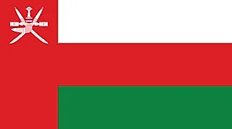
| Legal Name | Sultanate of Oman |
|---|---|
| Flag |
|
| Capital City | Muscat |
| 23 37 N, 58 35 E | |
| Total Area | 309,500.00 km2 |
| Land Area | 309,500.00 km2 |
| Water Area | N/A |
| Population | 4,974,986 |
| Major Cities |
|
| Currency | Omani rials (OMR) |
| GDP | $76.98 Billion |
| GDP Per Capita | $15,474.03 |
This page was last updated on December 7, 2022