9 Great Road Trips to Take in New Mexico
New Mexico’s highway network crosses several terrains, including the Rio Grande corridor, the Sangre de Cristo foothills, the Jemez Mountains, the Tularosa Basin, and the long I-40 corridor. Many of the state’s most satisfying drives are defined by long, clearly signed highways that let you watch the landscape change without constant turns or complicated directions.
These routes include established scenic byways such as the Turquoise Trail National Scenic Byway (NM-14) between Albuquerque and Santa Fe, the Enchanted Circle Scenic Byway mountain loop around Taos, and the Jemez Mountain Trail National Scenic Byway, which is commonly driven as a loop through canyon, forest, and the Valles Caldera area. Find practical point-to-point road trips like NM-15 from Silver City to Gila Cliff Dwellings and US-70 through the Tularosa Basin past White Sands. Each trip sticks to designated highways and a small set of stops directly on or near the main corridor, so you can easily plan the best road trip adventure in New Mexico.
High Road to Taos

High Road to Taos is the slower alternative to the Rio Grande corridor between Española and Taos. Most drivers run it on NM-76 and NM-518, which keeps navigation simple while still delivering steady elevation change through the Sangre de Cristo foothills.
From Española, the route climbs into upland villages with quick, on-route stops that don’t require detours. Chimayó is the most practical early stop, since El Santuario de Chimayó sits close to the corridor. The drive continues through Truchas and nearby communities, where the road alternates between open foothill stretches and tight village segments.
Farther along NM-76, Trampas is an easy stop for the landmark San José de Gracia Church on the village plaza. Near the north end, Ranchos de Taos provides a final stop before Taos, with the San Francisco de Asís Mission Church near the approach.
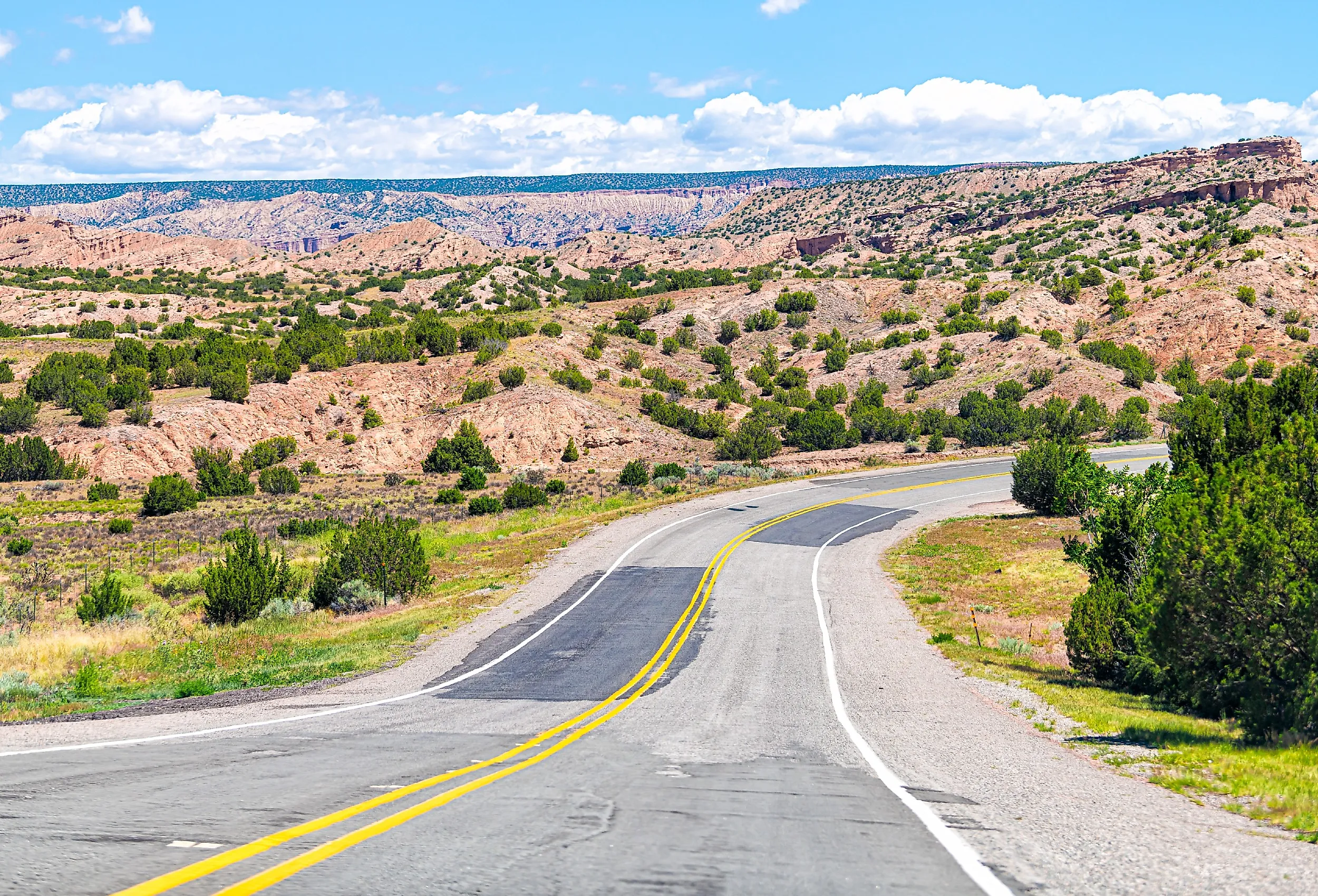
Turquoise Trail National Scenic Byway

The Turquoise Trail National Scenic Byway is an approximately 52-mile National Scenic Byway on NM-14 that links Albuquerque and Santa Fe as a two-lane alternative to I-25. The route crosses high desert and low mountain terrain, and the towns sit directly on the byway.
From the Albuquerque side, drivers typically access NM-14 via Tijeras, then continue north past Cedar Crest. For stops that stay directly on the corridor, plan around the two classic mining-town breakpoints: Madrid (gallery-and-café main street right on NM-14) and Los Cerrillos (small historic center with easy pull-in access). Between them, the byway runs through piñon- and juniper-dotted hills and rocky outcrops, with stretches that feel notably quieter than I-25.
Enchanted Circle Scenic Byway

The Enchanted Circle Scenic Byway is an 84-mile loop that begins and ends in Taos, following US-64, NM-522, NM-38, and NM-434. It stays in mountain country long enough for you to really feel the shift in elevation and vegetation, and it typically takes about 2.5 to 3 hours of driving time, plus whatever you add for stops.
On a clockwise loop, Taos leads into Questa on the NM-522 segment, then the route climbs toward the Red River area. Red River provides a compact stop on the loop. Further along, Eagle Nest Lake State Park offers multiple lake-and-peak pull-offs close to the highway. Angel Fire provides services and a convenient mid-loop break before the route returns to Taos on US-64.
Always check weather conditions before travel. Snow and ice can affect higher segments in winter, and traffic increases on peak ski weekends.
Jemez Mountain Trail National Scenic Byway

Jemez Mountain Trail National Scenic Byway is commonly driven as a 132-mile loop along NM-4 through the Jemez Mountains, moving from canyon driving into higher forest and the open grassland of the Valles Caldera area. A practical way to run the byway is from San Ysidro on NM-4 toward Jemez Springs and the Valles Caldera area, then continuing to Los Alamos, then looping back on I-25.

Jemez Springs is the most practical early stop for services (and it is also where many travelers plan a short hot-springs break). Farther north, Soda Dam is a quick roadside landmark, and the Gilman Tunnels area provides a short side trip that stays close to the NM-4 corridor. As you climb toward the Valles Caldera, the landscape opens into high-elevation grassland with broad sightlines and frequent pull-offs. Near the Los Alamos end, an optional side trip to Bandelier National Monument is a common add-on if you are turning this into a full-day itinerary.
Billy the Kid National Scenic Byway

Billy the Kid National Scenic Byway is an approximately 84-mile loop through Lincoln County and portions of the Lincoln National Forest. Plan at least two hours for the loop, without extended stops. Drivers can join the loop on US-380 from Capitan on the west side or Picacho on the east side, then complete the circuit via NM-48 and US-70. NM-214 provides an optional cut-through.
Lincoln is the main historic core tied to the Lincoln County War, and it is the most logical must-stop on the loop. Fort Stanton is a common add-on earlier in the route if you want a second history stop. The NM-48 segment brings the route toward the Ruidoso Downs area before the loop returns toward US-380. On the Ruidoso Downs side, the Hubbard Museum of the American West is an easy, byway-relevant museum stop if you want something indoor and time-bounded (however, it is currently closed for renovations, so check before you go).
Gila Cliff Dwellings Route

The drive to Gila Cliff Dwellings National Monument runs north from Silver City on NM-15 and is best suited as a dedicated day trip. The National Park Service notes that the approach road is slow and that drivers should allow extra time, which matches the sustained curves and grades on NM-15. The return trip uses the same highway.
Silver City is the practical starting point for fuel and supplies. North of town, NM-15 climbs through forested terrain with intermittent canyon views. Weather can slow travel or affect conditions, so it’s smart to check current advisories before departing. The monument provides a clear turnaround point, and the trail loop to the Mogollon dwellings gives you the opportunity to stretch your legs before hitting the road again.
Rio Grande Gorge Bridge Drive

The Rio Grande Gorge Bridge sits northwest of Taos on US-64 and offers a short drive with a clear view of the stunning gorge. The approach runs through open, exposed terrain, and the gorge crossing changes the route's feel immediately.
From Taos, drivers reach the bridge on US-64 and can use the pull-offs and viewpoints near the crossing for safe stops. Continuing past, the bridge on US-64 provides a longer segment through higher, open terrain before returning the same way. Wind exposure is often high, and icing is possible in colder months.
White Sands Drive

US-70 runs through the Tularosa Basin past White Sands National Park and continues toward the Las Cruces area. The corridor remains desert-defined for most of its length, with long sightlines and strong sun exposure.
The primary planning issue with this route is access. The National Park Service posts scheduled closure information tied to military testing, and those closures can affect both White Sands National Park access and portions of US-70 between the park and the Las Cruces area. When the route is open, the dunes provide a clear primary stop, and the westbound drive transitions toward the Organ Mountains corridor.
Route 66 Corridor

New Mexico’s Route 66 corridor runs across the state on alignments that often parallel or overlap I-40. A point-to-point drive from Tucumcari west toward Albuquerque is a practical long-distance road trip.
Tucumcari provides a clear eastern start and a built-in reason to stop: classic Route 66 neon and motel signs plus a concentrated cluster of murals along the old alignment. Santa Rosa is a predictable mid-route break, and it is also the town most associated with the Blue Hole, a well-known Route 66-era stop. Moriarty provides another straightforward service break before the route reaches Albuquerque. The scenery changes gradually from open high plains into mesa and basalt-dominant forms closer to central New Mexico.
When choosing a trip, start with terrain preference and available time. Loop routes, such as the Enchanted Circle, are suitable for a full day, while shorter segments, such as US-64 to the Rio Grande Gorge Bridge, are suitable for a half day. Long corridors, such as Route 66, are better for longer road trips with fewer stops. Always check for closures and weather updates before departure to plan your route, then sit back and enjoy the greatest road trips in New Mexico.