Which Countries Border Croatia?
The Republic of Croatia is located in the southeast and central Europe. It is part of Mitteleuropa and the Balkans. Croatia is the 127th largest country with an area of 21,851 square miles. The state borders five countries; Hungary to the north, Montenegro to the south, Slovenia to the west, and Serbia and Bosnia and Herzegovina to the east. A large part of Croatia is located in longitudes 20°, and 13°E, and latitudes 47° and 42° N. The country's maritime territory is about 7,329 square miles while the internal water bodies cover an additional 4,826 square miles.
Geography of Croatia
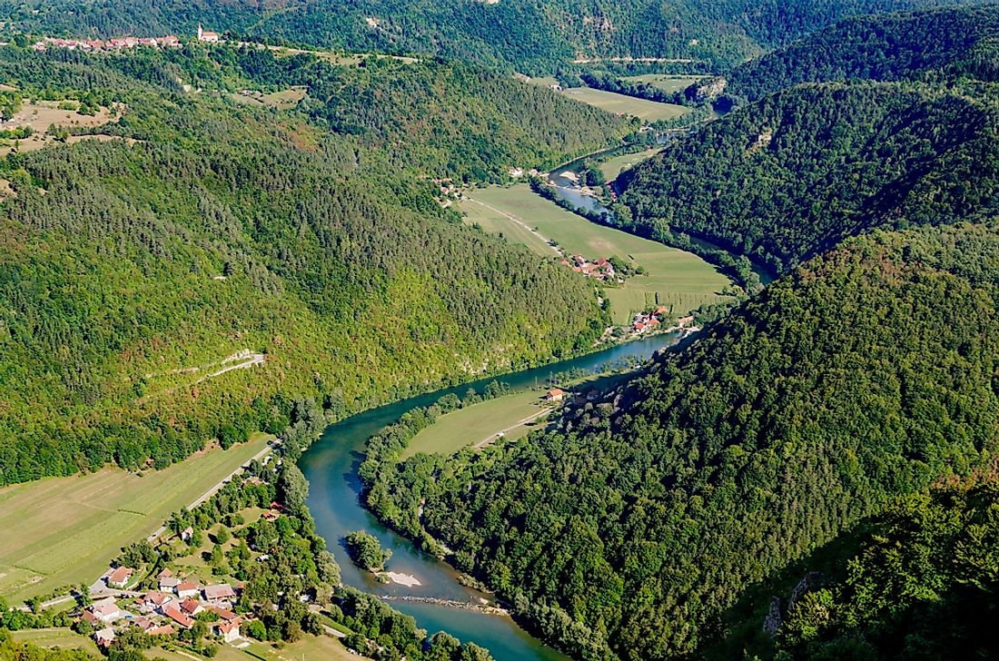
Croatia consists of three natural geographic regions. The coastal region in the south, the lowlands in the north, and the highland-montane at the center. These regions are not limited to Croatia but extend over to other European countries. The northern lowlands are part of the Pannonian basin while the coastal belt stretch along the Mediterranean. The highland-montane region is part of the Dinaric Alps. The transition between the montane and the littoral is narrow, but the boundary between the montane and the lowlands in the north is quite large and separately known as the Peri-Pannonian region. The Alps are located on the northwestern border of the country. The highland-montane region covers about 14% of Croatia; the coastal region covers 31%, while the lowlands and Pannonian section cover about 55%
Croatia's Borders
The entire length the of the country’s continental borders is about 1,260 miles. The boundary with Bosnia-Herzegovina is the longest at 579 miles, Slovenia (311 miles), Hungary (204 miles), Serbia (127 miles), while Montenegro’s border (15.5 miles) is the shortest. Natural features demarcate a large part of Croatia's boundaries. The Mura and Drava Rivers form the border with Hungary while the Una Sava, Korana, and Glina Rivers form the boundary with Bosnia-Herzegovina. The Danube River separates Croatia and Serbia while the Bregana, Sutla, Dragonja, Cabranka, and Kupa Rivers separate Slovenia and Croatia. Some borderlines ran across mountains and are demarcated by mountain massifs. The Dinara, Kamesnica, and Pljesivica are located on the border with Bosnia-Herzegovina while Zumberak Mountain lies on the border with Slovenia. The maritime boundary of Croatia in the Mediterranean is 14 miles wide.
Territorial Changes
The first Croatian state existed between the 10th and 11th centuries. Her boundaries extended from the Danube and Drava Rivers in the north to the Adriatic Sea in the south, west to Rasa, Kupa, and Sutla Rivers and east to Drina River. After Croatia lost independence and joined Hungary, her territory shrank considerably as some regions broke off and established separate states. Between the 12th and 14th century, Bosnia strengthened and expanded her territory into Croatian land while the city of Dubrovnik sought to gain independence. The Venetian Republic also extended to Istria.
In the 15th-century Turkey invaded Europe and took over Bosnia and parts of Croatia. As the Ottoman Empire expanded, Croatian territory shrank to near collapse. A series of peace treaties saw Croatia regain some of the lands it had lost to the Ottoman Empire and by 1718, Croatia, Dalmatia, and Slavonia had merged. Attempts to unify all Croatian territories failed until 1848 when unity was realized for a short time.
Part of the territory along the border with occupied Bosnia-Herzegovina was placed under military administration until 1881. Religious migration along the border occurred in the late 18th and early 19th centuries as the Catholic population migrated deeper into Croatia or Austria. Part of the Catholic population that had been assimilated into the Islamic faith by the Turks evolved to a separate Muslim nationality.
After the Ottoman Empire disintegrated, the Austro-Hungarian empire was established, but its existence was short lived. The Slovenes, Serbs, and Croats created the state of Yugoslavia which also included Macedonia and Montenegro. Ethnic tension, cultural differences, political and economic inequality, and the need to be independent led to a bitter civil war that broke the state into independent states based on ethnic backgrounds. On October 8, 1991, Croatia declared independence.
Extreme Points of Croatia
The northernmost part of Croatia is Žabnik in Međimurje County, the easternmost point is Rađevac, Vukovar-Syrmia County, Cape Lako, Istria County is the westernmost point, and the islet of Galijula is the southernmost point. The Dinara peak of Dinara mountain (6,007 feet) is the highest point in the country while the Adriatic Sea is the lowest point.


