Which Countries Border Indonesia?
Situated in Southeast Asia, Indonesia is one of the largest archipelagic countries in the world. The nation is made up of over 13,000 islands that cover a combined area of over 0.735 million square miles. Despite being recognized as an island nation, Indonesia has a land border that is 1,924 miles in length. The country shares its land border with three countries of East Timor (157 miles), Papua New Guinea (512 miles), and Malaysia (1,255 miles). Indonesia also has a long maritime border that it shares with India, Australia, Thailand, Vietnam, Palau, Singapore, and the Philippines.
Papua New Guinea
Indonesia and Papua New Guinea share a land border. The border between the two countries cuts across the island of New Guinea and is 510 miles in length. The border follows a straight line and runs from north to south of the island. The border starts from the Pacific coast and runs south until ending at the Arafura Sea. Indonesia’s provinces of West Papua and Papua are found along the border. The international border was first determined while the two nations were under the colonial administration of the British and Dutch in the 19th Century.
The two countries had engaged in territorial disputes for many years which they resolved after signing a treaty in 1979. The Indonesian defense forces have made incursions across the border on a few occasions to the chagrin of Papua New Guinea. Nonetheless, both countries agree that having a safe border is important for the mutual economic benefit of the two neighboring countries. Among the busiest border crossings on the Papua New Guinea-Indonesia border is the one at Wutung. The border crossing is used by thousands of people from Papua New Guinea to access the cheap commodities available at the Bhatas markets in Indonesia.
The border is porous with cross-border movement being mostly unregulated by government authorities. While the lack of proper border controls helps in connecting tribal villages found on opposite sides of the border, this also exposes both countries to security breaches. The problem is aggravated further by the presence of a secessionist movement. The porous border has been the headache of conservationists who claim that illegal loggers take advantage of the lack of border controls to smuggle lumber, which has gravely affected the forest cover in New Guinea.
East Timor
Indonesia shares a land border with East Timor on the island of Timor. The border between the two countries is the shortest land border that Indonesia shares with another country, stretching 157 miles in length. The international border was first defined in 1915 by the Dutch and the Portuguese which had laid claim on the island of Timor. Indonesia would retain the border after gaining independence from the Dutch. However, the border witnessed the bloody civil war pitting two political groups in East Timor as the country was struggling for independence from Portugal in the 1970s.
Malaysia
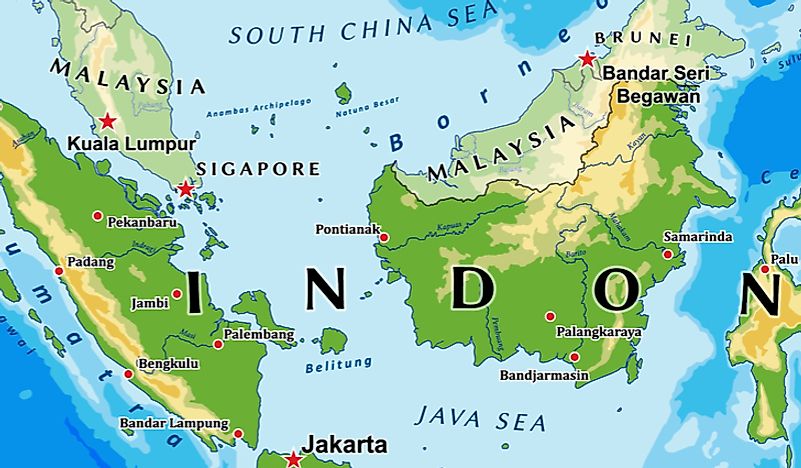
Another country that Indonesia shares a land border with is Malaysia. The international border delimiting the two nations is situated on the island of Borneo. Starting at Tanjung Datu, the border runs 1,255 miles in length ending at the Gulf of Sebatik. The border touches three Indonesian provinces of West, North, and East Kalimantan. In Malaysia, the border touches two states of Sarawak and Sabah.
The border delimiting Malaysia and Indonesia was first determined in 1891 when the two countries were Dutch and British colonies respectively. The border was defined in the Border Convention signed on June 20th, 1891 in London. The two colonial powers would later agree to fine-tune the border in the early 20th Century. Both Malaysia and Indonesia would maintain the border as established by the colonial powers after the two countries gained independence. However, the two countries would later engage in territorial disputes over the demarcation of the international border. Indonesia and Malaysia finally agreed to conduct a joint intergovernmental survey on the border in November 1973 which started in 1975 and ended in 2000.
There are numerous border crossings found along the border. The border has only three official border crossings where border officials control cross-border movement. These official border crossings are the Badau-Lubok Antu crossing, the Aruk-Biawak crossing, and the Entikong-Tebedu crossing. However, these official border crossings notwithstanding, the border is porous and experiences thousands of illegal crossings each day. Some points on the border experience such a large number of illegal crossings that they are regarded as informal border crossings.
Maritime Borders
Besides sharing a land border with Indonesia, Malaysia also shares a long maritime border with its neighboring country. The two countries have maritime borders in the South China Sea, the Straits of Singapore, Malacca, and the Celebes Sea. The maritime border features more than 20 official sea crossings which facilitate cross-border movement between the neighboring nations. The maritime border was established after the signing numerous international treaties over the 20th Century. However, only the border delimiting the two countries in the South China Sea has been defined and accepted by both nations. As a result, there exist territorial disputes particularly in the Celebes Sea where the two countries have both laid claim on the Ambalat Block as well as the Sipadan and Ligitan islands.
Among the countries that Indonesia shares a maritime border with is Vietnam. The maritime border delimits the territorial claims the two countries have in the South China Sea. The border was defined in an agreement the two countries signed in 2003 in Hanoi. According to the agreement, the border (known as the continental shelf boundary) is defined as an imaginary line found between two points.


