Which Countries Border Armenia?
Armenia is located in Eurasia, right along the border between Europe and Asia. Because it is located toward the end of the southern Caucasus Mountains, Armenia is sometimes referred to as a Transcaucasian country. This nation covers a total area of 11,484 square miles. Of this area, approximately 4.71% is made up of bodies of water. Despite having a relatively large area of water, Armenia does not have direct access to an open ocean. This characteristic means that it is considered a landlocked nation and its government must rely on good political relationships with nearby countries in order to access seaports to take part in international trade.
Countries Bordering Armenia
Armenia shares borders with the following countries: Azerbaijan, Nagorno-Karabakh Republic (a disputed territory), Turkey, Nakhchivan Autonomous Republic (an exclave of Azerbaijan), Georgia, and Iran. This article takes a closer look at the borders shared between Armenia and these countries.
Azerbaijan
The border between Armenia and Azerbaijan runs for a total of 625.78 miles, making it the longest international border in Armenia. This measurement considers that the disputed territory of Nagorno-Karabakh Republic is part of the territory of Armenia. That dispute, discussed below, is the reason the border between these two countries is closed.
The primary section of the border between Armenia and Azerbaijan is located along the western edge of Armenia. Its northernmost point begins at the tripoint boundary with Armenia and Georgia. From here, the border generally runs in a southeastern direction until it reaches the tripoint boundary with Iran. The Shikahogh State Reserve of Armenia is located along this southern end of the border with Azerbaijan.
Both countries were once part of the Soviet Union and after obtaining independence, the governments of each maintained most of the borders that were established during the Soviet era, although some territories are still under dispute. The border between Armenia and Azerbaijan is located in mountainous terrain. It takes on an erratic shape because long sections of this border follow the course of the Voskepar River. At one point, this border runs through the Joghaz Water Reserve as well.
Nagorno-Karabakh Republic
The Nagorno-Karabakh Republic is a disputed territory that is located within Azerbaijan. The majority of its population, however, identifies as ethnic Armenian. Most countries around the world recognize this republic as a part of the territory of Azerbaijan despite the fact that it is governed by an independent state government. This republic covers a total area of around 1,700 square miles, although some estimates suggest that it is actually over 3,000 square miles.
If the Nagorno-Karabakh Republic is considered part of Azerbaijan, then the border length between Armenia and Azerbaijan is only 351.69 miles. If it is considered part of Armenia, then the border length is the previously mentioned 625.78 miles. This calculation means that the border surrounding this territory measures approximately 274.09 miles in length.
Turkey
The border between Armenia and Turkey stretches for a length of 193.24 miles, making it the second longest international border in Armenia. This border runs along the northwestern region of Armenia, beginning at the tripoint shared with Georgia. It separates Lake Arpi National Park in Armenia from the territory of Turkey. From here, it turns in a southeastern direction, curving into Armenia before turning back into Turkey. In this section, the border runs through the middle of the Arpacay Baraji waterway, giving water access to both countries. This boundary continues running in a southeastern direction until running into the tripoint shared between Turkey, Iran, and the Nakhchivan Autonomous Republic (an exclave of Azerbaijan).
The relationship between these two countries is unfriendly and has been many years. Turkey, for example, does not recognize that the Nagorno-Karabakh Republic belongs to Armenia. As a result of these poor relations, the only border between these two countries is closed. It is located between the cities of Akyaka and Gyumri.
Nakhchivan Autonomous Republic
The Nakhchivan Autonomous Republic is technically part of the territory of Azerbaijan, considered a landlocked exclave. It lies along the southwestern edge of Armenia and is separated from Azerbaijan by the southern tip of Armenia, which has a peninsula-like shape. Armenia and the Nakhchivan Autonomous Republic share a border that runs for approximately 137 miles in length. The border between these two regions is characterized by its mountainous terrain, which is made up of the Zangezur Mountain range. The eastern side of these mountains is covered in large stretches of forest habitats.
Georgia
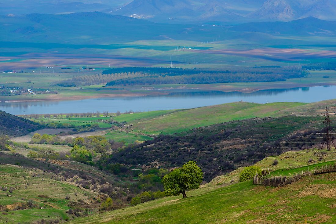
The border between Armenia and Georgia stretches for 136 miles and is situated along the northern region of Armenia. The westernmost point of this border begins at the tripoint shared between Armenia, Turkey, and Georgia. From here, it moves in a generally eastern direction until reaching the tripoint shared between Armenia, Iran, and Georgia. These two countries share a crossing point at the city of Sadakhlo in Georgia, which is connected to the city of Bagratashen in Armenia by bridge that crosses the Debed River. This area of the border is marked by rolling hills and fertile valleys.
This border crossing is the only access that Armenia has to the rest of Europe. Therefore, Armenia relies on maintaining a friendly political relationship with Georgia. It is also through this country that Armenia has access to the ports of the Black Sea, allowing it to participate in international trade.
Iran
The border between Armenia and Iran stretches for only 27.34 miles, making this the shortest international border in this country. This border sits at the southernmost tip of the peninsula-like region of Armenia. These two countries are primarily separated by the Aras River, which is also known as the Araxes River. The westernmost point of the border runs from the tripoint between Armenia, Iran, and the Nakhchivan Autonomous Republic. From here, it runs in an eastern direction, where it ends at the tripoint shared between Armenia, Iran, and Azerbaijan. Politically, Armenia and Iran have maintained a stable relationship and do not have any border conflicts. In fact, Armenia produces a large amount of energy and relies on Iran to export the surplus.


