US States That Border Mexico
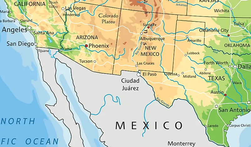
The US-Mexico border stretches for 1,954 miles from the Gulf of Mexico in the east to the Pacific Ocean in the west. The border separates the American states of Texas, New Mexico, Arizona, and California from the Mexican states of Tamaulipas, Nuevo León, Coahuila, Chihuahua, Sonora, and Baja California. The Rio Grande acts as the borderline for about 1,254 miles until a point west of El Paso Texas where there are no other natural geographic barrier apart from a small stretch of the Colorado River. About 700 miles of the border consists of chain link, barbed wire, wire mesh, and post-and-rail. The current shape of the border took effect on December 30, 1853, when both countries agreed on the Gadsden Purchase.
History of the Border
When Mexico attained independence from Spain, it stretched as far north as Oregon. In 1845, the United States annexed Texas marking the beginning of the annexation of Mexican territory. The US offered 30 million dollars to Mexico for the purchase of New Mexico and California, but Mexico turned down the offer. The US sent 4,000 troops to annex California and New Mexico. After a series of bloody confrontations, the American forces took control of the Mexican capital in 1847. On sensing defeat, the Mexican government accepted a $15 million sale agreement for what is today New Mexico, Arizona, California, and Utah, as well as part of Wyoming, Kansas Colorado, and Oklahoma.
4. California
California borders the Mexican state of Baja California for 140.4 miles. The borderline is the shortest boundary between an American and a Mexican state. There are nine border crossings points, three of which are located in the San Diego–Tijuana metropolitan region. The San Ysidro Port of Entry is the busiest land entry in the United States with over 17,000 vehicles and 20,000 pedestrians crossing each day.
3. Arizona
Arizona borders the Mexican states of Sonora and the Baja California. The entire borderline stretches for about 372.5 miles. Part of the border is separated by a wall, a situation that has forced illegal migrants to seek entry along the Baboquivari Mountain and the Sonoran desert. There are nine border-crossing points all of which are in Sonora. There is no border crossing point between Baja California and Arizona, those seeking to make the journey must go through California.
2. New Mexico
New Mexico shares a 179.5-mile long boundary with the Mexican states of Chihuahua and Sonora. Part of the boundary has been fenced with a barrier wall while the remaining part is under construction. There are three border crossing points along the boundary which are: Antelope Wells, Columbus, and Santa Teresa. The crossing points are all located in Chihuahua. Those seeking to travel from Sonora must go through the state of Arizona. The towns of Columbus, New Mexico and Puerto Palomas, Chihuahua, are located on either side of the border. The similarity in culture between the two has fostered close ties that has seen the towns engage in joint provision of services such as firefighting and other emergencies.
1. Texas
Texas has a boundary that stretches for 1,241 miles, the longest boundary between an American state and Mexico. Texas borders the Mexican states of Tamaulipas, Nuevo León, Chihuahua, and Coahuila. The entire borderline is demarcated by the Rio Grande. Texas has seven crossing points with Chihuahua, five with Coahuila, one with Nuevo León, and sixteen with Tamaulipas.
US States That Border Mexico
| Rank | US State | Bordering Mexican States | Border Length in miles |
|---|---|---|---|
| 1 | California | Baja California | 140.4 mi |
| 2 | Arizona | Sonora, Baja California | 372.5 mi |
| 3 | New Mexico | Chihuahua, Sonora | 179.5 mi |
| 4 | Texas | Tamaulipas, Nuevo León, Coahuila, Chihuahua | 1,241.0 mi |


