Ecological Regions Of Uganda
Uganda is one of the East Africa’s countries bordered by Kenya, Tanzania, South Sudan, Democratic Republic of Congo, and Rwanda. The country is the second most populous landlocked country in the world after Ethiopia. Uganda is within the Great Lakes Region and lies within the Nile basin. The country lies between latitude 4 degrees North and 2 degrees South and longitude 29 and 35 degrees East. The average elevation of the country is 1100m above the sea level. Uganda shares one of the world’s largest freshwater lakes with Kenya and Tanzania, Lake Victoria. The country experiences a modified equatorial climate and is divided into several ecological regions including;
East African Montane Forests
East African Montane Forests is a tropical moist forest common in the eastern part of Africa including Uganda, South Sudan, Kenya, and South Sudan. The ecological region is mainly in areas above 1000m above sea level. East African Montane Forests covers a total of 65500 square kilometers in 25 different enclaves. The area includes the region around Mount Moroto in Uganda and parts of Mount Elgon in Kenya-Uganda border. The climate within this ecoregion is relatively temperate because of the high altitude with temperatures falling as low as 10 degrees and rising above 30 degrees. The annual precipitation ranges between 1200 and 2000mm. The region is characterized by montane and sub-montane forest with a bit of bamboo, grassland, and rocky habitats. The rapidly expanding human population is a major threat to this ecoregion. The land is being transformed into plantations and settlements.
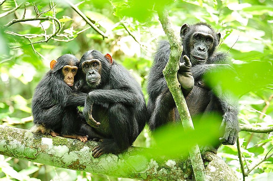
Albertine Rift Montane Forests
Albertine Rift Montane Forests covers the western part of Uganda. The eco-region has been identified by most NGOs for conservation as one of the exceptional fauna and flora endemism. The region is dominated by chains of mountains running through to the Ruwenzori Mountains in Uganda. Ruwenzori is the highest peak in this eco-region with an elevation of 5110m above the sea level. The Albertine Rift was formed as a result of a combination of the uplifted Pre-Cambrian rocks and the volcanic activities. The large cracks in the rocks are filled with water that forms lakes. The region experiences an average rainfall of between 1200 to 2000mm per annum.There are 1200 species of plants in this area, especially in the Bwindi forest. There are also several species of mammals and reptiles in this region. Logging, clearing of forest for settlement, and farming are some of the threats facing this ecological region.
East Sudanian Savannah
East Sudanian Savannah is a hot and dry tropical savannah in East and Central Africa. The area is comprised mainly of shrubs and tree species and covers the northwestern side of Uganda. The eco-region is flat with an altitude of between 200 to 1000m above sea level. The temperatures range between 18 degrees and 33 degrees centigrade with an annual precipitation of 600mm. Fauna is endemic and consists of mammals such as Mouse, Mus goundae, and reptiles. There are five species of birds and 2750 species of plants. East Sudanian Savannah is threatened by agricultural activities such as cultivation and herding.
Other Ecological Regions
Other notable ecological regions of Uganda include Northern Acacia-Commiphora Bushlands and thickets, Northern Congolian Forest-Savanna Mosaic, Victoria Basin Forest-Savannah Mosaic, East African Halophytes, and Zambezian Flooded Grasslands among others. The country has a total of 15 eco-regions consisting mainly of five biomes; Tropical and Subtropical Moist Broadleaf Forests, Tropical and Subtropical Grasslands, Savannas, and Shrublands, Flooded Grasslands and Savannas, Freshwater, and Montane Grasslands and Shrublands
Ecological Regions Of Uganda
| Rank | Ecoregions of Uganda | Biome |
|---|---|---|
| 1 | East African Montane Forests | Tropical and Subtropical Moist Broadleaf Forests |
| 2 | Albertine Rift Montane Forests | Tropical and Subtropical Moist Broadleaf Forests |
| 3 | East Sudanian Savannah | Tropical and Subtropical Grasslands, Savannas, and Shrublands |
| 4 | Northern Acacia-Commiphora Bushlands and Thickets | Tropical and Subtropical Grasslands, Savannas, and Shrublands |
| 5 | Northern Congolian Forest-Savanna Mosaic | Tropical and Subtropical Grasslands, Savannas, and Shrublands |
| 6 | Victoria Basin Forest-Savannah Mosaic | Tropical and Subtropical Grasslands, Savannas, and Shrublands |
| 7 | East African Halophytics | Flooded Grasslands and Savannas |
| 8 | Zambezian Flooded Grasslands | Flooded Grasslands and Savannas |
| 9 | East African Montane Moorlands | Montane Grasslands and Shrublands |
| 10 | Ruwenzori-Virunga Montane Moorlands | Montane Grasslands and Shrublands |
| 11 | Upper Nile | Freshwater |
| 12 | Lake Kivu | Freshwater |
| 13 | Lake George | Freshwater |
| 14 | Lake Edward | Freshwater |
| 15 | Lake Victoria | Freshwater |


