Ecological Regions Of Belize
Also known as an ecoregion, an ecological region refers to a region defined by its ecology or geography and is no bigger than a bioregion. Located on land, water, or both, these regions usually contain distinct characteristics in the flora and fauna that are different from others. Almost every country in the world has one or more ecoregions and Belize is no different. Data from the World Wildlife Fund shows that Belize has seven ecoregions.
Seven Ecoregions of Belize
1. Peten-Veracruz Moist Forests
This ecoregion has an area of about 57,600 square miles and extends over three countries namely Guatemala, Belize, and Mexico. These forests are mostly located on a coastal lowland in a region full of rivers with its conservation status set as critical/endangered. This ecoregion contains some protected areas such as Mexico’s Montes Azules Biosphere Reserve and Guatemala’s Maya Biosphere Reserve. Species living in the ecoregion include Morelet's crocodile, the ocellated turkey, breadnut, mahogany, and others.
2. Yucatan Moist Forests
These forests have an area of about 26,900 square miles in a region with minimal topographic relief and a tropical humid climate. The region is home to a number of species including 200 bird species, 90 mammals, 40 reptiles, and 15 amphibian species. Examples of these species include the emerald hummingbird, the Caribbean elaenia, the Cozumel Island raccoon, and others. The conservation status of the ecoregion is set at vulnerable.
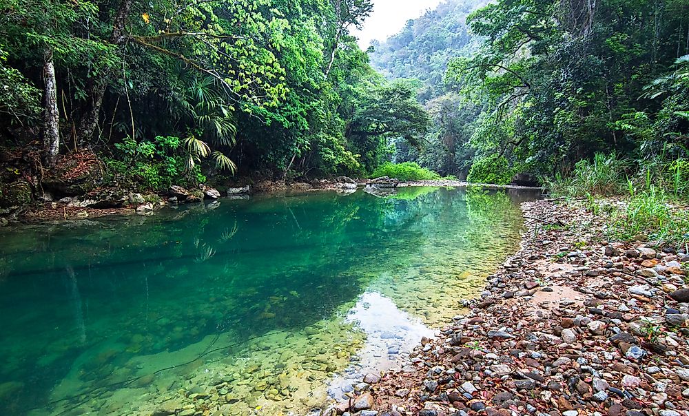
3. Belizean Pine Forests
This zone has a size of about 1,100 square miles and is currently classified as critical/endangered. The terrain varies depending on the region. For example, the Maya Mountains have a rugged topography full of rivers and low temperatures at night. Some areas, especially the ones in the central regions, are protected. Species in this ecoregion include tapir, puma, Caribbean pine, and others.
4. Belizean Coast Mangroves
This region spans an area of about 1,100 square miles mostly along Belize’s coast and Guatemala’s Amatique Bay. This ecoregion is classified as vulnerable. The ecoregion has a tropical climate with the wettest months ranging from May to February. The main vegetation includes red, black, and white mangrove. Bird and animal species include brown jay and Baird’s tapir.
5. Belizean Reef Mangroves
This zone is classified as vulnerable and has a small area of only 100 square miles. Most of the vegetation is red mangrove with black and white mangrove existing in smaller numbers. Most of the fauna is composed of birds such as boat-billed herons and cattle egret. Unfortunately, illegal hunting threatens this diverse birdlife.
6. Quintana Roo-Motagua
This ecoregion has a tropical humid climate and spans over four countries namely Belize, Mexico, Honduras, and Guatemala. The topography is mostly flat although the Sierra Madre is hilly and includes a number of rivers like the Hondo and the Belize. This region is mostly known for its numerous fish species from several families like Poecilia and Vieja.
7. Western Caribbean Sea
This ecoregion is part of the larger Caribbean Sea, which is partly located in Guatemala. Included in this ecoregion is the Mesoamerican Barrier Reef, which has a vast array of life including 65 stony coral species, 350 mollusk species, and at least 500 fish species.
Ecological Regions Of Belize
| Rank | Ecoregions of Belize | Biome |
|---|---|---|
| 1 | Peten-Veracruz Moist Forests | Tropical and Subtropical Moist Broadleaf Forests |
| 2 | Yucatan Moist Forests | Tropical and Subtropical Moist Broadleaf Forests |
| 3 | Belizean Pine Forests | Tropical and Subtropical Coniferous Forests |
| 4 | Belizean Coast Mangroves | Mangroves |
| 5 | Belizean Reef Mangroves | Mangroves |
| 6 | Quintana Roo-Motagua | Freshwater - Tropical and Subtropical Coastal Rivers |
| 7 | Western Caribbean Sea | Marine - Tropical Northwestern Atlantic |


