Ecological Regions Of Mexico
Mexico is located in the southern part of North America with most of the country lying in the North American Plate. Mexico has an average area of 1.9 million square kilometers. Mexico is bordered by the United States in the north with the Rio Grande defining the border between these two countries. Sierra Madre Oriental and the Sierra Madre Occidental mountain ranges run through the country from north to south. Mexico is divided into more than fifty ecological zones which define its climate and weather patterns. Some of the ecological regions of Mexico include;
Ecological Regions
Alvarado Mangroves
Alvarado mangroves ecoregion is located in the southern Mexico. It covers an area of 600 square miles and consists mainly of the mangrove swamp as well as reed beds and palm forest. The coastal land is dominated by the mangroves while there are also small lagoons which are fed by fresh water from the rivers which run through this ecoregion. Several species of birds have found shelter in the swamp with most of them nesting on the branches of the mangrove trees. Some of the birds in this ecoregion include the Keel-billed Toucan, wood stork, and kingfisher species. Mammals found in Alvarado mangroves include the spider monkeys and the West Indian Mantes. Most of the ecoregion has been destroyed, and the remaining parts are under threats such as logging and agricultural activities.
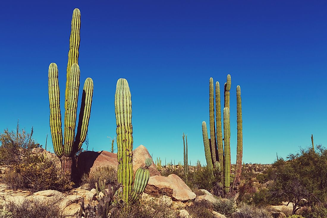
Baja California Desert
Baja California desert covers the desert regions of western Baja California Peninsula, most of Baja California Sur, and Baja California Desert, Mexico. The ecoregion covers an area of 30,000 square miles. It is characterized by a dry climate with low rainfall although the Pacific Ocean moderates its temperature. The elevation ranges from mountain ranges in the western portion, pains, and extensions of coastal dunes. The flora of Baja California desert mostly consists of xeric shrubs and over 500 species of vascular plants. Baja California desert is one of the most preserved deserts in Mexico and a home to 4 species of amphibians, over 40 reptiles, 200 birds, and over 50 mammals. Livestock ranching and salt extractions are the principle threats to Baja California desert.
Bajío Dry Forests
Bajío dry forests are located in the western central Mexico forming part of central trans-volcanic belt. The geography of the ecoregion is comprised of valleys interspersed with steep slopes and canyons. The soil is shallow but well-drained and rocky derived from sedimentary rocks. Bajío dry forests receive an average annual precipitation of 500-930 mm. The habitat is a mosaic of forest patches and thorn shrubs. The Bursera species dominate the forested area. Lake Chapala supports the majority of the biodiversity in the ecoregion. Mammals in this ecoregion include Mexican Wolf and pocketed free-tiled bat while the birds’ species include Black-throated Magpie-jay and dwarf vireo. Due to the effects of agriculture and the industrial development along Bajío dry forests ecoregion, only 5% of the original habitat remains.
Threats To The Ecological Regions Of Mexico
Significant portions of Mexico’s ecological regions have been destroyed by the various human activities. Agricultural activities such as cattle ranching, hunting and wood cutting have been the major threats to the ecosystem in the country. Even with the conservation means such as listing of the protected areas, these ecoregions continue to suffer from human activities because of reluctance in enforcing the conservation measures.
Ecological Regions Of Mexico
| Ecological Regions of Mexico | Biome |
| Alvarado mangroves | Mangroves |
| Baja California desert | Deserts and Xeric Shrublands |
| Bajío dry forests | Tropical and Subtropical Dry Broadleaf Forests |
| Balsas dry forests | Tropical and Subtropical Dry Broadleaf Forests |
| California chaparral and woodlands | Mediterranean Forests, Woodlands, and Scrub |
| Central American dry forests | Tropical and Subtropical Dry Broadleaf Forests |
| Central American pine-oak forests | Tropical and Subtropical Coniferous Forests |
| Central Mexican matorral | Deserts and Xeric Shrublands |
| Central Mexican wetlands | Flooded Grasslands and Savannas |
| Chiapas Depression dry forests | Tropical and Subtropical Dry Broadleaf Forests |
| Chiapas moist forests | Tropical and Subtropical Moist Broadleaf Forests |
| Chihuahuan desert | Deserts and Xeric Shrublands |
| Chimalpas montane forests | Tropical and Subtropical Moist Broadleaf Forests |
| Gulf of California xeric shrub | Deserts and Xeric Shrublands |
| Jalisco dry forests | Tropical and Subtropical Dry Broadleaf Forests |
| Marismas Nacionales-San Blas mangroves | Mangroves |
| Mayan Corridor mangroves | Mangroves |
| Meseta Central matorral | Deserts and Xeric Shrublands |
| Mexican South Pacific Coast mangroves | Mangroves |
| Pantanos de Centla | Tropical and Subtropical Moist Broadleaf Forests |
| Petenes mangroves | Mangroves |
| Petén-Veracruz moist forests | Tropical and Subtropical Moist Broadleaf Forests |
| Revillagigedo Islands dry forests | Tropical and Subtropical Dry Broadleaf Forests |
| Ría Lagartos mangroves | Mangroves |
| San Lucan xeric scrub | Deserts and Xeric Shrublands |
| Sierra de la Laguna dry forests | Tropical and Subtropical Dry Broadleaf Forests |
| Sierra de la Laguna pine-oak forests | Tropical and Subtropical Coniferous Forests |
| Sierra de los Tuxtlas | Tropical and Subtropical Moist Broadleaf Forests |
| Sierra Juárez and San Pedro Mártir pine-oak forests | Tropical and Subtropical Coniferous Forests |
| Sierra Madre de Chiapas moist forests | Tropical and Subtropical Moist Broadleaf Forests |
| Sierra Madre de Oaxaca pine-oak forests | Tropical and Subtropical Coniferous Forests |
| Sierra Madre del Sur pine-oak forests | Tropical and Subtropical Coniferous Forests |
| Sierra Madre Occidental pine-oak forests | Tropical and Subtropical Coniferous Forests |
| Sierra Madre Oriental pine-oak forests | Tropical and Subtropical Coniferous Forests |
| Sinaloan dry forests | Tropical and Subtropical Dry Broadleaf Forests |
| Sonoran desert | Deserts and Xeric Shrublands |
| Sonoran-Sinaloan transition subtropical dry forest | Tropical and Subtropical Dry Broadleaf Forests |
| Southern Pacific dry forests | Tropical and Subtropical Dry Broadleaf Forests |
| Tamaulipan matorral | Deserts and Xeric Shrublands |
| Tamaulipan mezquital | Deserts and Xeric Shrublands |
| Tehuacan Valley matorral | Deserts and Xeric Shrublands |
| Tehuantepec-El Manchon mangroves | Mangroves |
| Trans-Mexican volcanic belt pine-oak forests | Tropical and Subtropical Coniferous Forests |
| Usumacinta mangroves | Mangroves |
| Veracruz dry forests | Tropical and Subtropical Dry Broadleaf Forests |
| Veracruz moist forests | Tropical and Subtropical Moist Broadleaf Forests |
| Veracruz montane forests | Tropical and Subtropical Moist Broadleaf Forests |
| Western Gulf coastal grasslands | Tropical and Subtropical Grasslands, Savannas, and Shrublands |
| Yucatán moist forests | Tropical and Subtropical Moist Broadleaf Forests |
| Zacatonal | Montane Grasslands and Shrublands |


