This Alaska Scenic Byway Is The Road Trip Of A Lifetime
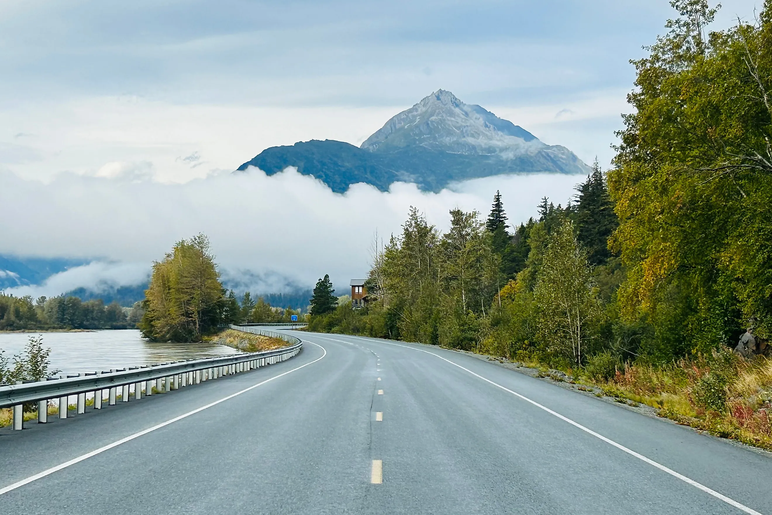
Bald eagles gather by the thousands along the Chilkat River each fall, and one Alaska road runs right past them. That road is the Haines Highway. The Chilkat people traveled this corridor for generations before Jack Dalton widened it into a packhorse trail during the 1890s Klondike rush. The U.S. Army rebuilt it as a military supply route in 1943. Today road trippers follow the paved byway past river flats and eagle roosts below the Chilkat Range. The Alaska stretch covers about 40 miles between Haines and the Canadian border, one of the most scenic drives in Alaska.
Drivers can spot a bald eagle above the Chilkat River while covering the roughly 40-mile Alaska portion of the byway. Stops along the way include Fort William H. Seward National Historic Landmark and the Chilkat Bald Eagle Preserve. Late fall brings the most eagle activity and the gold of Alaska's autumn foliage. Winters here run long and hard, though Haines Borough crews keep the road plowed and drivable through the season.
Day 1: Haines

The trip begins on the banks of the Chilkat River in Haines, an underrated stop for visitors to Southeast Alaska. Fort William H. Seward National Historic Landmark carries real military history, having grown out of the Gold Rush era as the last of twelve posts built in the territory. From 1925 to 1940 it stood as Alaska's only active Army post. Nearby, staff at the American Bald Eagle Foundation lead guided tours and keep a museum focused on bird conservation and local wildlife, with doors open at least five days a week.
After a morning with the birds, travelers can stop for lunch at Mountain Market & Cafe, which pours Ripinsky Roasters coffee alongside grilled sandwiches and baked goods. Two museums near Haines Boat Harbor fill an afternoon. The Hammer Museum, open May through September, traces the history of one of humankind's oldest tools across more than 2,000 hammers. The Haines Sheldon Museum on Main Street holds Indigenous and local art plus historical vignettes of the town. A traveler can close the day at the Captain's Choice Motel, with dinner at the Bamboo Room Restaurant and a drink at the historic Pioneer Bar.
Day 2: Nature Excursion & Mosquito Lake
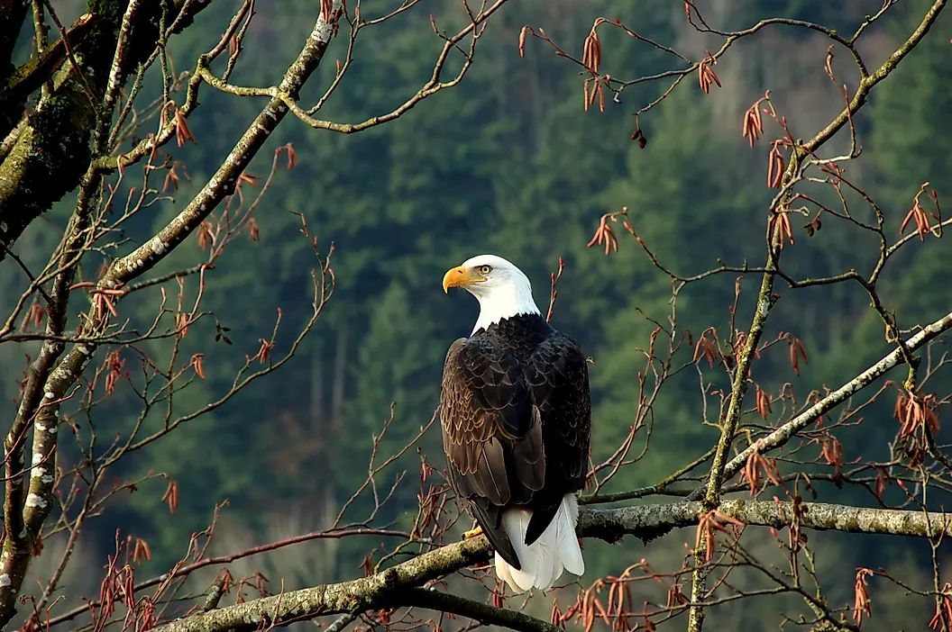
The second morning starts with coffee and a warm breakfast at the Rusty Compass Coffeehouse, with the snow-capped Chilkat Range filling the western skyline. A stop at Olerud's Market covers a packed lunch for the road. The drive out of Haines passes Haines Airport, a likely arrival point for many visitors. Haines Highway then follows the Chilkat River up to the Chilkat Bald Eagle Preserve. Moose, bald eagles, swans, bears, and mountain goats all live within the 48,000-acre reserve. A two-mile riverside trail, along with boardwalks and viewing platforms, gives visitors a place to watch wildlife along the Chilkat River. The parking area makes a fine spot to eat lunch before the next stop.
A few minutes north on Haines Highway sits the Jilkaat Kwaan Heritage Center in Klukwan, open afternoons. A guided tour walks visitors through the cultural heritage of the Chilkat people around Klukwan and Haines. The tours suit anyone who wants a fuller picture and a chance to ask questions. The route then continues through Wells, crosses the Chilkat River Bridge, and reaches K.J. Tuckers Farm Bed and Breakfast at Mosquito Lake for the night.
Day 3: The Canadian Border

The final morning starts with a home-style breakfast at the bed and breakfast before the last leg of the drive. About six miles north of Mosquito Lake, the 33 Mile Roadhouse is the last fuel stop before the border, and its counter is known among locals for burgers and homemade pie. Past the roadhouse, the highway climbs out of the Klehini River valley and a pullout opens onto a view of the Saksaia Glacier hanging in the peaks to the west.
At mile 40 the road reaches the Dalton Cache border station, where all traffic entering the United States stops for customs. There is more history here than the modern booths suggest. The weathered cabin behind the station began as the 1898 men's quarters for the North-West Mounted Police, who ran the adjacent post at Pleasant Camp to control the miners streaming toward the Klondike. That flow of gold seekers is the same traffic that first turned Jack Dalton's pack trail into a road. A Welcome to Alaska sign stands at the boundary with British Columbia, and it makes a natural photo stop to close out the Alaska stretch of the byway.
From here, drivers can carry on into British Columbia, still on Haines Highway, toward Chilkat Pass and the run to Haines Junction. Others turn back toward Haines for an extra night or two before planning their departure, having finished one of Alaska's classic scenic byways.
After Haines, What's Next?
Plenty of other scenic byways lie across Alaska for a return trip. The Alaska Marine Highway spans 3,500 miles of coastline by ferry. Glenn Highway runs past glaciers, and Seward Highway follows rugged coast where beluga whales surface in Turnagain Arm. Nature lovers, photographers, birders, and outdoor travelers find hikes and roadside vistas along these routes. Kayaking, rafting, and fishing fill the gaps between drives, and travelers spot wildlife along the way.
A traveler could plan another road trip north through British Columbia or save a second Alaska byway for another season. Long drives remain one of the best ways to take in a region, its roadside stops, and its local culture.