9 Most Scenic Drives in Massachusetts
The Mohawk Trail received its designation in 1914 as New England's first official scenic byway. The route had already existed as a Native American trade corridor for centuries before any automobile passed over it. Its success seeded a network of similar designations across the state over the following hundred years. Massachusetts now holds nine designated scenic byways in total. Each route anchors a different layer of the state's history. The drives ahead are the ones worth a full Saturday.
The Mohawk Trail Scenic Byway (MA Route 2)

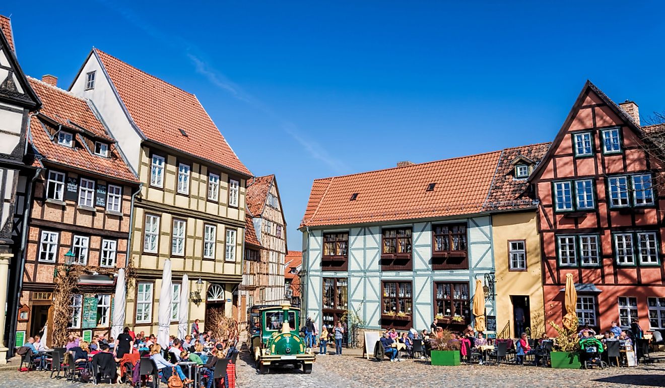
The Mohawk Trail Scenic Byway takes about one to two hours to drive, not including stops. This historic road winds through western Massachusetts, beginning around Athol and continuing westward to Williamstown. The 63-mile corridor follows an ancient Native American trade route through the Berkshire Mountains and was the first scenic byway officially designated in New England, in 1914.
As the road winds through the mountains, travelers should make a point to stop in Shelburne Falls. Here, visitors can walk across the Bridge of Flowers, a former trolley bridge that local gardeners transformed into a botanical walkway in 1929. It feels like a secret garden suspended over the water.
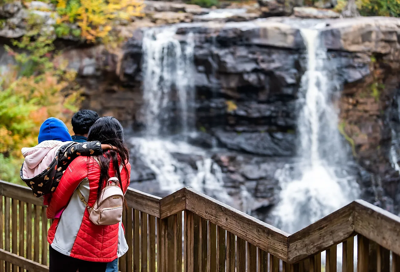
Further west, drivers will experience significant elevation changes, particularly as the road climbs toward the famous Hairpin Turn. The overlook here provides panoramic vistas of the Hoosic River Valley and the surrounding Berkshire Mountains. The trail ends in North Adams, a former industrial town now home to the Massachusetts Museum of Contemporary Art (MASS MoCA), a contemporary art museum housed in a former mill complex.
Lost Villages Scenic Byway (MA Route 122)

Passing east of the Quabbin Reservoir is the Lost Villages Scenic Byway, Route 122. The route's name is a tribute to the four towns that were disincorporated and flooded in the Swift River Valley in the 1930s to help provide water for Greater Boston. Those towns were Dana, Enfield, Greenwich, and Prescott, and they remain underwater today. The drive links Orange and Paxton along about 40 miles of back roads, passing through communities such as New Salem, Petersham, Barre, Oakham, and Rutland.
Drivers will see dense woods, quiet town centers, and glimpses of reservoir views from nearby lookouts. To truly appreciate the scale of this "lost" valley, visitors can seek out the views in the Quabbin area. The reservoir's islands are the former peaks of the hills that ringed the valley before it was flooded. To view more of the area's flora and fauna, travelers can visit the Swift River Reservation in Petersham. The Swift River has old pine and hemlock along its banks, and nine miles of trails to explore.
Old King's Highway (Route 6A)

Spanning about 34 miles along the north side of Cape Cod, this route passes through salt marshes and past hundreds of preserved historic structures and maritime cottages, some dating back to the 1600s. This scenic route starts in the historic town of Sandwich and winds through several coastal villages before ending in Orleans. The corridor is also a designated Regional Historic District, the largest in the United States by area.
The drive offers several fascinating detours, such as the Sandwich Glass Museum, which features live glassblowing demonstrations and a collection of historical glasswork from the Boston and Sandwich Glass Company, which operated here from 1825 to 1888. Before continuing farther east, travelers can visit Scargo Tower in Dennis. This stone observation tower, built in 1901, offers a 360-degree view of Cape Cod Bay and Scargo Lake.
When driving through Brewster, road trippers can make a stop at the Cape Cod Museum of Natural History. Visitors can stop at the aquarium or walk one of the nature trails leading out into the salt marshes and unique coastal ecosystems. This drive takes about one to two hours, depending on how long travelers spend at each pit stop.
Battle Road Scenic Byway

The Battle Road Scenic Byway is a short but historically dense drive of about 7.7 miles that takes around 30 minutes to complete without making any stops. The route runs along Route 2A from Concord east through Lincoln and into Lexington, tracing the road the British regulars marched on April 19, 1775.
This drive follows the approximate path of the colonial militia's response during the opening of the American Revolution. In Concord, literary fans can visit Louisa May Alcott's Orchard House, the home where the author wrote her famous novel, Little Women, in 1868.
The road passes through Minute Man National Historical Park, where the landscape preserves key sites from 1775. Visitors can walk across the North Bridge and see exactly where the "shot heard 'round the world" was fired. Along the way, travelers will pass the Hartwell Tavern, a restored 18th-century home and tavern that hosts living-history programs, and the Captain William Smith House, another preserved colonial dwelling on the original Battle Road.
Mount Greylock Scenic Byway

This 16-mile mountain ascent climbs to the highest point in Massachusetts. The route begins in Lanesborough, climbs to the 3,491-foot summit of Mount Greylock, and then descends toward North Adams. Beginning at the Mount Greylock State Reservation Visitor Center, explorers can learn about the area's natural history and hiking trails. The Money Brook Falls trailhead is located along the road. This trail has a steep descent to a waterfall on the western flank of the mountain.
The Mount Greylock Scenic Byway climbs up the mountain before reaching the summit. Travelers can take in long views from the Veterans War Memorial Tower, a 92-foot granite tower built in 1933 that on clear days offers sightlines into five states. The drive ends as the road winds back down toward North Adams. The full route takes about an hour to complete and is closed from late fall through spring.
Jacob's Ladder Trail Scenic Byway

Jacob's Ladder Trail is a 33-mile stretch of Route 20 that takes approximately two hours to drive with stops. Opened to automobile traffic in 1910, it was one of the earliest east-west mountain crossings in the northeastern United States. The route starts in Russell and continues west toward Lee and the Lee-Lenox town line. The byway has rugged, forest-heavy scenery and travels along the Westfield River.
Along the route is the Chester-Blandford State Forest, which has hiking trails and offers views of Sanderson Brook Falls, a 60-foot cascade reached by a short trail off Route 20. Further west, the road passes right by Jacob's Pillow in Becket. This is a dance center and a National Historic Landmark, founded in 1933 by choreographer Ted Shawn. The drive ends near Lee. Nearby is Lenox and Tanglewood, the famous summer residence of the Boston Symphony Orchestra and a classical music venue since 1937.
Essex Coastal Scenic Byway

The Essex Coastal Scenic Byway in Massachusetts is a 90-mile route that highlights the state's maritime history. The drive follows the North Shore coastline, offering travelers regular views of the Atlantic Ocean. While the full drive can take several hours, one especially scenic segment connects the city of Gloucester to the town of Newburyport and takes travelers about two hours to complete.
A highlight of the trip is a stop in Rockport to see Motif No. 1, the red fishing shack in the harbor that has become a familiar symbol of New England's coastal scenery. First built in the 1840s and rebuilt after the Blizzard of 1978, it is a favorite subject for artists and provides a perfect backdrop for a photo of the rocky coastline.
In the town of Essex, the Essex Shipbuilding Museum offers a deep look at the area's history as a major shipbuilding center, with exhibits and a working boatyard. The town produced more two-masted fishing schooners than any other place in the world during the 19th century. As the route continues through Ipswich, it passes one of the largest collections of preserved First Period homes (built between 1626 and 1725) in the United States.
Connecticut River Scenic Byway

This 60-mile route follows the banks of the Connecticut River Valley, starting in the town of South Hadley and heading north toward Deerfield. The landscape is characterized by valley farmland and dramatic ridgelines, and the drive takes about three hours.
For the best view of the valley, drivers travel up Summit House Road in Skinner State Park to the Summit House, a Victorian mountain hotel built in 1851 on top of Mount Holyoke and now preserved as a state-park landmark. From the top, the oxbow of the Connecticut River is visible, the same scene painted by Thomas Cole in 1836. The drive also passes through Northampton, where Look Park provides a spot for a ride on the miniature steamer train, a trip around Willow Lake on a pedal boat, or a visit to the park's Christenson Wildlife Center. For the last stop on the trip, travelers should visit the historic village of Deerfield, a beautifully preserved 18th-century English settlement.
Route 112 Scenic Byway

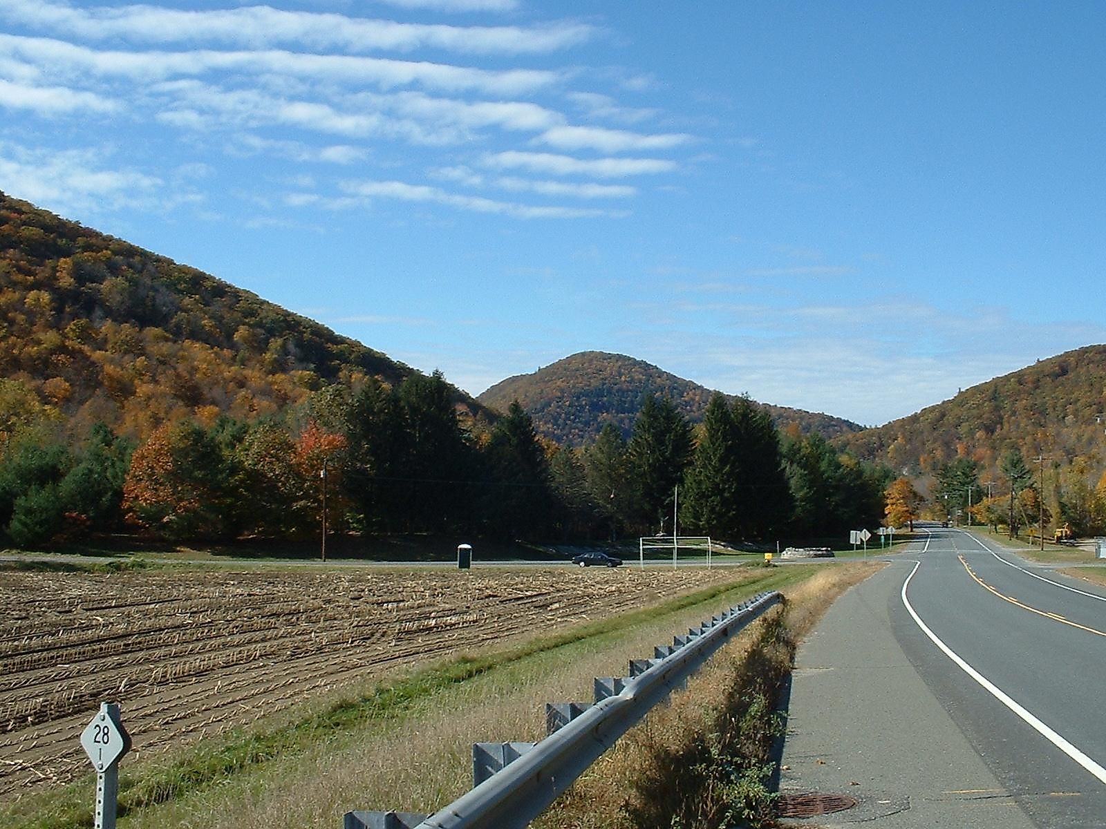
Route 112 is a 44-mile byway that travels through the foothills of the Berkshires. This quiet, rural road starts in Huntington and heads north toward the Vermont border, ending in the small town of Colrain. The drive takes about two hours. It is a great option for those looking to enjoy the rolling Massachusetts hills, small New England towns, and forested scenery.
One of the most impressive sights on this route is the Knightville Dam in Huntington. Built by the U.S. Army Corps of Engineers and completed in 1941, it is a flood-control structure, and the area around it offers expansive views of the East Branch of the Westfield River cutting through the hills. Another natural feature is Glendale Falls, a detour in Middlefield. The 160-foot cascade is among the longest waterfalls in the state.
Roads That Show the State Best
Each of these byways shows a different version of Massachusetts. The Mohawk Trail covers the mountains, Old King's Highway covers the coast, the Connecticut River Scenic Byway covers the farmland, and Battle Road covers the founding history. Pairing two routes on a long weekend gives a fuller sense of the state than any single drive can.