9 Best Spots Along the Blue Ridge Parkway
The Civilian Conservation Corps built the Blue Ridge Parkway (BRP) during the Great Depression, with many scenic stops along some of the most cherished sights in the Southern United States. You can also start your journey on the 105-mile Skyline Drive over the mountain spine through the spectacular Shenandoah National Park, which connects straight to the BRP. The beautiful BRP stretches scenically for 469 miles (755 km) from Georgia through Tennessee, South Carolina, North Carolina, Virginia, West Virginia, Maryland, and Pennsylvania.
These nine highlights along the scenery-abounding drive include explorative hikes and overlooks near small, inviting towns with big attractions. At Milepost 431, you will be driving on the highest point on the Parkway at 6,047 feet, along a spruce-fir forest. The flashy Parkway throughout the year becomes most populated IN October with exploding foliage colors, crisp air for cool hikes, and favorable weather conditions for the clearest views.
Peaks Of Otter (Mileposts 84 to 87)

For over 8,000 years, the Peaks of Otter have been magnetic, attracting people for the stupendous scenery. In the later years, Native Americans hunted around the area, while European settlers began calling the region home in the mid-18th century and no doubt visited the peaks for views. After the first inn opened in 1834, the Peaks of Otter became a popular destination with inspiring vistas along the Blue Ridge Parkway. It is a great rest stop for driving for a stroll and relaxation, with restrooms, water, and an amphitheater at the visitor center, which is open from May through October. Buy a postcard or a book and see exhibits on the wildflowers, birds, and animals of the region.
Take a bus ride from here to up to 1,500 feet of the Sharp Top summit, or make a day out at Abbott Lake, just behind the Peaks of Otter Lodge. Stanley William Abbott was the Parkway's first resident landscape architect and planner. The crisp, 24-acre lake is great for fishing with smallmouth bass, catfish, golden shiners, sunfish, and bluegill or hiking the one-mile loop trail around it. You can pause for the night in the Peaks of Otter tourist village, with a quality restaurant and lodge over the lovely lake against the mountainous backdrop. There is also an easy two-mile loop hike to Johnson Farm for pastoral life back in the 1930s or summiting Sharp Top at 3,875 feet on foot.
Mabry Mill (Milepost 176)

The picturesque creekside sawmill at Milepost 176 is one of the most photographed sites on the Blue Ridge Parkway, along with the nearby blacksmith shop from 1905. Take a selfie with the structure and walk past the costumed "villagers," recreating life back in the day. Marvel at their skillful blacksmithing, basket-making, and spinning, and grab the best country-style sweet potato pancakes of your life topped any way you like for any time of the day at the Mabry Mill Restaurant.
This wooden 1900s gristmill appears stuck in time like a postcard over a stream. Visit in October for the fabulous fall foliage adorning the scenery in happy yellows, rusty oranges, and lusty reds. After the freshly prepared meal in the century homestead, you are ready to cross the Virginia/North Carolina border at Milepost 216.9, with 250 exciting miles remaining of the Parkway. This scenically charged stretch will reveal the highest and most spectacular ranges, like the dramatic Black Mountains.
Rough Ridge (Milepost 302.8)

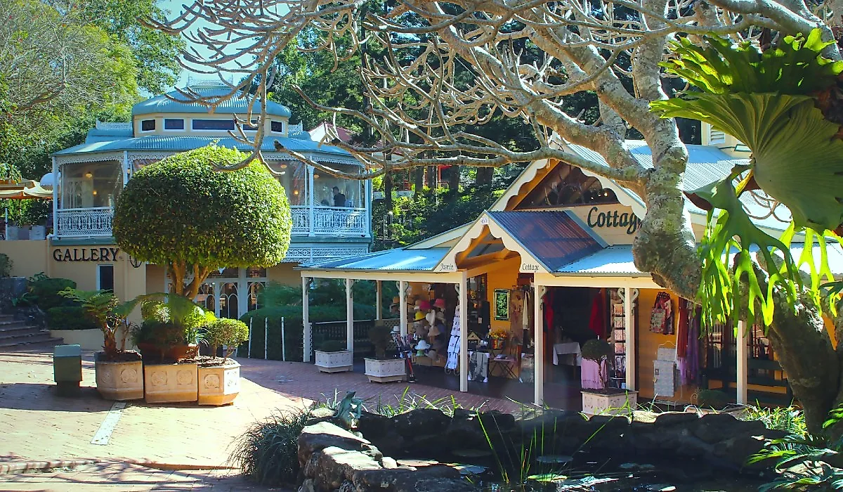
Stop for a break in Blowing Rock, an artsy town with tasty restaurants, to recharge with cultural sights on a stroll after lunchtime. The closest parking area at mile 302.8 of the Blue Ridge Parkway is your trailhead for the incredible Rough Ridge Trail, easily one of the best hikes to fantastic views, just a 1/3-mile uphill. Turn onto a boardwalk at around 0.3 miles (0.5 kilometers) atop the rocky mountain for an epic overlook of the Linn Cove Viaduct and Grandfather Mountain in the distance. A mere 0.5-mile (0.8-kilometer) trek takes you to the 4,773-foot (1,455-meter) summit.
The "Lion King Rock" is a worthy sight to linger with a picnic, take selfies, or stretch your back by the formation jutting out over the valley on a sunny day. Explore the jagged terrain in the fall foliage for more heart-stopping sights and photo ops. Set off early in the morning or evening to avoid seasonal crowds, and go ahead and venture to the edge of the "Lion King Rock" if you dare. You will be dangling your feet 4,700 feet above the ground by your proud, lonesome self or only a few other daredevils.
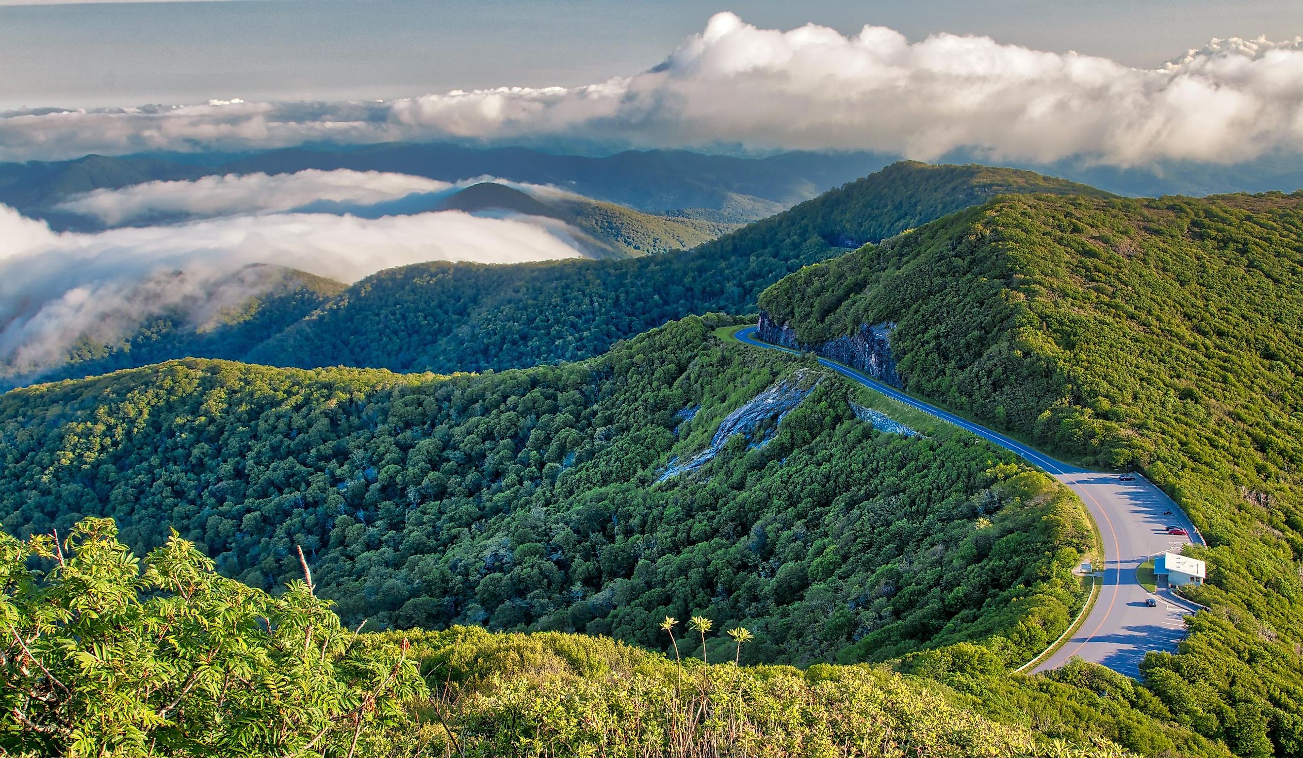
Linn Cove Viaduct (Milepost 304)

Linn Cove Viaduct, a 1,243-foot bridge, is one of the most photographed curves in the road, weaving through the Blue Ridge Mountains. This feat of engineering is a real sight to see, clinging as if growing from the face of Grandfather Mountain. Learn more about its construction at the visitor center, also along this last seven-mile section of the parkway to be completed.
Park here and hike the Tanawha Trail, a moderate 0.8-mile loop trail to a vantage point and the best places along the way to see Linn Cove Viaduct. Linger at the Yonahlossee Overlook and stroll a short footpath toward the Viaduct for another scenic view of the bridge, or venture to the Rough Ridge Lookout for a nice distant perspective.
Grandfather Mountain & Linville Falls (Milepost 316.4)

Visiting Grandfather Mountain requires tickets only through online reservations, some two to three weeks before the day, but it is well worth all the experience. See the Swinging Bridge and Nature Museum, and then take a pick from the hiking trails around, like wildlife habitats and scenic drives to the top with lookout points along the winding road. The notable selfie spots and stops to reflect include Half Moon Overlook, Cliffside Overlook, and Sheer Bluff. The 2.4-mile Grandfather Trail scrambles over rocky cliffs with cables and ladders to spectacular views worthy of every single strenuous moment of the half-day hike.
The Linville River flows from its source high up Grandfather Mountain down two thousand feet into a two-tiered cascade of the spectacular Linville Falls, a 90-foot water drop into the forested Linville Gorge. Linville Falls is one of North Carolina's best, nestled in the lush embrace of a forested landscape, part of the Linville Gorge Wilderness Area. It is a perfect place to relax with picnics and cooling dips, as well as hiking trails around the area, including rock climbing. Follow the rim of the "Grand Canyon of the Appalachians" to Lake James and the Catawba River, or "Eeseeoh," meaning the River of Cliffs in Cherokee—a star of the Blue Ridge Parkway.
Mount Mitchell (Milepost 355.4)

At milepost 355.4, see the highest peak rising above the Appalachians, Mount Mitchell, a popular hike and scenic drive. Summiting the 6,684-foot mountain is a strenuous feat, mostly due to the fifteen- to twenty-degree drop in temperatures from beginning to end. Plan for a cloudless day to avoid the chill and get all the scenery, so you can linger at the top with clear views of up to 85 miles in the distance.
You can also access the summit via a comfortable drive almost all the way to the top and hike the rest of the way to get the most rewarding view over the area. Find more information about this soaring giant, the highest point east of the Mississippi River, at the namesake state park with an on-site museum, including historical insights and a network of easier trails. But hey, rough it out first for a sought-after spot on the bench at the top with views that stretch on forever.
Craggy Pinnacle, Mt. Mitchell State Park (Milepost 364)

Just under an hour from Asheville, Craggy Pinnacle is one of the easiest-accessible and best Blue Ridge Parkway overlooks. Park and trek a short 0.5-mile trail to the top of Craggy Dome for 360-degree panoramic views—a place worth lingering. You will have the Blue Ridge Mountains, North Carolina's sprawling valleys, and the whole Blue Ridge Parkway in the palm of your hand. Despite its popularity and the chill mountain breeze at 5,892 feet, it is the best place to watch the sunset on the Blue Ridge Parkway. Arrive early and wear layers to be cozy and in the front row seat of the spectacle!
Venture into Mt. Mitchell State Park from here for under two miles through its fairytale, mythical forest. The trail gradually inclines, but the stony steps and wildflowers make every strain worth it all the way to the summit, nearly three thousand feet above sea level. Take breaks for scenic pictures and photoshoots with the lush, weaving trails through the rhododendron forest. The summit greets you with a sweeping, 360-degree landscape of the Blue Ridge Mountains.
Craggy Gardens (Mileposts 364.4 to 367.6)

Hike to panoramic views from Craggy Pinnacle at 5,892 feet from Milepost 364.1. Just a quick hop to Milepost 364.4, the Craggy Gardens Visitor Center at the Gap at 5,497 feet awaits from late May through October. At 367.6, the Craggy Gardens Picnic Ground and Craggy Gardens Trail to Craggy Flats at an elevation of 5,680 feet are also open from late May through October. This short, one-third-kilometer trail is the best place to see the natural gardens. Visit mid-June for the stunning rhododendron bloom, turning the Catawba rhododendron peak blooming pinks and purples. Visit any time for the views of high-elevation summits, but the high-altitude flowers make it worth returning.
The Craggy Gardens are just 20 miles from downtown Asheville, making for a fantastic detour into a spectacular town with hotspots and places to rest. These mile-high gardens are visible as you approach the area and follow the sign for the Craggy Picnic Area, with nearby picnic tables and tremendous hiking. Enjoy the super scenic trails with breathtaking views in the crisp air at 3,500 feet higher than Asheville. Despite low clouds and 10–20 degrees cooler temperatures than the city, the weather can change quickly, either way, to hopefully disperse the fog.
Waterrock Knob (Milepost 451.2)

The last stop along The Blue Ridge Parkway meets all the hype as the most rewarding Waterrock Knob Visitor Center, the highest along the parkway at 5,719 feet above sea level. It is a great place to relax or stretch your legs as you explore the area for panoramic views. Take a stretch of the southernmost hiking trail along the Parkway that leads into the Great Smoky Mountains National Park and perhaps find a spot for a celebratory picnic. Plan to arrive early in the fall and be greeted with the prettiest foliage colors right here on the parkway.
There's also the short and steep climb to the peak, with just 412 feet of elevation gain, which rewards you with rich Appalachian Mountain views and otherworldly sunrises and sunsets. Moreover, venture down an even more rugged path with a left turn at the fork before the summit to an eerie sight of an abandoned plane crash from 1983. Others can enjoy views to the east and west right from the parking area—an opportunity for the tired drivers to set up a tailgating party against a picturesque mountain panorama.
The Blue Ridge Parkway is an irresistible drive with stops for all types of adventures that makes for the best journey when you have a plan. Find everything from chasing waterfalls to summiting peaks, with some of the best hikes attainable for any level to achieve the sought-after panoramic vistas. These nine stops along the parkway reign supreme for all-level hikes, overlooks, and varying sights like Blowing Rock and blooming rhododendrons.
Find visitor centers near many hotspots, like the newest Blue Ridge Parkway Visitor Center at Milepost 384. This LEED-certified building is most impressive, with high-tech exhibits like its 22-foot interactive "I-Wall" and a high-definition film. The neighboring small town of Asheville, home of the Biltmore Estate, is renowned for its music and culinary scene.