8 Great Road Trips to Take in Tennessee
Whether you prefer exploring the dense, misty hardwood forests of the Great Smoky Mountains, following in the footsteps of early settlers, or taking a dip in one of the state's many lakes and rivers, there’s no shortage of amazing adventures to be had on a road trip in Tennessee. The state features more geographic and ecological diversity than any other inland state, creating landscapes that range from temperate rainforests to highland oak forests, limestone caves to alluvial plains, and the longest expanse of hardwood-forested plateau anywhere in the world. With over 2.4 million acres of public land, 16 state forests, and an extensive collection of scenic roadways, there are few places in the United States better for travelers who enjoy experiencing the country’s beauty along the open road. These are some of the best road trips that Tennessee has to offer.
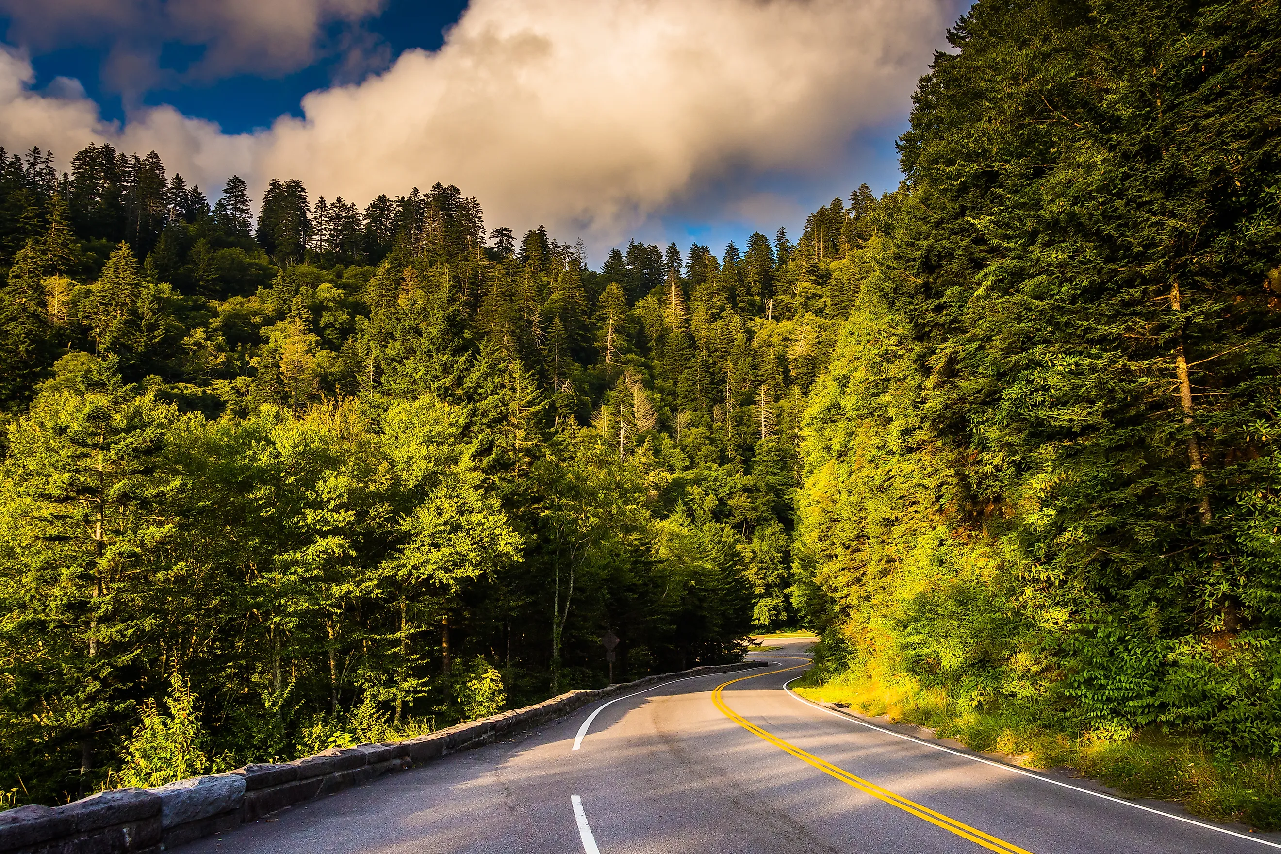
Newfound Gap Road

Newfound Gap Road, or US-441, is the main throughfare through Great Smoky Mountains National Park in eastern Tennessee. The 35-mile-long scenic byway connects the towns of Gatlinburg, Tennessee, and Cherokee, North Carolina, rising to elevations of over 5,000 ft, and treating motorists to gorgeous views of the peaks and valleys of the iconic mountain range. Several of the park's most popular hiking trails are accessible along this road, including Alum Cave and Chimney Tops, and the Appalachian Trail intersects with the road at the Newfound Gap Overlook. Kuwohi, the highest mountain in the park, can also be accessed via a paved road off US-441 just before mile marker fifteen. Climbing up to the top of the observation tower provides some of the best views in the park on a clear day. Newfound Gap Road is quite popular, especially during fall and summer, and it is not uncommon for trailhead parking lots to fill up early in the day. It can take anywhere from one to two hours to drive end-to-end without stopping, and visitors should check the road status on the National Park Service website before beginning their trip, as the road does sometimes close during the winter.
The Natchez Trace Parkway

The Natchez Trace Parkway roughly follows the path of the Natchez Trace, a historic forest trail corridor used by generations of Native Americans and settlers. The road passes through Mississippi, Alabama, and Tennessee from Natchez to Nashville. The parkway totals 444 miles, and driving from end to end can take at least two days to fully enjoy, but even driving a small section can be a rewarding and memorable experience. The Tennessee section will take travelers 102 miles from Nashville, the northern terminus of the route, down through the fertile cedar glades of the Central Basin and the green hills of the Highland Rim before passing over the border into Alabama. Along the way, you’ll cross Birdsong Hollow on the Double Arch Bridge 155 feet above the valley below, and pass several scenic overlooks affording sweeping views of Water Valley and Baker Bluff. There are multiple trailheads along the route for day hiking experiences, and frequent towns, welcome centers, and picnic areas provide good stopping points to break up the drive. The Meriwether Lewis Monument at milepost 385.9 marks the final resting place of the famed explorer, and a visitor center features exhibits related to his final days before his death in 1809.
The Great River Road

This All-American Road and National Scenic Byway follows the twists and turns of the Mississippi River for over 2,000 miles from Minnesota to the Gulf of Mexico. The road passes through ten US states and dozens of major cities. Traveling the entire route is quite an undertaking, but, luckily, exploring even a small section will provide numerous opportunities to explore historical sites, delicious cuisine, and the natural beauty of the American South.
The Great River Road winds along the western border of Tennessee from the bald cypress stands at Reelfoot Lake State Park in the northwest corner of the state all the way down to Memphis. The route is an excellent way to experience the unique geography of the Gulf Coastal Plains. While less mountainous than other parts of the state, hiking and outdoor recreation opportunities abound in several parks along the way. Explore the largest tract of bottomland hardwood forest in the state at Chickasaw National Wildlife Refuge, or paddle along the Hatchie River as it flows into the Mississippi, before ending your trip experiencing the vibrant culture, cuisine, and nightlife in Memphis.
Cherohala Skyway

The Cherohala Skyway is one of the best ways to experience the gorgeous mountain scenery in the Cherokee and Nantahala National Forests of eastern Tennessee. This 43-mile-long National Scenic Byway runs from Tellico Plains, Tennessee, to Robbinsville, North Carolina. In Tellico Plains, travelers will wind their way up to over 5,400 feet in the mountains, where the Turkey Creek and Lakeview Overlooks provide excellent stopping points to take in the beauty of the surrounding mountains and catch a glimpse of Indian Boundary Lake to the north. Stop at hiking trails such as Falls Branch Trail and Whigg Meadow Trail to stretch your legs and get up close and personal with the fragrant pine forests.
As you head west, the Skyway takes you past Bald River Falls, a ninety-foot cascade, which is one of the most popular stops along the route. When traveling the road in the fall, you can enjoy the multi-hued splendor of the changing leaves, while opting for a springtime sojourn will reward you with vast meadows of blooming wildflowers.
Cumberland Historic Byway

This 200-mile-long National Scenic Byway crosses through eight counties in northern Tennessee, from Claiborne County in the east to Clay County in the west. It is one of the best ways to see the unique geography and biodiversity of the rugged Cumberland Plateau. As a natural barrier, the plateau played a role in the state’s early history, as settlers and pioneers traversed the uplands through the Cumberland Gap.
Start at the Cumberland Gap Traveling west from the town of Cumberland Gap takes you along the northern boundary of Chuck Swan State Forest, which provides ample opportunities for fishing and hiking. The western portion of the drive passes by Scott State Forest, Pogue Creek Canyon State Natural Area, and the historic Victorian village of Rugby, where you can visit the first free public library in the south. The western terminus of the byway is the town of Celina on the banks of the Cumberland River, about two hours away from Nashville.
Tennessee River Trail Byway

The Tennessee River Trail Byway is the longest in the state at 440 miles. The route follows along both banks of the Tennessee River from Knoxville west to Clarksville, looping south through Chattanooga near the Alabama border.
While there is no shortage of opportunities to interact with the countryside and the river itself, this road trip’s attractions tend towards the historical. Notable stops along the route include the Civil War battlefields at Fort Donelson in Dover and Shiloh National Military Park. Both locations provide fascinating explorations of the struggle and sacrifice of the soldiers and the impact on the nation at large. Also worth exploring is the sprawling campus of Sewanee: The University of the South, a 13,000-acre sprawl of stunning natural beauty and distinctive architecture, which is routinely cited as one of the prettiest colleges in the country. To truly experience the Tennessee River Scenic Byway, give yourself a couple of days to enjoy both some of Tennessee's bigger cities and its historic sites.
Great Smoky Mountains Byway

If you didn’t get enough of the Smokies on Newfound Gap Road, you can follow US Highway 321 for 200 miles through their foothills on a journey through the heart of Appalachia. The Great Smoky Mountains Byway passes through Gatlinburg, making it easy to combine with a trip to Great Smoky Mountains National Park.
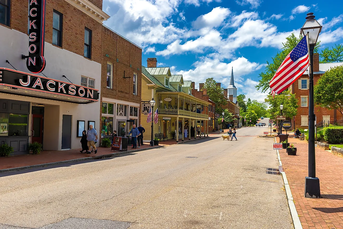
This route is an excellent way to experience the vibrancy of Appalachian communities, including Jonesborough, the site of the annual National Storytelling Festival. Held every October since 1973, this festival is considered one of the most prestigious in the country and attracts up to 10,000 visitors each year. The byway will also take travelers through Pigeon Forge, home to Dollywood, a 165-acre theme park with world-class rides and incredible views of the surrounding mountains.
Walton Road Scenic Byway

Named for its constructor, Captain William Walton, Walton Road Scenic Byway will provide travelers a window into Tennessee’s pioneer past. Along this 120-mile route, you can enjoy the best of the highlands and the lowlands as you travel from the floor of the Tennessee Valley up across the steep and rugged Cumberland Plateau.
The road was designed to closely follow the Cumberland Trace, one of the most utilized wagon routes across the treacherous landscape for pioneers traveling from the East Coast to the uncharted West. Today, parts of the original route have been subsumed by US Highway 70 and I-40, but the byway still retains plenty of historical significance, unspoiled nature, and Southern charm. Some must-see stops along the route include the 110-foot Ozone Falls in Cumberland County, where springtime mountain laurel blooms add stunning pink accents to the distinctive landscape. In Roane Country, consider adding a stop at Watts Bar Lake to enjoying a day of paddling.
Take the Scenic Route Through Tennessee
For those who don't mind slower speed limits, getting off the main thoroughfares can provide some of the most memorable travel adventures in Tennessee. With such geographic diversity, a new discovery waits around every hairpin turn and up every steep mountain slope. Whether you're exploring the state's Civil War battlefields, catching the sunset in the Smokies, or paddling along the winding Tennessee River, there is no shortage of one-of-a-kind excursions to be had when you drive Tennessee's scenic byways.