8 Great Road Trips to Take in South Carolina
South Carolina is built for road trips, with routes that run from Atlantic beaches and Lowcountry marshes to the Blue Ridge foothills. These eight scenic drives highlight some of the state’s best detours, from waterfall hikes near Clemson to wildlife watching in Port Royal and historic landmarks on the way to St. Helena Island. Along the way, you’ll pass through barrier islands, quiet small towns, and mountain backroads that show off the state’s striking variety. If you’re looking for a drive that mixes scenery, culture, and memorable stops, these routes deliver.
Charleston to Port Royal

The direct route from Charleston to Port Royal follows Highway 17 to Highway 21 for just under 75 miles and takes about an hour and 45 minutes if you don't stop along the way. However, the best part of this low-country road trip is getting off the highway to explore beaches and wildlife. Start your adventure about 30 minutes south of Charleston on Folly Island, where six miles of beachfront are perfect for shell hunting. From Folly Island, get back on 17 and continue to the Ravenel Caw Caw Interpretive Center. Once part of several rice plantations, this place is now a birder’s paradise.

Jump back onto 17 for about 30 minutes. You’ll grab Highway 174 for a beautiful drive where the landscape shifts between marshland and a tree-lined road, bringing you straight to Edisto Island. Here you can explore Botany Bay Plantation Heritage Preserve with its unspoiled coastline, marsh grasses, and breathtaking views of the Atlantic Ocean. One more time, you’ll get back on 17 to 21, and it’s a straight shot into Port Royal. Here you can spot dolphins from the observation tower, see alligators at the Cypress Wetlands, or hunt for shark teeth at Sands Beach.
Rock Hill to St. Helena Island

This road trip is an exploration of South Carolina’s rich African American history through four points of interest across about 210 miles. Your journey starts at McCrory’s Five and Dime in Rock Hill. Visit and have a cup of coffee at the spot where four students from Friendship Jr. College refused to leave the counter when they were denied service in 1960. From Rock Hill, take Highway 77 to Columbia, where the African American History Monument tells the story of African Americans in South Carolina from the 17th century to the present. Also in Columbia is the Modjeska Monteith Simkins House, honoring one of the state's most celebrated human rights activists. Today, visitors can tour her modest home and learn about the pivotal role she played in the long civil rights movement through the multimedia exhibit.

Out of Columbia, you’ll take Highway 26 into Orangeburg. There you’ll find the monument to three college students who lost their lives in 1968 during a segregation protest that came to be known as the Orangeburg massacre. Follow Highway 21 through sleepy little towns onto St. Helena Island. Here, surrounded by Spanish moss-draped trees, the Penn Center is a 50-acre historic district that includes 25 historic buildings and structures. The former Penn School was one of the first in the South to provide education to previously enslaved people, and it is also where Martin Luther King Jr. worked on his “I Have a Dream” speech.
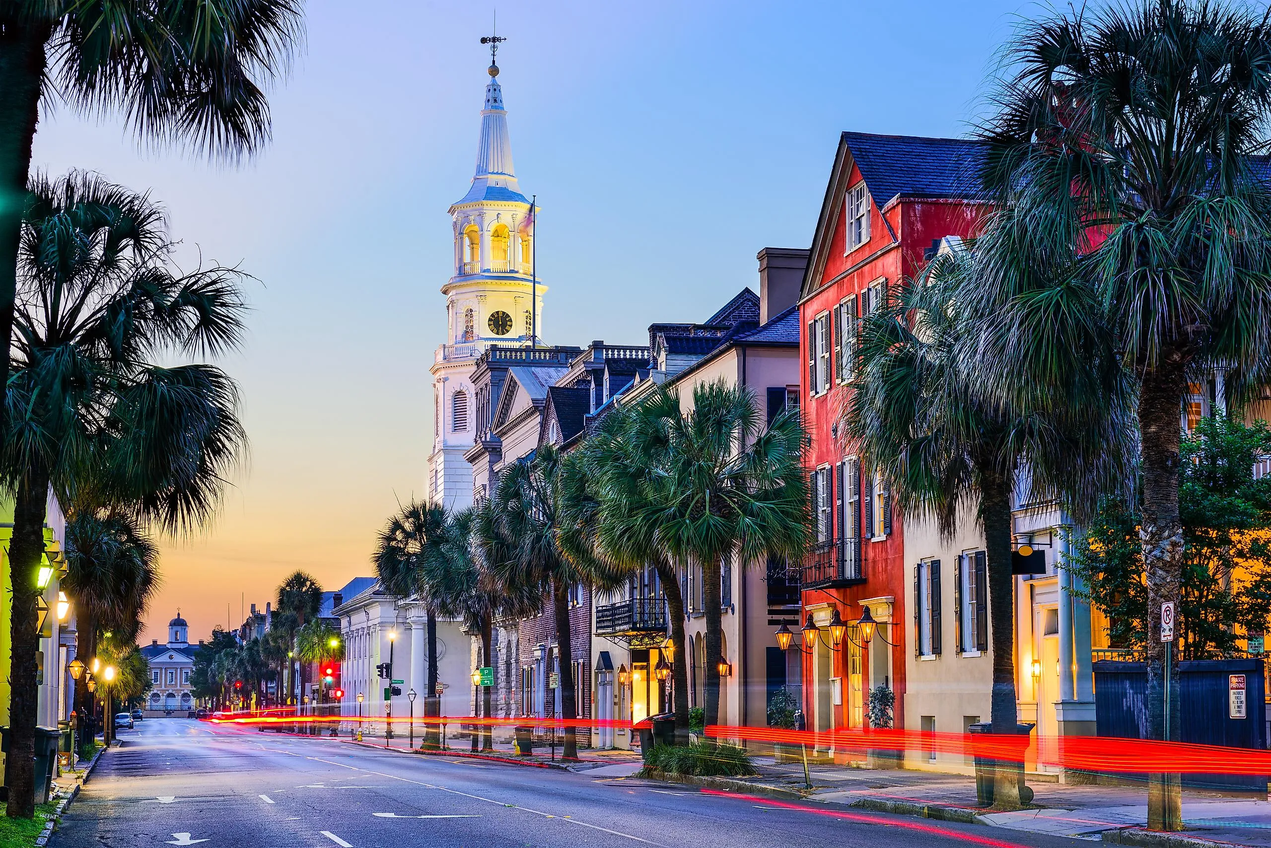
Myrtle Beach to Charleston

Ride along South Carolina’s coast on Highway 17 for this 100-mile road trip that will bring you through small towns and past pristine beaches, all just a short jump off the highway. Take in the beauty of the coast, with a stop by Murrells Inlet and explore the unique shops and cafes along the half-mile wooden boardwalk at its heart. Six miles to the south is Brookgreen Gardens, a sprawling cultural landscape with manicured botanical displays, expansive sculpture collections, and the Low Country Zoo. Right before crossing the Waccamaw and Great Pee Dee Rivers is Hobcaw Barony. Hobcaw Barony’s 16,000 acres boasts a rich diversity of nearly every ecosystem found on the South Carolina coast. In addition, there are more than 70 important cultural sites, including cemeteries and slave cabins.

When you cross the bridge, you’ll enter Georgetown. This town of about 9,000 people sports five museums where you can learn about local history, the Gullah Geechee People, the importance of the rice crop to South Carolina, and the state’s maritime history. After a drive through the Santee Coastal Reserve, you’ll arrive at the Boone Hall Plantation and Garden, in Mount Pleasant, just north of Charleston. The history of this plantation, founded in 1681, is well preserved, as are the gardens. Two rows of massive oak trees planted in 1743 have grown into a natural canopy over the walkway. Before you cross the Cooper River into Charleston, you can take one more walk along the shore at Sullivan’s Island Beach or Isle of Palms Beach.
Greenville to Clemson

Greenville is less than an hour from Clemson on a straight shot along Highway 123, but this road trip takes the scenic route and rewards with attractions and activities, especially for the outdoors enthusiast. Starting in Greenville, the 345-foot Liberty Bridge at Falls Park on the Reedy connects the Downtown and the West End districts. The concrete deck of the bridge provides breathtaking views of the rushing waterfall and gardens below. And that’s just the start. Opt for Highway 183 to get out of the city and start a rolling tree-lined drive in the foothills of the Blue Ridge Mountains.

Head to Table Rock State Park, where 3,083 acres of mountain country are waiting for you to explore. Stunning views of the Mill Creek and Carrick Creek waterfalls await on the walking trails. There are seven trails ranging in length and difficulty from the easy 0.6-mile Mill Creek Pass loop to the 4.2-mile, very strenuous, one-way trail to the summit of Pinnacle Mountain. After leaving Table Rock, head south for a beautiful drive through rolling hills with gorgeous views around every curve. More trailheads and waterfalls are found along the 40-minute drive into Clemson.
Cherokee Foothills Scenic Highway

The Cherokee Foothills Scenic Byway, Highway 11, skirts the edge of the Blue Ridge Mountains and runs between Lake Hartwell, at the Georgia state line, and Gaffney, near the border with North Carolina. With more than 120 waterfalls, state parks, lakes, and historical sites, this two-and-a-half-hour road trip through the Piedmont offers a more picturesque, slower alternative to Interstate 85. A great time to do it is when the fall colors are at their peak. Just a short hop off the byway, you can be trout fishing or kayaking at Lake Jocassee in Devils Fork State Park, and for breathtaking vistas of Table Rock, stop at Caesars Head State Park, home to the 420-foot Raven Cliff Falls. Step onto the suspension bridge for a spectacular view.

Make your way to the small town of Campobello to explore two historic bridges. Built in 1820, Poinsett Bridge is the oldest bridge in South Carolina and perhaps in the entire southeastern United States, and nearby Campbell’s Covered Bridge is the last of its kind in the state. Built between 1909 and 1911, the 38-foot-long structure spans Beaverdam Creek. As you roll into Gaffney, you’ll find a town that celebrates the arts in such beloved spaces as the Gaffney Visitors Center and Art Gallery and the downtown gallery of the Cherokee Alliance of Visual Artists. Meanwhile, history buffs can check out the Cherokee County Museum, the Veterans Museum, and Carolina Rising: A Revolutionary Experience, an immersive, high-tech exhibit designed to bring the stories of the American Revolution’s Southern Campaign to life through interactive 3D video, artificial intelligence, and firsthand accounts.
Savannah River Scenic Byway

The 100-mile Savannah River Byway follows the river and runs along the western edge of the state on Highway 81. This road trip is dotted with lakes and parks and is another great option for the outdoor enthusiast. Start at Lake Strom Thurmond, a man-made lake on the Savannah River, at Clarks Hill. As you drive along the waterfront, Stevens Creek Heritage Preserve, Hamilton Branch State Park, and Sumter National Forest offer plenty of options to get out and stretch your legs. About 45 minutes into the drive, you’ll arrive at Baker Creek State Park. There you can go hiking, biking, geocaching, swimming, boating, fishing, birding, or just hang out at the playground. If you want just a little more to do, go 10 miles up the road to Hickory Knob State Park and Resort. There, you can do all the same things, as well as archery, skeet shooting, and axe throwing. Those activities do have a charge, and appointments are needed.

15 miles off the byway is the town of Abbeville. Here, you’ll want to take a little time to visit Abbeville Square, filled with 19th-century architecture and home to many boutiques and restaurants. Back on the byway, you'll return to some of the best outdoor adventures South Carolina can offer at the Jim Rampey Recreation Area and, overlooking Lake Russell, the peaceful Calhoun Falls State Park. The byway technically ends in Oakway, but you’ll want to go about six more miles up to Westminster, where you can continue with outdoor recreation, take in a performance at the Westminster Music Centre, or enjoy an exhibit at the Gateway Arts Center.
Charleston to Spartanburg

This 225-mile road trip takes you from the flat, marshy landscape of the coast up to the foothills of the Appalachian Mountains. In between, you travel through the sandy, forested Inner Coastal Plain and the rolling hills of the Piedmont. Just outside of Charleston, at Moncks Corner, learn about the swampy ecosystem at Cypress Gardens. After leaving the Lowcountry, you’ll cross into central South Carolina, where Santee State Park sits on the shore of Lake Marion. With more than 300 bird species recorded, this is a hotspot for birders and wildlife enthusiasts.

As you head north, you’ll enter the Midlands, a hilly zone that separates the Coastal Plains from the Piedmont. The Harbison State Forest, just off Interstate 26, is a great place to feel the terrain change. Before you leave the Piedmont region, take a quick detour to the Rose Hill Plantation State Historic Site for hilltop views, historic grounds, and short hiking trails through the forest to the Tyger River. Just south of Spartanburg, the rolling hills of Croft State Park signal the beginning of the Foothills. Finish up your road trip in downtown Spartanburg, where you can enjoy walkable streets filled with public art.
Oscar Wigington Scenic Byway

It’s only 14.5 miles long, but you can easily spend the entire day on the Oscar Wigington Scenic Byway. Begin at the northern end of Highway 107. For breathtaking views, pull off on State Road 413 to the Wigington Overlook for a beautiful peek at Lake Jocassee. Another short skip off the byway onto a very windy road brings you to the Wallhalla State Fish Hatchery, one of five such facilities in the state and the only one dedicated to coldwater trout. Get back on the byway and head south, winding your way through the Sumter National Forest along the crest of the Blue Ridge Mountains. Several trailheads give hikers and walkers miles of options for a range of skill levels.
Another location on this short drive that provides picture-perfect views is the Cherry Hill Recreation Area, where you can fill up your water bottle at a natural, cool-water spring. You’ll finish up this journey at Oconee State Park, where you can take a walk along the shoreline of one of two mountain lakes. To give visitors a chance to fully enjoy the lakes, the park rents pedal boats, kayaks, canoes, stand-up paddleboards, and Jon boats.
Get Out and Explore South Carolina
Whether you’re planning a leisurely weekend escape, a bit of history, or a spontaneous day trip, these eight journeys will take you from one end of South Carolina to the other. From sun-soaked beaches to mountain trails, diverse landscapes make it the perfect state for adventure on the open road. These eight routes highlight the very best of its scenery, heritage, and culture.