5 Best Natural Wonders To Visit In The United States This Year
Some of the country's most geologically specific wonders sit far east of the Rockies. The Apostle Islands sea caves run along Lake Superior's Wisconsin shoreline, and Cloudland Canyon in northwest Georgia drops 1,000 feet through the Cumberland Plateau. Goblin Valley State Park in central Utah protects thousands of Jurassic-era hoodoos standing up to 15 feet tall, and the park allows visitors to walk freely among the formations rather than holding to designated trails. The Hoh Rainforest on Washington's Olympic Peninsula receives an average of 140 inches of rain each year and supports old-growth Sitka spruce that reach 300 feet or more. Lexington Arch in eastern Nevada's Great Basin National Park is one of the largest natural limestone arches in the West, formed from rock laid down beneath an ancient sea.
Hoh Rainforest, Washington State

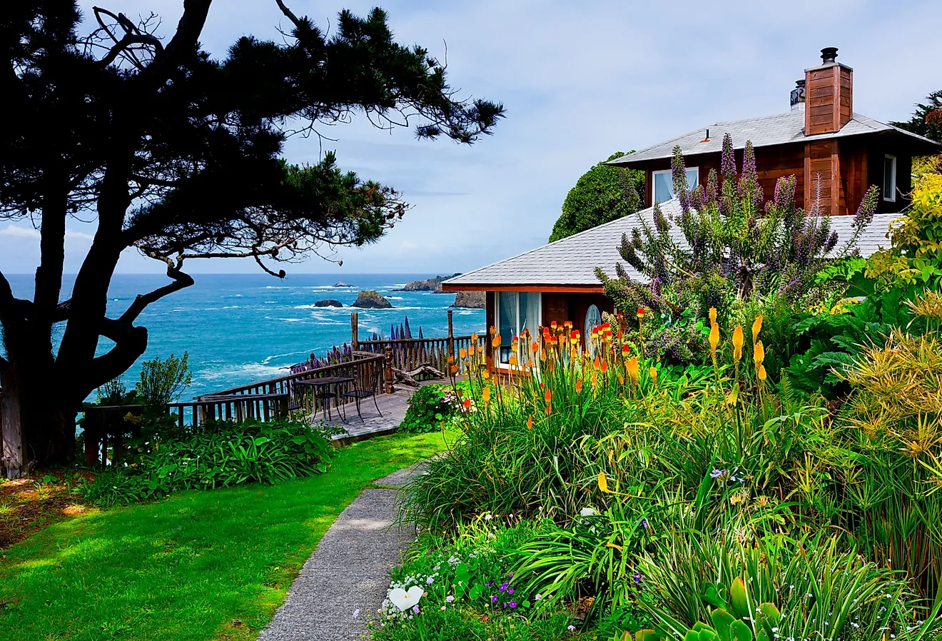
Located at the western side of Olympic National Park on Washington's Olympic Peninsula, the Hoh Rainforest is one of the largest temperate rainforests in the United States. This verdant woodland receives an average of 140 inches (3.55 meters) of precipitation each year, creating dense stands of Sitka spruce, western hemlock, Douglas fir, and bigleaf maple, with some trees rising more than 300 ft (91 m) tall.
What stands out most, however, are the mosses and lichens that coat nearly every surface. You can experience this dense moss-and-fern environment in aptly named areas like the "Hall of Mosses." Trails here provide short access routes into old-growth sections of the forest, though visitor center hours can vary by season, so travelers should check current Olympic National Park conditions before arriving.

The 56-mile (90 km) Hoh River flows through this part of the national park, fed by water from Blue Glacier, White Glacier, and Hoh Glacier, before emptying into the Pacific Ocean north of Ruby Beach. It cuts right through the rainforest and supports salmon runs that also attract significant numbers of river otters, bears, and bald eagles. Roosevelt elk are frequently seen in open sections, too, notably near the visitor area and along nearby trails.
The best time to visit for easier trail conditions and fuller access is late spring through early fall, although winters here are significantly quieter.
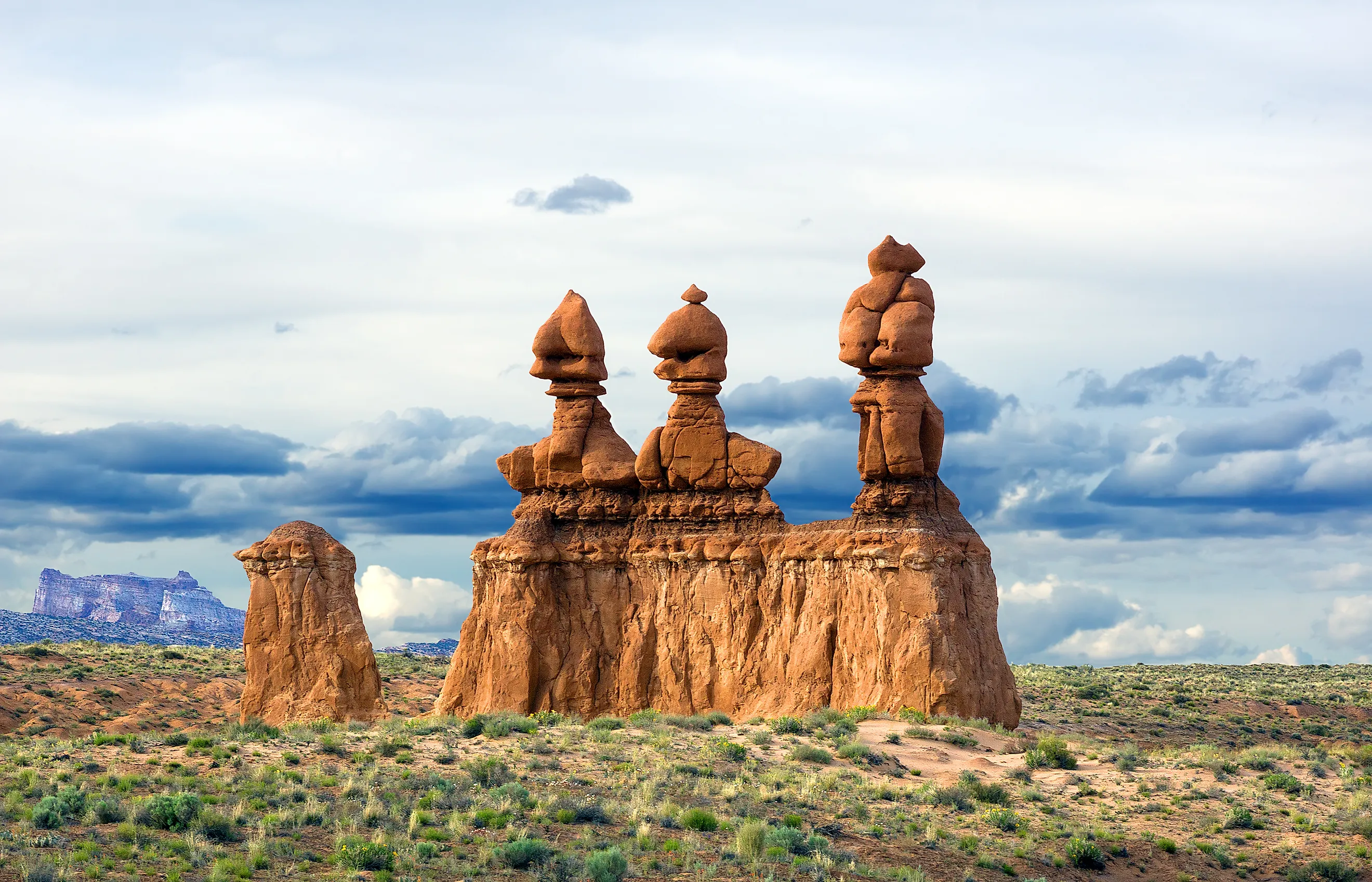
Goblin Valley, Utah

Sitting in central Utah, Goblin Valley State Park is a stark, unusual landscape that contains thousands of distinctive rock formations known as hoodoos. These rock structures were carved over millions of years through erosion acting on Entrada Sandstone deposited during the Jurassic Period. Many of these unique formations stand between 3 ft and 15 ft (0.9 and 4.6 m) tall, creating dense clusters across the valley floor that resemble a stone forest.

Unlike many protected desert areas of the Southwest, visitors are given considerable freedom to explore this spot and are allowed to walk directly among the formations rather than staying strictly on designated trails. Moreover, several nearby canyons contain narrow slot passages and exposed sedimentary layers shaped by flash flooding and wind erosion. For safety, you should avoid going out during heavy rain, as flash floods in Goblin Valley can become dangerous quickly.
The valley's remote location also makes it a recognized dark-sky area with minimal artificial light pollution. Furthermore, sitting at roughly 5,000 ft above sea level, Goblin Valley remains one of the more remote and sparsely developed park landscapes in Utah. Spring and fall are generally the most comfortable times to visit; summer temperatures can reach the 90s and 100s, so visitors should hike early, carry ample water, and avoid exposed routes during peak afternoon heat. Winter nights can drop below freezing.
Apostle Islands, Wisconsin

Along the southern shore of Lake Superior in northern Wisconsin, the Apostle Islands National Lakeshore watches over 21 islands, sea caves, old-growth forests, and some of the most rugged Great Lakes coastline in the country. Waves, immense slabs of shifting ice, and freeze-thaw erosion over centuries have carved the extensive cave systems into this shoreline's brown sandstone cliffs, which visitors can view from the water or from land-based overlooks when conditions allow.

The park covers more than 69,300 acres, including historic lighthouses dating back to the 19th century that once guided shipping traffic across the lake. Summer and early fall are generally the best times to visit, when kayaking routes weave through narrow cliff passages and arches, while hiking trails cross boreal forest containing paper birch, white cedar, balsam fir, and other mixed tree species. Keep an eye out for resident black bears, bald eagles, and peregrine falcons that inhabit parts of the islands, too. In winter, sections of the mainland sea caves can form dramatic icicles and ice chambers, but access is highly condition-dependent and may remain closed when lake ice is unstable.
Water temperatures in Lake Superior remain cold year-round, often staying in the 40s into early summer and rarely exceeding 60°F even later in the season, except in some protected bays. Swimmers should plan for cold-water conditions.
Cloudland Canyon, Georgia

Perched on the western edge of Lookout Mountain, about a half hour's drive south of Chattanooga, Tennessee, Cloudland Canyon State Park is one of the deepest canyons in the southeastern United States.
Sitton Gulch Creek carved the canyon through layers of sandstone and shale, creating steep cliffs that drop as much as 1,000 ft (305 m) to the canyon floor.
Encompassing more than 3,530 acres, the park holds a variety of biomes that include dense hardwood forest, lofty rock walls, caves, waterfalls, and rugged backcountry terrain. Sandstone outcrops along the canyon rim provide the bulk of the wide views across the surrounding Cumberland Plateau region, while heavy rainfall can rapidly increase creek flow through the gorge, especially during spring and after major storms.

Two of the park's best-known features, Cherokee Falls and Hemlock Falls, are reached by a staircase trail descending hundreds of steps into the canyon. With that in mind, elevation does change significantly across the park, creating shifting habitats that support healthy populations of white-tailed deer, bobcats, amphibians, and numerous migratory bird species.
Summers in and around Cloudland Canyon are warm and well-suited to camping, whereas fall is often the most comfortable time to visit, with cooler temperatures and colorful foliage across the canyon. Travelers visiting in 2026 should check current park updates before arriving, as construction and temporary visitor facilities may affect arrival logistics.
Lexington Arch, Nevada
Hidden within Great Basin National Park, Lexington Arch is one of the largest natural limestone arches in the western United States. The arch stands six stories tall and was formed through erosion acting on Pole Canyon Limestone deposited during the Paleozoic Era, when the region sat beneath an ancient shallow sea. That limestone origin is unusual: most arches across the broader Southwest are Jurassic sandstone shaped by wind and water erosion above ground, while Lexington Arch is built from marine-deposited carbonate rock.
Sitting in a remote canyon reached by a 5.6-mi (9 km) round-trip hiking trail, plus possible extra road walking depending on conditions, Lexington Arch is more demanding than its mileage suggests. The surrounding terrain contains pinyon-juniper woodland, exposed rock layers, dry washes shaped by seasonal runoff, and open desert-mountain scenery. Mule deer, golden eagles, and bighorn sheep occasionally appear in the area, too.
Because of its isolation inside eastern Nevada's mountain-desert landscape, Lexington Arch receives far fewer visitors than many natural landmarks in neighboring Utah or Arizona, making this one a top choice for those looking to avoid the crowds in 2026. Late spring through early fall is generally the best window to visit. Before you make the journey out, check current road conditions, bring plenty of water, sun protection, food, and basic vehicle recovery supplies, and prepare for extra hiking if the access road is washed out. In winter, pack warm clothing as the high local elevation can bring snow and freezing conditions.
Why These Natural Wonders Stand Out In 2026
These five destinations span rainforest valleys, freshwater sea caves, desert hoodoos, and steep mountain canyons, showcasing the range of landscapes across the United States. Many of these sites preserve unusual geology, rare ecosystems, history, and remote terrain that simply cannot be replicated elsewhere. Visiting them this year offers a direct look at the forces that shaped these distinctive natural wonders, plus an unforgettable adventure full of learning and sightseeing.