10 Breathtaking Natural Wonders Of America
There are too many natural wonders in the US, all deserving of a spotlight. Here are some of the most breathtaking, in the way they were created by nature to continue attracting millions of admiring eyes yearly.
Arches National Park, Colorado

This, essentially deserted 120 square miles (310 square km) area with sandstone formations, situated in eastern Utah on the Colorado River, was established as a national monument in 1929 and designated national park in 1971. The park lies on the northern edge of the Colorado Plateau, at 4,000 to 5,600 feet (1,200 and 1,700 metres) above the sea level. With wind eroding the red sandstone, unique pinnacles, windows, and arches, including the Balanced Rock, Courthouse Towers, The Windows Section, Delicate Arch, Fiery Furnace, and Devils Garden, have formed. One of the longest natural freestanding spans of rock on Earth, the Landscape Arch spanning some 290 feet (88 metres) and the Wall Arch, are the most notable in the area, although the first is somewhat intact, while the other, has collapsed.
The bed of salt underlying the park that was deposited there roughly 300 million years ago was covered by sand and other sediments, eventually compressing together to a state of rock that caused the unstable salt bed to shift. The rock layers rose in dome-like formations, while other spots buckled into caverns. Upon a salt dome collapse, its flanks become cracked, making it a child's play for the wind and the water to erode and further wear out the fins into, more than 2,000 arches at the park, at one time or another. Although the summers often exceed 38 °C, winter temperatures dip below freezing, and rains are infrequent but flood-causing downpours. Walking through the park is pleasant enough with forests of scattered juniper and piñon pine trees, cottonwoods, box elders, Russian olives, and tamarisks, as well as cacti, including the edible prickly pear, and a wide variety of spring wildflowers in the area.
Avenue of The Giants, California

The Coast Redwoods or California Redwoods (Sequoia Sempervirens) are found growing in a narrow bend along the Avenue of Giants near the coast of Northern California and Southern Oregon. These Redwoods, being the tallest trees in the world (while Giant Redwoods are the most massive), can grow to over 360 feet, and live for couple thousands of years, making this "avenue" very old, and having been admired by many prior generations. In general, Coast Redwoods can grow 100 feet in the first fifty years, making even the baby trees look fully grown. In comparison, their roots only grow to be 6 to 12 deep, but up to 50 feet in reach.

The ponderousness of the place continues makes with more unique characteristics of the Redwoods, such as their resistance to fires by being thick, tough, and acidic. The tallest tree on Earth, the 700 to 800 years old, Hyperion at 379 feet is taller than the Statue of Liberty at 309 feet, while the Eiffel tower is 984 feet, and the Empire State Building is 1,454, for the visual effect. The first known Redwoods appeared around the same time that dinosaurs became extinct, about 65 million years ago, while their ancestors made appearance on Earth about 240 million years ago. The third type of Redwood, the Dawn Redwood, was believed to be extinct, until it was sighted again in China in 1940.
Crater Lake, Oregon

Sitting at 6,173 feet (1,881 metres) above sea level in a crater, or a "mouth" of a collapsed volcano of the Cascade Range in south-western Oregon, Crater Lake, with the average depth of 1,500 feet (457 metres) is a popular tourist destination or rest-stop for its strikingly blue color, as well as the origin of its creation. The lake was formed within a 6 miles (10 km) remnant of some 12,000 feet (3,700m) Mount Mazama volcano that self-destructed upon its last eruption about 7,700 years ago. Pieces of the former volcano at the bottom of the crater called cinder cones still signal mellow volcanic activity. The most distinguishable cinder cone is the Wizard Island, rising 764 feet (233 meters) from the water.
With a maximum depth of 1,943 feet (592 metres), Crater Lake is the seventh deepest lake in the world, while its exceptionally clean and clear composition allows one to see for over 100 feet (30 meters) into the water. The 286 square miles (741 square km) area around lake is known as the Crater Lake National Park and contains over 90 miles (145 km) of hiking trails. When the sunlight enters the rocky grey crater to be reflected off the clear waters completely free of sediment and exclusively rainwater fed, the deep brilliant blue with the green hues color, so pleasant to the eyes, is reflected to the fascination of the spectators.
Denali, Alaska

Also known as Mount McKinley, Denali is the tallest peak in North America at 20,310 feet (6,190 metres), with two summits rising above the Denali Fault. Sitting near the center of the Alaskan Range, in south-central Alaska, some 130 miles (210 km) north-northwest of Anchorage and 170 miles (275 km) southwest of Fairbanks, this giant block of granite is part of the Denali National Park and Preserve. Its current-day, sharp initial rise out of the Denali Fault for 18,000 feet (5,500 metres), followed by a slower ascent began about 60 million years ago, from the tectonic activity in the Earth's surface. The permanently snow-covered upper half of the mountain feeds many glaciers in the surroundings, including some giants of over 30 miles (48 km) in length.

Known by the Russians as Bolshaya Gora (Big Mountain) and by the Athabascan Indians as "the Great One", hence the native name, Denali, the mountain was first discovered by the Europeans in 1794, when the English sea navigator George Vancouver sighted the peak while sailing the Gulf of Alaska, from the Cook Inlet. The first attempt to climb it in 1903 by James Wickersham was unsuccessful. The first ascent to the South peak was made by Hudson Stuck and Harry Karstens, in 1913, and in 1932, the first airlift to the mountain's flanks took place, becoming the standard way to start conquering the peak, with several hundred of climbers attempting to make it annually. The mountain was erected the name McKinley in honor of William McKinley in 1896, a prospector, who became the 25th president of the United States later that year.
Fairyland Canyon, Utah

The Bryce Canyon, named after the area's early resident, Ebenezer Bryce, encompasses a number of natural amphitheatres with various erosion-sculpted structures made of limestone and sandstone forming white, pink, and orange columns, spires, windowed walls, mazes, cathedrals, recesses, and fins. The composition of the canyon dates to the Cenozoic Era, some 60 million years back, while the amphitheaters were carved by the freezing and thawing of water in the cracks of the rocks in the past 13 million years. Created through erosion, an ongoing process happening in a north and westward direction, the younger structures in the northern sector of the park are yet to be developed, compared to the older ones sitting in the amphitheatres of the southern flank. The "hoodoo graveyard" south of the Campbell Canyon, contains remnants in the form of multi-colored clay mounds.
Also known as the Fairyland Canyon and the formations, as hoodoos, the Paiute Indians believed that they were ancient peoples who were turned into stone. The rim of the canyon is covered by Ponderosa Pine forest, inhabited by deer, jays, turkey, chipmunks and squirrels. Further down, little Douglas Fir forest patches, as well as larger groves of pinyon and juniper trees, along with clay slopes that are void of any greenery, can be found. There, wild creatures such as Mountain Lions, fox, bobcat, and Great Basin Rattlesnakes roam and slither. Various wildflowers are on display on the southern section of the rim, including Wyoming Paintbrush, Blue Flax, Showy Stoneseed, and Southwestern Stoneseed.
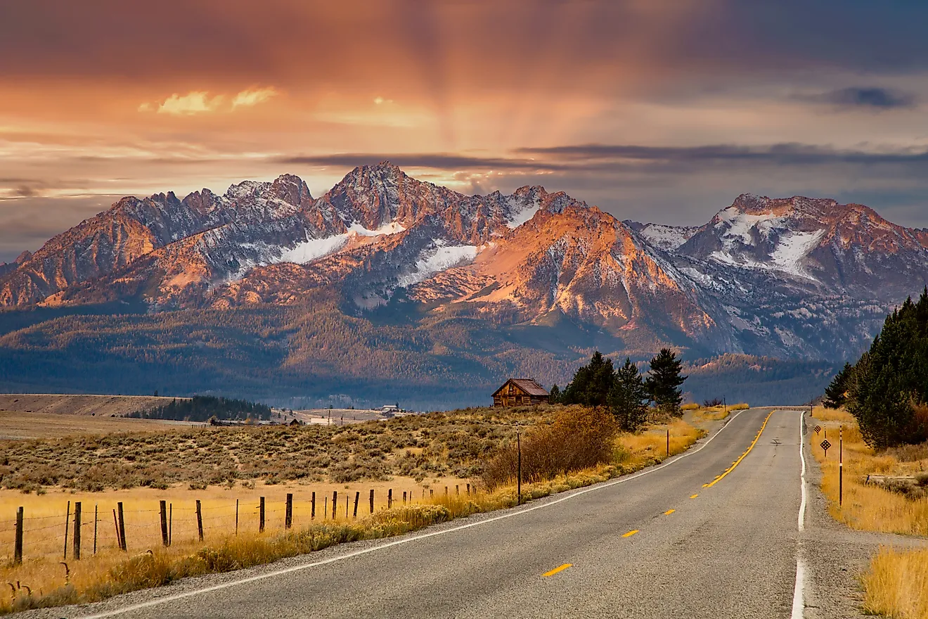
Grand Teton National Park, Wyoming

Grand Teton National Park, established in 1929 is a glaciated mountainous region located in the north-western Wyoming north of Jackson and south of Yellowstone National Park. A true haven for the active, the park, with a total area of 484 square miles (1,254 square kilometers) has a myriad of climbing routes and 235 miles (380 kilometers) of hiking trails. Being one of the most visited among the US national parks, with warm summers that provide the best experience for hiking. Severe winters, typical to the mountainous regions, are inclusive with heavy snowfalls of some 15 feet (4.5 meters) annually that feed small glaciers at high elevations.
These steep mountains to the west of the park, with snow-covered peaks extend into the sky for some 7,000 feet (2,130 meters) above Jackson Hole, with the highest peak, the Grand Teton, reaching 13,770 feet (4,198 meters) above sea level. Snake River runs through the Grand Tetons National Park, while numerous lakes dot the range, including Jenny Lake at the base of the tallest peaks, and Jackson Lake, a dammed section of the Snake River. Nevertheless, the Grand Tetons are not the only contenders at being the nature's wonder, in this park. At lower elevations, the tall lodgepole pines require periodic fires, which help them release seeds from cones to procreate. In the early spring some wildflowers begin to bloom under the blanket of snow, a heart-wrenching sight.
Great Sand Dunes, Colorado

Part of the Great Sand Dunes National Park sitting on the eastern edge of the San Luis Valley in south-central Colorado, the wind and water-eroded sand dunes, are ponderous to be around. Established on September 13, 2004 by George W. Bush, the Great Sand Dunes National Park consists of 107,341.87 acres (434.4 sq. km or 167.7 sq. miles). Some archaeological sites in the area date back 9,000 years, although it is known that humans have been present there two thousand more years longer. Don Diego de Vargas was the first European to set foot on the San Luis in 1694, while the dunes were first noted in writing in 1807 by Zebulon Pike.
The dunes with 5 billion cubic meters of sand, initially deposited, in theory, from the ancient Rio Grande river are some 30 miles in area reaching 150 f or 65.5 c on some summer days. Great Sand Dunes of Colorado are the tallest dunes in North America, with Star Dune at 755 feet in height, being the grandest. The total elevation change within the park's area is 6084 feet, with the lowest point near San Luis Lakes at 7520 feet, and the highest point being the Tijeras Peak, at 13,064 feet. Surrounding the park are wildlife-filled wetlands, tundra, alpine peaks, and forests, including the Rio Grande National Forest, the San Isabel National Forest, as well as the San Luis Lakes State Wildlife Area, the Baca National Wildlife Refuge, and the western Sangre de Cristo Range.
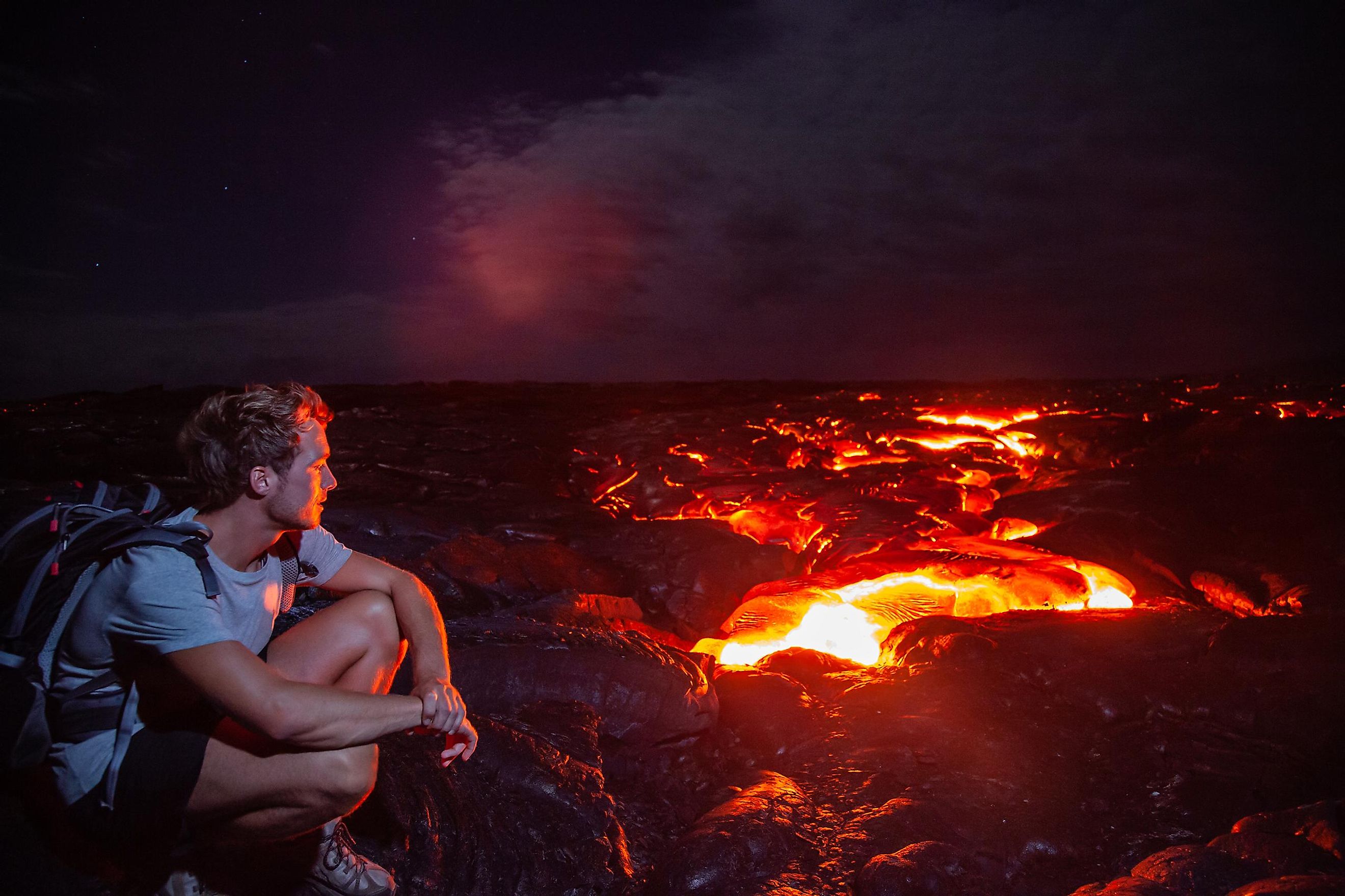
Hawaii Volcanoes National Park, Hawaii

This 505 square miles region along the south-eastern shore of the Hawaii Island established as a national park in 1961 and designated as a UNESCO World Heritage site in 1987, is an area of high volcanic activity, containing two active shield volcanoes sitting 25 miles (40 km) apart. There is also a dense tropically-forested area that receives some 100 inches (2,500 mm) of rain yearly, many tropical birds that fly about, as well as introduced species roaming the land, including mongooses, wild goats, pigs, pheasant, and quail. South of center and covering half of the island, Mauna Loa rises 3 miles (5 km) from the ocean's floor to break the water's surface, and continues reaching skywards for another 2.6 miles (4.2 km). Peaking at 13,677 feet (4,169 metres) above the sea level, it is the world's largest volcano. Having erupted over thirty times since its first well-recorded eruption in 1843, its most recent eruption was in 1984.

Mauna Loa Trail meanders in an ascending fashion to its peak, from Kilauea. East of Mauna Loa and covering one seventh of the island, Kilauea, peaking at 4,090 feet (1,250 metres), is the Earth’s most active volcano, as well as the youngest in the state. Its most active crater, Halema‘uma‘u Crater, drains its active lava lake to erupt frequently, and, often, for months, spewing ash and blocks of lava. Its eruptions in 2018 opened-up several lava-releasing fissures complete with clouds of sulphur dioxide gas, through the island's residential neighbourhoods, while one of the explosive eruptions sent volcanic ash 30,000 feet (9,140 metres) into the air. Kilauea's rain shadow contains an area of unusual lava formations, known as the Ka‘ū Desert.
Mammoth Cave National Park, Kentucky

This national park, covered by hardwood forest with meandering Green and Nolin rivers is located in west-central Kentucky is known for its intricate configuration of extensive limestone caverns. Stretching for 83 square miles (215 sq. km), it was established in 1941 and designated as a World Heritage site forty years later, with various underground passages. The link between the Mammoth Cave and the Flint Ridge Cave System was discovered in 1972, and a connection to Roppel Cave in 1983. The combined length of the multi-cave system is around 400 miles (650 km), which makes it the longest in the world. Human remnants of, possibly, pre-Columbian origin, have been found in the Mammoth Cave, while following the War of 1812, during which, the nitrates from the cave were extracted for gunpowder, the cave served as a hospital for people affected by tuberculosis.
The caves were formed continuously over time from the interaction of the underground composition with water, which dissolved the limestone in the environment of 54 °F (12 °C) and with 87 percent of humidity. The caves have a natural entrance, as well as numerous lakes, rivers, and geologic formations. Among the most unique stalactites and stalagmites in this underground system are the Pillars of Hercules or Frozen Niagara. Various creatures that have evolved to get around by sensing the dark environment live there, including cave crickets, eyeless fish, and eyeless crayfish, as well as fungi-related species.
Thor's Well, Oregon

Named after the Scandinavian God of Thunder, Thor’s Well at Cape Perpetua on the beautiful Pacific Coast in Oregon is known for its mesmerizing views and unique water configuration of, what appears to be, an endless sinkhole. Theory states, that, the collapse of a cave's top part due to continuous beating by the waves over the same spot, has resulted in this large sea cave that looks like a natural well roughly 20 feet deep. Some have erected the place with the name “the drainpipe of the Pacific”, because it appears as if the middle of Cape Perpetua, is sucking in the Pacific Ocean. While others call the place “the gate to hell”, the physiology of this natural wonder of the US, is not very sinister, with the place not being any more dangerous than any other spot along the same coast.
Although the non-stop overflow and refill of the well appears as if the Pacific Ocean is continuously being swallowed, the pressure of the ocean waters themselves, play along with the wind to put on this spectacle, while the winter storms agitate the waters further. Sitting conveniently only 40 minutes south of Newport or 30 minutes north of Florence, right off of Highway 101, it is best visited during a high tide, when the waves at the bottom raise the waters to burst through the top. Nevertheless, this, one of the seven wonders of Oregon, can be precarious for the incautious at high tide, when a strong undertow can pull one to sea, with sharp rocks and edges around. Spouting Horn at Cook's Chasm, an ocean geyser created when the waves, funnelling into the cave, come out in a spouting horn spectacle, is right next to the well, making this destination, a 2-in-1, wonder.

Today is the time, when exploring one's country and visiting remote natural wonders is chosen over visiting populated attractions elsewhere. With so many wonders in one's own backyard shows how much nature's imagination has to offer, and makes one wonder, what is brewing in its pot currently for the future generations to ponder at, that people may bypass on regular basis today.