Point Pelee National Park
Point Pelee, the southernmost spot on Canada's mainland, sits at about 41.9° N latitude. That is the same parallel as Rome. It is also the second-smallest national park in Canada at 15 square kilometres, and one of the most biodiverse: 390 documented bird species pass through its tapered peninsula at the confluence of the Mississippi and Atlantic flyways. The park sits roughly 50 kilometres south of Windsor, Ontario, on a Lake Erie sand spit that runs straight out into open water.
How A Sand Spit Became A National Park

The peninsula formed at the end of the Pleistocene, when retreating glaciers left behind the five Great Lakes and a great deal of sand. Lake Erie's wind and waves deposited fine sediment along the lake's shallow western basin over thousands of years, and a sand spit emerged. Carolinian deciduous forests followed. Archaeological evidence places Indigenous occupation of the area to at least 600 CE, when peoples of what Parks Canada identifies as the traditional territory of the Three Fires Confederacy (Ojibwa, Odawa, and Potawatomi) hunted deer, fished the marsh, and foraged wild rice and nuts. Other agencies recognize partly overlapping Anishinaabe, Haudenosaunee, and Miami presence in the area.

In 1790, lands including Point Pelee and Pelee Island were ceded to the British Crown under the McKee Purchase, also known as Treaty 2, with signatories from the Chippewa, Odawa, Pottawatomi, and Huron-Wendat First Nations. The Caldwell First Nation was not a signatory and did not benefit from the treaty, though the Crown later promised them Point Pelee land in recognition of Caldwell military service in the War of 1812. The Caldwell were displaced anyway as European settlement advanced. In 2010, after decades of protests and petitions, the federal government reached a $105 million settlement with the Caldwell First Nation, which has since used the funds to establish reserve lands in and around Leamington.
The push for federal protection came from a single hunting trip. In 1882, ornithologist W.E. Saunders went hunting on the peninsula and was struck by the migratory bird traffic overhead. He founded the Great Lakes Ornithological Club, built a small clubhouse near the present-day Visitor Centre (locals knew it as "The Shack"), and spent the next 36 years lobbying Ottawa. The park was established in 1918. Middle Island, the true southernmost point of Canada, was added to the park's jurisdiction in 2000.

National park status did not stop development. Agriculture and residential lots continued to degrade the ecosystem for another five decades. Even six thousand parking spots could not contain peak summer crowds; motorists fanned out unofficially across the peninsula. The focus finally shifted to restoration in the 1960s and 1970s. Homeowners were bought out (an emotionally difficult process that echoed the earlier Caldwell displacement in some respects). Roads and farms were removed. A shuttle service was introduced to ferry visitors to The Tip, reducing daily foot and tire traffic on the spit's fragile sand.
What Lives Here

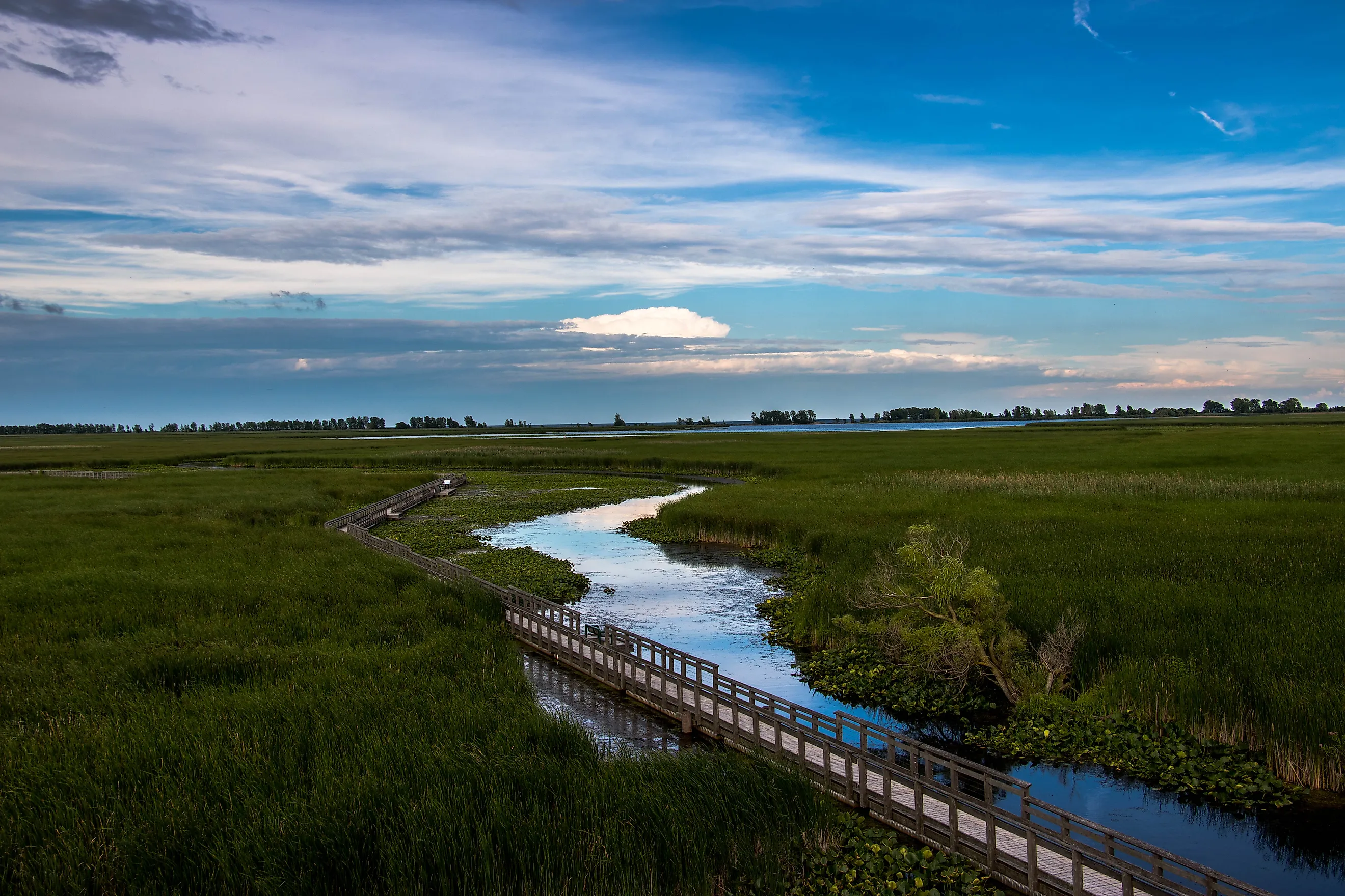
Point Pelee covers 15 square kilometres and includes 20 kilometres of Lake Erie beach. Two-thirds of the park is wetland, one of the largest marsh complexes in southwestern Ontario and a designated RAMSAR Wetland of International Importance. The park is also a Dark Sky Preserve, certified by the Royal Astronomical Society of Canada, and an internationally recognized Important Bird Area. Three hundred and ninety bird species have been documented inside its boundaries, including 43 of Canada's 52 warbler species. Nationally rare trees including hackberry, black walnut, tulip, and sassafras grow here, more typical of southern Ontario's small Carolinian zone than of the rest of the country. Resident fauna includes the eastern fox snake (Ontario's longest), the spotted turtle, the five-lined skink (eastern Canada's only native lizard), and the reintroduced southern flying squirrel.
The park's small size and surrounding farmland leave it vulnerable. Too many white-tailed deer eat native seedlings before they establish. Invasive plants crowd out remaining Carolinian growth. Heavy spring bird-watching foot traffic compacts marsh edges. Several reptile and amphibian species disappeared from Point Pelee through the twentieth century, and remaining populations of threatened species are scattered enough that further local extinctions are possible. Stay on designated trails. Pack out everything packed in.
Trails, Beaches, And Birds

Eight multi-use paths cover 12 kilometres of mostly crushed-gravel trail, five of which are wheelchair accessible. The one-kilometre Marsh Boardwalk loop is the park's signature route. A two-kilometre car-free stretch of road connects the Visitor Centre with The Tip's trailhead and gets heavy bike traffic in summer. Cross-country skiers have the park largely to themselves in winter; Point Pelee is open year-round.
Canoes, kayaks, and standup paddleboards are available for rent or self-launch at Pelee Wings, which also rents bikes and binoculars. Northwest Beach and West Beach are the designated swimming spots. The Tip is closed to swimming year-round because of strong rip currents at the lake's confluence, with fines for violators of up to $10,000.

Point Pelee's position at the confluence of two flyways makes it one of the busiest migration stops in eastern North America. March through June brings songbirds, vireos, tanagers, orioles, and warblers (those 43 of Canada's 52 warbler species) in breeding plumage. Waterfowl including swans, loons, grebes, dabbling ducks, and diving ducks pass through the same window. September and October bring birds of prey: sharp-shinned, Cooper's, and broad-winged hawks, peregrine falcons, and golden eagles, joined by returning songbirds. The annual Festival of Birds runs the first two weeks of May and is one of the largest events of its kind in Canada.
Camp Henry inside the park has 24 oTENTiks bookable through Parks Canada. The structures are a hybrid of an A-frame cabin and a prospector tent: floors, beds, and a wood stove inside a canvas-and-wood frame.

Two cultural sites sit on opposite sides of Point Pelee Drive midway through the park. The DeLaurier Homestead on the east side preserves the cabin, outbuildings, and cemetery of one of the peninsula's earliest permanent settler families and documents the land-use changes that followed. The Indigenous-led installation called Madbin Jina on the west side (the name means "sit a while" in Anishinaabemowin) honours the Caldwell First Nation through a traditional learning circle, ceremonial fire pit, teepee, and play area for kids.
If The Tip is all you have time for, park at the Visitor Centre and take the regular shuttle (April through October) to the trailhead. The walk out is short and the spit gets visibly narrower with every step. The Tip Tower at the trailhead offers a 360-degree view of the entire peninsula, neighbouring Pelee Island, and the broader Lake Erie basin.
Pro Tips

- Admission is free June 19 through September 7, 2026, under the Canada Strong Pass.
- Arrive early. There is one road in and one road out, and lots fill by mid-morning on summer weekends.
- Pick a base and stick with it. The Marsh Boardwalk works well as a central anchor, with the Visitor Centre and The Tip both reachable by bike or shuttle.
- East Barrier Beach is much quieter than The Tip. Most visitors walk straight out to the spit and skip the eastern side entirely.
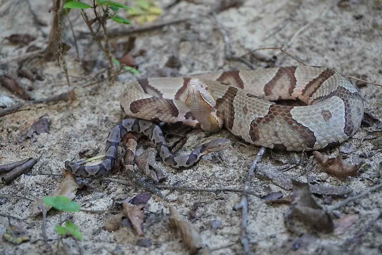
- You will see snakes. None are venomous. Most sightings are garter snakes vanishing into the brush, occasionally the longer eastern fox snake doing the same.
- Ticks are present and a small percentage carry Lyme disease. Long layers and DEET are standard precautions. Check yourself at the end of the day.
- Three species of poison ivy live in the park. Stay on trails.
- Dark Sky Nights run monthly, with the park staying open until midnight for stargazers.
A Small Park With Big Numbers

Point Pelee covers 15 square kilometres, the second-smallest national park in Canada. Inside its boundaries are 390 documented bird species, the eastern fox snake (Ontario's longest), the five-lined skink (eastern Canada's only native lizard), the southern flying squirrel, three species of poison ivy, sassafras and tulip trees more associated with the Carolinas than with Canada, a RAMSAR wetland, an Important Bird Area, a Dark Sky Preserve, and the southernmost spot on mainland Canada. The whole package sits on the same parallel as Rome. Not bad for a sand spit.