Where is Webster County, West Virginia?
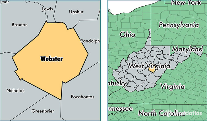
Webster County is a county equivalent area found in West Virginia, USA. The county government of Webster is found in the county seat of Webster Springs.
With a total 1,440.62 sq. km of land and water area, Webster County, West Virginia is the 1987th largest county equivalent area in the United States. Home to 8,834 people, Webster County has a total 5379 households earning 27645 on average per year.
Webster County, West Virginia - Quick Facts
| FIPS Code | 54101 |
| Area Codes | 304 |
| Time Zone | EST |
| Major Cities | Webster Springs (population: 3,559), Cowen (population: 2,939), Camden on Gauley (population: 961), Hacker Valley (population: 448), Diana (population: 349), Upperglade (population: 248), Erbacon (population: 195), Cleveland (population: 164), Bergoo (population: 94) |
| Land Area | 3,411 sq miles |
| Water Area | 553 sq miles |
| Household Income | $27,645 |
| Housing Units | 5,379 |
| Median Home Value | $64,100 |
| High School Grads | 71% of population |
| Holders of Bachelors Degrees | 9% of population |
| Retail Spending | $4,246 per capita |
| Food & Accomodation Sales | $1,965 per capita |
This page was last updated on June 30, 2016.