Where is Randolph County, West Virginia?
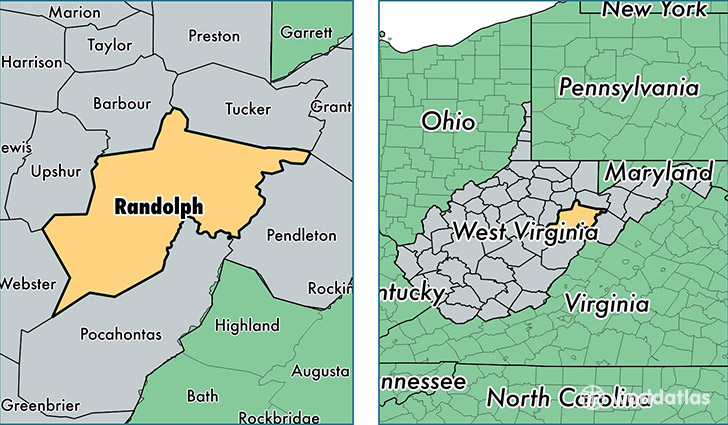
Randolph County is a county equivalent area found in West Virginia, USA. The county government of Randolph is found in the county seat of Elkins.
With a total 2,693.46 sq. km of land and water area, Randolph County, West Virginia is the 727th largest county equivalent area in the United States. Home to 29,429 people, Randolph County has a total 14107 households earning 37276 on average per year.
Randolph County, West Virginia - Quick Facts
| FIPS Code | 54083 |
| Area Codes | 304 |
| Time Zone | EST |
| Major Cities | Elkins (population: 14,580), Beverly (population: 3,487), Huttonsville (population: 2,039), Montrose (population: 1,727), Mill Creek (population: 1,708), Coalton (population: 956), Harman (population: 754), Valley Head (population: 728), Valley Bend (population: 599), Mabie (population: 590) |
| Land Area | 11,363 sq miles |
| Water Area | 1,040 sq miles |
| Household Income | $37,276 |
| Housing Units | 14,107 |
| Median Home Value | $99,000 |
| High School Grads | 83% of population |
| Holders of Bachelors Degrees | 19% of population |
| Retail Spending | $11,252 per capita |
| Food & Accomodation Sales | $30,726 per capita |
This page was last updated on June 30, 2016.