Where is Greenbrier County, West Virginia?
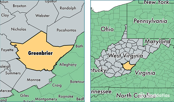
Greenbrier County is a county equivalent area found in West Virginia, USA. The county government of Greenbrier is found in the county seat of Lewisburg.
With a total 2,653.47 sq. km of land and water area, Greenbrier County, West Virginia is the 741st largest county equivalent area in the United States. Home to 35,450 people, Greenbrier County has a total 19007 households earning 37895 on average per year.
Greenbrier County, West Virginia - Quick Facts
| FIPS Code | 54025 |
| Area Codes | 304 |
| Time Zone | EST |
| Major Cities | Lewisburg (population: 9,215), Alderson (population: 5,376), White Sulphur Springs (population: 5,265), Ronceverte (population: 4,618), Rainelle (population: 3,829), Rupert (population: 1,904), Crawley (population: 1,558), Frankford (population: 1,532), Renick (population: 1,298), Quinwood (population: 958) |
| Land Area | 13,687 sq miles |
| Water Area | 1,020 sq miles |
| Household Income | $37,895 |
| Housing Units | 19,007 |
| Median Home Value | $96,700 |
| High School Grads | 83% of population |
| Holders of Bachelors Degrees | 17% of population |
| Retail Spending | $14,127 per capita |
| Food & Accomodation Sales | $139,522 per capita |
This page was last updated on June 30, 2016.