Where is Lincoln County, West Virginia?
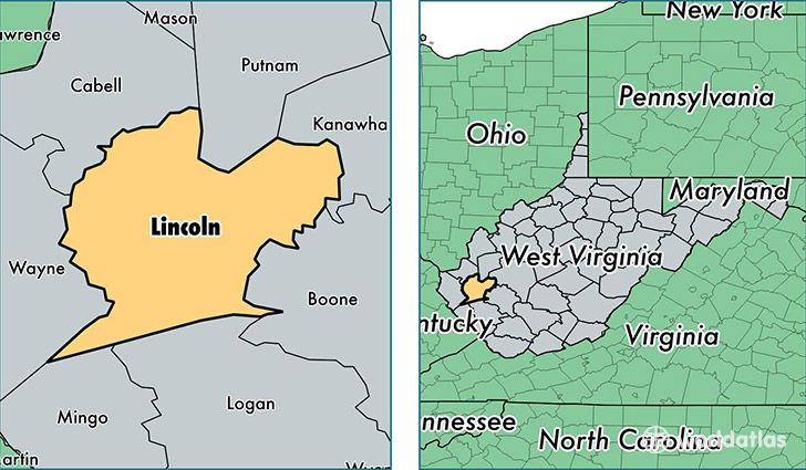
Lincoln County is a county equivalent area found in West Virginia, USA. The county government of Lincoln is found in the county seat of Hamlin.
With a total 1,135.95 sq. km of land and water area, Lincoln County, West Virginia is the 2393rd largest county equivalent area in the United States. Home to 21,561 people, Lincoln County has a total 9760 households earning 35487 on average per year.
Lincoln County, West Virginia - Quick Facts
| FIPS Code | 54043 |
| Area Codes | 304 |
| Time Zone | EST |
| Major Cities | Branchland (population: 5,022), Harts (population: 3,463), Hamlin (population: 2,639), West Hamlin (population: 2,196), Ranger (population: 1,746), Sod (population: 1,244), Alkol (population: 1,125), Griffithsville (population: 1,096), Yawkey (population: 965), Sumerco (population: 920) |
| Land Area | 8,325 sq miles |
| Water Area | 437 sq miles |
| Household Income | $35,487 |
| Housing Units | 9,760 |
| Median Home Value | $76,700 |
| High School Grads | 74% of population |
| Holders of Bachelors Degrees | 8% of population |
| Retail Spending | $3,309 per capita |
| Food & Accomodation Sales | $2,777 per capita |
This page was last updated on June 30, 2016.