Where is Putnam County, West Virginia?
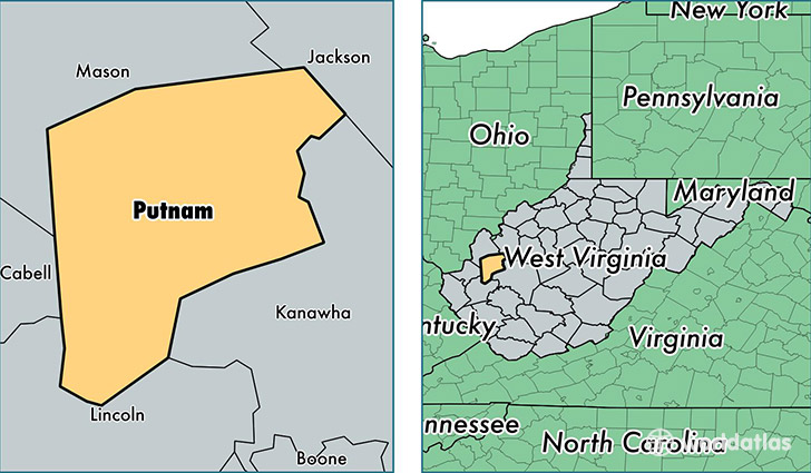
Putnam County is a county equivalent area found in West Virginia, USA. The county government of Putnam is found in the county seat of Winfield.
With a total 907.53 sq. km of land and water area, Putnam County, West Virginia is the 2731st largest county equivalent area in the United States. Home to 56,770 people, Putnam County has a total 23575 households earning 54854 on average per year.
Putnam County, West Virginia - Quick Facts
| FIPS Code | 54079 |
| Area Codes | 304 |
| Time Zone | EST |
| Major Cities | Hurricane (population: 22,276), Scott Depot (population: 8,133), Winfield (population: 5,606), Poca (population: 5,251), Red House (population: 2,545), Buffalo (population: 2,272), Eleanor (population: 1,711), Fraziers Bottom (population: 1,689), Liberty (population: 1,234), Bancroft (population: 813) |
| Land Area | 21,919 sq miles |
| Water Area | 346 sq miles |
| Household Income | $54,854 |
| Housing Units | 23,575 |
| Median Home Value | $142,900 |
| High School Grads | 89% of population |
| Holders of Bachelors Degrees | 24% of population |
| Retail Spending | $10,725 per capita |
| Food & Accomodation Sales | $61,640 per capita |
This page was last updated on June 30, 2016.