Where is Carroll County, Virginia?
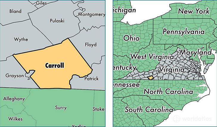
Carroll County is a county equivalent area found in Virginia, USA. The county government of Carroll is found in the county seat of Hillsville.
With a total 1,237.09 sq. km of land and water area, Carroll County, Virginia is the 2251st largest county equivalent area in the United States. Home to 29,621 people, Carroll County has a total 16515 households earning 32853 on average per year.
Carroll County, Virginia - Quick Facts
| FIPS Code | 51035 |
| Area Codes | 276 |
| Time Zone | EST |
| Major Cities | Hillsville (population: 9,208), Cana (population: 3,833), Woodlawn (population: 3,791), Austinville (population: 2,392), Fancy Gap (population: 1,715), Dugspur (population: 1,032), Laurel Fork (population: 884), Lambsburg (population: 663) |
| Land Area | 11,437 sq miles |
| Water Area | 475 sq miles |
| Household Income | $32,853 |
| Housing Units | 16,515 |
| Median Home Value | $102,900 |
| High School Grads | 76% of population |
| Holders of Bachelors Degrees | 13% of population |
| Retail Spending | $6,962 per capita |
| Food & Accomodation Sales | $23,259 per capita |
This page was last updated on June 30, 2016.