Where is Grayson County, Virginia?
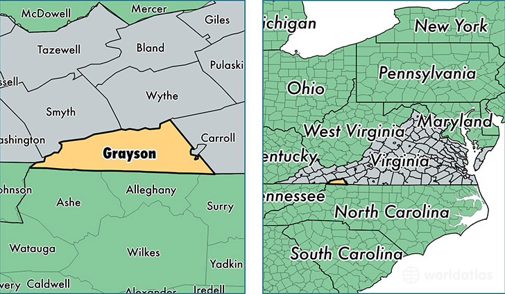
Grayson County is a county equivalent area found in Virginia, USA. The county government of Grayson is found in the county seat of Independence.
With a total 1,155.02 sq. km of land and water area, Grayson County, Virginia is the 2358th largest county equivalent area in the United States. Home to 15,093 people, Grayson County has a total 9108 households earning 30710 on average per year.
Grayson County, Virginia - Quick Facts
| FIPS Code | 51077 |
| Area Codes | 276 |
| Time Zone | EST |
| Major Cities | Independence (population: 3,868), Fries (population: 3,336), Mouth of Wilson (population: 1,334), Troutdale (population: 1,203), Elk Creek (population: 1,034), Whitetop (population: 522) |
| Land Area | 5,827 sq miles |
| Water Area | 442 sq miles |
| Household Income | $30,710 |
| Housing Units | 9,108 |
| Median Home Value | $97,900 |
| High School Grads | 75% of population |
| Holders of Bachelors Degrees | 11% of population |
| Retail Spending | $2,946 per capita |
This page was last updated on June 30, 2016.