Pico de Orizaba
Pico de Orizaba, also known as Citlaltepetl Volcano in the Nahuan language, is an inactive stratovolcano and Mexico’s highest mountain. It is also North America’s third-highest mountain after Denali and Logan and the Continent’s highest volcanic summit. Its local name (Citlaltepetl) translates to “the Star Mountain” since it is covered by snow all year round. “Orizaba” is a Spanish name for the municipality and city of Orizaba in the state of Veracruz. This stratovolcano towers the border between Puebla and Veracruz states in south-central Mexico. It rises 5,636 meters above sea level and is the world’s second-most prominent volcanic peak after Mount Kilimanjaro in Tanzania.
Description

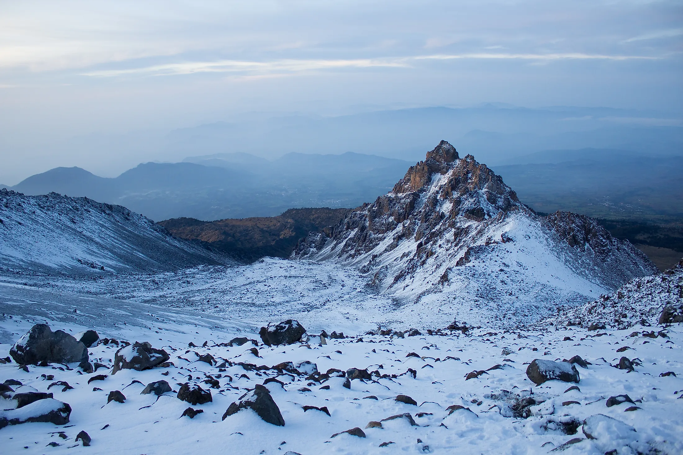
Although Pico de Orizaba is a dormant volcano, it is not extinct and may erupt in the future. At 5,636 meters above sea level, Citlaltepetl is North America’s highest volcano and third-highest mountain, the world’s 4th highest Volcanic Seven Summit, and the 3rd highest Seven Third Summit. This Star Mountain is also the world’s second-most prominent volcanic peak and the third highest peak in North America after Denali and Mount Logan, with a prominence of 4,922 meters. The inactive volcano is the world’s 16th most isolated peak, located approximately 110 kilometers to the west of the port city of Veracruz. Pico de Orizaba is Mexico’s highest point, making Mexico the world’s 20th highest country.
Location
Pico de Orizaba is located on the boundary between Puebla and Veracruz states, approximately 110 kilometers west of the port city of Veracruz on the Gulf of Mexico. The prominent volcano is about 200 km east of the country’s capital, Mexico City, and 480 km away from the Tropic of Cancer. The Star Mountain is the easternmost stratovolcano of the Trans-Mexican Volcanic Belt. The extinct Sierra Negra volcano is located approximately six kilometers southwest of Pico de Orizaba.
Geography

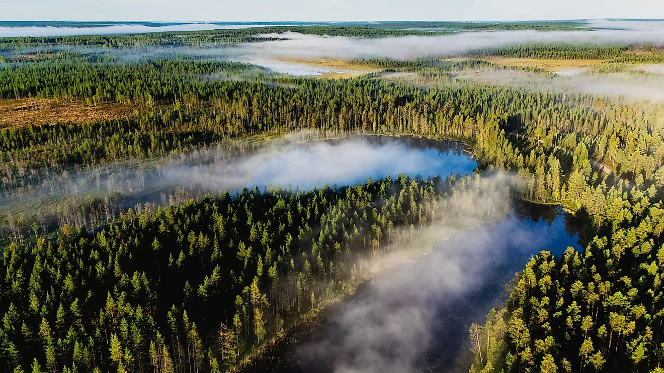
Pico de Orizaba rises on the Mexican Plateau’s southern edge and separates the plateau and the Gulf of Mexico’s coastal plains. The peak is asymmetrical and steepest on the eastern slope. The volcano’s northwestern slope is the most gradual, containing the most hiking routes to the summit. This gradual slope also contains the largest glaciers. The volcano influences the region’s climate and prevents the moisture originating from the Gulf of Mexico from reaching south-central Mexico. It is one of the three Mexican volcanoes that retain summit glaciers, the other two peaks being Iztaccihuatl and Popocatepetl. The snow-covered summit crater is 300 meters deep and is visible from International Space Station. The cooling ridges (lava flow levees) are also visible on the sides of the volcano, with the prominent ones located on the cone’s southwest flank. Pico de Orizaba is the source of several rivers, including the Jamapa River, which drains into the Gulf of Mexico.
Climate
Pico de Orizaba is part of Sierra Madre Oriental, a mountain range of the American Cordillera. Like the mountain range, Orizaba’s climate varies because of the prevailing wind and changing elevations. The volcano experiences microclimates on different parts due to the rugged terrain and latitude. The eastern slope receives the highest precipitation since the trade winds transporting moisture from the Gulf of Mexico cool and condense there. Low clouds and fog also cover the east face most time, with the lower elevation experiencing tropical climate. The elevation between 2,200 and 3,200 meters experience subtropical climate, characterized by regular precipitation throughout the year. Light snow and freezes are frequent in winter and autumn, but the snow on the southern and southeastern faces melt faster due to direct contact with solar radiation. The subtropical highland climate is dominant on the northern face, while the humid subtropical climate occurs on the southern face. The western slope experiences steppe or semi-arid climate influenced by katabatic winds. Polar climate prevails from an elevation above 4,300 meters, with the annual average temperature falling below -2 degrees Celsius.
Geology and Formation

The Star Mountain formed in three stages, with the final stage initiated approximately 16,000 years ago. The stage formed a stratovolcano, with the three volcanoes superimposed on each other to form Pico de Orizaba. The Torrecillas volcano formed about 650,000 to 250,000 years ago, followed by Espolon de Oro in 210,000 to 16,000 years ago. The current volcano, superimposed on the two earlier volcanoes, has existed for about 16,000 years. The lava that formed the volcano contained dacitic and andesitic volcanic rocks and flowed after several explosive eruptions. The lava steadily flowed out of the volcano, resulting in the mountain’s cone shape. Although Pico de Orizaba is a dormant stratovolcano, it is not extinct. It last erupted in 1846. It erupted every century from the 12th to the 19th century, except in the 18th century. The volcano’s most violent eruption may have occurred in 6710 BC, recording a Volcanic Explosive Index (VEI) of five. The summit crater is 300 meters deep and has a surface area of 154,830 square kilometers.
Glacier

Citlaltepetl is one of Mexico’s three volcanoes covered by an ice cap and consists of the country’s largest glacier known as Gran Glacier Norte. Besides the Gran Glacier Norte, Pico de Orizaba has seven other glaciers, namely Toro, Jamapa, Occidental, Noroccidental, Oriental, Suroccidental, Glacier de la Barba, and Lengua del Chichimeco. The southern and southeastern snow melts much faster than the snow on other parts of the volcano due to the solar radiation. The glacier forms mainly on the north and northwest faces because of low temperature. The Gran Glacier Norte forms on the volcano’s northern side and contains nine glaciers, of which seven are outlet glaciers. The nine named glaciers extend 3.5 kilometers from an elevation of 5,650 to 5,000 meters and cover about 9.08 square kilometers. The Jamapa Glacier is distinct and has influenced the mountain region’s geomorphologic evolution. It extends northwest for 2 kilometers from an elevation of 4,950 meters. After the 2 kilometers, the glacier divides into two tongues that terminate at 4,640 and 4,650 meters.
History and Climbing

Pico de Orizaba was a culturally significant mountain for the Totonac and Aztec people and features several mythologies. Hernan Cortes, a Spanish conquistador, passed by the volcano on the way to Tenochtitlan during Mexico’s Spanish conquest. In the 17th century, the Spanish built several routes around the Orizaba, with one of the routes passing through the Fortin de las Flores and Orizaba cities. In 1839, French-Belgian geologist Henri Guillaume Galeotti became the first European to explore the mountain region but did not reach the summit. The first people to hike to the volcano’s summit were two soldiers from United States, William Raynold and F. Maynard, in 1848. Afterwhich, several people have reached Pico de Orizaba’s summit, including Alejandro Doignon and Martin Tritschler.