What Is A Katabatic Wind?
Wind is the bulk movement of air that either result from temperature difference, largescale synoptic pressure, or local pressure and temperature differences. However, once the wind is generated, its direction and speed if modified by the existing surface structures. Local surface winds are often a function of the difference in temperature between the higher and the lower elevations. These winds are sometimes called mountain winds as they mostly occur in mountainous regions. However, meteorologists refer to them as either anabatic or katabatic winds. The difference between these two types of winds is the direction of flow; either upslope or downslope.
Katabatic Winds
Unlike anabatic wind which is an upslope wind, katabatic winds are downslope winds. In a simple definition, these are winds that carry high-density air from higher elevations down the slope. The name “katabatic” is derived from the Greek word “katabasis” which means descending. Such downslope winds are sometimes referred to as fall winds. Katabatic winds are formed when the mountain surface becomes colder than the surrounding air, forcing the wind to rush down the slope, sometimes in a hurricane speed of up to 80 miles per hour. The winds may also extend over a fairly large area like was in the case of the Santa Anna wind which is experienced in southern California in some parts of the year. Other examples of katabatic winds include bora winds of the Adriatic, oroshi winds of Japan, and piteraq in Greenland. It is important to note that not all downslope winds are katabatic winds. Some winds such as chinook, fohn, and bergwind are more of rain shadow winds which are formed when the moist air is driven up the slope on the windward side descend on the leeward side as the warm and dry wind.
Origin Of Katabatic Winds
According to meteorologists, the downslope winds originate from the cooling of the air at the top of a mountain, plateau, hill, or glacier. Because air density is inversely proportional to the pressure at the top, the air will be forced to flow downwards and warms up in the process of descent. The temperature of the air is determined by the extent of descent and temperature in the source region. For instance, in the case of Santa Ana, the winds sometimes become hot by the time they reach the sea level. The greater the difference in temperature, the stronger the winds.
Impact Of The Katabatic Winds
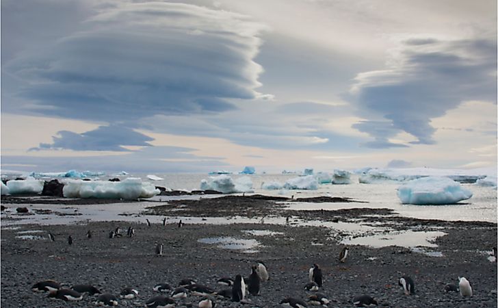
Katabatic winds most commonly blow out from large elevated ice sheets in Greenland and Antarctica regions. The high-density cold air that builds up over the ice sheet and the elevation of the ice sheet increases the force of gravity. When the winds are concentrated in a restricted area, it will blow with hurricane speed, reaching 190 miles per hour. In Greenland where these winds are referred to as piteraq. They are most intense as the low-pressure area approaches the coast. In some areas, especially in Antarctica, the snow may be scoured away by the force of the winds, leading to the formation of Antarctica oases. The descending katabatic winds have low relative humidity.