Maps of St Vincent and the Grenadines

St. Vincent and the Grenadines are a group of islands located in the Caribbean Sea and the North Atlantic Ocean. Covering a total area of 389 sq. km (150 sq mi), the island country of St. Vincent and the Grenadines comprises the larger St. Vincent Island and the northern Grenadine islands, along with some 32 islands and hundreds of islets, all stretching southward (about 48 miles) to the country of Grenada.
Lush forests and sandy beaches wrap around most of St. Vincent's coastline with larger hills and mountains sitting in the center. The entire island of St.Vincent is considered to be an active volcano. There is still regular volcanic activity as well, the most recent event occurred in 2020. This incident was considered minor, however, and only involved a slow leak of lava from certain parts of the mountain and resulted in little damage. The largest and most devasting eruptions at St.Vincent occurred in 1902 and 1812.
Mt. Soufrière, the highest point in the nation stands at an imposing 4,048 ft. (1234 m) tall and is located in the northern part of St. Vincent Island. Other notable peaks are Richmond Peak and Colonarie Mountain. These peaks provide a great look at the nearby ocean and calm tropical shoreline.
The Grenadines include the main islands of Bequia, Balliceau, Canouan, Mayreau, Mustique, Isle D'Quatre, Petit Saint Vincent, and Union Island, and over 600 rocky islets, all low-lying and ringed by coral reefs. Many of these islands are visited by tourists each year for their clear warm water and white sand beaches.
Parishes Map of St. Vincent and the Grenadines

St. Vincent and the Grenadines is administratively divided into 6 parishes. The parishes situated on St. Vincent Island are Charlotte, Saint Andrew, Saint David, Saint George, and Saint Patrick. The Grenadines parish is a part of the Grenadines Islands.
Covering a total area of 369 sq. km, the island country of St. Vincent and the Grenadines comprises of the larger St. Vincent Island and the northern Grenadine islands along with some 32 islands and hundreds of islets. Some of the other major islands are Young Island, Palm Island, Bequia, Mustique, Union Island, Mayreau, Petit St Vincent, and Canouan.
Located on the southwestern coast of St. Vincent island, overlooking the Kingstown Harbour is, Kingstown – the capital, the largest and the most populous city of St. Vincent and the Grenadines. It is the chief port and an important economic and commercial center of the island country.
Where is St Vincent and the Grenadines?

St. Vincent and the Grenadines is a multi-island nation and a part of the Windward islands in the southern Lesser Antilles in eastern Caribbean Sea. The islands are positioned in the Northern and Western hemispheres of the Earth. St. Vincent Island is situated to the southwest of Saint Lucia; to the west of Barbados and to the northeast of Grenada. St. Vincent and the Grenadines also shares maritime borders with Trinidad and Tobago and Venezuela.
Regional Maps: Map of North America
Outline Map of St Vincent and the Grenadines

The above blank map represents St. Vincent and the Grenadines - a group of small islands, located in the Caribbean Sea and the North Atlantic Ocean. The map can be downloaded, printed and used for educational purposes.

The above outline map represents St. Vincent and the Grenadines - a group of small islands, located in the Caribbean Sea and the North Atlantic Ocean. The larger island of St. Vincent (volcanic in origin) has a rugged mountainous terrain, while the Grenadines have over 600 rocky islets, ringed by coral reefs.
Key Facts
| Legal Name | Saint Vincent and the Grenadines |
|---|---|
| Flag |
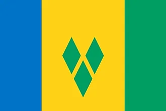
|
| Capital City | Kingstown |
| 13 08 N, 61 13 W | |
| Total Area | 389.00 km2 |
| Land Area | 389.00 km2 |
| Water Area | N/A |
| Population | 110,589 |
| Currency | East Caribbean dollars (XCD) |
| GDP | $825.39 Million |
| GDP Per Capita | $7,463.54 |
This page was last updated on November 28, 2023