Maps of Paraguay

The landlocked nation of Paraguay covering an area of 406,752 sq. km (157,050 sq mi), is located in Central South America. As observed on the physical map of the country, Paraguay is crisscrossed by many rivers. The three largest rivers - the Paraguay, Parana, and Pilcomayo Rivers -form over 75% of the country's borders. The Parana River forms the country's eastern and southern borders and joins the Paraguay River in the country's southwestern region. As marked on the map by an upright yellow triangle is the country's highest peak - Cerro Pero at 2,762 ft (842m).
The Paraguay River divides the country into two major regions: the Paranena (Eastern Region), east of the Paraguay River, is a fertile, cultivated landscape, with rolling hills, low mountains, and subtropical forests.
The Alto Paraná Atlantic forests bleeds across the borders of Brazil, Argentina, and Paraguay giving all three nations access to some of the densest jungles outside of the Amazon. The region is best known for its rare species of animals. Especially birds such as parrots.
The Pantanal is both the largest tropical wetland and the largest flooded grassland in the entire world. While the biggest portion of this region is located in Southern Brazil, parts of this amazing biome do leak into Northern Paraguay as well.
The Paraná Savana begins in the south of Paraguay and stretches all the way down into Argentina. Home to dozens of islands that are subject to flooding, the humidity here is some of the most intense in the world. It is the hottest in January when the average temperature is 25.4 °C (77.7 °F). Rain is common too. Each year the region is hit with more than 1,100 millimeters (43 in) of precipitation.
Western Region, the hot scrublands and low plains of the Chaco cover about 60% of Paraguay's total land area. The Chaco region is one of the most sparsely populated regions in South America due to its tough terrain and harsh environment.
The major bodies of water in Paraguay are Lake Ypoa and Lake Vera. The largest of the two, Lake Vera drains in the Ñeembucú plain a large expanses of marshland.
Departments of Paraguay Map

Paraguay (officially, the Republic of Paraguay) is divided into 17 departments (departamentos, singular - departamento) and 1 capital city (Distrito Capital). In alphabetical order, the departments are: Alto Paraguay, Alto Parana, Amambay, Boqueron, Caaguazu, Caazapa, Canindeyu, Central, Concepcion, Cordillera, Guaira, Itapua, Misiones, Neembucu, Paraguari, Presidente Hayes and San Pedro. Asunción is the Distrito Capital. These departments are further subdivided into districts (distritos). The districts are further divided into municipalities and rural districts.
The landlocked nation of Paraguay covers an area of 406,752 sq. km. Located on the east bank of Paraguay River is, Asunción - the national capital and the largest city of Paraguay. It is one of South America's "oldest cities", and is the administrative, cultural, and industrial center of Paraguay. Asunción is also the principal port of the country.
Where is Paraguay?

The landlocked nation of Paraguay is located in central South America. It is dissected by the Topic of Capricorn and is geographically positioned both in the Southern and Western hemispheres of the Earth. Paraguay is bordered by Bolivia to the north and northwest; by Brazil to the east and northeast and by Argentina to the west, south, and southeast.
Paraguay Bordering Countries: Argentina, Bolivia, Brazil.
Regional Maps: Map of South America
Outline Map of Paraguay

The above blank map represents Paraguay - a landlocked nation, located in central South America. The map can be downloaded, printed and used for geography educational purposes like map-pointing and coloring activities.

The above outline map represents Paraguay - a landlocked nation, located in Central South America. It is often referred as the "Heart of South America" due to its centralized location.
Key Facts
| Legal Name | Republic of Paraguay |
|---|---|
| Flag |
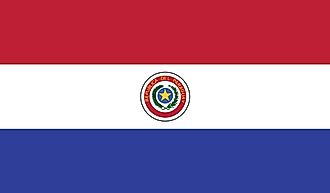
|
| Capital City | Asuncion |
| 25 16 S, 57 40 W | |
| Total Area | 406,752.00 km2 |
| Land Area | 397,302.00 km2 |
| Water Area | 9,450.00 km2 |
| Population | 7,044,636 |
| Major Cities |
|
| Currency | Guarani (PYG) |
| GDP | $38.15 Billion |
| GDP Per Capita | $5,414.80 |
This page was last updated on December 5, 2023