The Geography Of Egypt: The Climate And The Natural Regions Of Egypt
Egypt is a fascinating country, well-known across the world for the ancient Egyptian civilization that was well ahead of its time and highly advanced both in terms of of knowledge and technology. The geography of Egypt is very unique and it is interesting to study how the ancient Egyptians made the best use of the river Nile to build thriving and prosperous settlements in an otherwise parched desert land with extremes of temperature. Here, we will discuss some of the major aspects of the geography of Egypt and focus on the climate and major natural regions of the country.
5. Climate Of Egypt
One of the most striking features of the geography of Egypt is its extreme climate. Egypt is part of the desert belt of North Africa and hence, low levels of precipitation and high variations in diurnal and seasonal temperatures characterize the climate of Egypt. Two seasons can be clearly demarcated, the summer and the winter season. The former lasts from May to September and features extremely high temperatures throughout the inland areas of the country. The midday temperatures in June range from 33 °C at Cairo to 41 °C at Aswan. March to June is also the time when several sandstorms and dust storms sweep through the country. These are called the khamsins. Such storms are accompanied by reduced levels of humidity and a sudden surge in temperature by about 8 to 11 °C. Winds blowing at gale force are also common. The winters in Egypt are mild and cool with temperatures in January varying between 9 and 23 °C at Aswan and 9 and 18 °C at Alexandria. Sudden extremes of temperature are also quite common in Egypt.
Egypt is also bright and sunny throughout the year. During the summer months, the sun shines brightly for 12 h a day while during the winter the sunshine lasts for 8 to 10 hours a day.
Humidity in Egypt decreases from north to south of the country. Humidity is quite high along the Mediterranean coast of Egypt and in summer, the conditions can be quite oppressive. Egypt receives very little annual precipitation that also decreases from north to south. So, while Alexandria along the Mediterranean coast receives an annual average precipitation of 175 mm, Cairo in the Nile delta receives 25 mm and Aswan in the interior receives almost a negligible precipitation of 2.5 mm. The Sinai Peninsula receives a relatively higher amount of precipitation than the Western Desert region and the Red Sea coast of Egypt, both of which are extremely arid and nearly uninhabitable.
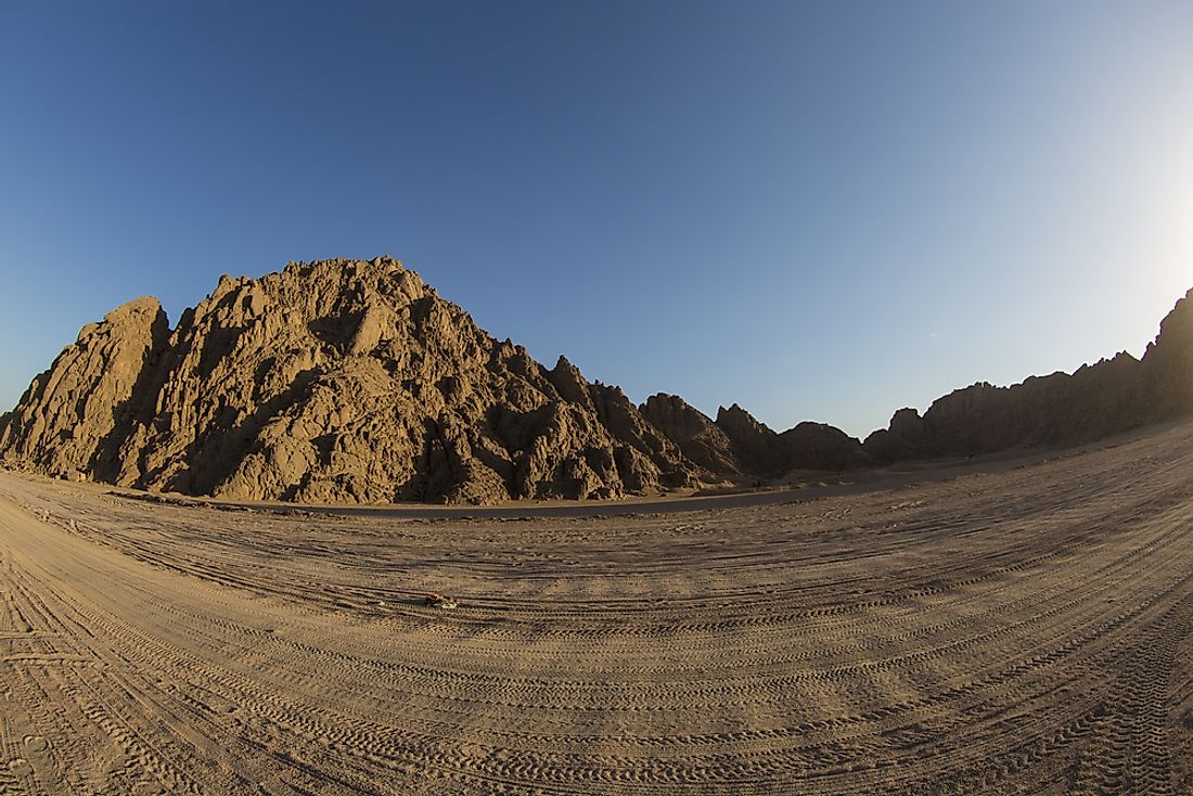
4. The Eastern Desert
The Eastern Desert natural region of Egypt occupies an area of 221,900 square km that is roughly equivalent to one-fourth of the total area of the country. The Eastern Desert stretches north to south from the Nile River delta to Egypt’s borders with Sudan. In the east to west direction, the desert extends from the Nile River valley to the coasts of the Red Sea and the Gulf of Suez. The desert arises abruptly from the eastern banks of the Nile valley as a rolling sandy highland which then continues for about 80 to 137 km and then gives way to the Red Sea Hills. The latter is a prominent feature of Egypt’s Eastern Desert region and consists of rugged and arid, volcanic mountains running in the north to south direction. The 7,175 ft tall Mount Shāʾib al-Banāt is the tallest peak in the region. Several wadis also dissect these mountain chains. Although the Eastern Desert of Egypt is quite inhospitable because of its rugged terrain and lack of water resources, it is rich in natural resources like oil, gold, uranium, asbestos, phosphate, manganese, etc. The only sedentary settlements in this natural region are found to the east of the Red Sea Hills along the coast of the Red Sea. The most important economic activities of the people here are fishing, oil extraction, and mining. Nomadic herders and traders are found in the rest of the desert area.
3. The Western Desert
Occupying about two-thirds of the area of Egypt, the Western Desert natural region is a massive stretch of arid land extending from the western banks of the Nile to Egypt’s borders with Libya. North to south, the desert stretches from the narrow coastal plains of the Mediterranean Sea to the borders of Egypt with Sudan. The area covered by the desert is 680,650 square km. The elevation of the Western Desert is the highest in the southeast at the Al-Jilf al-Kabīr plateau (3,300 ft). From here, the plateau gradually slopes northeastward and forms the first depression that is occupied by the Al-Dākhilah and the Al-Khārijah oases. The second depression is found farther north and contains the Al-Baḥriyyah and the Al-Farāfirah oases. Finally, the plateau ends in the uninhabitable and virtually impassable Qattara Depression. The oases of Siwa, the most populated oasis in the region, lies to the west of the Qattara Depression. An area of sandy ridges with stony tracts in between characterize the landscape of the Western Desert that stretches from the south of the Qattara Depression towards the Libyan border. North of depression, the plateau ends in the narrow coastal plain of the Mediterranean Sea.
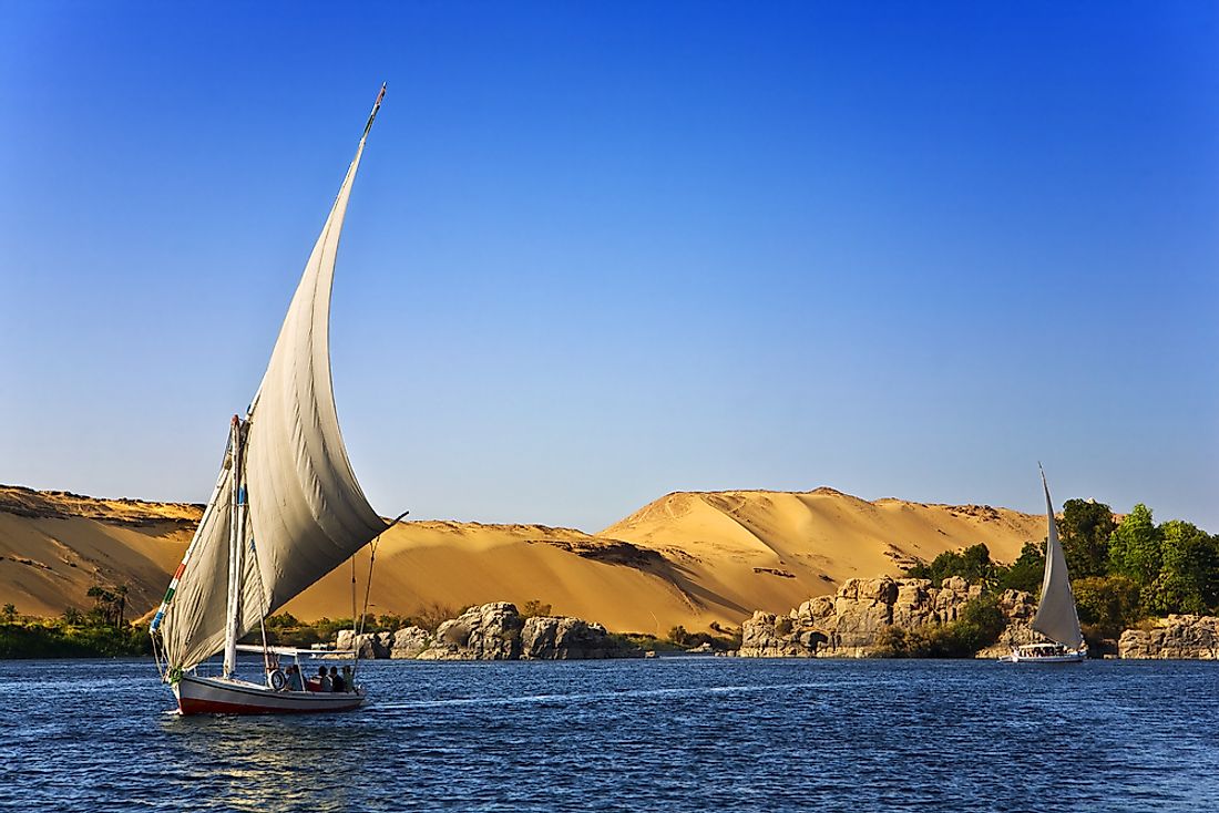
2. Nile River Valley And Delta
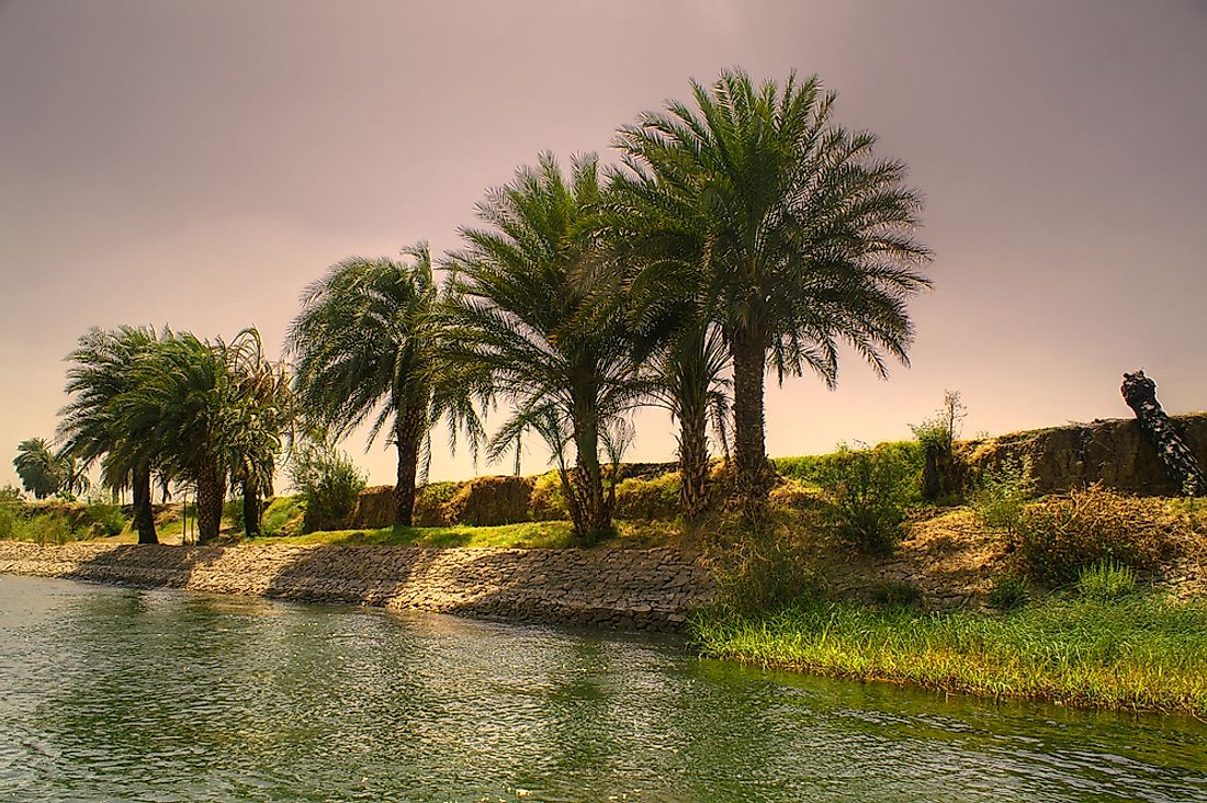
The Nile River is the most important feature of the geography of Egypt. It is the lifeline of the country and allowed the Egyptian civilization to flourish despite the location of the country in the highly arid north African desert area.
The Nile is a north-flowing river that flows through the Nile valley in Egypt and ends up in a large delta on the Mediterranean coast of Egypt. The Nile valley region between Aswan and Cairo is cultivable but the width of the cultivable land varies throughout the length of the river and ranges between 8 and 16 km. The construction of the Aswan High Dam in 1970 has made provisions for perennial irrigation, allowing crops to be grown throughout the year. The construction of the dam led to the creation of Lake Nasser, one of the biggest man-made lakes in the world behind the dam. The lake is a major tourist attraction and an important fishing area and has several settlements around its banks.
The Nile delta, one of the major deltas of the world, occupies an area of 25,000 square km and stretches for a distance of about 160 km from Cairo to the shores of the Mediterranean Sea. The coastline of the delta extends from Port Said to Alexandria for 240 km. Two major branches of the Nile, the Rosetta and the Damietta Branch flow through the delta. The terrain of the delta is primarily flat but crisscrossed by several drainage channels and canals. Several brackish lagoons form on the coast of the delta.
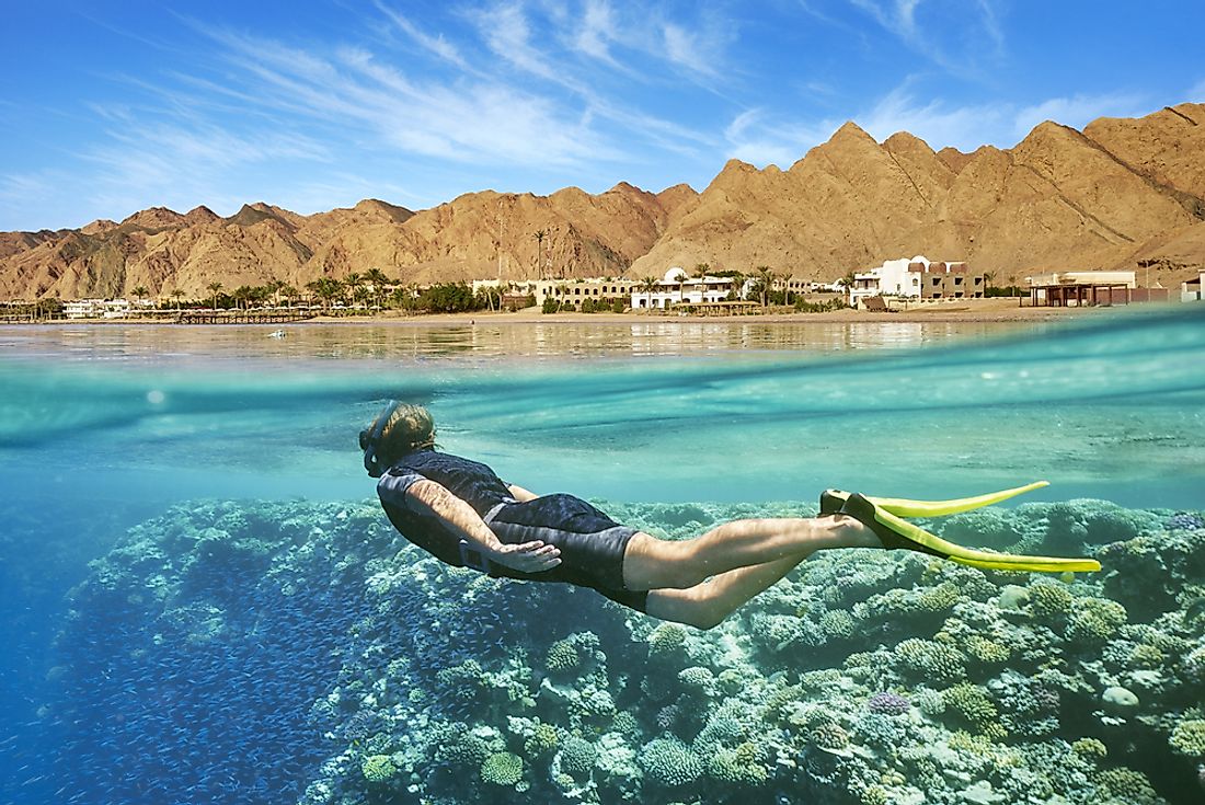
1. The Sinai Peninsula
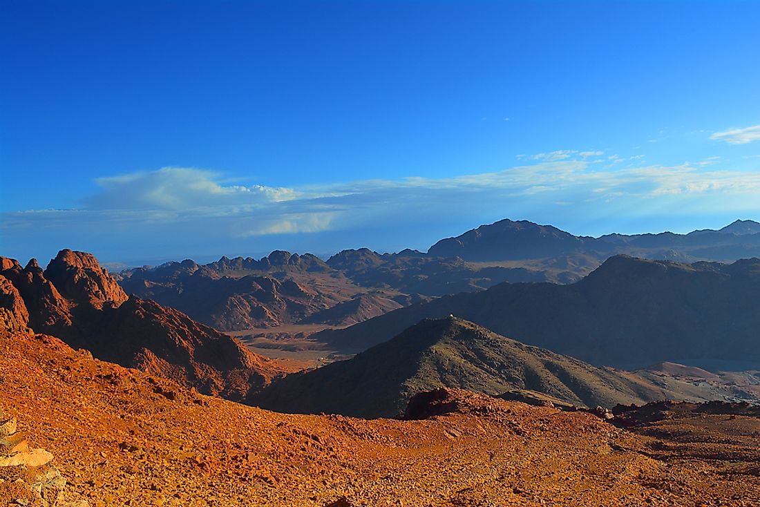
The Sinai Peninsula, an important feature of the geography of Egypt, is a wedge-shaped section of land between the Mediterranean Sea in the north and the Gulf of Suez in the south. The peninsula has a highly varied landscape from north to south. The southern part of the Sinai Peninsula features rugged mountains including the tallest mountain of Egypt, the 8,668 ft tall Mount Catherine. The central area of the peninsula has two plateaus, namely, the Al-ʿAjmah and the Al-Tīh. Towards the northern slopes of these plateaus are dome-shaped hills that give way to a series of parallel sand dunes, some of which are over 300 ft in elevation. The Mediterranean coast of the Sinai Peninsula features the Lake Bardawīl, a large salt lagoon.


