7 Must-See Historic Forts In Alaska
Alaska built its forts for three very different enemies: gold-rush chaos, the Imperial Japanese Navy, and sheer distance. The result is a scattered collection of outposts that today sit on clifftops, islands, and riverbanks at the far edges of the state, most of them reachable only by trail, boat, or a very committed road trip. Some guarded stampeders' gold, one carried the telegraph line that finally wired Alaska to the rest of the country, and several spent World War II scanning the horizon for an invasion that, in the Aleutians, actually came. Fort Egbert, Fort McGilvray, Fort Schwatka, and the rest preserve those stories in bunkers, barracks, and parade grounds you can still walk. Here are seven must-see historic forts in Alaska.
Fort Abercrombie State Historical Park

Fort Abercrombie holds one of the better military records in this article: it never fired a shot in anger and never took one either. Established in 1941 on the cliffs of Miller Point to defend Kodiak's naval installation during World War II, the post housed roughly 200 soldiers, mounted 8-inch guns above the surf, and was named for Lieutenant Colonel William R. Abercrombie, an Army explorer of the Copper River country. The war ended, the Army left, and in 1969 the site became a state historical park where the scenery now outguns the artillery: steep cliffsides, Sitka spruce forest, wildflower meadows, and a lake or two. The Kodiak Military History Museum operates inside the fort's old ready-ammunition bunker, and a campground lets visitors sleep where the gun crews once waited for an enemy that never showed.
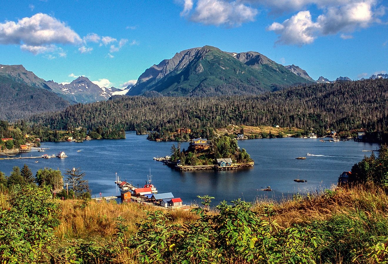
Fort McGilvray

Fort McGilvray is the fort you have to earn. It sits 650 feet above Resurrection Bay at Caines Head, and getting there means either a water taxi from Seward or a roughly five-mile coastal trail with a beach section that only passes at low tide, so hikers plan around a tide table like it is 1943. The Army began fortifying the headland in 1941 because ice-free Resurrection Bay mattered: Seward was the ocean terminus of the Alaska Railroad, the supply line feeding the whole territory. The post took the name Fort McGilvray in 1943, honoring a fallen Army officer, the same year the Aleutian threat collapsed after Allied forces retook Attu and Kiska. The concrete command post and gun emplacements survived the peace remarkably well, which is why this is now one of the best-preserved World War II sites in Alaska, with alpine meadows and views across the Gulf of Alaska thrown in as a bonus.
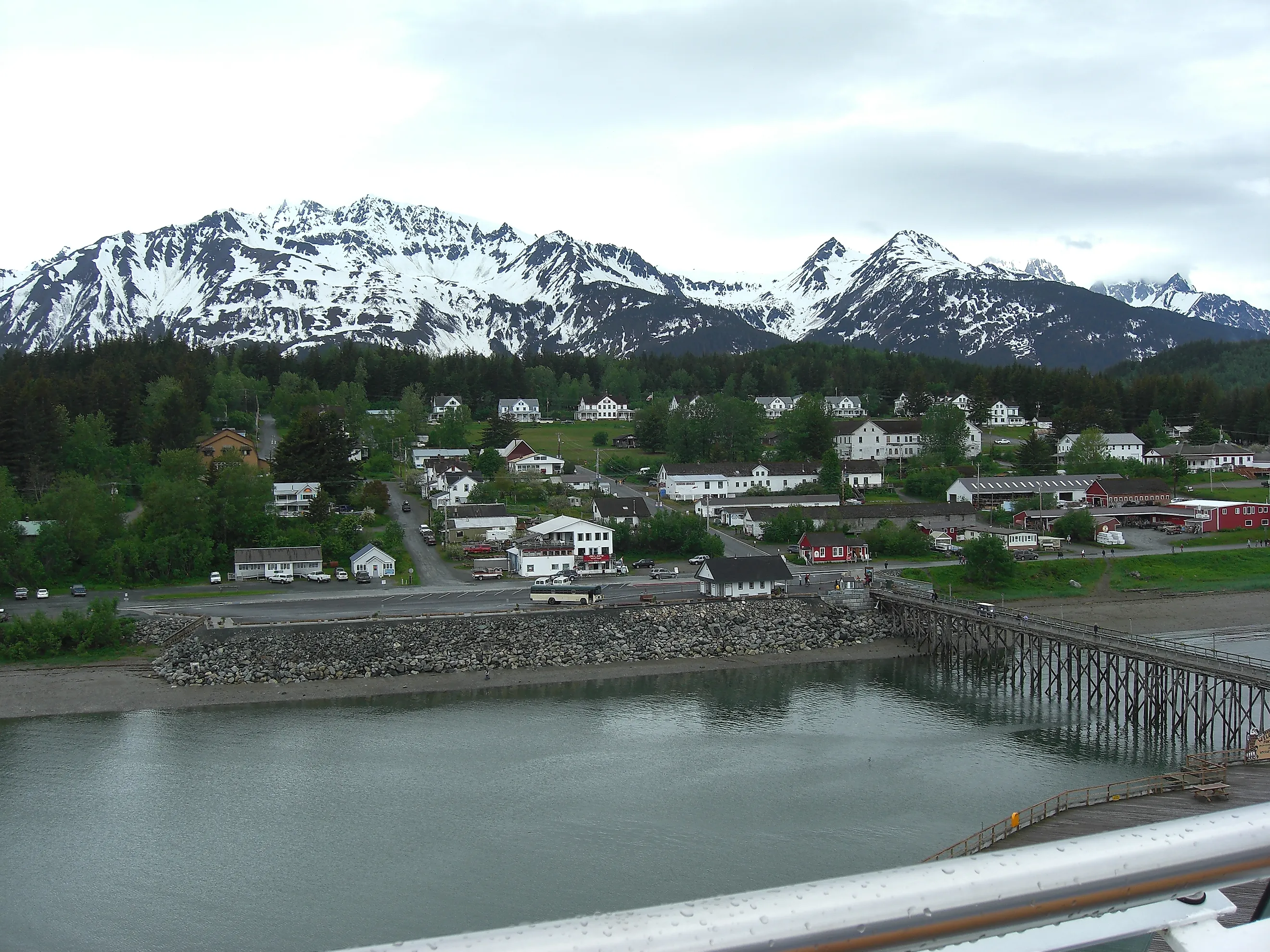
Fort William H. Seward National Historic Landmark

Fort William H. Seward in Haines was built to police a gold rush. After the Klondike stampede sent roughly 100,000 prospectors, con artists, and card sharps streaming north, the Army established this post in 1902, the last of nearly a dozen gold-rush-era military posts in Alaska, to keep order along the routes into the Yukon. The fort was renamed Chilkoot Barracks in 1922 and then earned a remarkable distinction: between 1925 and 1940, it was the only active Army post in all of Alaska. The best chapter came after the fighting ended, when a group of World War II veterans bought the entire decommissioned fort in 1947 and turned it into a community. Today the white clapboard officers' row still lines the parade ground above Chilkoot Inlet, the buildings house inns, galleries, and businesses, and Alaska Indian Arts keeps a working totem-carving studio in the former hospital. This is the rare fort where the architecture never went to ruin because people simply never stopped living in it.
Fort Schwatka

Fort Schwatka holds the altitude record: built on Ulakta Head atop Mount Ballyhoo in the Aleutian Islands, roughly 900 feet above the sea, it ranks as the highest coastal battery ever constructed in the United States. The Army raised it in the early 1940s to shield the naval base at Dutch Harbor, and the threat was not hypothetical. Japanese aircraft bombed Dutch Harbor on June 3 and 4, 1942, and the occupation of Attu and Kiska that followed marked the first invasion of US soil since the War of 1812. The campaign also brought a darker chapter, the wartime internment of Unangax̂ (Aleut) civilians removed from their island homes. Named for Yukon explorer Frederick Schwatka and now part of the Aleutian World War II National Historic Area, the fort is open for self-guided wandering among gun mounts, observation posts, Quonset hut foundations, and the scattered remains of a post that once served roughly 250 soldiers. The wind does the narration.
Fort Egbert

Fort Egbert went up in 1899 because the gold-boom town of Eagle, on the upper Yukon River, was generating more lawlessness than law. Named for Colonel Harry Clay Egbert, who fell in the Philippines that same year, the post gave the Army a foothold in the Interior and quickly became something more important: a communications hub. A young lieutenant named Billy Mitchell, later the famous prophet of air power, oversaw construction of the WAMCATS telegraph line from here, the system that finally connected Alaska to the rest of the country in 1903. The wire earned its keep in December 1905, when Roald Amundsen mushed hundreds of miles to Eagle to telegraph the world that he had conquered the Northwest Passage. Five restored buildings still stand today, including an enormous mule barn, along with exhibits, an interpretive trail, and a campground for travelers who make it this deep into the Interior.
Fort Raymond

Fort Raymond never stopped working; it just kept changing jobs. Established at Seward in 1942 after the United States entered World War II, the post guarded the railroad town at the head of Resurrection Bay, then pivoted after the war into a tuberculosis sanatorium that operated into the late 1950s. The magnitude 9.2 Good Friday earthquake of 1964, the most powerful ever recorded in North America, devastated Seward and finished off most of what remained. The survivors are scattered through town: Quonset huts pressed into civilian service, the old NCO building raised from local lumber, and a plaque marking the original grounds. The neatest twist is that the site still belongs to the military, as Seward Resort, a recreation facility where service members now come to fish and unwind on the footprint of a wartime fort.
Fort Bulkley

Fort Bulkley drew the most exposed assignment in the Seward defenses: Rugged Island, at the very mouth of Resurrection Bay, where a bright orange-and-white day marker now flags the old World War II lookout. This was the first line of defense against enemy ships, and the roughly 80 men posted here drove jeeps up a switchback road shaped like a sideways W, a zigzag still visible cutting through the terrain on the back side of the ridge. The Army abandoned the post in 1944 as the Pacific war moved far beyond Alaska, and the island has been quiet ever since. There is no trail access and no dock crowd; visitors arrive by boat, poke through the surviving structures, and share the place with seabirds, sea otters, and whatever else the bay sends past. As ruins go, the commute is spectacular.
Some Of Alaska's Most Historic Forts
Line these seven up and you get Alaska's whole military biography in concrete and clapboard: the gold-rush police stations at Eagle and Haines, the telegraph line that ended the territory's isolation, and the World War II watchtowers that turned cliffs and islands into gun platforms after Japan struck the Aleutians. Almost none of them ever fired at an enemy, which is exactly the point; their job was to stand ready at the edge of the map, and standing is what they still do best. Pack boots, check the tide tables for Caines Head, and let the forts tell the rest.