Why Does Texas Have 254 Counties?
Texas has 254 counties due to its size as the largest state in the lower 48 states, at nearly 268,600 square miles, and a practical need to keep local government buildings close enough for all residents to reach in an era before motorized vehicles. In fact, Texas has the most counties of any of the states, with nearly 100 more than the state with the second-largest number of counties: Georgia, which has 159 counties.
Spanish Texas
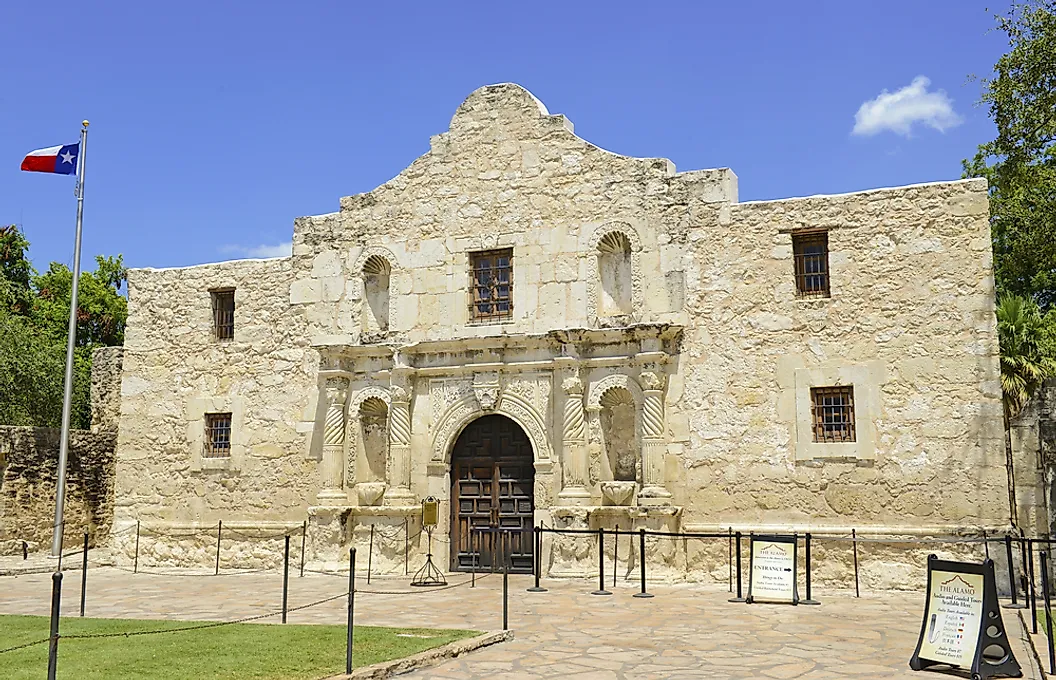
Texas was first explored by the Spanish in the 16th century, who traveled north from their territories in modern-day Mexico. Their initial presence was small, mainly through missions where missionaries attempted to spread the Catholic faith among the Native populations.
In 1718, the Spanish established their first permanent settlement in San Antonio and would incorporate modern-day eastern Texas into the Province of Tejas. The western section of Texas was managed under the territory of New Mexico.
In 1821, Spain ceded these territories to the newfound nation of Mexico, which had won its independence from Spain in the Mexican War of Independence. Mexico invited white settlers, many of whom owned slaves, to the territory. However, tensions rose between the Mexican government and the settlers, in part driven by tariffs, slavery, and the centralization of the Mexican government. As a result, the Texans revolted, ultimately securing their independence during the Texas Revolution from 1835 to 1836.
The growth and organization of Texas

Texas applied for statehood with the US government, but this was put on hold for 9 years, as Texas wanted to enter as a slave state, which would have given slave states more representation in Congress than free states. Thus, from 1836 to 1845, Texas was an independent nation, the Republic of Texas, often called the Lone Star Republic.
Texas inherited 23 municipalities which had been organized under the Spanish model. These municipalities were organized around an ayuntamiento, a governing body that handled all administrative and judicial duties. The Texans converted these municipalities into counties. Over the next 7 years, 13 more counties were added.
The next biggest expansion took place in 1846, with 31 counties added, which coincided with the Mexican-American War. Lasting from 1846 to 1848, this war ended in a decisive US victory. In the treaty, Mexico was forced to cede all of Western Texas, along with the entirety of the US Southwest.
Texas would continue to add new counties, adding a total of 103 from 1848 to 1875. The following year, Texas drafted and passed a new constitution that put into law the same principles it had been following with all of its counties.
The guiding principle of Texan counties

The primary guiding principle at play in Texas was to enable access to the courthouse from all parts of the county. In particular, a rider should be able to reach the courthouse from any part of the county in a "day's ride."
This was especially important due to the often heavily undeveloped or nonexistent roads, and the often rugged desert landscape of Texas. Texas also needed a good deal of counties to accommodate all of its land. The second biggest state in the lower 48 is California, which at roughly 163,700 square miles is more than 100,000 square miles smaller than Texas. Texas is eclipsed only by Alaska at nearly 665,400 square miles, which has to rely on a different organizational system.
The Texas Constitution of 1876 laid out guidelines to ensure this practice was followed with all new counties. In territory outside any existing county, it required new counties to cover at least 900 square miles and to be laid out in a square form, unless pre-existing boundary lines or the state line made that impracticable. Counties carved out of existing counties had a lower floor of 700 square miles, and any between 700 and 900 needed a two-thirds vote of each house of the legislature.
The same article also governs county seats, which the day's ride principle placed as near the geographic center of the county as the terrain allowed.
Section 2 of Article IX of the Constitution notes, "The Legislature shall pass laws regulating the manner of removing county seats, but no county seat situated within five miles of the geographical centre of the county shall be removed, except by a vote of two-thirds of all the electors voting on the subject. A majority of such electors, however, voting at such election, may remove a county seat from a point more than five miles from the geographical centre of the county to a point within five miles of such centre, in either case the centre to be determined by a certificate from the commissioner of the general land office."
The county that was organized twice

The last county in Texas to be organized was in fact organized twice: Loving County. Located on the western border of Texas and New Mexico, it was initially organized in 1887 by detaching it from Tom Green County.
However, the men who pushed for this organization were part of the Loving Canal and Irrigation Company, and they aimed to start a business in the region. To do so, they misrepresented the number of people who lived in Loving County, stating that they represented 150 voters, when in reality there were only 3 people. Their supposed elections were also fraudulent. When Texan officials began investigating the fraud, the county board fled, and the county was disorganized in 1897 and joined with Reeves County.
That wasn't the end for Loving County, as in 1925 the Pecos Valley Petroleum Company discovered oil in a field. This renewed business interest brought in a large number of workers, and in 1931, the county was organized once again as Loving County.
However, over the decades, residents began to leave due to a lack of natural resources. Today, there are an estimated 52 people living in Loving County, making it the least populated county in the US
The square counties of Texas
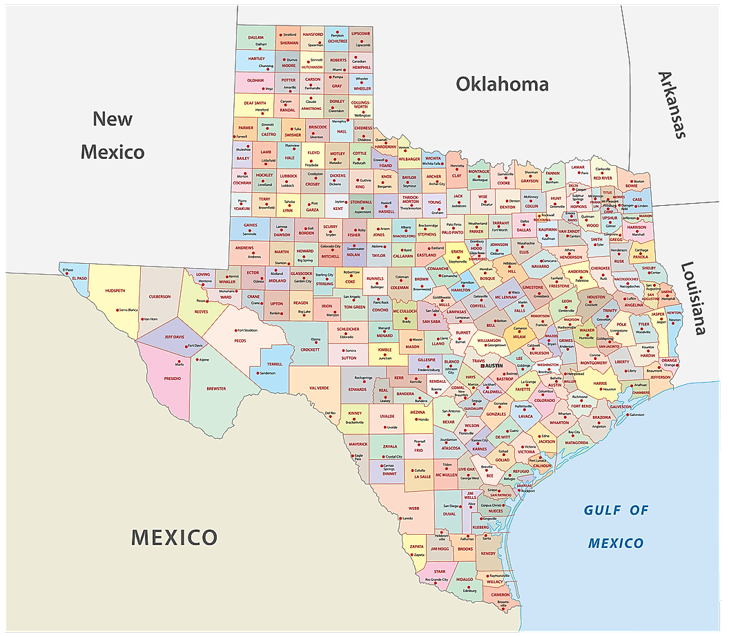
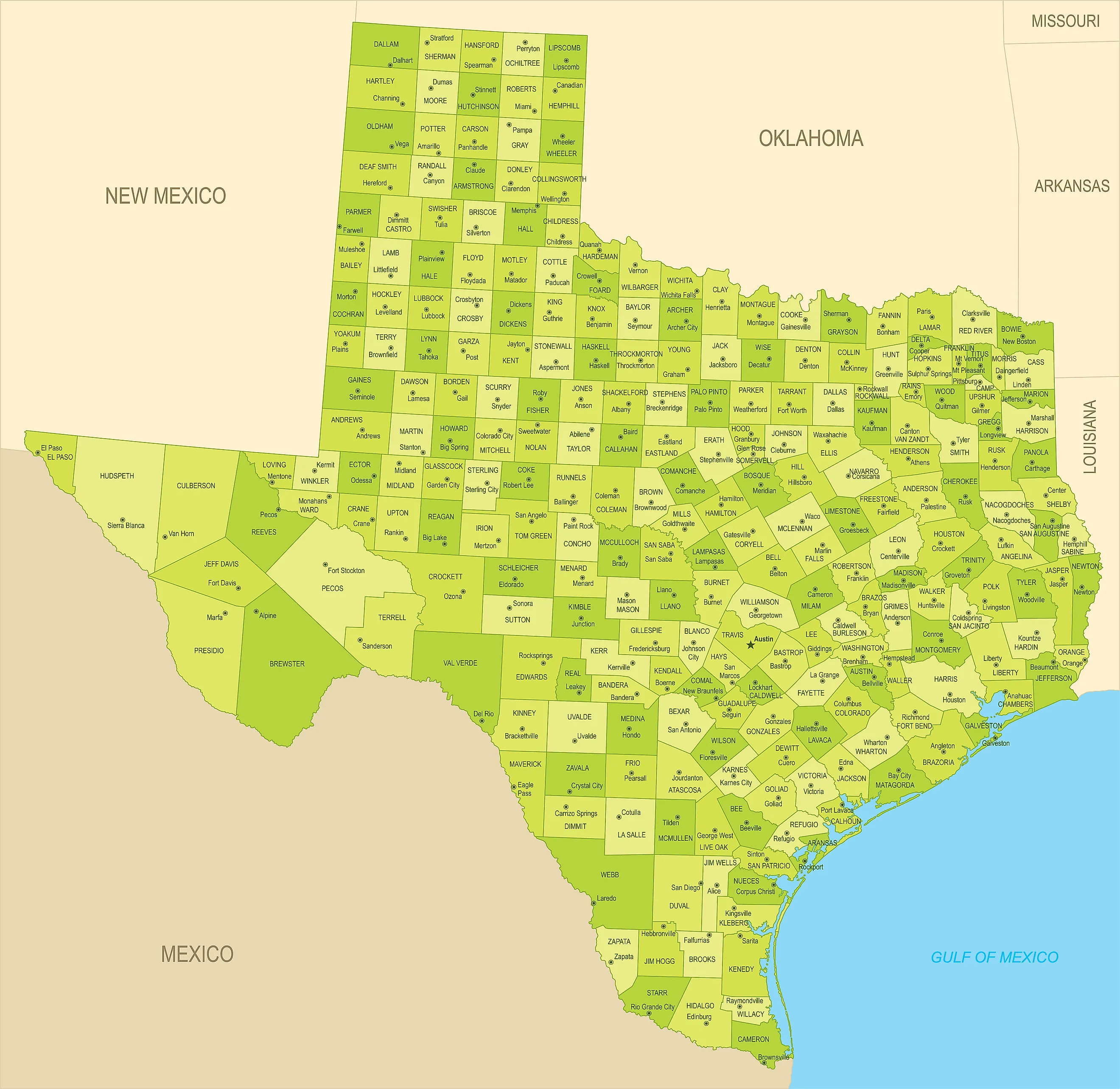
A map of Texas shows the grid of square counties running across the Panhandle and the plains below it. These coincide with the Texas Constitution of 1876, which called for a square form wherever it was practicable. Further west around Big Bend, the terrain forced larger and more irregular shapes. Although today it is much easier to travel across Texas via automobiles and airplanes, the same principle of keeping local government close to all parts of the county still applies, even if Texans don't need horses to get from place to place anymore.