The Most Remote Counties In The American West
Some counties in the American West cover more ground than entire New England states while housing fewer people than a single suburban high school. Federal wilderness, national forest, and Bureau of Land Management holdings swallow up the vast majority of the acreage in each of these counties, leaving private, developable land scarce and settlement sparse. This list ranks ten counties across the continental West, based on a combination of 2020 U.S. Census Bureau population density figures and how physically cut off from services each county remains today. They are ordered from the least densely populated to the most, though every entry on this list would qualify as remote by nearly any American standard.
Esmeralda County, Nevada

Esmeralda County recorded just 729 residents in the 2020 census, spread across 3,582 square miles of land, for a population density of roughly 0.2 people per square mile, among the lowest of any county in the contiguous United States. The county has no incorporated communities at all. Local governance and services run out of the county seat, Goldfield, a former gold-mining boomtown whose weathered historic buildings include the towering Goldfield Hotel. Another population center is the unincorporated community of Dyer, near the base of Boundary Peak, Nevada's highest natural point at 13,140 feet. Large stretches of the county are federally managed desert, while the Inyo National Forest reaches into its western edge around Boundary Peak. Visitors who make the drive along U.S. Route 95 pass through vast, empty basin-and-range country before reaching Goldfield's handful of surviving storefronts, a landscape that has changed little in the century since the mines went quiet.
Garfield County, Montana

Garfield County is one of the least populated counties in the contiguous United States. It had just 1,173 residents as of the 2020 census across roughly 4,677 square miles of land, with a density of about 0.25 people per square miles. The county seat, Jordan, is often described as one of the most isolated towns in the Lower 48, sitting more than 80 miles from the nearest traffic light in Miles City. Cattle ranching dominates the local economy, and the sweeping grassland and badlands terrain gives way in the north to the Charles M. Russell National Wildlife Refuge, which wraps around Fort Peck Lake on the Missouri River and reaches into the county along its northern edge. Winters here are long, and rural roads can become difficult after heavy snow. Jordan is home to the Garfield County Health Center, while patients needing higher-level care may require transfer to larger hospitals outside the county.
Catron County, New Mexico

Catron County is New Mexico's largest county by area at about 6,924 square miles, yet its 2020 population of 3,579 people works out to a density of about 0.52 people per square mile. Less than a fifth of the county's land is privately owned; most of the remainder is public land, much of it managed by federal agencies, including the Gila National Forest and the New Mexico portion of the Apache National Forest. Catron County is also home to the Gila Cliff Dwellings National Monument, where Mogollon-era dwellings are tucked into natural caves along a canyon wall, and to The Lightning Field, a land-art installation of 400 stainless steel poles arranged across the high desert that draws visitors despite its deliberately hard-to-reach location. The county's enormous size, sparse population, and limited road network leave many residents facing long drives for services available in larger communities.
Hinsdale County, Colorado

Hinsdale County's 2020 population of 788 people across 1,117 square miles of land works out to about 0.71 people per square mile, the lowest density of any county in Colorado. The county seat and only incorporated town, Lake City, sits near Lake San Cristobal, Colorado's second-largest natural lake, and is frequently described as one of the most remote communities in the Lower 48 given its surrounding ring of mountain passes. Roughly 96 percent of Hinsdale County is public land, including extensive national forest holdings and four designated wilderness areas, and the Alpine Loop threads through the county over rugged, high-elevation four-wheel-drive routes that connect historic mining sites such as Engineer Pass. Colorado State Highway 149 provides the main paved access to Lake City, and winter storms can make travel difficult. Outside the summer tourist season built around fishing and hiking, along with a smaller winter draw for activities such as ice climbing, Hinsdale County's population thins out considerably, leaving its fourteeners and alpine lakes to a small year-round community.
Harney County, Oregon

Harney County covers about 10,134 square miles of land, making it the largest county in Oregon and one of the largest in the country, yet its 2020 population of just 7,495 people gives it a density under 0.75 people per square mile. Roughly 70 percent of the county is federally or state managed, including the Malheur National Wildlife Refuge, an important destination for migratory bird-watching south of the county seat, Burns. To the southeast lies the Alvord Desert, a dry lakebed so flat and remote it has been used for land-speed record attempts, and above it rises Steens Mountain, a 30-mile-long fault-block mountain that climbs to nearly 9,700 feet. Burns and neighboring Hines are the county's only two incorporated municipalities, and travelers heading south toward Frenchglen or the Steens Mountain Loop Road can drive long stretches through sparsely settled country. Specialized medical care can also require travel to larger regional centers outside the county.
Custer County, Idaho

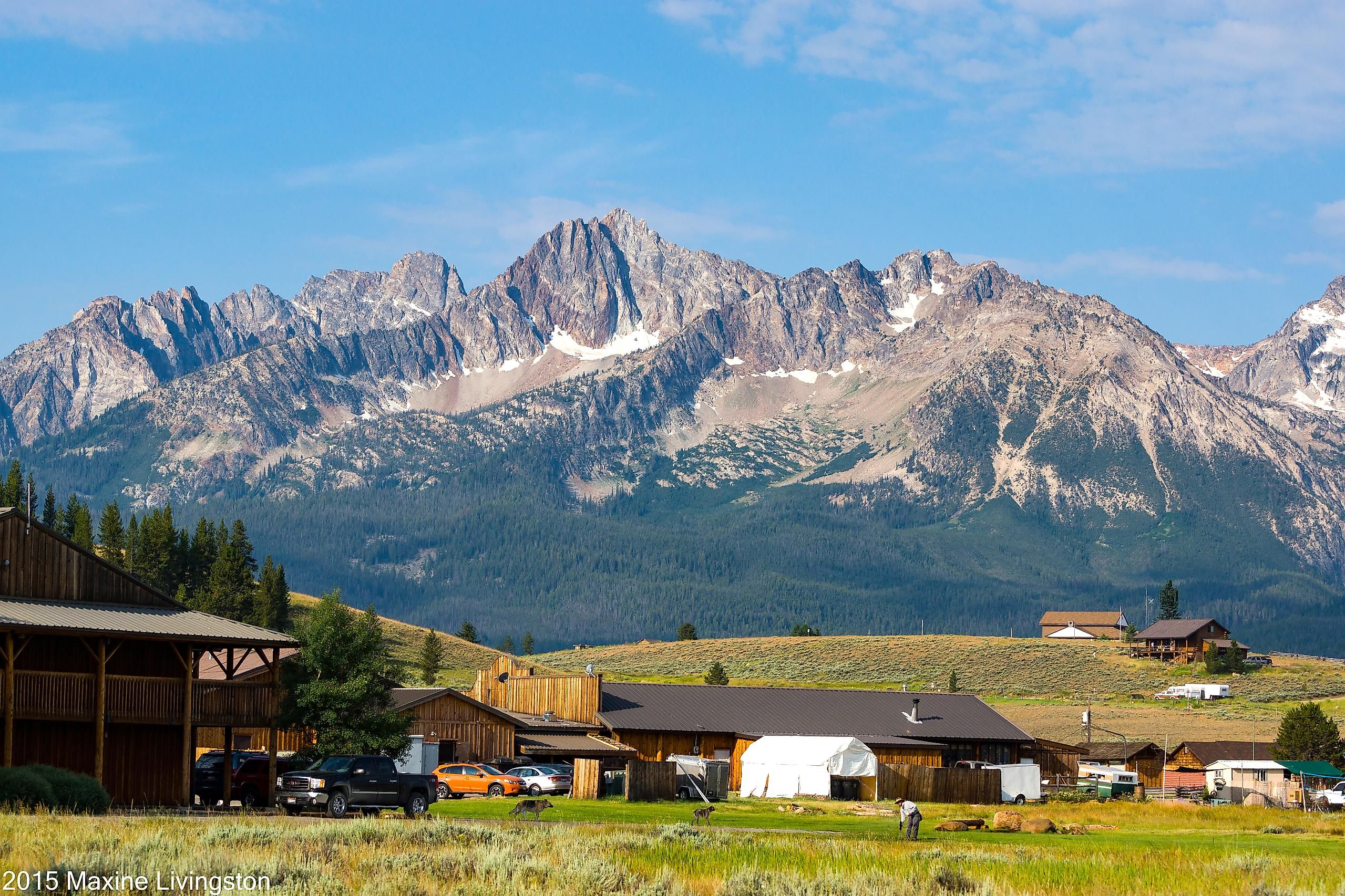
Custer County recorded 4,275 residents in the 2020 census across roughly 4,922 square miles of land, a density of about 0.87 people per square mile. The county seat, Challis, and the tourist town of Stanley anchor a landscape dominated by the jagged peaks of the Sawtooth National Recreation Area and the headwaters of the Salmon River, nicknamed the "River of No Return" for the difficulty early boatmen had navigating back upstream against its current. Stanley sits at the edge of the Sawtooth Wilderness and remains a tiny settlement despite drawing whitewater rafters and hikers from across the country each summer. Winters in the Stanley Basin are severe, while residents across the county can face long drives between communities and specialized services. The region is also seismically active. The 1983 Borah Peak earthquake, the largest earthquake recorded in Idaho, struck the Challis-Mackay region and remains one of the state's most significant seismic events.
Daggett County, Utah

Daggett County is Utah's least populous county, with just 935 residents recorded in the 2020 census spread across 697 square miles of land, for a density of about 1.34 people per square mile. Tucked into the state's northeastern corner along the borders of Wyoming and Colorado, the county is defined by the Uinta Mountains to the south and the Green River. Construction of Flaming Gorge Dam began in 1958, the reservoir began filling in 1962, and the project was completed in 1964, creating Flaming Gorge Reservoir and its surrounding national recreation area. The county seat, Manila, and the small community of Dutch John, built originally to house dam construction workers, together hold much of the county's year-round population. Mountainous terrain historically complicated travel between the area and the rest of Uintah County before Daggett County was created in 1917. Modern access has improved, but higher-level medical care still requires travel outside the county.
Niobrara County, Wyoming

Niobrara County is Wyoming's least populous county, with 2,467 residents in the 2020 census spread across 2,626 square miles of land, a density of about 0.94 people per square mile. The county seat, Lusk, sits in the high plains of eastern Wyoming near the Nebraska border. The Stagecoach Museum in downtown Lusk preserves the area's ranching and railroad history, while the Lance Creek area is an important Late Cretaceous fossil locality and the type locality of the Lance Formation, which has yielded significant Triceratops material. Ranching remains the backbone of the local economy, and cattle can easily outnumber people across the county's rolling grasslands. Niobrara County's isolation from major population centers, combined with minimal development, has also made its open country attractive for stargazing. Lusk has the critical-access Niobrara Community Hospital, though more specialized medical care can require travel to larger regional centers.
Alpine County, California

Alpine County is California's least populous county, with 1,204 residents recorded in the 2020 census across about 738 square miles of land, a density of about 1.63 people per square mile. It has no incorporated cities; the county seat, Markleeville, functions as the closest thing to a town center. Alpine County sits high in the Sierra Nevada along the Nevada border. About 96 percent of its land is federally managed, while roughly 91 percent lies within three national forests: the Eldorado National Forest, the Stanislaus National Forest, and the Humboldt-Toiyabe National Forest. The region draws skiers to Bear Valley in winter and hikers to alpine destinations such as Grover Hot Springs State Park in summer. State Route 4 over Ebbetts Pass, one of the county's main mountain crossings, closes seasonally during winter, cutting off that route until snow conditions allow it to reopen. Alpine County has local clinic services, but more advanced medical care requires travel outside the county.
Garfield County, Washington

Garfield County is Washington's least populous and least densely populated county, with 2,286 residents recorded in the 2020 census across about 711 square miles of land, working out to roughly 3.2 people per square mile. The county seat, Pomeroy, is also its only incorporated city, and the surrounding countryside is given over largely to wheat and legume farming in the rolling hills of the Palouse. To the north, the county is bordered by the Snake River, with access to Lower Granite Lake for fishing and boating, while Umatilla National Forest lands extend into the Blue Mountains to the south. Agriculture remains central to the local economy, and the county's sparse settlement leaves long stretches of open farmland between communities. Garfield County Memorial Hospital in Pomeroy is a critical-access hospital with emergency services, although specialized care can require travel to larger medical centers. The county's isolation from any interstate highway also keeps through-traffic to a minimum.
Perfect For Loners
Distance from a city is key to what these counties offer. What draws people to Jordan, Lake City, or Stanley are the unpaved lands, dark skies, and a pace of life set by weather and season rather than commute times. For travelers willing to plan around long drives, limited services, and unpredictable mountain roads, these ten counties offer some of the emptiest and most striking country left in the American West.