The Counties Most Threatened By Wildfire
The most dangerous wildfire ground in America is the seam where subdivisions run up against dry brush and timber, and where a single wind-driven ember can reach thousands of roofs. A 2026 nationwide analysis of USDA Forest Service Wildfire Risk to Communities data ranks counties by that exposure, counting the buildings sitting directly in a wildfire's potential path alongside each county's national risk percentile. California dominates the resulting list, but Florida, Idaho, Washington, and Colorado all break into the top 15. A few counties earn their place through raw numbers of exposed structures; others land there because an enormous share of everything they have built stands in harm's way. Read together, the 15 map out how far America's wildfire problem now reaches beyond the places most people picture.
Riverside County, California

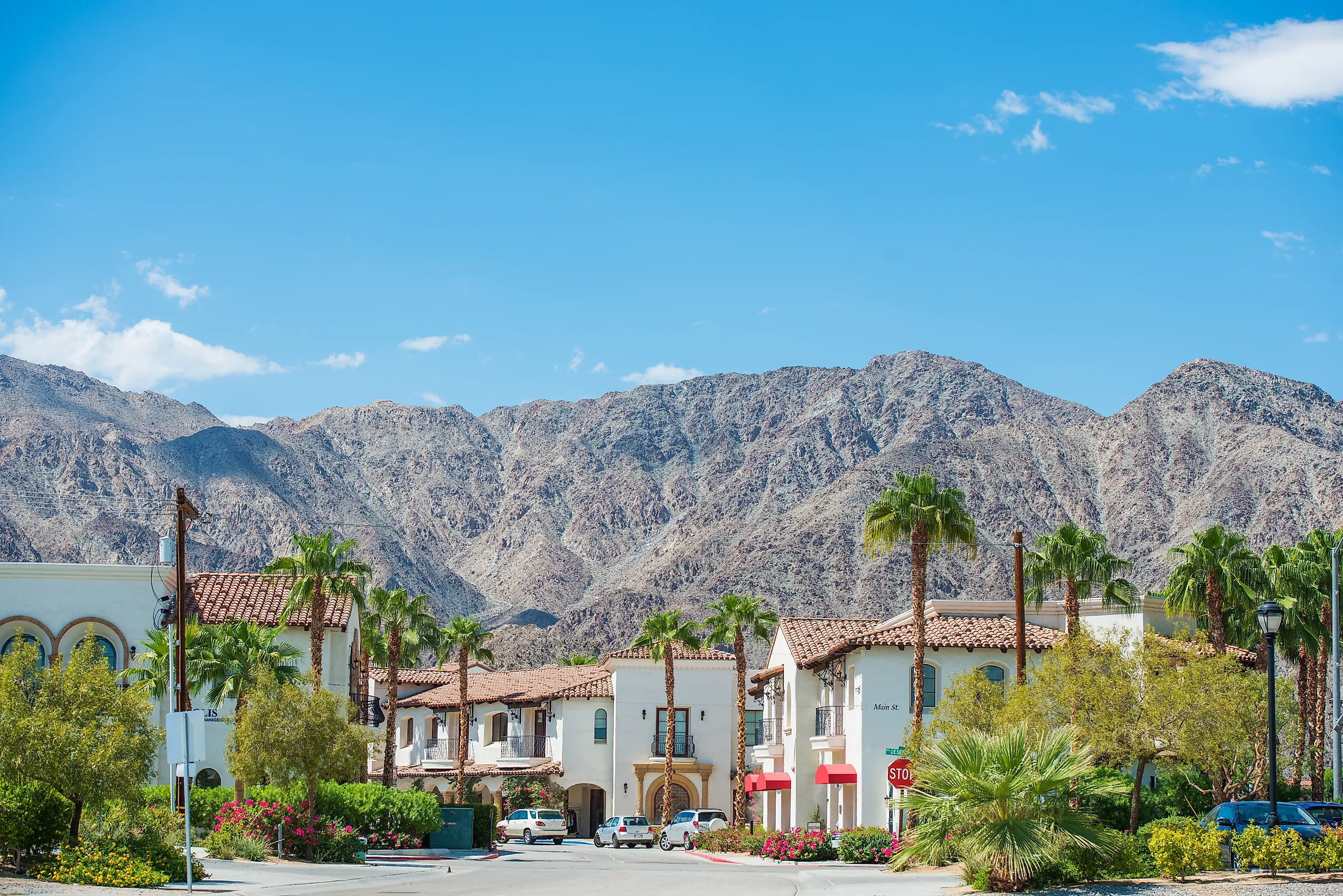
No county in the country puts more buildings directly in a wildfire's path than Riverside, where an estimated 144,599 structures sit in exposed zones and the overall risk lands in the 99th percentile nationally. The figure tracks the county's geography, which stretches from dense Inland Empire neighborhoods up into chaparral foothills, mountain towns, and desert-edge settlements. County planners fold wildland fire into the current Local Hazard Mitigation Plan as one of the hazards assessed for long-term risk reduction, and in the 2025 update they concentrate on pinpointing vulnerable areas before a disaster arrives rather than after.
That spread of terrain is why conditions vary so sharply within a single county line. Palm Springs and the Coachella Valley share the county with the San Jacinto Mountains, Temecula wine country, and the forested roads around Idyllwild, each carrying its own fuel type and its own fire behavior. The top national ranking reflects how much has been built into that flammable landscape, not a forecast that Riverside burns next.
Los Angeles County, California

Roughly 138,530 buildings in Los Angeles County stand in direct exposure zones, the second-highest count in the nation, yet they make up only 5% of a building stock this large. The county ranks in the 99th percentile for risk all the same. Under the 2025 All-Hazards Mitigation Plan, about 243.7 square miles of the planning area fall inside wildfire exposure, and county officials flag development in the wildland-urban interface as a driver of that vulnerability. Those numbers sit behind a familiar Southern California contrast, where towers and freeways give way within an hour to trails in the Santa Monica or San Gabriel mountains. Griffith Park, the Malibu canyons, the gateways into Angeles National Forest, and the coastal ridges are all open space set against one of the country's biggest metro areas, which is exactly why residents lean on official alerts and road updates when the wind picks up on a hot day.
El Dorado County, California

Exposure here is not a fringe problem. An estimated 64,951 buildings sit in a wildfire's potential path, and that equals 64.7% of every structure in El Dorado County, a share that pushes its national risk rating into the 99th percentile. When nearly two-thirds of a county's buildings are exposed, wildfire stops being a concern for one edge of the map and becomes a countywide condition.
The El Dorado County Board of Supervisors adopted a new Western El Dorado County Community Wildfire Protection Plan on February 3, 2026. The plan identifies risks at the neighborhood scale and ranks the mitigation work by priority, all of it aimed at protecting lives, property, infrastructure, natural resources, and local communities.
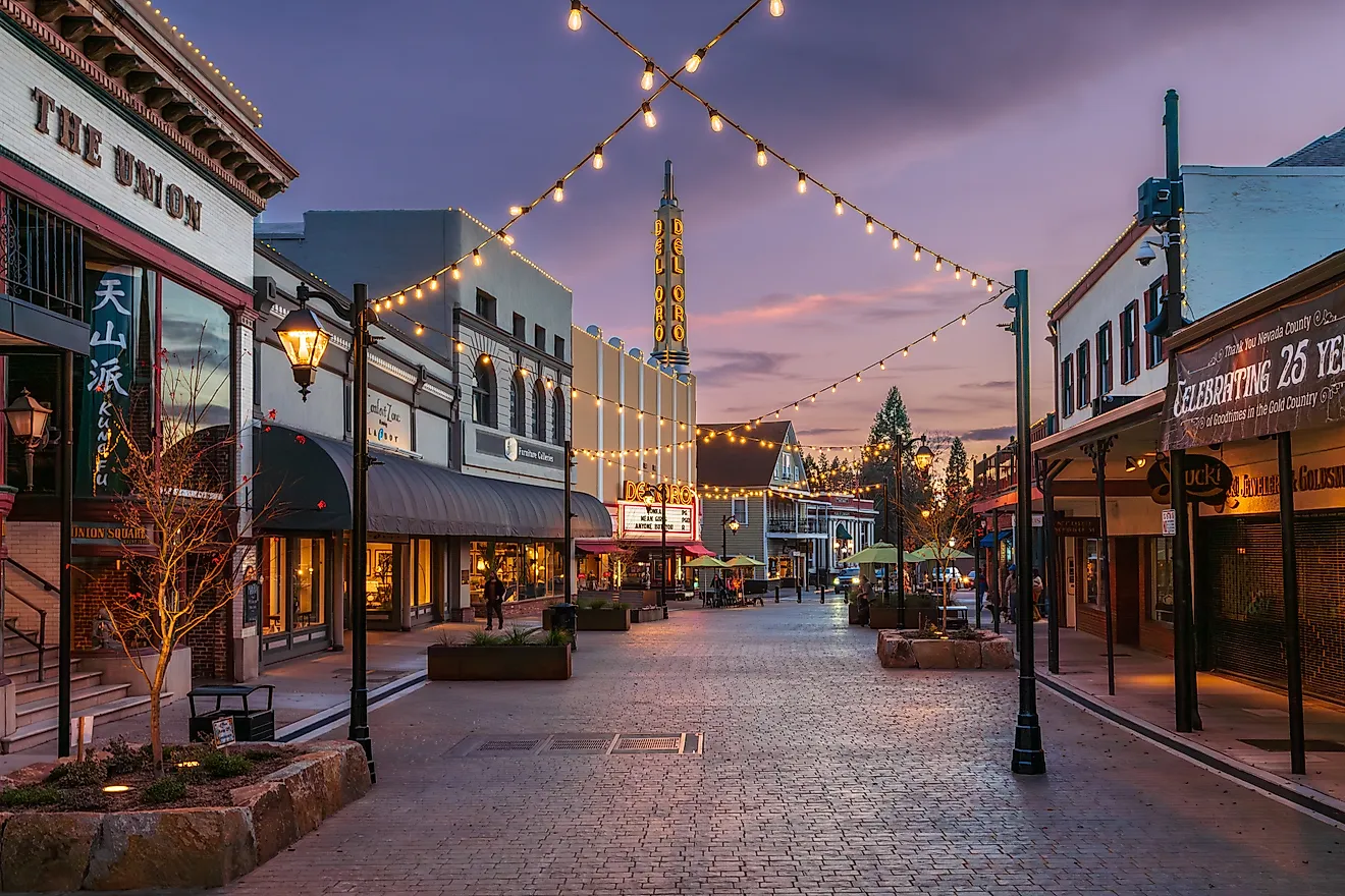
Several projects already carry names in the county program, among them fuel-reduction work around South El Dorado County, Coloma-Lotus, Georgetown-Marshall Road, and Spanish Flat. The terrain those crews are treating runs eastward from Placerville's Gold Rush core through foothill roads, reservoirs, and pine forest toward the Lake Tahoe Basin. Vegetation shifts quickly across that climb, and so do the conditions that decide how a fire moves.
Placer County, California

About 63,537 buildings in Placer County fall into exposed zones, 36.1% of the total, enough to place it in the 98th percentile for wildfire risk nationwide. The county's long west-to-east reach packs several environments into one jurisdiction, from the lower foothills around Auburn to dense Sierra forest and the North Lake Tahoe communities. That range complicates every part of wildfire planning.
Placer County began building its first countywide Community Wildfire Protection Plan in August 2025, when the Board of Supervisors approved a $334,543 contract and set a mid-2027 target for completion. Officials describe the plan as a way to identify the most urgent mitigation needs and to coordinate projects spanning fuel reduction, structural hardening, better communications, and improved access. For the communities around Foresthill, Donner, and Tahoe, that effort is a standing reminder that the same mountain setting drawing people outdoors demands serious preparation.
San Luis Obispo County, California

San Luis Obispo County pairs a high count with a large share: about 62,949 structures, or 41.3% of the county total, sit in exposed zones, and the county ranks in the 98th percentile nationally. Its 2025 Multi-Jurisdictional Hazard Mitigation Plan lists wildfire and grassfire among the hazards that call for fire-resistant building components, defensible space, spark arrestors, and fuel modification. Those measures matter across a county where coastal communities, oak-covered hills, vineyards, ranchland, and drier inland valleys sit close together.
The distances involved are short. A morning at Morro Bay, a stop in San Luis Obispo, and an afternoon among Paso Robles vineyards all stay inside one county. Montana de Oro State Park adds rugged coastal trails, and the inland roads open onto a much drier side of the Central Coast. Each of those settings burns differently, which is what a countywide plan has to account for.
Brevard County, Florida

Brevard County is the clearest proof that severe wildfire exposure is not a Western problem alone. An estimated 62,368 buildings stand in exposed zones, 24.1% of the county's building stock, and Brevard lands in the 98th percentile nationally for wildfire risk. The county fire service keeps 22 brush-fire apparatus positioned for wildland-urban-interface operations, and every operational firefighter trains in wildland tactics. Conditions turn serious enough for local burn bans: in 2026, the county imposed restrictions once the Keetch-Byram Drought Index passed 500. All of that readiness sits beside Kennedy Space Center, Merritt Island National Wildlife Refuge, the Atlantic beaches, and the Indian River Lagoon. The setting reads as unmistakably subtropical, which is what makes Brevard's place among the nation's most exposed counties so instructive.
Ada County, Idaho

Boise sits at the urban core of Ada County, but wildfire country starts within sight of downtown. An estimated 53,911 buildings fall in exposed zones, 26.9% of the county total, and Ada ranks in the 99th percentile for wildfire risk. The county's Multi-Hazard Mitigation Plan lists drought, dry seasons, and dry lightning among the conditions that raise fire likelihood, and it flags recreation in the wildland-urban interface as a source of ignitions.
Those risks are plain from the Boise foothills, where trail systems climb straight out of the neighborhoods and open slopes run toward higher country.
County records show wildfire-mitigation projects going back to the earlier hazard plan, so the response reaches beyond emergency suppression. Much of Boise's appeal comes from this immediate access to open land, with the Greenbelt tracing the river through the city and foothill trailheads a few minutes from home. That same closeness keeps wildfire awareness part of daily life rather than a concern reserved for the backcountry.
Shasta County, California

More than half of everything built in Shasta County sits in a wildfire's potential path. The exposed count runs to about 52,579 structures, 53.3% of all buildings, and the county ranks in the 99th percentile for risk. Its hazard plan sets out a broad program of fuel breaks along highways and public roads, prescribed burning, fire-weather monitoring, vegetation-management requirements, and annual hazard-abatement notices. State agencies have also flagged three high-priority fuel-reduction projects in the county, along Highway 44, in West Redding, and at China Gulch. These are heavy measures for a place organized around outdoor access. Redding is a natural base for trips to Shasta Lake, Whiskeytown National Recreation Area, and the volcanic country beyond. Here, county crews build wildfire mitigation into the same roads, forests, and towns that visitors come to Northern California to enjoy.
Yakima County, Washington

The dry side of Washington produces a wildfire landscape nothing like the wet forests west of the Cascades. In Yakima County, about 49,566 buildings sit in exposed zones, 40.8% of the building stock, placing the county in the 99th percentile nationally. Its Community Wildfire Protection Plan moves past broad warnings to name specific priorities: fuel breaks, defensible space, neighborhood fuel treatment, safety zones, evacuation routes, and roadside clearing.
One recommendation calls for keeping or opening road corridors 30 feet on either side where access demands it. In a detail like that, wildfire preparation comes down to the width of a single route rather than acres of vegetation.
Yakima Valley vineyards, orchards, shrub-steppe, and the rising eastern slopes of the Cascades give the county real variety. They also set communities beside several distinct fuel types at once, which is why the exposure figure climbs so high.
Jefferson County, Colorado

Through its own wildfire program, Jefferson County points to Forest Service analysis ranking it second in Colorado for wildfire risk and above 98% of U.S. counties. Another 44,230 exposed structures, 21.1% of the county total, come from the national estimate. County officials name steep terrain, dense fuels, hot and dry weather, wind, and building right up against vegetation as the main contributors. That mix is plain around Golden, Morrison, and the foothills west of Denver, where neighborhoods give way fast to pine-covered slopes and open space.
County officials stress defensible space and structure hardening, since both cut the chance a home ignites and give firefighters safer ground to work. Red Rocks, Lookout Mountain, and an extensive trail network put an easy foothill escape within reach of Denver, and the wildfire numbers are why mitigation runs so deep into local life.
Monterey County, California

Big Sur may own the postcards, but Monterey County extends across a much wider mix of coastal mountains, oak woodland, farm valleys, and inland towns. That range gives its estimated 43,704 exposed buildings some context. About 29.5% of the county's building stock sits in direct exposure, and the county ranks in the 99th percentile for risk. Its FEMA-approved 2022 Multi-Jurisdictional Hazard Mitigation Plan spans unincorporated areas, all 12 incorporated municipalities, and five special districts, setting wildfire and other hazards inside one coordinated framework. The landscapes vary just as widely, from the Pacific cliffs along Highway 1 to the farm country of the Salinas Valley and the rocky interior of Pinnacles National Park. That mix is also why one county can contain so many different fire conditions at once.
Santa Clara County, California

In Santa Clara County, a modest percentage still translates into a staggering number of buildings. Only 8.2% of its building stock sits in exposed zones, yet that share works out to roughly 42,621 structures, and the county ranks in the 97th percentile for risk. Its 2023 Community Wildfire Protection Plan assesses wildfire at the county, community, and parcel scales and sets priority areas for mitigation.
Santa Clara County Fire concentrates on home ignition zones, defensible space, ignition-resistant construction, and hazardous-fuel reduction across parks and open spaces, focusing that work on the seams where developed Silicon Valley runs into hills and brush.
The contrast is one of the county's real surprises. Downtown San Jose and the major technology campuses sit within reach of Mount Hamilton, Almaden Quicksilver County Park, Lexington Reservoir, and the wooded roads near Los Gatos. Exposure here is concentrated rather than countywide, but tens of thousands of buildings keep the stakes high.
Collier County, Florida

A second Florida county cracks the top 15. About 40,715 buildings in Collier County sit in exposed zones, 26.7% of its building stock, enough for a 97th-percentile national rating. The county's emergency-planning system pairs a Local Mitigation Strategy with dedicated wildfire-mitigation plans, and its 2025 Comprehensive Emergency Management Plan won state approval on July 9, 2025. Earlier county rules already required wildfire prevention and mitigation plans for certain development in designated rural-fringe areas, covering structural design, firebreaks, buffers, water features, and prescribed burning.
All of that planning has to reckon with a landscape reaching far past the Naples beaches. Big Cypress country, pine flatwoods, wetlands, and inland settlements take up a huge share of eastern Collier County. The result is a subtropical wildfire story built where development meets vast expanses of natural vegetation.
Douglas County, Colorado

Douglas County names wildfire its number-one safety hazard, and the national figures bear that out. About 38,856 buildings sit in exposed zones, 31.4% of the county total, with overall risk in the 98th percentile nationally. County officials identify ponderosa pine, Gambel oak, and prairie grass as the common fuels and warn that wooded, private home sites can string continuous vegetation right up to the walls of a house.
New construction inside the county's Wildfire Hazard Overlay District has to meet adopted wildfire-mitigation standards, which writes risk reduction directly into how the county develops. Douglas County is also revising its broader Hazard Mitigation Plan in 2026.
Castle Rock, Roxborough State Park, and the rolling Front Range make the county an easy escape south of Denver. The open prairie-to-foothill transition is a fine drive, and it also explains why local planning has to handle both grass and woody fuels instead of a single forest type.
Santa Barbara County, California

Santa Barbara County closes out the top 15 with an estimated 37,378 buildings in exposed zones, 25.5% of its total building stock, and a 97th-percentile national rating. The county's emergency-planning records include its 2023 Hazard Mitigation Plan alongside Wildfire Emergency Response Team reports for the 2024 Lake Fire and the 2025 Gifford Fire, a sign that post-fire assessment stays part of active planning here.
The terrain shifts fast over a short distance. The Santa Barbara waterfront climbs abruptly toward the Santa Ynez Mountains, and the roads beyond the coastal ridge open onto vineyards, oak-dotted valleys, ranchland, and Los Padres National Forest. That quick change is part of what makes the county rewarding to explore, and it also means conditions can differ sharply between the marine-cooled coast and the interior, which is why current county alerts carry more weight than a glance at the beach weather.
Reading the ranking
Two very different measures share this list. Riverside and Los Angeles reach the top on raw exposure, the sheer count of buildings standing in a fire's path, while El Dorado and Shasta land there because more than half of everything they have built is exposed. What unites them is the wildland-urban interface, the widening seam where houses press against fuel, and every county on the list has met it with named plans, funded contracts, and mapped priorities rather than hope. The 15 also stretch the map well past the usual picture of Western fire, pulling in Florida's subtropical flatwoods and Idaho's high desert. The clear lesson of the ranking is that wildfire exposure now lines up with where Americans have chosen to build.