Towns That Sit at the Bottom of a Canyon
Imagine waking up to rock walls that rise thousands of feet outside your window. That is everyday life in Telluride and a handful of towns like it across the United States and Canada. Each one sits on the floor of a canyon shaped by a river. Bisbee climbs the sides of a gorge in the Arizona desert. Supai sits so deep that mail still arrives by mule. These eight communities show why people choose to live between the walls.
Telluride, Colorado

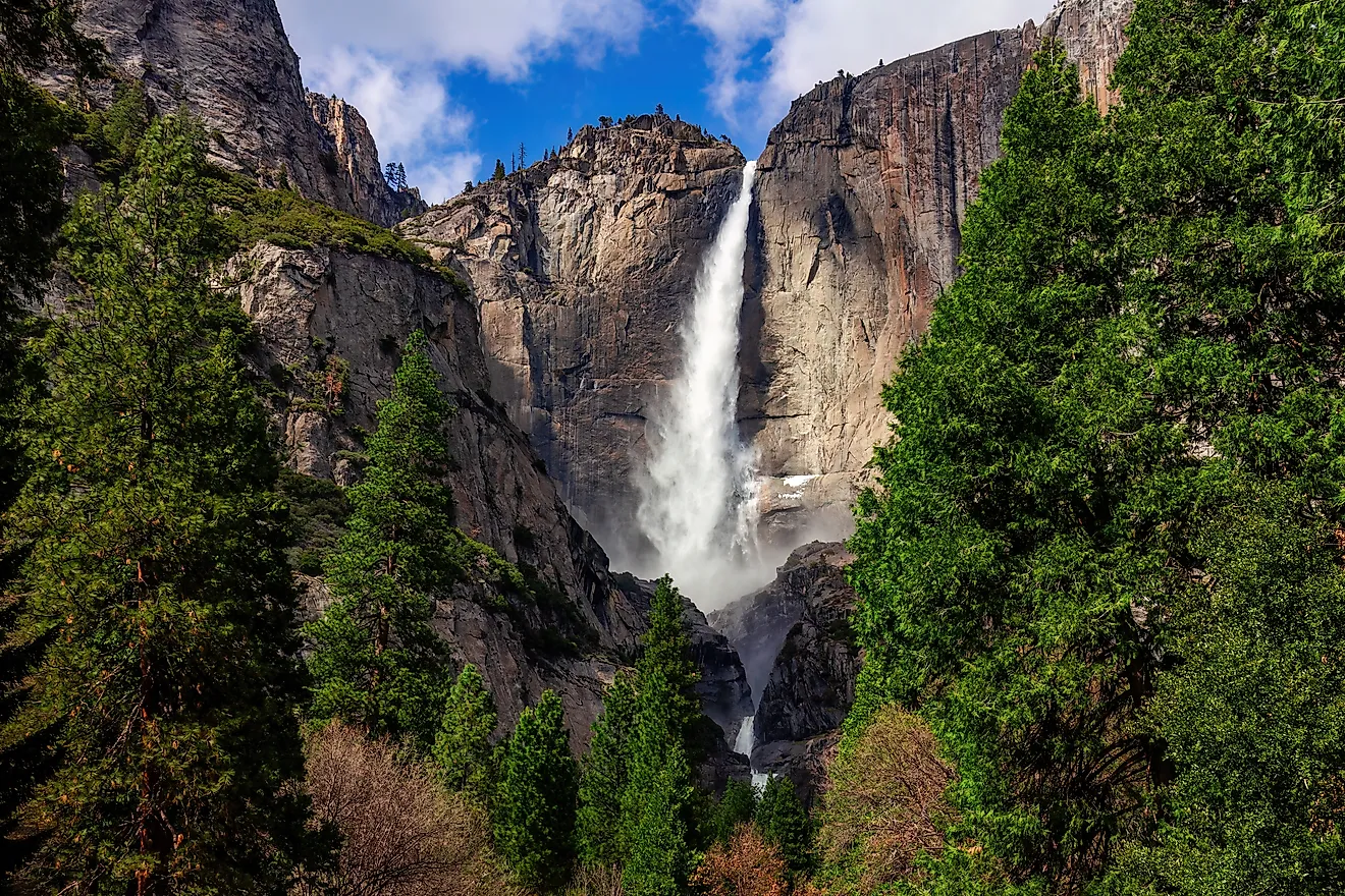
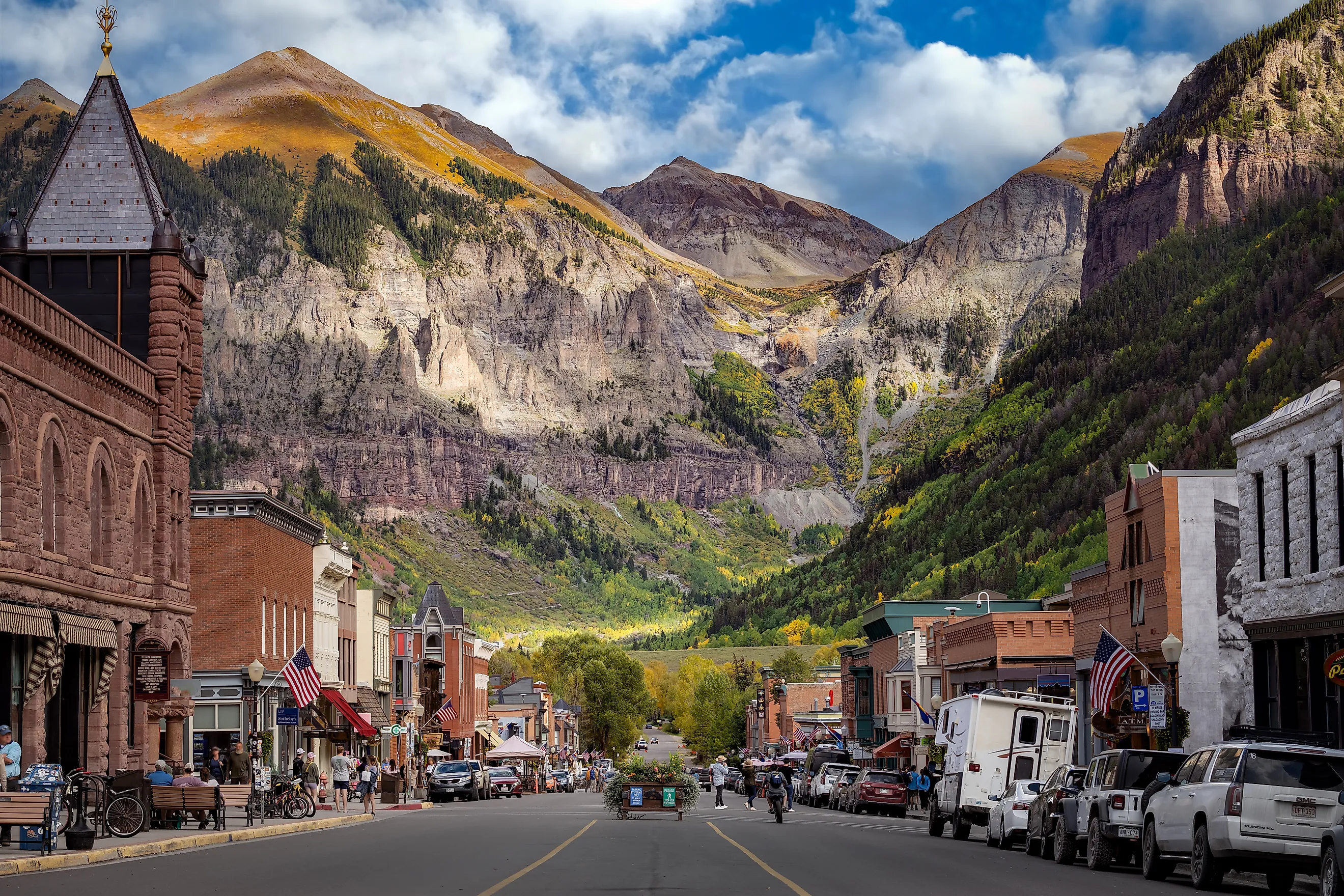
Telluride looks as if it was placed at the end of the world and then surrounded on purpose. This former mining town sits in a box canyon in southwestern Colorado, enclosed by 13,000- and 14,000-foot peaks. The town is famously small in shape, only a few blocks wide and a few blocks long, which makes the cliffs feel even closer. At the head of the canyon, Bridal Veil Falls drops 365 feet, giving Telluride one of the most dramatic backdrops in North America.
The town began as a mining settlement in the late 1800s, and its isolation helped preserve much of its historic character. Today, Telluride is better known for skiing, festivals, hiking, and luxury mountain travel than for ore and hard labor. Still, the canyon setting has not stopped reminding people who is really in charge. Winter brings avalanche danger in the surrounding mountains, and the steep roads and passes around town are not forgiving. Black Bear Pass, for instance, is famous among off-road drivers for all the wrong reasons if they are unprepared.
For visitors, Telluride offers a rare combination of beauty and compression. There are Victorian buildings, galleries, restaurants, trailheads, and a free gondola connecting the town to Mountain Village. But there is also very little room to sprawl. The same box canyon that makes Telluride unforgettable also keeps it contained. Every street seems to end in a wall of rock, a waterfall, or a mountain that looks too steep to climb.
Riggins, Idaho

Riggins sits deep in the Salmon River canyon country of Idaho, where the Salmon and Little Salmon rivers meet and the mountains crowd the road. It is often called Idaho's whitewater capital, which is not just a marketing phrase. Life here revolves around the river, whether people are rafting, fishing, jet boating, or watching the canyon walls change color with the light.
The town is small, but the landscape around it is enormous. The Salmon River, also known as the River of No Return, has carved one of the great canyon corridors of the American West. Around Riggins, the river is not a distant attraction. It is the reason the town exists, the reason visitors arrive, and one of the reasons the community has so little room to spread out.
Like many canyon towns, Riggins is beautiful in a way that can become inconvenient very quickly. Steep terrain limits development. River conditions can change. Roads follow the canyon because there are not many other places for them to go. Still, for people who love whitewater, wilderness, and a town where the canyon is always visible, Riggins is exactly where it should be: at the bottom of the action.
Bisbee, Arizona

Old Bisbee does not sit neatly on flat ground. It climbs, drops, twists, and squeezes itself through Tombstone Canyon in the Mule Mountains of southeastern Arizona. Houses cling to hillsides, stairways replace streets in places, and historic buildings appear to have been fitted into whatever space the canyon would allow. It is one of the clearest examples of a town adapting to vertical geography rather than the other way around.
Bisbee began as a mining town after copper, gold, and silver were found in the area in the late 1800s. As the mines grew, the settlement expanded through the canyon and up the slopes. The result is a town that feels less planned than poured into place. Old Bisbee's narrow lanes, colorful houses, hotels, galleries, and former mining buildings give it a strange and memorable charm.
But canyon living here has never been simple. The steep terrain makes building difficult, parking scarce, and walking more demanding than visitors expect. Summer heat can settle into the canyon, while monsoon storms can turn narrow streets and washes into trouble. Still, Bisbee has turned its awkward geography into personality. The town's unusual shape is part of the reason people remember it long after they leave.
Supai, Arizona

The village of Supai can be reached by leaving Route 66 in Peach Springs, driving north to Hualapai Hilltop, and hiking 8 miles down into Havasu Canyon, a tributary canyon of the Grand Canyon. It is also possible to fly there by helicopter, but it is not a journey for anyone who gets nervous around cliffs. There are no roads into the village, which makes Supai one of the most isolated communities in the United States.
This tiny place is home to the Havasu Baaja, or the Havasupai Tribe, whose name is often translated as the "people of the blue-green water." The description fits. Havasu Creek runs through the canyon in bright turquoise shades, feeding the famous waterfalls that have made the area one of the most coveted destinations in Arizona. Visitors can see Havasu Falls, Mooney Falls, Beaver Falls, and other cascades, but only if they have the proper reservation or permit. Supai is not part of Grand Canyon National Park, and visitors must respect the rules of the Havasupai Tribe.
Daily life here is unlike daily life almost anywhere else. Mail and supplies still arrive by mule, a reminder that the canyon decides what is convenient and what is not. Visitors can stay at the Havasupai Lodge or continue another 2 miles to the campground, but even the most beautiful trip here requires planning, stamina, and humility. Supai may sit at the bottom of a paradise-like canyon, but it is still a remote tribal community first and a tourist destination second.
Clifton, Arizona

Clifton sits at the bottom of a canyon shaped by the San Francisco River. Its historic downtown lies within a tributary gorge known as Chase Creek Canyon, where old buildings press close to the cliffs and the river remains an unavoidable presence. The town was founded in 1873 after copper deposits were discovered in the surrounding rock, and today Clifton is a historic frontier destination with a long memory.
That memory includes water. Living at the bottom of a canyon is beautiful until the river rises. Clifton has experienced repeated flooding, with the worst event occurring in October 1983, when Tropical Storm Octave sent the San Francisco River surging through the canyon. Homes and businesses were damaged or destroyed, residents were forced to evacuate, and the town was left with a permanent reminder that narrow canyon floors offer few places for floodwater to go.
Afterward, flood-control work became part of Clifton's identity. Massive floodgates and a levee help reduce the danger, but they do not erase it. Visitors who come today will find historic buildings, Chase Creek Street, the old Clifton Jail, and access to the Coronado Trail. They may also hear ghost stories about local hotels and boarding houses. But the most powerful story in Clifton is still the one told by the river: the canyon made the town possible, and it can threaten it just as quickly.
Boston Bar and North Bend, British Columbia

Boston Bar and North Bend sit across the Fraser River from one another in the rugged Fraser Canyon of British Columbia. They are not large communities, but they occupy a dramatic piece of river country between Yale and Lytton, where steep slopes press toward the water and roads and railways have to share the narrow corridor.
The two communities have long been tied to movement through the canyon. The Fraser River, the Trans-Canada Highway, and major rail lines all pass through this difficult landscape. In a place where cliffs, water, and weather dictate the route, transportation is not just background scenery. It is part of the town's story. Even the old aerial tram that once connected Boston Bar and North Bend speaks to the same challenge: crossing the canyon is not always simple.
Visitors come through this area for river views, railway history, and access to the larger Fraser Canyon region. But there is a hard edge to the beauty. Heavy rain can bring rockslides and road closures. The river can rise. The canyon can isolate communities quickly. Boston Bar and North Bend may be small, but they show exactly what it means to live in a place where the only easy direction is along the river.
Yale, British Columbia

Yale sits at the southern entrance to the Fraser Canyon, one of southwestern British Columbia's most historic communities. During the Fraser Canyon Gold Rush, Yale became a busy point of arrival, trade, and transportation. Steamships once reached this area, and the town became an important gateway into the interior of the province.
The geography explains why Yale mattered. The Fraser River narrows into canyon country here, forcing people, goods, roads, and railways into a tighter passage. What looks today like a quiet historic community was once a busy threshold between the coast and the goldfields. The canyon did not just shape the town; it helped determine who passed through it and how far they could go.
Today, visitors can explore Yale's historic buildings, museum sites, and Gold Rush stories while standing near the same river corridor that made the town famous. It is not as enclosed as Supai or Telluride, but Yale belongs on this list because it sits at the canyon's mouth, where the landscape begins to close in and the Fraser starts to feel less like a river and more like a force carving its way through stone.
Lytton, British Columbia

Lytton sits where the Thompson River meets the Fraser River, at the north end of the Fraser Canyon. It is in Nlaka'pamux territory, and its location has made it important for thousands of years. Rivers meet here, roads meet here, and canyon winds move through the valley with a force that can make the place feel exposed despite the surrounding mountains.
For many years, Lytton was known as one of Canada's hottest communities. Then, in June 2021, that reputation became tragic. After Canada's record temperature of 49.6 degrees Celsius was recorded in Lytton, a wildfire swept through the village the next day and destroyed most of it. The disaster showed how dangerous canyon towns can become when heat, wind, dry vegetation, and limited escape routes combine.
Lytton's story is still being written. The village has been rebuilding, but recovery in a place like this is not as simple as putting structures back where they were. The canyon location, the archaeological significance of the land, wildfire risk, and the needs of nearby Indigenous communities all shape what comes next. Lytton remains one of the most striking canyon-bottom communities in Canada, but it is also one of the clearest reminders that living in a dramatic landscape can come with dramatic consequences.
Living on the Edge
Living at the bottom of a canyon sounds like a dream, but in real life it comes with real danger. The towns on this list are undeniably beautiful, whether surrounded by red rock, mountain waterfalls, whitewater rivers, or the steep walls of the Fraser Canyon. Yet the same geography that makes them unforgettable can also make them vulnerable. Floods, fires, rockslides, avalanches, heat, and isolation are not abstract concerns here. They are part of daily life.
Still, these towns endure because canyon living offers something few other places can. The scenery is immediate. The history is visible. The landscape is not something in the distance, but something wrapped around every street, bridge, trail, and home. It takes a special kind of resilience to live between rock walls and restless rivers, but for many residents, there is nowhere else that feels quite as much like home.