5 Best Lakeside Towns in New Zealand
New Zealand's largest and deepest lakes are found in glacier-carved trenches across the South Island and in a volcanic crater at the middle of the North Island, and the settlements on their shores have organised themselves around the water. Lake Wakatipu at Queenstown reaches 378 metres (1,239 feet) down, deep enough that its floor lies below sea level. Lake Taupō covers 616 square kilometres (238 square miles) of a caldera left by the Ōruanui eruption. At Te Anau, most of the lake sits inside Fiordland National Park, the largest national park in the country. These five towns rank among the best lakeside bases in New Zealand, each one set on a different body of water.
Queenstown, Lake Wakatipu

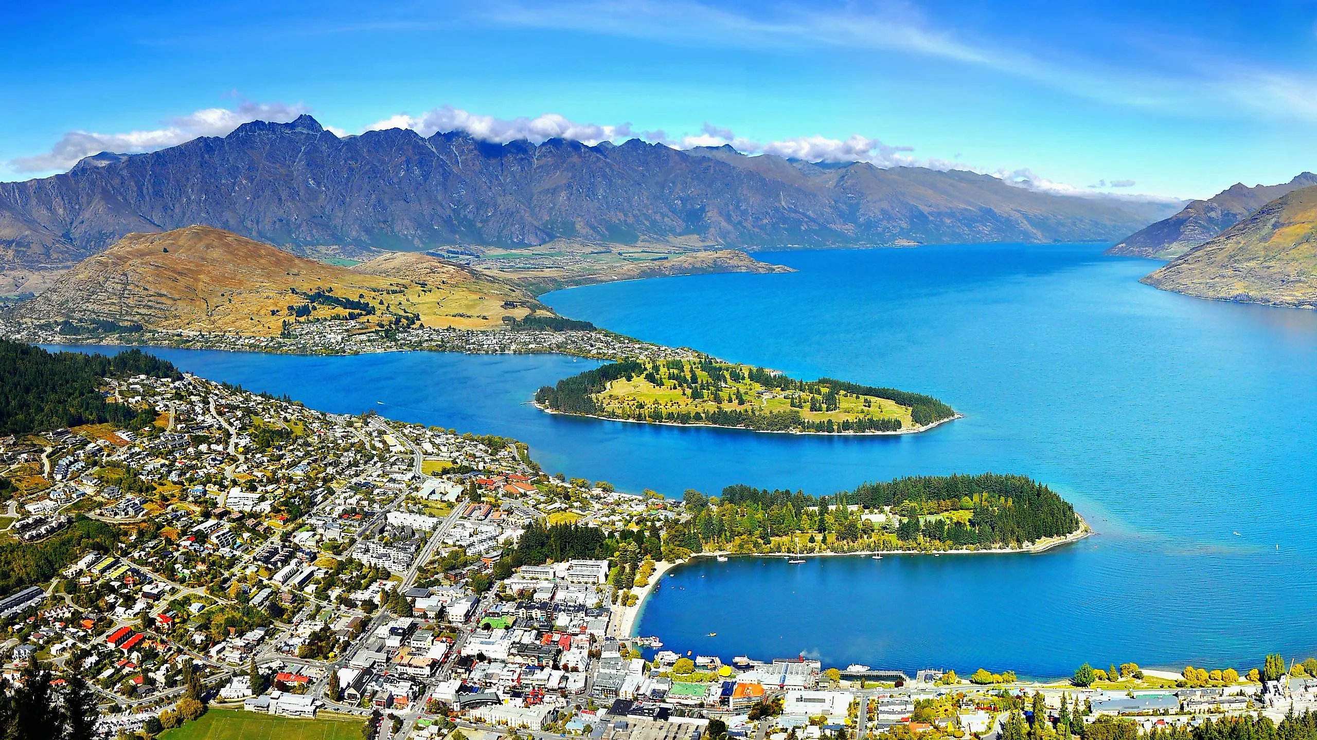
Lake Wakatipu fills a glacier-carved trench in the southwest corner of the Otago region of New Zealand's South Island. The country's longest lake is 80 kilometres (50 miles) long and covers an area of 291 square kilometres (112 square miles). It's also one of the deepest, reaching a depth of 378 metres (1,239 feet), low enough that its floor lies below sea level. Its surface rises and falls between 10 and 20 centimetres (four and eight inches) on a cycle of roughly 27 minutes, a standing wave that Māori tradition describes as the heartbeat of a sleeping giant beneath the lake. Set on a bay on the lake's northern shore, Queenstown started off as a humble sheep station in 1859, but the discovery of gold in the Shotover River in 1862 soon turned it into a bustling mining town.

Eichardt's Private Hotel on Marine Parade stands on the site of the original woolshed. The coal-fired steamer TSS Earnslaw, also known as the Lady of the Lake, was launched in 1912 and still crosses the lake to Walter Peak High Country Farm for sheepdog demos and a BBQ lunch. Across the bay, Queenstown Gardens covers a peninsula planted with English oaks in 1866 and now includes an ice rink, a skate park, and an 18-hole disc golf course. The Skyline Gondola climbs 450 metres (1,476 feet) to the top of Bob's Peak, where the whole length of the lake comes into view. Its operator calls it the steepest cable car lift in the Southern Hemisphere.
Wanaka, Lake Wanaka

A single crack willow standing in the shallows at Roys Bay in Lake Wanaka has become one of the most photographed trees in the country. Known as That Wanaka Tree, it grows a few steps off Wanaka's shoreline, so it is hard to miss (just look for the crowds of admirers). Lake Wanaka covers an area of 192 square kilometres (74 square miles) and is New Zealand's fourth-largest lake. Out on the lake itself, Mou Waho is a predator-free island reserve with Arethusa Pool near its high point, a small lake on an island in a lake. It can be reached by water taxi from the town jetty.

Outdoor enthusiasts have much to do here, including hiking up Roys Peak. The Roys Peak Track gains more than 1,200 metres (4,000 feet) over a 16-kilometre (10-mile) round trip to the 1,578-metre (5,177-foot) summit, climbing through private farmland before crossing a gate onto conservation land. Mount Aspiring National Park itself begins further west, covering 3,562 square kilometres (1,375 square miles) and taking its name from Mount Aspiring/Tititea, a 3,033-metre (9,951-foot) peak. Other stops in and around Wanaka include Puzzling World, which has a wooden maze, illusion rooms, and the Leaning Tower of Wanaka, a folly that tilts at 53 degrees. In town, Cinema Paradiso seats its audience on couches, armchairs, and even the back seat of a classic old car. For wine enthusiasts, Rippon is a biodynamic vineyard on Mills Mound overlooking the lake.
Taupō, Lake Taupō

The largest lake in New Zealand, Lake Taupō owes its existence to the Ōruanui eruption 26,500 years ago. At 616 square kilometres (238 square miles), it is also one of the world's largest crater lakes. The town of Taupō itself makes for a great base for exploring the lake, with the paved Great Lake Walkway being the most popular route. The walkway runs 10 kilometres (six miles) from the town harbour to Five Mile Bay, and the beaches along it are among the busiest on the North Island.
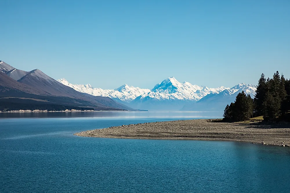
Three kilometres (two miles) north of town, the Waikato leaves the lake. New Zealand's longest river narrows from 100 metres (330 feet) across to a rock channel just 15 metres (50 feet) wide before dropping over Huka Falls at a rate of 220,000 litres (58,000 gallons) a second. Downstream, gates at the Aratiatia Dam regularly open to refill a dry rapid for spectators. Town attractions include the Taupō Museum with its Tūwharetoa gallery of Māori taonga and carved meeting house. Spa Thermal Park at the northern edge of town gives free access to Otumuheke Stream, where geothermally heated water flows into the cold Waikato.
Te Anau, Lake Te Anau

New Zealand's second-largest lake and the largest in the South Island, Lake Te Anau covers 344 square kilometres (133 square miles) and features three distinct arms: North Fiord, Middle Fiord, and South Fiord. Most of it lies inside Fiordland National Park, the country's largest national park, and is part of the Te Wāhipounamu World Heritage Area. Te Anau is the only town of any size on the shore and serves as the supply point for the lake. Hikers use the town as a base for three of New Zealand's Great Walks.

The Kepler Track, a 60-kilometre (37-mile) loop, climbs to Luxmore Saddle at 1,400 metres (4,600 feet) before dropping to Lake Manapouri. On wet days (and Fiordland has plenty), the Fiordland Cinema screens Ata Whenua, an aerial film of the country most visitors never reach on foot. A ten-minute walk south along the Te Anau lakefront, Punanga Manu o Te Anau is the town's bird sanctuary. The aviary houses the flightless takahē, declared extinct in 1898 and rediscovered in 1948 in the Murchison Mountains across the water.
Lake Tekapo, Mackenzie Basin

A small stone church is why most people stop at Lake Tekapo on the South Island. Built in 1935 in memory of the district's early pioneers, the Church of the Good Shepherd stands at the water's edge in the Mackenzie Basin, the dry inland bowl of tussock country east of the Southern Alps. The lake itself covers 83 square kilometres (32 square miles) at 710 metres (2,330 feet) above sea level, reaches 120 metres (390 feet) deep, and feeds the Tekapo A power station through a tunnel 1,400 metres (4,600 feet) long beneath the village. A canal takes that water on toward Lake Pukaki, where Mt Cook Alpine Salmon raises king salmon in the current at what the company calls the world's highest-altitude salmon farm.

Tekapo Springs operates hot pools above the lake, and the Alps 2 Ocean Cycle Trail passes through on its way to the coast at Oamaru. Lake Tekapo is also the gateway to the Aoraki Mackenzie International Dark Sky Reserve, which covers 4,367 square kilometres (1,686 square miles). The first reserve of its kind in the Southern Hemisphere, it is home to the University of Canterbury Mount John Observatory, home to New Zealand's largest optical telescope. The reserve's Dark Sky Project takes visitors to the summit at night, with an indoor session on Māori star knowledge when clouds obscure the night sky.
Living Beside New Zealand's Lakes
The glacial trenches of the South Island and the volcanic basin at the centre of the North Island have left New Zealand with a set of lakes that share little beyond their scale. Wanaka faces Roys Peak across 192 square kilometres (74 square miles) of water, with a single crack willow standing in the shallows at Roys Bay. Lake Tekapo sits at 710 metres (2,330 feet) in the tussock country of the Mackenzie Basin, inside the first dark sky reserve declared in the Southern Hemisphere. That spread is why lakeside New Zealand rewards a town-by-town look.