12 Most Breathtaking Towns In North Carolina
Above 5,000 feet the color has already turned. Over the next three weeks it works its way down the mountain, and North Carolina gets something almost no other state does: five weeks of peak foliage somewhere, because the land drops from 6,684 feet to sea level inside 300 miles.
The towns below are arranged to take advantage of that. Several put unusual landscapes within a few minutes of downtown. Dry Falls and Bridal Veil Falls are both beside US 64 near Highlands. In Bryson City, the Tuckasegee River runs past the railroad depot, and Great Smoky Mountains National Park begins just north of town. Beaufort faces a protected marsh across Taylor's Creek, and Southport sits directly on the shipping channel at the mouth of the Cape Fear. The scenery here is specific enough to plan a trip around, and right now the mountains are the place to start.
Highlands

Highlands sits at roughly 4,100 feet on a plateau in the southern Blue Ridge, which puts its peak color in the third week of October. Drivers descending US 64 toward Franklin enter the Cullasaja River Gorge, where two waterfalls require almost no detour. Dry Falls is reached by a short path from the road and lets you walk behind the falling water. Bridal Veil Falls is farther along the same highway, and for a stretch you could once drive under it.
The Highlands Plateau Greenway has several short trail sections near downtown. One route reaches the Highlands Botanical Garden, where visitors cross wetland boardwalks and walk around the lake. The garden is useful for understanding the plateau's elevation, since many of its native plants belong to the cooler southern Appalachian climate rather than the Piedmont below.
The Bascom occupies a six-acre former horse farm near the edge of town. Visitors enter across a covered bridge before reaching the galleries, and a sculpture trail continues down the slope beside a brook. Classes and studio work take place in the barn, so there is usually more to see than finished work hanging on a wall.
Bryson City

At the end of Lakeview Drive north of Bryson City there is an unlit tunnel about 1,200 feet long that leads nowhere. The road was meant to replace routes submerged or cut off when Fontana Dam was built in the 1940s. Construction stopped after roughly six miles. The federal government eventually settled Swain County's claim for $52 million, and the tunnel is why locals still call the route the Road to Nowhere. Four overlooks along the way give views over Fontana Lake.
Passengers board Great Smoky Mountains Railroad excursions at the downtown depot for trips toward the Nantahala Gorge and Fontana Lake. The tracks run close to the Tuckasegee River, so the railroad is part of the everyday downtown scene rather than an attraction on the outskirts. The autumn excursions are the busiest of the year and sell out well ahead.
The Deep Creek section of Great Smoky Mountains National Park is just north of town, and it stacks three waterfalls onto one walk. Tom Branch Falls is close to the trailhead, Indian Creek Falls can be added to the same loop, and Juney Whank Falls sits on another short branch. In summer, visitors tube sections of Deep Creek.
The Swain County Heritage Museum is inside the old courthouse downtown. Exhibits cover the railroad and Fontana Dam, including the communities the reservoir displaced. Seeing those before driving Lakeview Drive gives the unfinished road the context it needs.
Brevard

Transylvania County counts more than 250 waterfalls inside its borders and promotes itself as the Land of Waterfalls on that basis. Looking Glass Falls is the easiest to reach: roughly 60 feet, directly beside US 276 north of Brevard, with an overlook at road level and steps down toward the creek. At about 2,230 feet the town peaks late, usually the last week of October, which makes it the right place to end a foliage trip rather than start one.
DuPont State Recreational Forest is south of town. High Falls and Triple Falls are linked by popular trails along the Little River, and Hooker Falls downstream needs only a short walk from its parking area. Go farther in and the sections around the lakes thin out considerably.
Silvermont is a different kind of stop close to downtown. The 33-room Colonial Revival house was built in 1917 for industrialist Joseph Silversteen, whose businesses included lumber and tanning, and his family gave the property to Transylvania County in 1972. The grounds are a public park now.
Brevard's white squirrels are the local oddity, descended from a pair that escaped a carnival truck decades ago and now established well enough that the town throws an annual festival for them. Watch for them around residential streets and parks. Main Street is a short drive from Looking Glass Falls, so a two-day trip does not have to choose between downtown and forest.
Saluda

The railroad grade below Saluda reaches about 4.7 percent, which made it the steepest standard-gauge mainline grade in the United States. Runaway trains were common enough that special safety tracks were built along the descent to catch them. Freight service ended in 2001, and the corridor has since been acquired for conversion into a rail trail.
Main Street runs parallel to the former tracks near the top of the grade, and that position is the whole explanation for the town: trains needed a stop near the summit before starting down. The Saluda Historic Depot and Museum covers the engineering and documents the accidents that happened here.
Thompson's Store has operated on Main Street since 1890 and is generally identified as North Carolina's oldest continuously operating grocery store. Ward's Grill works out of the same building. The original wooden floorboards are still down, which visitors notice immediately because nearly everything in the room still looks functional rather than staged.
For time outside town, the Green River Gorge nearby is used for whitewater trips. Pearson's Falls is the easier option, a quarter-mile trail inside a botanical preserve the Tryon Garden Club has owned since the 1930s.
Hot Springs

This is the only town in North Carolina where the Appalachian Trail runs down the main street. Hikers come along Bridge Street before crossing the French Broad River, and with fewer than 600 residents the arrival of thru-hikers each spring is impossible to miss.
From downtown you can climb to Lover's Leap for a view over the French Broad valley, which also makes the town's geography legible. Hot Springs occupies a narrow shelf near the meeting of Spring Creek and the river, with steep ground immediately beyond the developed blocks.
That location turned destructive during Hurricane Helene in September 2024. Floodwater damaged homes and businesses downtown, and much of the Hot Springs Resort and Spa property was affected, including the mineral tubs beside the creek. The resort has since reopened for soaking and camping and many Main Street businesses are trading again, but recovery is ongoing, so check current operating information before leaving home.
The mineral springs are why the settlement exists at all. Warm water surfaces near Spring Creek and is piped into private outdoor tubs at the resort, a short walk from the trail crossing. October is the best month for it, with cool air and warm water.
Banner Elk

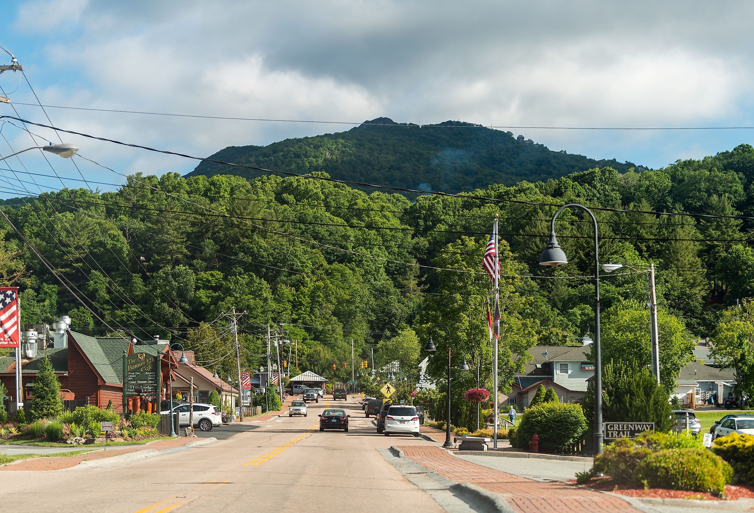
At roughly 3,700 feet in an open High Country valley, Banner Elk turns earlier than almost anywhere else on this list, with color arriving through the second and third weeks of October. Lees-McRae College has been here since 1900, and several of its older buildings use dark local stone. The Elk River runs along the valley floor.
Wildcat Lake has a public swimming beach at the base of the surrounding slopes and a fishing dock, which makes it an easy stop for anyone who wants mountain views without committing to a trail.
Grandfather Mountain is about 15 miles away, and its Mile High Swinging Bridge crosses an 80-foot chasm at an elevation of exactly 5,280 feet. Linville Peak on the far side reaches 5,305 feet. The bridge dates to 1952 and was rebuilt with a steel superstructure in 1999, though you can still feel it move underfoot when the wind picks up, which it does.
Grandfather Vineyard sits lower in the valley beside the Watauga River, and its tasting area is close enough to the water to be the obvious stop after the higher, windier conditions up on the mountain.
Blowing Rock

Snow sometimes falls upward here. Blowing Rock takes its name from a cliff above Johns River Gorge where updrafts are strong enough to push light objects back up at you, and in the right winter conditions that includes snow. A Cherokee legend attached to the site tells of a warrior carried back toward his lover after leaping from the rock.
Main Street sits at about 3,500 feet, which puts peak color here around the third week of October. A mile north, Moses H. Cone Memorial Park preserves the former estate of textile manufacturer Moses Cone, who had roughly 25 miles of carriage roads built across the property at grades gentle enough for horses. Those roads are now some of the easiest long walks in the High Country, and the loop around Bass Lake has almost no elevation gain.
The Glen Burney Trail starts a few blocks from Main Street and descends along New Year's Creek toward Glen Burney Falls, with Glen Marie Falls farther down. The climb back up is substantially harder than the way down, which is worth knowing before committing to the lower falls.
The Blowing Rock Art and History Museum is on Main Street and pairs local history with rotating exhibitions. It works well on the same day as the Glen Burney Trail, since both start downtown.
Hillsborough

The Mountains-to-Sea Trail runs through Hillsborough on the paved Riverwalk beside the Eno River, about three miles of it, and it is one of the more urban stretches of the statewide route. You can join it close to downtown without driving to a remote trailhead. Being Piedmont, the color here does not arrive until early November.
At the western end, Occoneechee Mountain State Natural Area reaches 867 feet, the highest point in Orange County. Mountain laurel grows on the slopes alongside rhododendron more commonly associated with western North Carolina, and old quarry ponds are visible from the trails before the overlook above the Eno.
At the other end sits the former Occoneechee Speedway, a nine-tenths-mile dirt oval that opened in 1947 and was one of the first tracks used by NASCAR. Racing ended in 1968. The banked track is still visible under the trees, and you can walk the old racing surface on foot, which is a strange thing to be able to do.
East of downtown, Ayr Mount is a Federal-style house built in 1815, with open grounds and woodland that give the town another substantial green space away from the river corridor.
Edenton

In October 1774, fifty-one women in Edenton signed a public statement backing a boycott of British goods. The Edenton Tea Party was one of the earliest organized political actions by women in the American colonies, and London newspapers answered it with mocking cartoons, which is how you know it registered. The anniversary falls this month.
At the waterfront end of Broad Street, Colonial Park faces Edenton Bay, and the 1886 Roanoke River Lighthouse stands on pilings over the water. It is a screw-pile light, built as a square cottage for shallow sounds, and the last surviving example of its type in North Carolina. The structure was moved to its current location and restored.
A few blocks inland, the Cupola House dates to 1758, with a heritage garden behind it. Boat tours leave from the docks at Colonial Park, which gives visitors the same harbor perspective arriving vessels had when the waterfront was the town's main entrance.
Manteo

A marble statue of Virginia Dare stands beneath a live oak in the Elizabethan Gardens, and it has had a considerably more eventful life than most statues. Sculptor Maria Louisa Lander finished it in 1859, imagining the first English child born in America as a grown woman. On its way to North Carolina it spent roughly two years underwater after a shipwreck.
The Elizabethan Gardens cover about ten acres within the Fort Raleigh area. The Garden Club of North Carolina developed them in the 1950s using plants able to handle the island's salt, and Queen Elizabeth II later contributed a rose from Windsor.
Downtown Manteo sits beside Shallowbag Bay in the Outer Banks. Walk the docks to the Roanoke Marshes Lighthouse, a reconstruction of the cottage-style lights once used in the sounds. Across the water at Roanoke Island Festival Park, the Elizabeth II represents the kind of English merchant vessel used during the colonization period, and you can board it, which makes the maritime history far easier to picture than any plaque manages.
Beaufort

Wild horses graze directly across the water from the restaurants on Front Street. The Rachel Carson Reserve occupies the far bank of Taylor's Creek, protected salt marsh with dunes and maritime forest behind it, and the feral herd there is often visible from the Beaufort waterfront without taking a boat at all.
The North Carolina Maritime Museum on Front Street displays artifacts recovered from the wreck believed to be Queen Anne's Revenge, Blackbeard's flagship, which grounded near Beaufort Inlet in 1718 and was located in 1996. Other exhibits cover the fishing and boatbuilding that supported the town for generations.
Two blocks inland, the Old Burying Ground holds graves dating to the early 1700s under mature live oaks, with table stones, brick vaults, and iron gates around some family plots. It is worth half an hour for anyone interested in the town's older families, since names from the historic district turn up again on the markers.
Southport

Southport was chartered as Smithville in 1792 and renamed in 1887 during a push to build a major shipping port at the mouth of the Cape Fear. The port never materialized, which is precisely why the older residential grid still sits right against the waterfront instead of behind a container terminal.
Southport Waterfront Park faces the shipping channel, with benches and porch swings pointed at the river and a fishing pier. Container ships pass on their way up to Wilmington, the Southport-Fort Fisher ferry crosses the same water, and smaller fishing boats work closer to shore.
The Fort Johnston-Southport Museum stands on Bay Street on the grounds of a colonial fort. The North Carolina Maritime Museum at Southport explains why this stretch of river mattered so much to the pilots who guided ships across the Cape Fear bar, with exhibits on local wrecks and major storms.
The ferry takes about half an hour to cross toward the Atlantic side of the river. From the passenger deck the marsh is visible beside the shipping channel, with the Cape Fear widening toward the coast.
Timing A Trip This Month
Elevation decides the order. Banner Elk at 3,700 feet and the higher ground around Grandfather Mountain turn through the second and third weeks of October. Blowing Rock and Highlands, both in the 3,500 to 4,100 foot range, follow in the third week. Brevard, Bryson City, Saluda, and Hot Springs sit lower and peak toward the end of the month. Hillsborough, in the Piedmont, waits until early November, and the four coastal towns are not foliage destinations at all, though autumn is their best season for every other reason, with the summer heat and crowds gone.
Two practical notes before you drive. The Blue Ridge Parkway is still closed between Linville Falls and Mt. Mitchell for Hurricane Helene repairs, with the Park Service targeting full reopening by the end of 2026, so check the current map rather than assuming a through route. And High Country lodging in Blowing Rock and Banner Elk books out months ahead for the middle two weeks of October, which is the single busiest stretch of the mountain year.