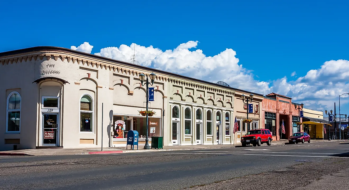
10 Most Scenic Drives in North Carolina
North Carolina has no shortage of amazing scenery, from Blue Ridge and Smokies views to the dunes, beaches, and lighthouse stops of the Outer Banks. The state is also home to 62 scenic byways, plus iconic drives like the Blue Ridge Parkway, which means you can take in mountain ridges and coastline all from the road. If you do not know where to start, we suggest the Blue Ridge Parkway, thanks to its 252-mile run through western North Carolina and standout stops like Linn Cove Viaduct and the turnoff for Mount Mitchell. If you're interested in coastal scenery, the Outer Banks Scenic Byway is another essential route, with NC 12 threading between the Atlantic Ocean and Pamlico Sound before reaching Cape Hatteras Lighthouse and Ocracoke Island.
Blue Ridge Parkway

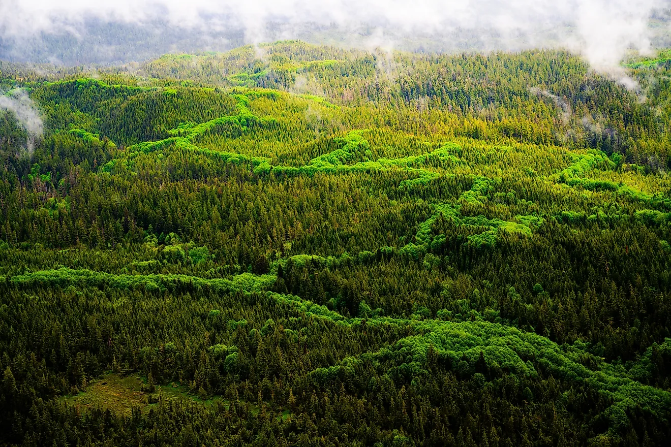
High along the Appalachian spine, the Blue Ridge Parkway enters North Carolina near Cumberland Knob and winds for 252 miles toward Great Smoky Mountains National Park near Cherokee. The route reveals the Blue Ridge at its most dramatic, with sweeping ridgelines, forested slopes, and the deep canyon of Linville Gorge unfolding beside the roadway. Long overlooks reveal layers of mountains fading into the distance, while other stretches curve beneath tunnels of hardwood forest that glow with color each autumn.
Scenic stops appear often along the drive. Open views spread out near Doughton Park, while the engineering marvel of the Linn Cove Viaduct curves gracefully around Grandfather Mountain. Farther south, the road leading to Mount Mitchell State Park branches toward the highest peak east of the Mississippi. Short stops near Linville Falls bring the sound of rushing water within easy reach of the road, making it simple to pause and absorb the mountain landscape before continuing south.
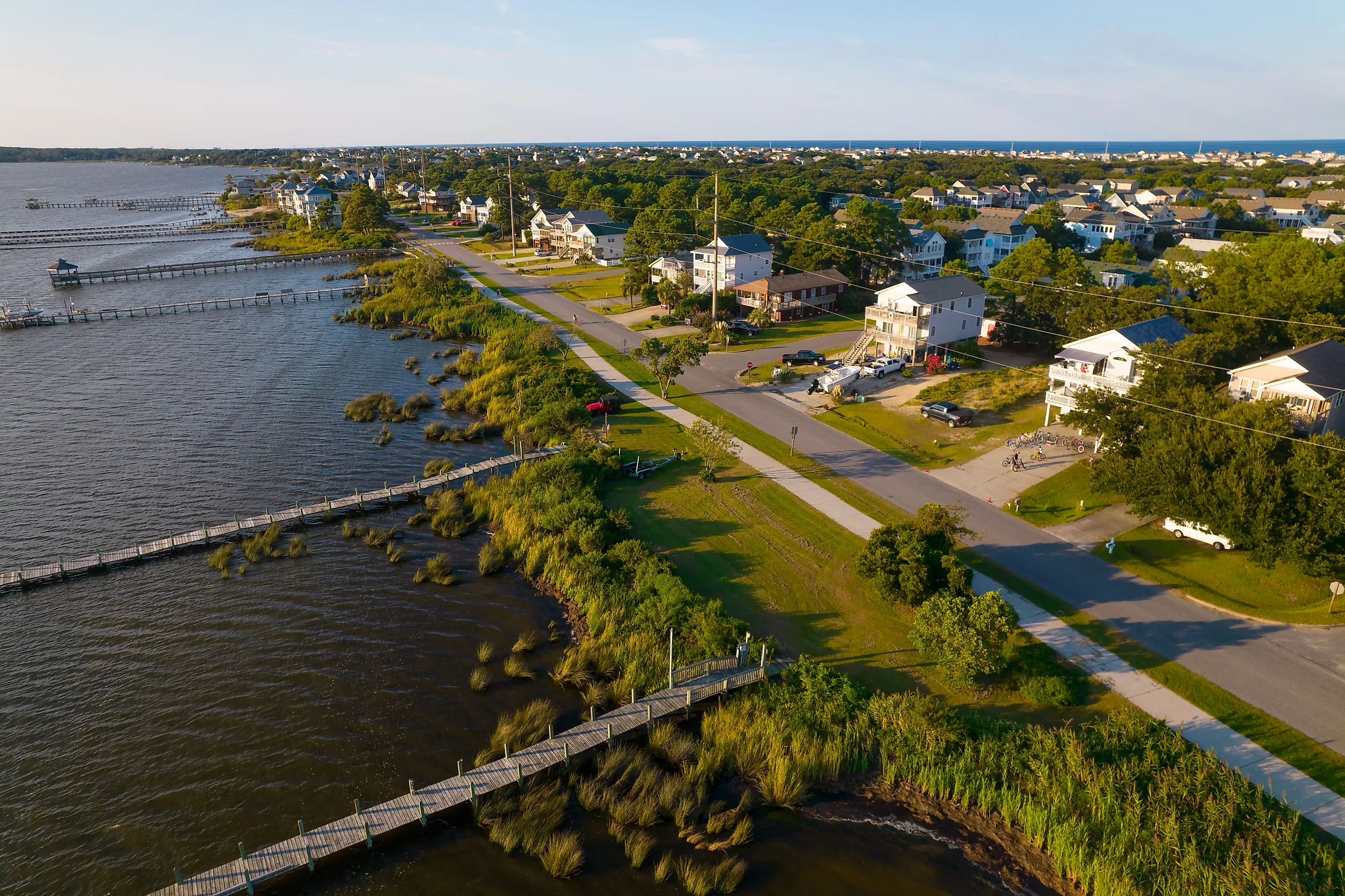
Outer Banks Scenic Byway

Few drives in the country feel as close to the ocean as the Outer Banks Scenic Byway, which follows NC Highway 12 from Nags Head south toward Ocracoke Island, with ferry connections extending to Cedar Island. The narrow barrier islands place the Atlantic Ocean on one side of the road and Pamlico Sound on the other, where wind-shaped dunes, sea oats, and wide beaches define the scenery mile after mile.
Southbound travelers soon enter Cape Hatteras National Seashore, where the towering Cape Hatteras Lighthouse rises above the dunes as one of the most recognizable landmarks on the Atlantic coast. Beach access points and side pull-offs appear throughout the drive, inviting spontaneous stops to watch waves roll in or pelicans glide above the water. Reaching Ocracoke Island feels like the natural finale to the journey, where maritime forests and quiet harbor views capture the coastal rhythm of North Carolina’s Outer Banks.
Whitewater Way Scenic Byway

A short stretch of road delivers one of the most striking mountain descents in the state along the Whitewater Way Scenic Byway. Beginning near Cashiers, NC Highway 107 drops quickly down the Blue Ridge Escarpment through dense forest within Nantahala National Forest, revealing glimpses of the distant foothills as the elevation falls toward the South Carolina state line.
Along the way, overlooks open wide views across the escarpment, particularly dramatic when autumn colors sweep across the mountains. A brief stop leads to Whitewater Falls, where the upper cascade plunges 411 feet, making it one of the tallest waterfalls east of the Rocky Mountains. Just down the road, Silver Run Falls rests beside the highway, offering a refreshing pause where water spills into a clear mountain pool beneath the trees.
Cherohala Skyway

Remote mountain wilderness defines the Cherohala Skyway, a sweeping high-elevation route linking Robbinsville, North Carolina, with Tellico Plains, Tennessee. Designated a National Scenic Byway, the 43-mile roadway climbs steadily through Nantahala National Forest, rising above 5,000 feet where long ridgelines stretch toward the horizon.
Early miles pass through dense forest before the road emerges onto exposed mountain ridges. Scenic pull-offs appear along the crest, where panoramic views reveal a vast sweep of Appalachian peaks. Near the North Carolina-Tennessee border, the perspective opens even wider, offering a sense of the region’s immense scale before the roadway continues west toward Tennessee.
Great Smoky Mountains Scenic Drive

Crossing the heart of Great Smoky Mountains National Park, US Highway 441 (known as Newfound Gap Road) connects Cherokee, North Carolina, with Gatlinburg, Tennessee. The road gradually climbs through hardwood forest where mist often drifts between the ridges, creating the soft blue haze that gave the Smokies their name.
Several overlooks reveal the lush valleys below, including sweeping views across the Oconaluftee Valley. At the crest of the mountains sits Newfound Gap, where expansive views stretch across multiple states. A short, paved path nearby leads to even higher viewpoints, allowing travelers to stand above the ridges and look out across one of the most famous landscapes in the eastern United States.
Forest Heritage Scenic Byway

Forest and waterfall scenery define the Forest Heritage Scenic Byway, which follows US Highway 276 from Brevard toward Waynesville through the Pisgah Ranger District of Pisgah National Forest. The drive quickly enters dense woodland where streams tumble alongside the road and thick hardwood canopy shades the mountainside. Only minutes from Brevard, Looking Glass Falls pours down a rock face just steps from the highway, creating one of the easiest waterfall stops in the state. The road then climbs deeper into Pisgah’s forested ridges before reaching the junction with the Blue Ridge Parkway, where the scenery transitions from rushing streams to long-range mountain views.
Nantahala Byway

Mountain water and forested cliffs shape the drive along the Nantahala Byway, which follows US Highway 74 from Topton west to Marble in Cherokee County. The road traces the path of the Nantahala River, where whitewater rapids rush through a narrow gorge framed by steep wooded slopes. Multiple pull-offs allow drivers to watch rafters navigate the river’s fast-moving current. The route continues through the lively recreation area surrounding the Nantahala Outdoor Center, where the sound of rushing water and mountain air create an atmosphere that captures the adventurous spirit of western North Carolina.
Mountain Waters Scenic Byway

The Mountain Waters Scenic Byway refers to the scenic corridor along US Highway 64 between Franklin and Highlands crossing the southern Appalachian Mountains. The route winds through steep terrain and hardwood forests with multiple waterfalls visible directly from roadside pull‑offs or short adjacent paths. Elevation increases steadily toward Highlands with mountain ridges and forested slopes dominating the landscape.
Heading east, drivers encounter roadside cascades, such as Dry Falls and Bridal Veil Falls. Curving mountain sections require attentive driving particularly during wet conditions. Spring and early summer provide strong water flow while autumn enhances forest color. Winter ice can form on shaded curves at higher elevations.
French Broad Overview

The French Broad Overview follows NC Highway 209 from Lake Junaluska north to Hot Springs paralleling portions of the French Broad River valley. The drive traverses rolling farmland before climbing into steeper Appalachian ridges with river views and wooded slopes visible along the corridor. Elevation changes are noticeable but gradual offering broad scenic vistas across the river valley and surrounding mountains. Several ridge sections reveal views of the French Broad River winding through the valley below. As the road approaches Hot Springs, the mountains close in around the river, creating a picturesque arrival in one of the region’s best-known trail towns along the Appalachian Trail.
Sandhills Scenic Drive

Far from the towering peaks of western North Carolina, Sandhills Scenic Drive crosses Uwharrie National Forest and reveals a much older mountain landscape. Perhaps the most scenic portion of NC Highway 24/27 runs between Albemarle and Troy, passing through the gently rolling Uwharrie Mountains, whose rounded ridges have been shaped by erosion over hundreds of millions of years. Pine forests line the roadway as it winds across low ridgelines and quiet woodland stretches. The Morrow Mountain Overlook is a short, 7-mile detour from the Sandhills Scenic Drive, offering panoramic views of the Uwharrie Mountains. Additional roadside access points offer glimpses into one of the oldest mountain ranges in North America, showing that North Carolina’s scenery extends far beyond its famous high peaks.
Scenic Journeys Across North Carolina
These scenic drives highlight the state’s unmatched geography from the rugged, mist‑laden ridges of the Blue Ridge Parkway and sweeping gorges of the Cherohala Skyway to the sandy barrier islands of the Outer Banks Scenic Byway. Each route captures North Carolina’s signature mix of mountains rivers forests and coastline offering experiences that cannot be replicated elsewhere. From winding river valleys and elevated forest overlooks to open coastal stretches these drives immerse travelers in landscapes landmarks and views found only in North Carolina leaving every journey unmistakably rooted in the state’s natural beauty.