Which Countries Does The Sahara Desert Cover?
The Sahara desert is one the world’s hottest desert and it covers an area of 3,600,000 square miles which is comparable the size of the United States or China. The desert covers a large area of North Africa, which account for approximately 31% of the total area of the continent. For years, this arid area has received annual rainfall below 200 mm. The countries within Sahara desert are Morocco, Mali, Mauritania, Egypt, Libya, Algeria, Chad, Niger Republic, some parts of Sudan, a small portion of Nigeria, and a small part of Burkina Faso.
Sahara Desert in Egypt
The Western Desert of Egypt which is located west of River Nile and extends to the Libyan border forms part of Sahara in Egypt. The desert covers an area of 262,800 square miles of the country, which is equivalent to two thirds of the entire country. Rocks and sand characterize the region. Its highest altitude is 3,300 feet above sea level, located on the Gilf Kebir plateau near the Egyptian, Sudanese and Libyan border. Besides, there are several oases namely Siwa, El Faiyum, Bahariya, Farafra, Dakhla, and Kharga.
Sahara Desert in Libya
The part of Sahara that extends to Libya constitutes the Libyan Desert. This area is one of the driest, the most remote, and the harshest regions of the Sahara, experiencing very little rainfall. It covers approximately 420,000 square miles. There is a wide variety of landscapes including mountains and oases. The daytime temperatures can reach up to 50°C especially during the summer. During the winter, natural phenomena known as “White Nights” occurs due to the formation of radiation frost. In 1922, a record temperature was recorded at 58°C, which is the highest natural temperature ever recorded anywhere in the world. Lowest temperatures of -9°C have been recorded in the desert.
Sahara Desert in Mali
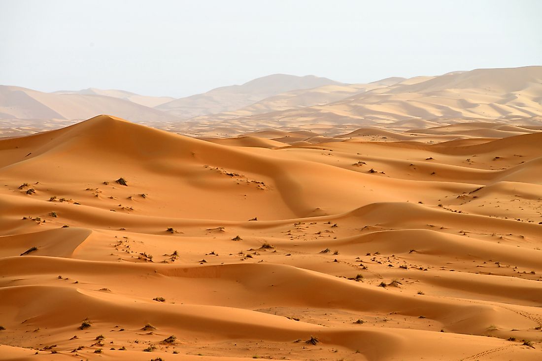
Mali is one of the hottest countries in the world. The Sahara desert covers about 65% of the total area in the country. The country is generally hot and has been known as the pressure cooker of Africa because of the sweltering heat during hot seasons in April where temperatures can rise to 46°C. In some regions, high temperatures of up to 48°C have been recorded in the country. The valley of the Niger River is the southernmost point of the Sahara desert, while the northern parts lie deep within the Sahara. In the north, the most common features are the formation of the ever shifting parallel dunes in the sand.
Sahara Desert in Chad
Sahara desert covers the most of the Northern part of the country where it experiences traces of rainfall throughout the region receiving as little as 1.18 inches of rain annually. There are some few oases and sporadic wells which are a source of water and crops such as millet, date palms, and other crops. In January temperature averages about 32°C, while in May they increase to about 45°C accompanied with strong winds which can result in powerful sandstorms.
History of Sahara
It is believed that Sahara was among the first regions to be farmed in Africa and about 5,000 years ago the whole of Sahara had vegetation thought to be almost like Savannah. Numerous cave drawings are indicate agricultural activities, and desertification may have started about 3000 BCE. Much of the Sahara desert has remained undisturbed other than the oasis, aquifers, and desert margins which have experienced the most degradation.


