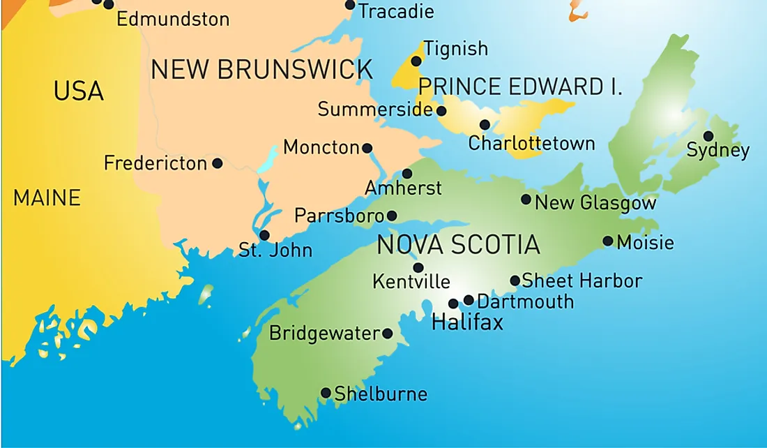
Where Is The Isthmus Of Chignecto?
An isthmus refers to a narrow strip of land which links two larger landmasses and also divides two bodies of water. It is a natural bridge over water between the two bodies of land which would otherwise be completely separate if it were not for the isthmus. The Isthmus of Chignecto serves as the border between the two Canadian maritime provinces of New Brunswick and Nova Scotia and links the Nova Scotia peninsula to North America. The Isthmus of Chignecto divides the water of Baie Verte, which is Sub-basin of the Northumberland Strait from those of Chignecto Bay, which is a sub-basin of the Bay of Fundy.
Description of the Isthmus of Chignecto
The Isthmus of Chignecto runs from the Valley of Petitcodiac River in the northern point near the Dieppe city in New Brunswick and stretches to the region near the town of Amherst in Nova Scotia in the south. The isthmus has the narrowest point between Tidnish and Amherst where it measures about 16 miles wide. The isthmus is located in a strategic point and has been the center of contention for different competing powers throughout the history of its settlement. The name of the isthmus is derived from the Mikmaq language name Siknikt which means drainage place. It is also the name of the Mikmaq district where isthmus is located.
History of the Isthmus of Chignecto
The French were the first Europeans to settle at the Isthmus of Chignecto, and the region became the center of the growing Acadian community of farmers known as the Beaubassin. In 1713, the Isthmus became a place of a historic divide line between the French territory and the British colony of Nova Scotia. In 1749, the French military base was established on the Aulac Ridge known as Fort Beausejour, and the British retaliated by constructing an outpost on the ridge just to the east known as the Fort Lawrence. Although the border between the two was never determined, the French assumed the boundary to be between the two ridges on a tidal stream known as the Missaquash River. Besides, the French constructed Fort Gaspereau, which was located on the shores of the Northumberland straight to enable them to control the movement along the isthmus.
Significance of the Isthmus
Currently, the Isthmus of Chignecto is a vital transport corridor with the inter-provincial railway and the Trans Canada Highway cross over the isthmus. The two also serve as the only means for the terrestrial wildlife to move out and into Nova Scotia.
Conservation
With the absence of any plan to deliberately conserve the ecosystem around the connectivity, any development around the isthmus has the potential to restrict natural movement of wildlife and plants across the isthmus. The combined effects of agriculture, transport corridors, intensive forestry management, and residential development are contributing to the fragmentation of natural habitats.
Currently, no official efforts are attempting to coordinate all the developments around the isthmus in ways that would consider the movement of the wildlife across the isthmus. However, organizations have carried out extensive research and have recommended certain measures to promote the conservation around the isthmus.