Caucasus Mountains
The Caucasus Mountain range stretches for 1,200 km between the Black Sea and the Caspian Sea at the intersection of Europe and Asia. The Caucasus region spans an area of 440,000 sq. km and extends southward from the lowlands of the Kuma and Manych river basins in western Russia to the northern frontiers of Turkey and Iran in the south.
Geography of Caucasus Mountains
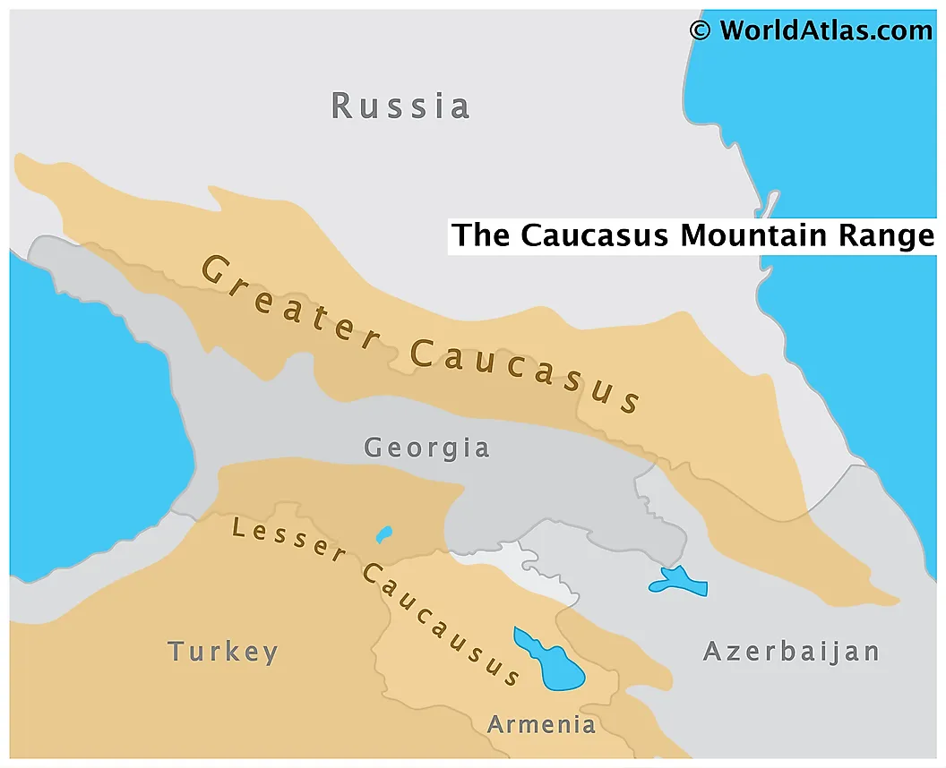
The mountain consists of two ranges: the Greater Caucasus in the north and the Lesser Caucasus in the south. The Greater Caucasus runs west-northwest to east-southeast, from the Caucasian Natural Reserve near Sochi, Russia on the northeastern shore of the Black Sea to Baku, Azerbaijan on the Caspian Sea. The Lesser Caucasus runs parallel to the Greater Caucasus for about 100 km in the south. These two regions are connected by the Likhi range in Georgia, whereby the Colchis Plain and the Kur-Araz Lowland lie to the west and east of this range, respectively.

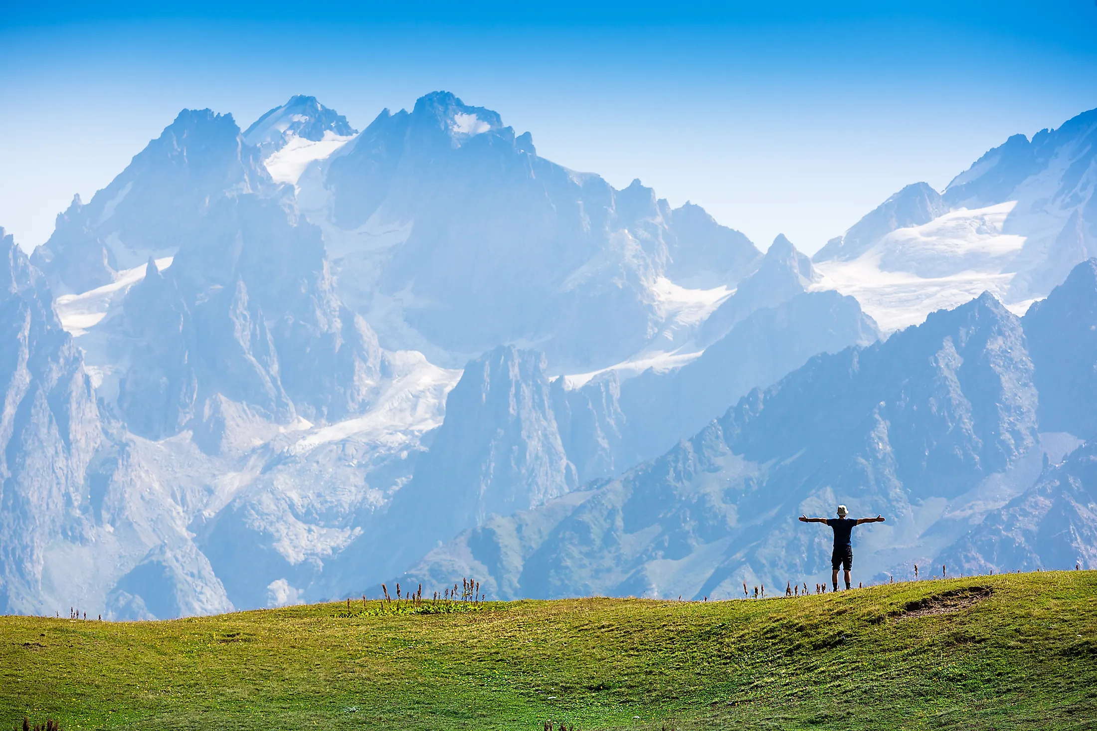
The Caucasus Mountain range is surrounded by the Caucasus region, and it boasts eight mountains higher than the highest mountains in the Alps, including Mount Elbrus, which is the highest peak in Europe, reaching an elevation of 5,642 meters above sea level. Caucasia does not only include the mountain range but also the country immediately north and south of the range. The land north of the Greater Caucasus is called Ciscaucasia while its southern counterpart is called Transcaucasia. The Transcaucasian Highland, formed by the Lesser Caucasus and the Armenian Highland, converge with the highland plateau of Eastern Anatolia at their western end.
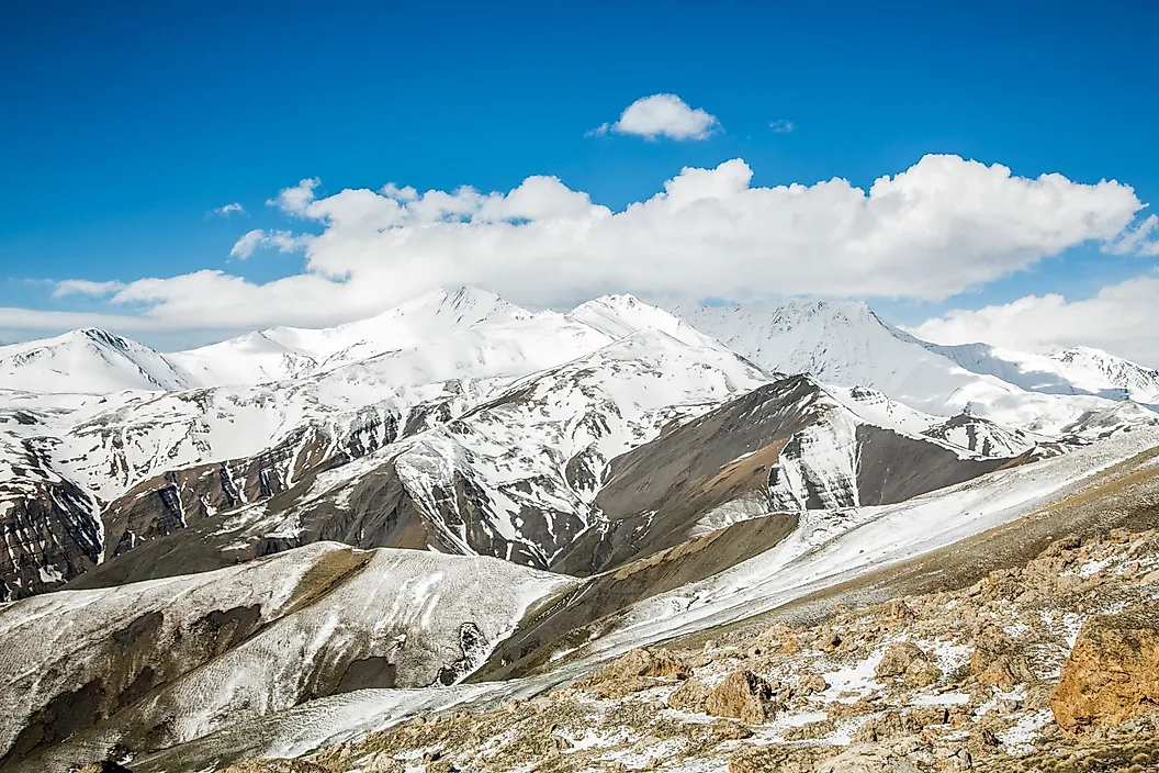
Western Caucasia consists mainly of plains, such as the lowland north of the Kuban River. Central Caucasia includes the Stavropol Upland which is characterized by tablelands of limestone or sandstone separated by valleys. The lower Terek River end traverses Eastern Caucasia in addition to the Kuma River from the north. In addition to Mount Elbrus, the range contains many prominent peaks, such as Mounts Shkhara (5,193m elevation), Dykhtau (5,205m elevation) and Kazbek (5,054 m elevation) in the central sector in addition to Mounts Tebulosmta and Bazardyuzyu, both reaching 4,550 m in the east.
Geology

The Caucasus Mountains are estimated to be 25 million years old from the late Oligocene Epoch, having a rugged and volcanic origin. The range belongs to the Alpine belt system that extends from southeastern Europe into Asia. This belt is a seismic and orogenic belt that includes a variety of mountain ranges along the southern margin of Eurasia. Cretaceous and Jurassic rocks in addition to Paleozoic and Precambrian rocks constitute the Greater Caucasus Mountains. On the other hand, the Lesser Caucasus Mountains are formed mainly of Paleogene rocks and a smaller portion of Jurassic and Cretaceous rocks.
The uplift of the Greater Caucasus is dated to the Miocene epoch during the Alpine orogeny and the evolution of the Caucasus began from the Late Triassic to the Late Jurassic period during the Cimmerian orogeny at the active margin of the Tethys Ocean. Tectonic plate collision between the Arabian plate moving north with the respect to the Eurasian plate led to the formation of the Caucasus mountains. The Arabian Plate collided with the Iranian plate and the Eurasian plate moved clockwise until it collided with the Iranian plate. These collisions led to the folding of the rocks deposited in the basin from the Jurassic and Miocene eras to form the Greater Caucasus mountains. These collisions also caused the uplift and the Cenozoic volcanic activity in the Lesser Caucasus mountains. Hence, the Greater Caucasus mountains have a predominantly folded sedimentary structure while the Lesser Caucasus mountains are predominantly of volcanic origin. Moreover, these collisions led the region to be an earthquake hotspot, as it is subject to strong earthquakes.
Contemporary seismic activity reflects the active faulting and crustal shortening. Clusters of seismicity occur in Dagestan and in northern Armenia. However, intense volcanic activity recently occured in the Caucasus area, where the Armenian Highland was flooded by calc-alkaline basalts and andesites in the Pliocene epoch and the highest summits of the Caucasus (Elbrus and Kazbek) formed as Pleistocene-Pliocene volcanoes. The Elbrus erupted in postglacial times and fumarole activity is registered near its summit where sulfuric gases leak out on the eastern face. The Elbrus has two glacier shrouded cones: the western one with an 5,642m high summit and an eastern one with a slightly lower summit, reaching 5,621m high only. However, the Kazbek is no longer active. River valleys cut deep into the mountains and create deep gorges and canyons, the majority of which have eroded. The Kuban River originates from the northern slope of the main range and flows into the Black Sea, in addition to the Kuma and Terek Rivers that flow into the Caspian Sea.
Climate
The climate of the Caucasus varies both with elevation and latitude, and the temperature generally decreases as elevation increases. The northern slopes of the Greater Caucasus Mountain range are about 3oC colder than the southern slopes. There are sharp temperature contrasts between the summer and winter months due to a more continental climate in the highlands of the Lesser Caucasus Mountains in Armenia, Azerbaijan and Georgia. While precipitation increases from east to west in most areas, the mountains in the Caucasus receive higher amounts of precipitation than the low-lying areas. The minimum annual precipitation is 250 mm in the northeastern Caspian Depression. However, the western parts of the range receive higher amounts of precipitation than the northern slopes, where the annual precipitation in the western part ranges from 1,000 to 4,000 mm while that of the eastern and northern Caucasus ranges from 600 to 1,800 mm. The maximum precipitation recorded was in Mount Mitrala area in the Meskheti Range in Ajaria, Georgia. Moreover, the Caucasus Mountain range is known for high amounts of snowfall, prominently the southwestern slopes of the Greater Caucasus Mountains. The Lesser Caucasus portion receives less snowfall as it is not subject to the moist influences of the Black Sea.
Ten Highest Peaks
| Peak Name | Height in Meteres | Height in Feet |
|---|---|---|
| Elbrus | 5,642 | 18,511 |
| Dykh-Tau | 5,205 | 17,083 |
| Shkhara | 5,193 | 17,037 |
| Koshtan-Tau | 5,152 | 16,903 |
| Pushkin Peak | 5,100 | 16,732 |
| Dzhangi-Tau | 5,085 | 16,683 |
| Mizhirgi | 5,047 | 16,558 |
| Kazbek | 5,034 | 16,516 |
| Katyn-Tau | 4,979 | 16,335 |
| Kukurtlu Dome | 4,978 | 16,332 |


