What Was The Indian Ocean Tsunami of 2004?
A tsunami is a sequence of waves in an ocean or large lake caused by the displacement of large volumes of water. The waves of a tsunami have a longer wavelength than typical currents or sea waves. Volcanic eruptions, earthquakes, underwater explosions, meteorite impacts, glacier calving, and landslides (below or above water) have the potential to cause a tsunami. A tsunami caused by an earthquake is known as an earthquake tsunami. The 2004 Indian Ocean earthquake caused one of the deadliest tsunamis in the region, resulting in a total of 227,898 casualties in over 14 countries.
The tsunami was caused by an earthquake which occurred on December 26, 2004, after the fault between the subducting Indian Plate and the Burma Plate ruptured. The earthquake triggered a sequence of tsunamis up to 100 ft high, overwhelming coastal communities along the coast of the Indian Ocean. The most severely impacted nations included Thailand, India, Sri Lanka, and Indonesia. The Indian Ocean earthquake also triggered other small earthquakes in Alaska. The epicenter of the earthquake was located between mainland Sumatra and Simeulue.
Warnings and Signs
Despite the few hours between the earthquake and impact of the tsunami waves, most of the casualties were unexpected. The initial warning sign is usually the earthquake itself, but the tsunami can hit thousands of miles away from where the earthquake occurred. The ocean usually recedes from the coastal area for minutes before a tsunami strikes, and this was noted on the eastern parts of the rupture zone around the shorelines of Penang Island (Malaysia), Khao Lak region (Thailand), Phuket Island (Thailand), and Aceh province (Indonesia).
Affected Nations
Some of the affected areas include:
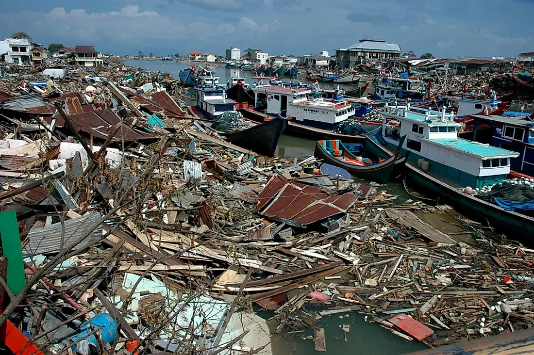
Indonesia
The tsunami struck the north and west coasts of northern Sumatra, primarily in the Indonesian province of Aceh. The tsunami was over 10 ft high in many beaches in Indonesia including the Banda Aceh coast, Sigli coast, and Krueng Raya coast. Other towns affected include Simeulue Island, Teunom, Calang, Patek, Lamno, Lhokruet, and Leupung. Over 130,736 people were confirmed dead in Indonesia, 37,063 were missing, and more than 500,000 were displaced.
Sri Lanka
Sri Lanka is about 1,056 miles from the tsunami’s epicenter, and therefore locals did not feel the earthquake. However, the coastline was struck by the tsunami two hours later. The first tsunami wave to hit Sri Lanka caused small floods, while the second was more destructive. The tsunami affected various parts in the country including Kahawa, Paiyagala, Beruwala, Weligama, Nonagama, Galle coast, Galle port, and Koggala. The tsunami also overturned a passenger train operating between Matara and Colombo Maradana, killing over 1,700 people. More than 35,322 Indonesians were confirmed dead, 21,411 injured, and 516,150 displaced.
Maldives
The tsunami severely affected the Maldives, located 1,553 miles from the earthquake's epicenter. The highest wave was reported at Vilufushi Island, with a height of 13.1 ft. Other affected parts of the Maldives include Male Island, Huhule Island, Huraa, Gan, Embudhus, and Dhiffushi islands. The tsunami resulted in 82 deaths and displaced more than 15,000 people.
Other Affected Nations
The tsunami affected more than fifteen countries, fourteen of which confirmed at least one casualty. India reported 12,405 deaths, while 647,599 others were displaced. Thailand confirmed more than 5,395 deaths, 8,457 injuries, and the displacement of at least 7,000 people. Somalia confirmed over 78 casualties, while Myanmar reported more than 61 deaths.


