Which Countries Border Kazakhstan?
Kazakhstan is located in the west-central region of Central Asia, where it covers a total area of 1,052,100 square miles. Of this area, only 1.7% is covered by bodies of water. Although Kazakhstan has a coastline along the Caspian and Aral Seas, it is considered a landlocked country due to its lack of access to an open ocean. This fact makes Kazakhstan the largest landlocked country in the world by area. Kazakhstan also has a population size of over 17.98 million. The majority of these individuals identify as ethnic Kazakhs.
The geography of Kazakhstan is varied, with plains in the central region, mountains to the east, and deserts to the south. Politically, this country has fourteen divisions that are referred to as regions. Each region is further divided into districts. Additionally, Kazakhstan has 8,304 miles of international borders, which are shared with the following countries: Uzbekistan, China, Russia, Turkmenistan, and Kyrgyzstan.
Russia - 7,644 km (4,750 Miles)
The border between Kazakhstan and Russia stretches for 4,750 miles, making this the longest international border shared by Kazakhstan. It comprises the entire northern edge of Kazakhstan and is considered the second longest in the world. This border was established during the era of the Soviet Union and has been upheld since its dissolution in the early 1990’s. In 2005, the Presidents of both countries came together to recognize the first official map of their shared boundary, marking a historic occasion. Over the last decade, both nations have invested in border markers to more clearly define the separation of these territories.
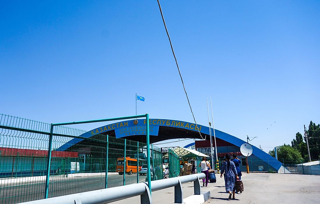
Uzbekistan - 2,333 km (1,450 Miles)
The border between Kazakhstan and Uzbekistan runs for 1,450 miles and is situated along the southwestern and south central edge of Kazakhstan. Both of these countries were once part of the Soviet Union and each country became a sovereign entity in the 1990’s. It was not until the early 2000’s, however, that the governments of Kazakhstan and Uzbekistan were able to reach an agreement on the location of their international boundary. The exact border location at the towns of Arnasai, Bagys, and Nsan remained under dispute for a longer period of time, but this disagreement was resolved in 2002.
Reports of drug and illicit goods being smuggled across this shared border prompted the government of Kazakhstan to invest in a border barrier, which is concentrated in the Saryagash and Maktaaral Districts of the South Kazakhstan region. This barrier stands at approximately 8.2 feet high, runs for nearly 28 miles, and consists of barbed wire fencing. Beginning in 2017, the governments of these two countries have been working toward increased bilateral coordination and improved international relations. As a result of these efforts, two highway border crossing locations have been reopened to make private travel between the two countries easier. Additionally, plans are underway to build a modern passenger train between the cities of Almaty in Kazakhstan and Tashkent in Uzbekistan.
China - 1,765 km (1,097 Miles)
The border between Kazakhstan and China runs for 1,097 miles and is located along the eastern edge of Kazakhstan. This border has largely been defined since as early as the Qing and Russian Empires, although its exact location has undergone significant conflict over the years. In 1969, for example, military members of China and the Soviet Union (to which Kazakhstan belonged at the time) were engaged in a violent conflict at Tielieketi. Today, this location is situated within the province of Xinjiang in China, although it was once considered territory of Kazakhstan. After the fall of the Soviet Union, some of the territory of Kazakhstan was lost to China. In fact, the governments of these two countries met in 1997, 1998, and 2000 to sign various agreements on the exact location of their shared border. Kazakhstan and China have made several attempts at improved international relations over the years. One example of this is the Khorgos (or Horgos in China) Free Trade Zone along the border, which was meant to facilitate trade between the two countries. The logistics of shipping goods through this isolated region, however, has lead to its lack of success.
Kyrgyzstan - 1,179 km (733 Miles)
The border between Kazakhstan and Kyrgyzstan runs along a line of 753 miles, which is located in the southeastern region of Kazakhstan. Both of these countries share a common history as former autonomous republics of the Soviet Union. The two nations gained their independence in the early 1990’s and have largely upheld the previously established border. Large sections of this boundary are marked by mountains, primarily the Tian Shan and Pamir mountain ranges.
Turkmenistan - 379 km (235.5 Miles)
The border between Kazakhstan and Turkmenistan is measured at 235.5 miles and runs along a small section of the southwestern region of Kazakhstan. The land territory of both of these countries ends at the Caspian Sea to the west and their boundary extends into its waters. This international border is the shortest land border held by each country.
The location of this international border was defined during the Soviet era, when each country made up a state of the Soviet Union. When independence was gained in the early 1990’s, the governments of Kazakhstan and Turkmenistan decided to maintain this boundary to mark their separate international territories. These countries are unique in post-Soviet era states in that they have not reported any major incidents of border conflicts. In fact, the international relationship between Kazakhstan and Turkmenistan is considered peaceful.
In 2005, both governments decided to fund border projects in order to set up official markers along their shared boundary. This investment has been the only major attempt made by either country to delineate its territorial line. One section of this border did remain under dispute, however. This disputed spot was the tri-point boundary between Turkmenistan, Kazakhstan, and Uzbekistan. In late 2017, this dispute was settled when representatives from these three governments signed an official border agreement, known as the Treaty on the Junction Point on the State Border.
Kazakhstan and Turkmenistan share one border crossing highway between the Mangistau Region of Kazakhstan and the Karakiya District of Turkmenistan. The highway located here is referred to as the Temir Baba Highway by both countries.
Countries Bordering Kazakhstan
| Rank | Country Bordering Kazakhstan | Border Length (Km) | Border Length (Miles) |
|---|---|---|---|
| 1 | Russia | 7,644 | 4750 |
| 2 | Uzbekistan | 2,333 | 1,450 |
| 3 | China | 1,765 | 1097 |
| 4 | Kyrgyzstan | 1,179 | 733 |
| 5 | Turkmenistan | 379 | 235.5 |


