What Countries Border Ireland?
Ireland is an island located in the North Atlantic Ocean. In terms of size, it is the second largest island within the British Isles. Additionally, it ranks as the third largest island in Europe and twentieth in the world in terms of size. Politically, the island is divided between the Republic of Ireland and Northern Ireland, which is a part of the United Kingdom (UK). The Republic of Ireland, which is also known simply as Ireland, covers five-sixths of the island. Ireland is bordered by only one nation, which is the United Kingdom (Northern Ireland). Sometimes referred to as the Irish Border, the Republic of Ireland–United Kingdom (Northern Ireland) border runs for about 310 miles from Lough Foyle (northern side of Ireland) to Carlingford Lough (northeastern side of Ireland), separating Ireland from Northern Ireland.
History of the Ireland Border
The border was established in 1920 as per the United Kingdom Parliament's Government of Ireland Act. This first border was only provisional, while a permanent one was later established between 1924 and 1925. The three parliaments in London (UK), Belfast (Northern Ireland), and Dublin (Ireland) ratified the new border agreement in December 1925. On February 8, 1926, the agreement was submitted to the League of Nations (which was later succeeded by the United Nations), thus making it recognized in international law. However, the report by the League of Nations Boundary Commissioner was not published until 1969.
On April 1, 1923, border checks were introduced shortly after the establishment of the Republic of Ireland, which was initially known as the Irish Free State. The controls and checks remained in place until their abolishment on January 1, 1993, when the countries of the European Community decided to remove the checks in order to facilitate a better free market. British and Irish citizens have always been able to travel between the two countries without needing a passport, with brief exceptions during World War II and the Conflict of Ireland in the 1970s, also known as the Troubles.
More recently, in 2007, the two countries came up with plans for reintroducing border controls. If the plans had been successful, then it would have meant the end of the Common Travel Area between the two areas. However, the proposition raised significant outrage from all sides and eventually led to the abandonment of the proposals in 2011 and the subsequent renewal of the "de facto" agreement. That year, December 20, 2011, was the first time that the UK and Irish authorities officially agreed on the maintenance of the border. Data shows that approximately 177,000 lorries, 1,850,000 cars, and 208,000 vans cross the border every month. Additionally, about 30,000 people cross the border on a daily basis for work.
Ireland-UK Border
The shape of the Ireland border is extremely irregular due to the well-established borders of the different counties. Additionally, there is no official documentation that explicitly defines the border. Instead, it is implied in the 1920 Government of Ireland Act, which infers the territory of Northern Ireland. One of the most noticeable features of the border is its irregularity. For example, the length of the border between Lough Foyle to Carlingford Lough is four times longer then it would be if it was a simple straight line. In total, there are about 200 different border crossings, and some roads cross the border more than once. In fact, one railway line that was closed in 1957 traverses the border six times.
The maritime border between North Ireland and Ireland has been a matter of contention since its creation. The problem did not exist when the whole island was a part of the UK. However, complications arose when the Republic of Ireland became a self-governing region. The problems even extended into the loughs or lakes located on the border of the two regions. For example, Lough Foyle lies in a region between Northern Ireland’s County Londonderry and Ireland’s County Donegal. The dispute over the lake forced correspondence between the prime ministers of Northern Ireland and Ireland. When a solution could not be reached, the Foyle Fisheries Commission, which was under the leadership of representatives from both Belfast and Dublin, was established in 1952. Today, it is not openly visible that the maritime border is disputed. Instead, the dispute is only a matter of principle.
"Troubles" at the Border
The Troubles, also known as the Northern Ireland Conflict or the Conflict in Ireland, refers to a dark chapter in the history of the whole of Ireland. The conflict, which began in the later stages of the 1960s, was a guerrilla war between unionists or loyalists and nationalists or republicans. The conflict occurred in Northern Ireland, although it often spilled over into parts of the Republic of Ireland, mainland Europe, and England.
Unionists, who were mainly Protestant, were fighting against the loyalists over whether or not Northern Ireland should join the United Kingdom or join with the Republic of Ireland to form a unified Ireland. Unionists wanted Northern Ireland to remain part of the UK, while nationalists, who were mainly Roman Catholic, wanted to form a united Ireland together with the Republic of Ireland.
The impact that the conflict had on the border was an increased enforcement of border controls and regulations. The British military was deployed in large numbers at several border crossings to curb unauthorized crossings. However, the border was simply too large to be completely secured by the military. Fortunately, the issue was resolved in 1998 after both parties agreed to sign the Good Friday Agreement. Today, due to the Common Travel Area between the UK and Ireland, the border controls no longer exist.
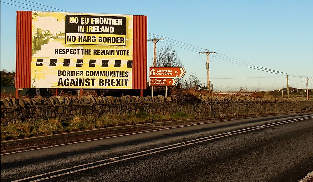
Brexit
The United Kingdom voted to leave the European Union (EU) on June 23, 2016, commonly referred to as Brexit. This decision will mean that Northern Ireland is no longer part of the EU, and will, therefore, complicate the Ireland-United Kingdom (Northern Ireland) border since the free movement agreements in the EU only applies to members of the EU. However, representatives from the EU, the Irish government, and the UK government have all stated that no party wishes to have a hard border between the UK and Ireland. Aside from trade and immigration, health issues have also been raised.


