The 10 Major Mountain Ranges of South America
The continent of South America is rich in geographic diversity and stunning natural beauty, accentuated by its majestic mountain ranges. From the famed peaks of the Andes to the Serra Do Mar range, South America's mountains extend through several nations and reveal a brilliant array of vistas and valley beauties. Here are 10 of the major mountain ranges of South America.
The Andes

The famed Andes Mountains run an astonishing length of nearly 9,000 kilometers and pass through seven South American nations - Ecuador, Argentina, Bolivia, Colombia, Chile, Peru, and Venezuela. Divided into three areas, the Dry Andes, the Wet Andes, and the Tropical Andes, respectively, the highest peak in the entire range is Argentina's Mount Aconcagua, with an elevation of 22,837 feet. Other peaks of note include Mount Mercedario, Mount Bonete, and Mount Ojos del Salado, which all contribute to the Andes' status as the longest mountain range in the entire South American continent.
Serra Do Mar

Located in southeastern Brazil, the Serra Do Mar range runs for around 1,500 kilometers near the cities of Rio De Janeiro, Sao Paolo, and Curitiba. Running parallel to the Atlantic Ocean from the Brazilian states of Espirito Santo to Santa Catarina in a north-south direction, Serra Do Mar covers an area of some 46,077 sq. kilometers. Its highest peak is Pico Parana, which reaches an elevation of 6,158 feet.
Wilhelmina Mountains
Named in honor of the Dutch Queen Wilhelmina, this mountain range is located in central Suriname and is amongst the smallest of its kind in South America. It is named after a former queen of the Netherlands. Extending only 113 kilometers, its highest peak Julianatop reaches an elevation of just 4,199 feet. Surrounded by the tropical rainforest, the area around the Wilhelmina Range is very biologically diverse, and some 3,000 different plant species can be found here.
Sierra Nevada De Santa Marta

The highest coastal mountain range of the tropics, the Sierra Nevada de Santa Marta in northern Colombia, runs 384 kilometers long and covers an area of 17,000 square kilometers. It is about 42 kilometers away from the Caribbean coast. The source of 36 rivers, the highest peak of this range, Pico Cristobal Colon, stands tall at 18,800 feet! Other peaks of note include Pico Simon Bolivar and Mount Colon. The Sierra Nevada de Santa Marta National Natural Park covers a large part of the mountains here and hosts incredible biodiversity, including 340 endemic species of Colombia.
Cordillera Blanca

The Cordillera Blanca forms part of the larger Andes but is located solely in Peru. Extending some 200 kilometers, this range is also the site of Peru's highest peak Huascaran at 22,205 feet. Falling within the Huascaran National Park, other summits of note include Kima Rumi, Santa Cruz, and Pisco. In addition, the Cordillera Blanca has the most extensive ice-concentrated mountain range in the world and includes over 700 individual glaciers. Snowmelt from these mountains is thus a major water source, and a series of glacial lakes can also be found at numerous bases.
Cordillera Oriental

Part of the Colombian Andean Mountains, the Cordillera Oriental spans a length of over 1,200 kilometers while covering an area of nearly 145,000 square kilometers. As a basin for rivers like the Amazon, the Magdalena, and the Orinoco, this mountain range also encompasses several national parks like Chingaza. The highest peak in the Cordillera Oriental is Ritacuba Blanco, at an elevation of 17,750 feet.
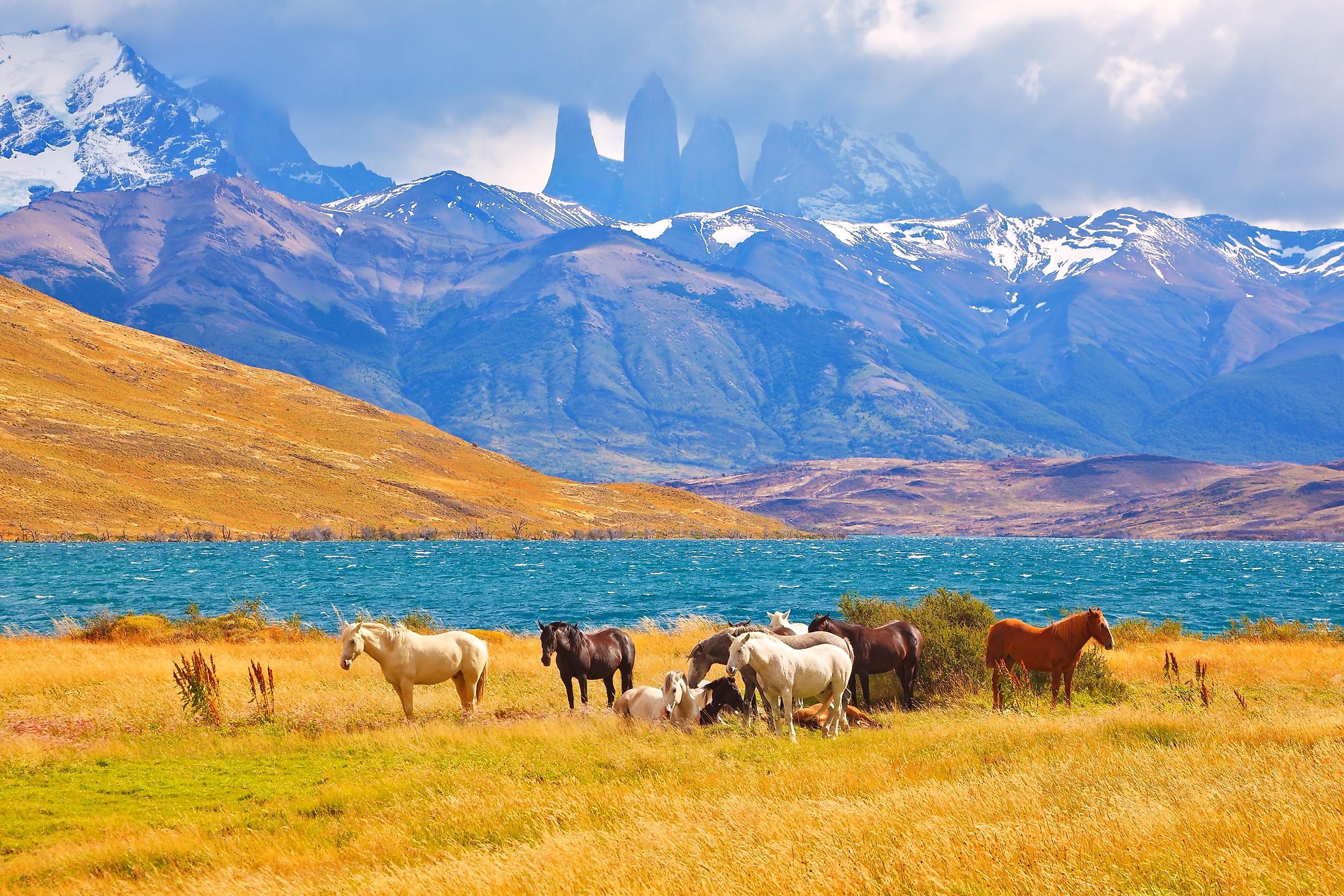
Cordillera Paine

From the Tehuelche indigenous word for "Blue," the Paine Mountains are situated in southern Chile in the famed Patagonia region. Located within the Torres del Paine National Park, these bluish-appearing peaks reach an elevation of just under 9,500 feet. Amongst the most beautiful and oft-visited mountain parks in South America, the highest summit is the Cerro Paine Grande reaching a height of 9,462 feet.
Cordillera Huayhuash

The Cordillera Huayhuash forms part of the Peruvian Andes and has one of the smallest lengths of any range in the continent. Spanning only 30 kilometers, the Huayhuash (from the Quechua word for "squirrel") includes several notable peaks. The highest is Yerupaja at an elevation of 21,768 feet, while other notable summits over 20,000 feet include Sarapo and Siula. Near the region of Lima (which houses the Peruvian capital of the same name), the Huayhuash Mountains have some of the most difficult peaks to scale, and the surrounding area is sparsely populated.
Western Cordillera

Creating a natural border between Chile and Bolivia, the Western Cordillera (or Cordillera Occidental) is known for its volcanic activity. With frequent sandstorms, lava flows, and vent eruptions, this mountain range is ironically cold and desolate, where biological life struggles to survive. The highest peak is Nevado Sajama, with an elevation of 21,463 feet, and that, like other famous volcanic cones like Mount Fuji, is permanently snow-covered. Other summits of note include Licancabur and Ollague.
Mantiqueira Mountains

Located in Southeastern Brazil, the Mantiqueira Mountains traverse the states of Minas Gerais, Rio de Janeiro, and Sao Paolo and stretch for approximately 320 kilometers. The highest peak is the Pedra da Mina (Brazil's fourth highest overall), at an elevation of 9,180 feet. Originally a forested area, these mountains are a vital source of drinking water and provide important sources of pasture and charcoal for cattle and other livestock. In addition, several rivers find their sources here, including the Jaguari and the Grande.
The mountain ranges of South America are amongst the continent's most striking and beautiful natural wonders. These land masses, found across several nations, are as unique and special as the cultures and histories that define Latin America, making for a most spectacular experience. From the Andes to the Mantiqueira, South America's mountains are an essential component of what makes this continent extraordinary.